Western Trips

Saturday, June 29, 2013

History of New Mexico / Fort Craig


Traveling through New Mexico can be a lot of fun if you're looking for historic old military outposts. The history of New Mexico is one of military conquest.
ruins fort craig new mexico
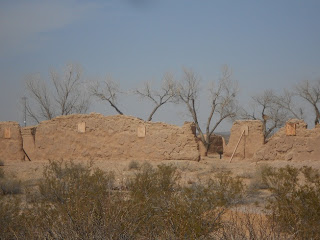
Ruins of Commanding Officers Quarters
Beginning with the Spaniards and followed by the Mexicans and then finally the Americans, New Mexico is a treasure trove of historic old military forts.

The Fort Craig Ruins

One very interesting site that Western Trips had the opportunity to visit is old Fort Craig. Today Fort Craig is a National Historic Site which was taken over by the BLM in 1981. The site consists of a Visitors Center and the ruins of the once large and proud military fort. The fort was named in honor of Captain Louis S. Craig who was murdered by deserters in California in 1852.

Fort Craig, established in 1854, was one of the largest and most important frontier forts in the West. Fort Craig had a significant role in both the Indian campaigns in the southwest as well as during the American Civil War. The Fort was home to the Buffalo Soldiers of the 9th Cavalry and 38th and 125th Infantry. The Hispanic New Mexico Volunteers and New Mexico Militia also served at Fort Craig. Fort Craig also saw the presence of Kit Carson who called Taos New Mexico home. 


fort craig national historic site
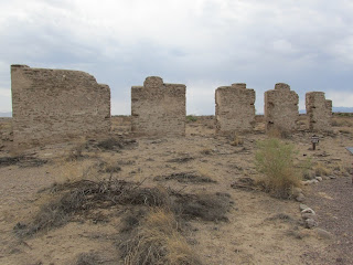
Ruins of Guard House and Sally Port
The site of Fort Craig New Mexico is very near the Rio Grande as well as adjacent to the site of the Battle of Valverde. The fort was built along the strategic road between Mexico and New Mexico. This road traveled generally along the Rio Grande. This was also the route taken by Confederate forces, mostly Texans, during the Civil War in their attempt to capture New Mexico Territory. 

Fort Craig and the Battle of Valverde

To understand the role of Fort Craig you want to know about the Battle of Valverde which did result in a Confederate victory. Colonel. E.R.S. Canby, assisted by a contingent of New Mexico volunteers commanded by Kit Carson, engaged the Confederates at a nearby crossing of the Rio Grande. The Confederate invaders who were referred to as the Confederate Army of New Mexco were led by Brigadier General Henry H. Sibley. An interesting side note is that this is the same Henry H. Sibley who invented the Sibley Stove. If your travels take you to Fort Stockton Texas you can view an authentic Sibley Stove on display at the Fort Stockton Museum.


southwest frontier forts
Diagram of Battle of Valverde site
The Battle of Valverde took place on February 21, 1862 and lasted the entire day. This represented a big victory for the Confederates and they did move northward from there to capture both Albuquerque and Santa Fe. After the Battle of Valverde the Union troops involved retreated back to Fort Craig which was not attacked. The Battle of Valverde is considered the largest Civil War battle in the southwest. The battle site is about seven miles north northeast of the fort and on the east side of the Rio Grande.

Eventually, Sibley and his forces were defeated further north at the historic Battle of Glorieta Pass located just to the east of Santa Fe along the old Santa Fe Trail. The ultimate goal of the Confederates was to attempt to capture Fort Union further north and the Colorado gold fields further north yet. Stopping this Confederate advance was why the Battle of Glorieta Pass was so significant for the Union.

The New Mexico Indian Campaign

Troops stationed at Fort Craig New Mexico Territory were involved in campaigns against Apache leaders such as Geronimo, Victorio and Nana. The southwest was the battle ground during the Apache Wars and Fort Craig played a large part. The Apache tribes in the area of the fort consisted of the Gila and Mimbres Apaches and the campaign took place from 1863 through 1865. This of course was the same period that the Civil War was going on.

frontier military forts
Ruins of fort Store House
When the Indian Wars eventually died down the fort, like many others throughout the old west, was deactivated. This occurred in 1885. Today, the tourist can enjoy a short walking trail and view the ruins which are described on placards.

The links below are to additional Western Trips photo articles you'll find interesting. 

The Fort Selden New Mexico Ruins

A Visit to Historic Messila New Mexico

Fort Union New Mexico on the Santa Fe Trail

Fort Garland in Southern Colorado
  

Visiting Fort Craig National Historic Site

Fort Craig is located just to the east of Interstate 25 about 44 miles south of Socorro New Mexico and on the west side of the Rio Grande. From the north, take I-25 to the San Marcial exit, then east over the Interstate, and south on old Highway 1 (about 11 miles). Then follow the signs to Fort Craig. (If traveling on I-25 from the south, take exit 115.) The fort is to the east of  NM 1, which parallels the freeway thru some lovely scenery and towns, and will also take you to the entrance of Bosque Apache Wildlife area and the turnoff to the El Camino Real Museum.

historic walking trails
After stopping at the Visitors Center where you'll view artifacts and a model of the old fort layout you'll want to walk on the trail which winds among the fort ruins. The Fort Craig walking tour is very informative and well laid out with resting areas along the way.

The walking trail at Fort Craig is named the Marion Cox Grinstead Historical Trail. Marion Cox Grinstead is well known for her literary work including Destiny at Valverde: The Life and Death of Alexander McRae.

During the summer months you'll want to take water along with you on the hike. Restrooms are available in the Visitors Center.

(Content and photos copyright Western Trips)


View Larger Map

Tuesday, June 25, 2013

Springerville Arizona


Springerville Arizona was settled in 1879 and grew all around a trading post owned by a man named Henry Springer. It wasn't uncommon for western settlements to grow from trading post sites. The town is located in the Round Valley of northeastern Arizona.

casa malpais museum
Casa Malpais Museum, Springerville, AZ
Springerville's early industry revolved around cattle and sheep ranching. If your road trip takes you through this scenic part of Arizona a stop at Springerville is well worth your time. The town which sits at an elevation of 7,000 feet is located at the junction of US 60 and State Highways 180 and 191.

Springerville's Ranching History

Springerville's ranching history is a colorful one. If you've heard about the famous Magdalena Cattle Trail, Springerville Arizona resided at the western end. This was a cattle trail that ran all the way from Springerville Arizona to Socorro New Mexico and the rail lines there. The Magdalena Trail through New Mexico had the same importance as the Chisholm Trail and the Goodnight-Loving Trail which both originated in Texas.

The Magdalena Trail is also called the "Magdalena Stock Driveway". This cattle trail was a designation of land by the federal government for allowing enough area for ranchers to drive their herd to the rail heads. In several places the driveway could extend five to ten miles in width. This large area allowed ample forage for the herd. This land was open range. No fences whatsoever.


renee donnet exhibits
Furnishings in the Renee Donnet exhibit
Springerville Arizona's Lady Rancher

Another interesting piece of ranching history involving Springerville Arizona has to do with a lady by the name of Mrs. Renee Donnet. Born in France and able to speak five languages, Mrs. Donnet, who was raised to be a pianist, came from a prominent European family. Many questioned how a woman from this background could end up being one of the world's largest ranchers. In fact, most of her friends thought her Arizona adventures were temporary and that she would eventually return to either New York or Paris. Neither occurred.

Mrs. Donnet's first husband was an heir to the Sears-Roebuck fortune. In that marriage she was given the choice of residing in either Chicago or Philadelphia. The marriage ended in divorce. Her second marriage was to a surgeon by the name of Dr. J.V. Donnet. Donnet had cattle interests in Arizona and practiced in a Phoenix hospital. 

When you visit Springerville Arizona you'll want to stop by two very interesting museums. These museums will give you an excellent picture of the ranching industry that was so big to the area as well as a glimpse of the life and career of Mrs. Renee Donnet.

old steinway piano
Donnet Steinway Grand Piano
Mrs. Renee Donnet died in Switzerland in 1969. She had been away from Springerville for some twenty years. Mrs. Donnet's ranching career had begun during 1940 and 1941. The first ranch purchased was the A-K Ranch near Arlington Arizona. Then it was the Fry Ranch outside of Tucson. Next was the White Mountain Hereford Ranch and then the Cowden Ranch. Mrs. Donnet purchased four different ranches in Arizona totaling about 70,000 acres. In addition to this she operated grape and sheep farms in southern France.

After her death the then Mrs. Renee Cushman willed her furnishings and artwork collection to the local Latter-day Saints Church. The exhibit at the Casa Malpais Museum which is explained below came from that collection.

The Casa Malpais Museum

In downtown Springerville you'll want to stop by the Casa Malpais Museum. The museum features ancient artifacts excavated from the ancient ancestral pueblo. The museum features pots, projectile points, jewelry, stone tools, books and interactive media. You'll also want to view their short film regarding the Springerville area.


springerville az museum
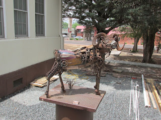
Artwork outside Casa Malpais Museum
 In the Casa Malpais Museum you'll also be able to view many pieces of furnishing and artwork donated by Mrs. Donnet. You'll view some very interesting European art which was part of the Donnet collection. Some of the antique furniture is the work of master craftsmen, with elaborate inlays of wood, metal, and tortoise shell. The exhibit also features a beautiful 1922 Steinway grand piano once owned by Mrs. Donnet. The Donnet exhibit is found in two rooms of the complex. This museum is located at 418 E. Main Street.

The Little House Museum

Located just a few miles west of Springerville Arizona is the Little House Museum. The museum is located on the X Diamond & MLY Ranch. This two story museum features exhibits about both ranching and pioneer life. Along with this the Little House Museum also exhibits a rare collection of automatic musical instruments. At his site tours to archaeological digs and petroglyphs are also available. The X Diamond Ranch is located off of Arizona Highway 260 about a ten mile drive west of Springerville.

butterfly collection
Museum's Butterfly collection
Another very interestingstop to make in Springerville is to one of the twelve Madonna of the Trail monuments created by sculptor August Leimbach. Starting in 1927, the German sculptor Leimbach placed one monument in twelve different towns in the U.S. The Springerville Arizona monument is across from the Post Office on Main Street.

August Leimbach with his sculptures marked the national Old Trails Highway from Maryland to California. Each of the statues were dedicated during the years 1928 and 1929.


Below are two links to more Western Trips photo articles you may enjoy.

A Visit to Winslow Arizona

The Theodore Roosevelt Indian Boarding School

Visiting Springerville Arizona

One thing to recognize when visiting Springerville Arizona is it's proximity to the White Mountains and the recreational opportunities there. The Sunrise Ski Resort is also located in Apache County and is about a 27 mile drive southwest of town via AZ Hwy 260 and 273.


round valley courthouse arizona
Round Valley Courthouse, Springerville, AZ
One of Arizona's top tourist areas is the Pinetop-Lakeside locale in the White Mountains. Pinetop-Lakeside is about 44 miles to the west of Springerville. Pinetop-Lakeside is surrounded by the beauty of the White Mountains, the Apache/Sitgreaves National Forest and the White Mountain Apache Indian Reservation. Hiking, biking, horseback riding, hunting and fishing are all popular Arizona tourism recreational activities in this Ponderosa Pine area of Arizona.

Another very interesting site to add to your trip planner in this part of Arizona is Fort Apache. Located about 63 miles southwest of Springerville, Fort Apache features a Native American museum, several very historic structures from the fort's operational years as well as buildings of the Theodore Roosevelt Indian Boarding School which was established there in the 1920's. The school still functions today.
 

(Content and photos copyright Western Trips)


View Larger Map

Saturday, June 22, 2013

Arizona Indian Reservation


Fort Apache located in the foothills of the White Mountains of Arizona offers a very interesting travel stop. The fort was established in 1870 at the confluence of the east and north forks of the White River. This was a very important military outpost in the center of the White Mountain Apache homeland and today is within an Apache Arizona Indian Reservation.

One of the most interesting aspect of Fort Apache is what was established there in the latter years of the fort's existence. This was the Theodore Roosevelt School, established in 1923 by an act of Congress.

roosevelt fort apache school
Theodore Roosevelt School cafeteria building
The Theodore Roosevelt School

Today when you visit Fort Apache there are a great many of it's historic structures still standing. It's a fascinating and very scenic place to visit. The fort actually had several names prior to it being designated Fort Apache. At one time the outpost went by the names of Camp Ord, Camp Mogollon and Camp Thomas.

The school's first students were actually Navajo Indian children but eventually the school was attended by Apache children exclusively. The school was within the Apache Arizona Indian Reservation. This was a boarding school administered by the Bureau of Indian Affairs. Interestingly enough a school still operates today at the same site as a middle school, under the administration of a school board selected by the  Apache Tribal Council.

Naming this school in honor of former president Theodore Roosevelt was quite fitting. Having spent a good deal of time in the west operating a cattle ranch,taking part in several hunting expeditions and meeting several Indian leaders in person, Roosevelt was more acquainted with Native Americans than any other president before him.

indian school fort apache
Boy's Dormitory Building
One very significant change that Roosevelt promoted as president was giving Native Americans preference in attaining teaching and medical service positions on the reservation. Prior to this the people who filled these positions worked under Civil Service classifications. While Roosevelt strongly defended Manifest Destiny this was a big step in Native American self governance. Theodore Roosevelt was also known to appoint people with actual native American knowledge to the post of commissioner of Indian Affairs.


Fort Apache Historic School Buildings

When you visit Fort Apache today you'll notice several large buildings on the eastern side of the fort.

Some of the buildings you'll see are the cafeteria building that was constructed in 1948. This building still serves as a cafeteria today.

You'll also see the Girl's Dormitory building that was built in 1932. The construction of this building was by the work of the Works Progress Administration during the early years of the Great Depression.


theodore roosevelt indian school
Girl's Dormitory Building
Another very large structure on this Apache Arizona Indian reservation is the Boy's Dormitory Building which was also constructed by the W.P.A. in 1932. The building was constructed with sandstone from a nearby quarry. Prior to the buildings construction the school used the old Cavalry barracks to house students.

Eventually new schools were constructed nearby and the students attending the Theodore Roosevelt School were transferred to these. After the transfer of the Apache students, the site became a boarding school  for students of many tribes. It remains open today.


The links below are to three additional Western Trips photo articles you'll enjoy.

Historic Old Tucson Arizona

A Visit to Old Town Scottsdale Arizona

A Man-Made Wonder in Sedona Arizona


fort apache buildings
Fort Apache Officers Quarters Bldg.
Visiting the old Theodore Roosevelt Boarding School

Fort Apache, the site of the Theodore Roosevelt School and in an area within the Apache Arizona Indian Reservation, is located in one of the most scenic parts of Arizona. The White Mountains area of northeastern Arizona is a very popular tourist and recreation area. This is also a part of Arizona that has the largest stand of Ponderosa Pines.

People also enjoy this part of Arizona which offers a respite from desert heat and features crystal clear streams. During winter the area also offers skiing opportunities. Arizona's White Mountains offer visitors a part of the state that experiences four seasons.

Fort Apache and the Theodore Roosevelt Boarding School is located just east of Arizona Highway 73 and about four miles south of the town of White River. The fort is about 190 miles north of Tucson and about 175 miles east of Phoenix.

fort apache museum
Fort Apache Museum and Visitors Center
The Fort Apache Visitors Center was opened in 1969.This is also the White Mountain Apache Cultural Center and Museum. This is a must stop while at the fort. The museum displays a large collection of artifacts, photos, manuscripts and other information about Apache history and culture. 

Another nearby site you'll want to include in your trip to Fort Apache are the Kinishba Ruins. The ruins are a National Historic Landmark and are located just four miles west of the fort. The Kinishba Ruins are what remains of a pueblo village that was once occupied by ancestors of today's Zuni and Hopi pueblo tribes. The site was designated as a National Historic Landmark because it's an excellent example of what a settlement was like by agricultural puebloans. The site was initially excavated during the 1930's and was partially rebuilt. This historic site dates back to 1200 to 1400 A.D.

(Content and photos copyright Western Trips)


View Larger Map

Tuesday, June 18, 2013

Inscription Rock / El Morro National Monument


In the western U.S. there are several very interesting sites where settlers, soldiers and other travelers left their mark for future generations. Independence Rock Wyoming and Pompey's Pillar in Idaho are two of them. Another interesting and quite scenic site that Western Trips had the opportunity to visit is Inscription Rock at the El Morro National Monument in New Mexico. This site is located on NM 53 between the towns of Grants and Ramah.


el morro national monument
El Morro National Monument
Inscription Rock

Inscription Rock, located about 125 miles west of Albuquerque New Mexico, is a 200 foot sandstone bluff where the bottom contains seven centuries of human inscriptions. Today's visitor to Inscription Rock has a choice of two trails to hike. The first is a relatively short trail which is about one-half mile each way. If you have only about an hour to visit El Morro, this is the trail to take. The second is about two miles long. Either of these trails will take you to the base of the rock. Many of the inscriptions have been excellently preserved and are easily legible.

Don Juan de Oñate, who settled New Mexico for Spain, stopped at the rock in 1605. Onate was searching for a passage to the Gulf of California. The Spaniard placed a beautiful inscription in Spanish on the rock which tourists can view today. Prior to the Spaniards reaching Inscription Rock, native pueblo people etched petroglyphs at the site. It's estimated that there are over two-thousand drawings, signatures and messages on the soft sandstone cliffs.

Don Juan Onate was at one time the Colonial Governor of New Spain which eventually became the New Mexico Territory and a portion later became the state of New Mexico. Five years prior to Onate's westward expedition he headed another which led east to the great plains.

inscription rock new mexico
Inscription Rock
Don Juan Onate was also in charge of planning the settling of Santa Fe which occurred in 1610 but ended up being tried and convicted back in Mexico for cruelty to both the natives and the settlers. Onate resigned from the army and was returned to Spain. The charges Onate was convicted of were eventually reversed.

El Morro National Monument

Inscription Rock is a portion of the El Morro National Monument but is the main point to visit. On its top lie ruins of two ancient pueblos. A waterhole located at the base of the cliff made it a popular campsite for travelers.El Morro national Monument borders the Ramah Navajo Reservation. A short drive west and south of the monument is the town of Ramah New Mexico. 

The monument was established in 1906 and is comprised of an area of two square miles. This is one of the smallest national monument's you'll come across although it is two square miles of unsurpassed beauty.Inscription Rock can be seen in several colors depending on sunlight and time of day. Mostly you will view muted shades of orange, red, grey and white.


el morro new mexico
Old El Morro School Gallery
Visiting El Morro National Monument

One of the first things to know about El Morro National Monument are the several other sites adjacent to it. In fact, El Morro is just one of the monuments you want to visit in the vicinity. This entire area of New Mexico is well known for the ancient volcanic activity that occurred there. El Morro does feature a nine space camping area but without hookups.

Two good sites to add to your New Mexico trip planner ar El Malpais National Monument and the Land of Fire and Ice.

El Malpais National Monument is about thirty miles to the southeast of El Morro and was established in 1987. Here you will view volcanic geology including lava flows, cinder cones, pressure ridges and complex lava tube cave systems. Some great hiking trails will also be found there.  

See our Western Trips photo article about El Malpais National Monument on the link below.

El Malpais National Monument


national monuments in new mexico
The Land of Fire and Ice is located just about twelve miles east of El Morro National Monument off New Mexico Route 53. The Land of Fire and Ice may be one of the more unique travel sites you'll visit. One trail through a lava flow field leads to the Ice Cave which features a twenty foot thick slab of ice and a temperature that never rises above thirty-one degrees Fahrenheit. Another trail will take you to the Bandera Volcano Crater. The Bandera Volcano Crater is the largest in the region.

Below is a link to our Western Trips photo article on the Land of Fire and Ice.

The Ice Cave and Bandera Crater

Traveling along Interstate 40 to El Morro National Monument or the other two mentioned nearby historic sites are best reached from Grants New Mexico. You'll want to exit Interstate 40 at Exit 81 and then turn left and drive southwestward on New Mexico Route 53.

(Content and photos copyright Western Trips)


View Larger Map

Friday, June 14, 2013

Ice Cave and Bandera Crater / New Mexico


Located at 8,000 feet elevation on the continental divide in New Mexico, The Ice Cave offers a truly unique experience to anybody traveling through the southwest. This is an opportunity to go along a self guided tour to both of these fun and educational sites.I believe you'll find both of these sites well worth the drive.

lava beds bandera crater
Lava beds along the Ice Cave Trail
Some Great Hiking Trail Adventures

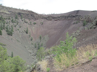
Western Trips had the opportunity to hike the trails and visit both the Ice Cave as well as the Bandera Volcano which the tourist can view today as a 1,200 foot wide crater. The crater is about 800 feet deep and you'll now see trees and shrub growing along it's sides and bottom.

The trail to the Ice Cave is about 400 yards in length each way. The trail from the trading post to the Bandera Volcano crater is about one-half mile each way and can be a bit strenuous but isn't a bad hike at all.

All of this geologic activity took place about 10,000 years ago when volcanoes in this area erupted and left an enormous amount of lava throughout the area. When you take the short hike from the trading post to the Ice Cave you'll walk a trail which is cut through a lava field. The trail will eventually lead to wooden stairs which go down to the Ice Cave itself. You'll marvel at how much the temperature changes as you walk down the steps.

land of fire and ice
Twenty foot thick ice
 The Unique Ice Cave

The Ice Cave stays at a temperature that never rises about 31 degrees Fahrenheit. It's believed that man has been aware of this phenomenon for about 1,200 years. Early southwest settlers and U.S. Cavalry personnel who came across the site called it "The Desert Ice Box". In fact, it's been said that early settlers traveled to the cave to bring ice back home. Factors are such that the ice today remains undisturbed and appears in a blue-green color. The ice floor in the cave is 20 feet thick.


the ice cave
Stairs down to the Ice Cave
When you walk the trail to the Ice Cave you'll see some circular lava ruins that appear to be stacks. These  are thought to be old Anasazi Indian Pithouses.The pithouse was essentially a residential dwelling that was started as a pit with a superstructure added. Because of the way they were constructed into the earth the pithouse would be warm in the winter and cool in the summer. These type of dwellings can be found in many places around the world. Another interesting fact is that the pithouse was not really a permanent structure. Usually they were abandoned after perhaps ten or twelve years.

The site of the Ice Cave and Bandera Volcano is in a geographical region of both forests and high desert. The Ice Cave itself is in a collapsed section of a lava tube. If you're traveling along Interstate 40 through New Mexico you'll view lava fields directly from the Interstate. This is all a part of the El Malpais lava fields which are a p[art of the larger Zuni-Bandera volcanic field.. The area is also referred to as the Zuni-Bandera Volcanic Field. This region was particularly active with ancient volcanoes and the lava fields stretch for dozens of miles.This is an amazing geologic area of the U.S.

bandera crater hiking trail
Hiking trail to Bandera Crater
Bandera Volcano

The Bandera Volcano Crater with it's large dimensions is the largest crater in the region. The lava itself first breaking out from along the side of the cone was estimated to be above 2,000 degrees Fahrenheit. A volcanic eruption such as that with the Bandera Volcano typically occurs in these two stages, the formation of a cinder cone and then the eruption of lava. The lava flow that came from the Bandera Volcano is estimated top be twenty-three miles long. The crater itself over time tends to fill up with rocks and earth slowly falling into it. In a large way the crater is constantly evolving.

There are two additional sites to add to your New Mexico road trip planner and both are in the same general area of the state. Links below are to our Western Trips photo articles.

The El Malpais National Monument

Red Rock State Park 


bandera volcano new mexico
Bandera Crater
Visiting the Land of Fire and Ice

Both trails are found at the Land of Fire and Ice located at the Ice Caves Trading Post, 12000 Ice Caves Road just south of Grants, New Mexico. Most reach the area via Interstate 40. You'll want to take Exit 81 and drive south on New Mexico Route 53 for about 26 miles.

The trading post where the trail heads are was built during the 1930's. At one time there was both a saloon and dance hall at the site. The tourism to the Bandera Crater and the Ice Cave began just after World War Two. The trading post exhibits some interesting artifacts that date back to over one thousand years and most were actually found in the lava beds.

I would recommend a stop at the Land of Fire and Ice for anyone traveling through New Mexico on Interstate 40. There are several other interesting and fun stops in the general area that are great companion trips. The map below shows you the location of the exact site in New Mexico.

(Photos from author's private collection)


View Larger Map
Wednesday, June 12, 2013

Panhandle Plains


The Texas Panhandle is so named because it is an area at the top of Texas, northwest Texas to be precise, which in a large way resembles the handle of a pan. This is an area of Texas very much rich in history which today has an economy consisting of agriculture and petroleum.

panhandle plains museum
Panhandle Plains Historical Museum
The largest city in the Texas Panhandle is Amarillo although it's not the oldest. The area's history is steeped in the ranching industry and was the home to perhaps one of the most, if not THE most, historically significant ranch in all of Texas, the XIT.

Western Trips traveled to the Texas Panhandle and had the opportunity to visit one of Texas' most magnificent museums regarding the Panhandle.

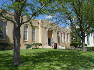
The Panhandle Plains Historical Museum located at 2503 4th Avenue in Canyon, Texas is also on the campus of West Texas A & M University. This is a museum that opened in 1933 as a 12,500 square foot facility. In 1968 the museum doubled it's size and today it's the largest historical museum in Texas.

Canyon Texas is located about twenty miles south of Amarillo along Interstate 27. Canyon is also just twelve miles west of popular and historic Palo Duro Canyon State Park. Palo Duro Canyon is well known as the site of the JA Ranch which was owned by Charles Goodnight and John Adair. The ranch is still owned by Adair's heirs. The JA Ranch was established in 1877.

remington civil war revolver
Remington 1861 Army Revolver
The Museum Collection

The Panhandle Plains Historical Museum exhibits their collection on two floors. There is also a third floor research center that is open to the public with museum admission during normal operating hours. This research center stores historical records, manuscripts, maps and photographs. Another interesting exhibit is the T Anchor Ranch House. This is a ranch house constructed during the 1870's and moved to the museum site in 1975. You'll find this ranch house on the east lawn outside the museum.

The museum offers thirteen permanent exhibits which cover art, paleontology, archeology, weapons, agriculture, petroleum, transportation, geology and much more.In essence, the museum exhibits everything pertaining to the Texas Panhandle and Plains. 

Panhandle Plains Pioneer Town

One very interesting permanent exhibit we found is the Pioneer Town. This is a replica of an old Texas Panhandle town which includes everything from adobe casitas, a jail, a bank, a church and more. The construction was the result of extensive research to make certain all structures were authentic replicas. The turn of the century era replicated covered the period 1890 to 1910.

pioneer town
Pioneer Town Western Union Office
Rare 1800's Weapons

Among the 1800's firearms exhibits at the museum is a Remington 1861 Army Revolver. This particular revolver was a percussion model commonly referred to as "cap and ball". This revolver came out just after the 1860 Army Colt and both this Remington and the 1860 Colt were popular during the Civil War years. Some have said that the Remington had a bit more accuracy than the Colt and records indicate that more Remingtons were purchased during the war than Colts. Remington produced two versions of this model revolver. The second version improvements came about simply from war experience. The first was called the Old Model and the new version the New Model. Not real creative but pretty simple to understand. 

Both Remington models were built with an eight inch barrel, a six shot cylinder and fired .44 caliber cartridges.The total length of the Remington 1861 Army Revolver was fourteen inches.

A 1903 Ford

The Panhandle Plains Historical Museum helps tell the story of the Texas Panhandle region at the turn of the twentieth century with a very rare car indeed. The museum displays a 1903 Ford Model A. Many remember the Ford Model A coming out in the late 1920's replacing the long popular Model T.  Henry Ford however actually did build his first Model A before his Model T and the museum is quite fortunate to have this vehicle on display. 

1903 Ford Model A
1903 Ford Model A
When you first look at the automobile it has the design characteristics of a carriage. This was true with many very early automobiles if for no other reason the cars (horseless carriages) were often built by carriage companies. When you view this 1903 Ford it looks very much like a carriage minus the horses.

Below is a link to our AutoMuseumOnline site and the photo story about the 1903 Ford Model A.

1903 Ford Model A

 
The Chuckwagon

If you're going to explore the days of the big cattle ranches in the Texas Panhandle you'll no doubt come to learn about the all important chuckwagon. Just as important to the cattle drive as the trail boss and drovers was the chuckwagon. 

See our Western Trips photo article on the Goodnight Ranch House in the Texas Panhandle. 

The Goodnight Ranch House in Goodnight Texas

Many historians credit the Texas rancher Charles Goodnight, often referred to as the Father of the Texas Panhandle, with inventing the chuckwagon. Goodnight reportedly employed the chuckwagon on his first cattle drives running from west Texas into New Mexico and then north to Colorado. This was the famous Goodnight-Loving Trail. 

santa fe railroad signs
Texas Panhandle railroad brochures
C.H. Guenther and San Antonio's Pioneer Flour Mill

The Panhandle Plains Historical Museum has a very interesting and authentic chuckwagon exhibit. You might notice the sacks of flour in the wagon. These are from the Pioneer Flour Mills in San Antonio Texas which was founded by a German immigrant named Carl Hilmar Guenther. After first settling in Fredericksburg Texas, Guenther moved to nearby San Antonio and founded Pioneer Flour in 1859. By the time of the cattle drive chuckwagons, Pioneer Flour had been in business for many years. 

The Pioneer Flour Mill operates to this day and is a popular tourist attraction in San Antonio. Visitors today can explore the original Guenther family home which was built in 1860. The restored home contains the River Mill Store, conference rooms, a museum with period furnishings, and an excellent restaurant. If you do have an opportunity to visit the Guenther House you would be wise to plan having a meal at this unique restaurant.

Below is our link to the Western Trips photo article of the Guenther House in San Antonio Texas.

A Visit to the Historic Guenther House

 Glenwood Antique Stove

Another interesting exhibit in the Panhandle Plains Historical Museum collection is an antique Glenwood Stove. This cast iron stove was a necessity for real frontier civilization. The Glenwood Stove and Range Company was located in Taunton Massachusetts and advertised their stoves and ranges for both cottages and mansions. The company's stoves and ranges came in so many styles and sizes that there would be one to fit any size kitchen. The company had huge furnaces smelted pig iron at temperatures of 2,600 degrees.

All of the stove manufacturers of the era made stoves that would not only do the job but they built them attractively as well. Manufacturers sold their stoves by a variety of means. Mail order catalogues, department stores, general stores were all used to distribute the stoves.

1900 glenwood stove
Glenwood Stove exhibit
Visiting the Panhandle Plains Historical Museum

The museum is located in Canyon Texas at 2503 4th Avenue. If you're traveling along Interstate 40 in Amarillo, you'll want to take Interstate 27 southbound for about twenty miles take exit 110. Go south on U.S. Hwy 60/87 which turns into 23rd Street and take it to the center of Canyon. Make a left on Fourth Street and the museum is two blocks on your left.

If you plan on visiting the museum you'll want to couple it with a visit to Palo Duro Canyon State Park. The park is only twelve miles east of the museum and makes a great Texas Panhandle companion trip. 

(Photos from author's private collection)


View Larger Map
Saturday, June 8, 2013

Frontier Museum


Western Trips enjoyed a visit to one of the best museums in the country to explore the life of cowboys and western American history. Everything from cowboys and cowgirls, cowboy art, western art, sculptures, a replica western town and much more is there to explore at this excellent museum.


national cowboy museum
One of the many exhibit halls
Oklahoma City, OK, the National Cowboy & Western Heritage Museum is must stop for anyone traveling through Oklahoma with an interest in cowboys, ranching, rodeos, old frontier towns and the history of people who traveled and lived in the old west. 

The National Cowboy & Western Heritage Museum is northeast of downtown Oklahoma City in an area known as Persimmon Hill. As a side note, the Persimmon Hill Garden Club has the distinction of being the oldest neighborhood garden club in the state. The street address of the museum is 1700 N.E. 63rd Street, Oklahoma City, Oklahoma. Museum hours are 10:00 a.m. - 5:00 p.m. Daily. The museum is closed Thanksgiving, Christmas and New Year's.

Enjoy an Extraordinary Western Museum


This is a massive museum, 220,000 square feet, is a world class venue comprising extraordinary collections of art, artifacts and archival materials.Included within the museum are twelve permanent galleries and halls that cover a wide range of subjects. In the museum which was built in 1965 you can walk around and explore a thirteen thousand square foot replica of a turn-of-the-century Western town. Here you can explore a blacksmith shop, photography studio, church, schoolhouse, general store and other replica structures. It's one of the most unique western museum exhibits you'll find anywhere.


old photography studio
Pioneer town old photography studio
Appreciating Western art is another good reason to visit this fabulous museum. Among the western art collections are works of Frederic Remington, Charles M. Russell, William R. Leigh and others. The museum is unique in that it highlights both classic and contemporary western art and exhibits many great sculptures.

The Idea Took Root in the 1950's

The National Cowboy & Western Heritage Museum originated in 1955. It was first named the Cowboy Hall of Fame and Museum with many people referring to it as simply the Cowboy Hall of Fame. It's mission was and is to honor the cowboy. A man named Chester A. Reynolds of Kansas City came up with the original idea based on his concern over what he felt was our country's loss of it's Western heritage.

While the original building that was completed in 1965 pretty much focused on the cowboy and cowgirls as well as noted rodeo performers along with western art and cowboy art, an addition was added in the 1990's which allowed the museum to also put a focus on the historical aspect of the American West in general. On November 16, 2000, the museum's name was officially changed to the National Cowboy and Western Heritage Museum.

cowboy art
Cowboy sculpture
Events at the  National Cowboy & Western Heritage Museum

In addition to the permanent and temporary exhibits, the National Cowboy & Western Heritage Museum also hosts western themed events throughout the year. These include the Academy of Western Art  Workshop covering a variety of subjects. 

The museum also hosts an invitational art exhibit of over 300 Western paintings and sculpture by the best contemporary Western artists in the nation. Included with this are art seminars, receptions and an awards banquet.

Scheduled for April 11-12, 2014 is the National Cowboy & Western Heritage Museum Western Heritage Awards. The awards are meant to honor those whose works in literature, music, film, and television reflect the significant stories of the American West. Also awarded at this event is the Chester A. Reynolds Memorial Award.

September 5, 2013 is the date for the Ace High: Dinner and Auction Benefitting The Cowboy. Take part in a reception and auction and help support the museum.

The links below are to two Western Trips photo articles you might also enjoy:

Perot Museum of Nature and Science in Dallas Texas.

Texas Electric Railway Museum in Plano Texas.


rodeo hall of fame
Museum Rodeo Hall of Fame
Yet another example of the many events planned at the National Cowboy & Western Heritage Museum is the Traditional Cowboy Arts Association 15th Annual Exhibition and Sale. The dates are October 11, 2013  - January 5, 2014. The association announces that they will exhibit works from TCAA members including spur making, saddlemaking, silversmithing, rawhide braiding as just some example. The event honors the culture of the American West by displaying the works of it's dedicated members.

These are only a sample of events held at the museum. For more detailed information and a complete listing see website www.nationalcowboymuseum.org.

Visiting the National Cowboy & Western Heritage Museum

As mentioned above, the museum is located in the northeast section of Oklahoma City. Visiting this museum is an all day outing and it's great for the entire family. Western art, cowboy art, western and cowboy artifacts including a large display of rodeo artifacts are all there. This is a fun and educational venue. Western American history is displayed throughout and depending on when your visit is planned there may be interesting workshops and presentations going on. Check their website listed above for dates and times of upcoming workshops. 

national cowboy and western heritage museum
Museum entrance
The National Cowboy & Western Heritage Museum also has a dining facility called Dining on Persimmon Hill. The restaurant which offers a full menu is located in the museum's east wing and offers a view of the Western States Plaza, pool and fountain.

Also make a point of visiting the Museum Store. It's important to note that all purchases from the Museum Store supports the museum's mission of preserving and presenting the culture and history of the American West.

We know you'll enjoy your visit to the National Cowboy & Western Heritage Museum as much as we did.


(Photos are from the author's private collection)


Sunday, June 2, 2013

Ruins of Historic Fort Selden / New Mexico


It's interesting just how close many old historic sites are to our modern Interstate Highway System. You'll see a good number of historic marker signs along western highways and in many instances you don't have to make a big detour to explore them.

fort selden state monument
One such historic site are the ruins of Fort Selden, located about thirteen miles north of Las Cruces New Mexico and just west of Interstate 25 near the Rio Grande. It's one of the many unique and interesting state monuments you'll find throughout New Mexico.


Saving An Historic Site

Thanks to the efforts of many people and organizations, the ruins at the old Fort Selden site have been saved for future generations to explore and enjoy.

Fort Selden was built in 1865 to protect settlers from both outlaw attacks and Indian attacks. The area around south central New Mexico was the scene of attacks from various Apache tribes as well as violent outlaws and gangs. The Mesilla Valley to the south was populated and some type of protection was greatly needed.

Many western army forts, especially in the plains and southwest, were abandoned around the year 1890. The Indian Wars in the west were over and the government wanted to cut expenses. When Fort Selden was abandoned in 1891 the structures were left to the elements. Wind, rain, snow all took their toll on the adobe style empty buildings. In addition to that, as was the case with other unprotected historic sites, souvanier hunters went through and removed parts of structures and just about anything they could find of value or interest.


fort selden ruins
View of Fort Selden adobe ruins
Things began to change around 1963, some seventy years after Fort Selden was abandoned. Something need to be done to protect such an historic site. If nothing was done the ruins would eventually be lost to history. When you see the ruins today it's amazing to know that at one time Fort Selden had numerous adobe buildings, an army hospital as well as stables and corrals.

The land around the site was donated to New Mexico. By 1970 the site was listed on the National Register of Historic Places and four years later the state designated the site one of it's state monuments.  Being a state monument, Fort Selden is operated by the New Mexico Department of Cultural Affairs.

The Troops of Fort Selden

Many different sets of troops occupied Fort Selden at various times. This included both Infantry and Cavalry. The troops were also composed of a good number of Buffalo Soldier regiments.

The Buffalo Soldiers had a strong presence in post Civil War New Mexico and served at several forts including Fort Union in northeastern New Mexico along the Santa Fe Trail, Fort Stanton to the north and east of Fort Selden, Fort Sumner of Billy the Kid notoriety and others as well.

old army forts
Another view of Fort Selden ruins
As mentioned above, the area around Fort Selden could be a lawless one, helped by it's long distance from the then territorial capital of Santa Fe.

An interesting side note regarding the fort is that during the early 1880's the post commander was Captain Arthur McArthur. McArthur's son was General Douglas McArthur of World War Two fame. 

After the end of the Civil War, black soldiers were formed into regiments, both infantry and cavalry. Most of these troops were sent to serve on the western frontier as opposed to serving in the South during Reconstruction. These were the troops referred to, especially by Native Americans, as the Buffalo Soldiers. After their regiments were formed in 1866 the Buffalo Soldiers comprising eight companies of the 125th Infantry were sent to New Mexico Territory. These troops were the first stationed at Fort Selden and would serve at seven forts throughout the territory. In the case of Fort Selden, the black troops along with others would go on to construct the buildings including the army hospital.

Black troops of the 9th Cavalry played a major role in the chasing down the Apache leader Victorio who was leading many of the raids in southern New Mexico. Victorio was eventually killed in battle by U.S. and Mexican soldiers who crossed the border north during the year in 1880 but the Apache conflicts still continued for some time under other chiefs. 

In addition to the Ninth Cavalry mentioned above, the Tenth Cavalry, also Buffalo Soldiers, would serve at Fort Selden. The black troops were excellent soldiers and fighter while serving at Fort Selden.The black troops were very excellent fighters whiles serving in the southwest. Nine Buffalo Soldiers would receive the Medal of Honor while serving in New Mexico Territory.

Links to two additional Western Trips photo articles you'll enjoy include:

el camino real
Army Forts along the old El Camino Real in NM
The Old Santa Fe Trail Wagon Ruts at Fort Union New Mexico

A Visit to Historic Mesilla New Mexico just outside of Las Cruces

Visiting Fort Selden State Monument

The state monument is open Wednesday through Monday. The site is closed on Tuesday. The Visitors Center at the state monument offers exhibits pertaining to the fort and frontier life in southern New Mexico.

Among the collections housed at Fort Selden State Monument are letters written by a soldier stationed there named James Henry Storey observing what life was like at a western army outpost. Information contained in these letters speak of both violence and boredom. Many of these letters had been sent east to New York addressed to his girlfriend. It's a collection you'll find interesting when visiting the ruins.

Visiting historic Fort Selden, viewing the ruins and exploring through the Visitors Center, gives you an excellent glimpse of the past. It's an excellent site to put on your New Mexico road trip planner and is one of the many unique state monuments you'll find throughout the state.

(Photos from author's collection)


View Larger Map