Western Trips

Thursday, March 31, 2011

The Oregon Trail Wagon Train / A Six Month Journey

They came by the thousands from Missouri to the Oregon Territory to make a brand new start in the West. The best estimates are that between 200,000 and 400,000 emigrants traveled the Oregon Trail. This involved a 2,000 mile overland journey before the time of the transcontinental railroad.


The emigrants traveled in a wagon train for a simple reason...safety. The trail from western Missouri to Oregon was wild and untamed country. There was always the danger of attack from hostiles Indians. The army established a line of forts but their troops could not easily be relied on because the distance to the nearest military post could be hundreds of miles. In regards to the wagon trains, excellent remainders of Oregon Trail wagon wheel ruts can still be seen at Lake Guernsey State Historic Park in Wyoming.


Because the trail was primitive and strewn with rocks there was always the chance of a wagon breaking a wheel or axle so traveling with many others meant there was plenty of assistance. In the evening the wagons would gather in a circle mainly to get some protection from the elements. Many historians contend that the main reason wagons formed a circle at night was for protection against the weather and not necessarily for protection from Indians. They say that although some wagon trains were attacked by hostiles, this was rare.


The cost for a family to travel the Oregon Trail was about $1,000. Add to that the cost of roughly $400 for the wagon. A typical wagon could carry from 2,000 to 2,500 pounds. The wagon train typically would depart Missouri in April. Certain progress had to be made so that the train would not be stranded in the mountains during harsh weather. At mountain altitudes brutal snow storms could hit well before winter.


The authority in the wagon train was the wagon master. You could say he acted as a mayor. He made the decisions that affected the train as a whole. He also hired the scouts. Scouts usually had been traders or trappers and they knew the trails well and knew where to guide the train.


The Oregon Trail had it's end point in the fertile Williamette Valley in Oregon. This valley was and still is Oregon's main population area. It contains most of Oregon's towns and cities and was the site of the first university on the West Coast. The valley was originally inhabited by the British through the Hudson Bay Company. After that it was jointly inhabited by the U.S. and British and eventually only by the U.S. after the 1846 Oregon Treaty. The Clackamah and Kalapuya were the dominant Native Americans in the valley.

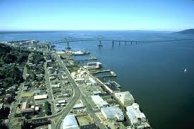
See our article with photos of Oregon City, the official end of the Oregon Trail.


If you are planning an Idaho vacation, I would highly recommend a visit to the National Oregon/California Trail Center. This is an interactive museum located in Montpelier, Idaho displaying wagon trains, trading posts and other pioneer attractions. Here you will see and hear and become part of a reenactment of a simulated wagon train journey. Montpelier is located in the Bear Lake Valley in southeastern Idaho. A visit there is definitely a worthwhile history lesson as well as fun for the entire family. You may also find a related short story interesting about the unique "wind wagon", used by Samuel Peppard to travel 500 miles over the Great Plains. Another interesting stop is Independence Rock where many westward emigrants etched their names into the rock.

(Photos are from the public domain)


Sunday, March 27, 2011

The Colorado Coalfield War 1913-1914


There are many ways to look at historical events. Sometimes they appear isolated and other times they portend to be part of something much larger. As time passes and we look back at them they can often take on greater significance. Two examples are the Triangle Shirtwaist Factory fire in New York City in 1911 where 146 garment workers, mostly immigrants, were killed and the Cocoanut Grove nightclub fire in 1942 which killed 492 people. Although they happened decades apart, both of these disasters ushered in much stronger building fire regulations. Such was the case with the Colorado Coalfield Wars of 1913-1914 that took place in southern Colorado in the area near Ludlow just north of Trinidad. 

On the surface it appeared to be just another instance of labor unrest which was prevalent during the late 1800's and early 1900's. In 1886 the country experienced the Haymarket Square Riot in Chicago where a pipe bomb was thrown into a crowd resulting in the deaths of seven police officers. The police responded by killing four demonstrators and a total of sixty people were injured. There was also unrest in the West Virginia coal mines in the latter part of the 1800's which led to violence and deaths. The impetus of the unrest was the workers desire to unionize and the industrialists equally strong desire for them not to. The case of the Colorado Coalfield Wars was no different...they had everything to do with unionizing and they were violent and deadly. There was general labor unrest with mine workers throughout Colorado and in some cases entire towns were occupied by striking miners but the events in Ludlow were particularly violent.


Working conditions in general were not good for the miners. The work was hard and dangerous. Cave-ins happened frequently causing deaths and the appearance was that the mine operators didn't place too much emphasis on safety. Colorado's mine worker fatality rate was running double the national average. Most of the miners at that time were European immigrants just happy to have a job.


The violence began in earnest after the Colorado militia entered the picture to try to force the miners back to work. The mine operators also hired the Baldwin-Felts Detective Agency to add muscle. Their detectives were primarily there to intimidate the miners and their families. In those days a coal miner and his family typically lived on land near the mines owned by the mine operator. When work stoppage began they were ordered off the property and ended up building a tent city on land leased by the union.


The strife escalated with the militia in open warfare with the striking miners and the miners trying to damage and destroy the mines. Each side was heavily armed and each trying to occupy strategic positions. There were accusations that the union organizers were intimidating many of the workers to strike and accusations that the state militia was nothing but an enforcement arm of the mine owners. It should be noted that the major investors in these mines were millionaires from the east such as John D. Rockefeller. While they sent representatives to Colorado, they were pretty much removed from the daily operations.


All of the strife came to a head with the destruction of the tent city at the hands of the militia. The tent city was fired upon with machine guns and burned with kerosene. The fighting at the camp lasted some fourteen hours. There were many deaths, mostly women and children. 


To illustrate how this was much more a war than a scuffle, the picture to the left shows what some called the " Ludlow Death Car", an armor plated automobile which served as a sort of urban army tank. After the Ludlow Camp massacre the fighting intensified with the union calling all workers to arms. Mines were attacked, mine guards killed and everything was escalating out of control. Peace was finally restored only after President Woodrow Wilson sent in federal troops. Total number of lives lost in this labor war vary widely depending on which side was asked, anywhere from 69 to 190


The aftermath of all this carnage was that the union did not win it's right to organize the workers. They were eventually replaced by other workers and the union ran out of money at the end of 1914.


What the workers did win was the recognition that conditions needed to be changed. John D. Rockefeller Jr. personally became involved in making the changes. Mine safety was improved, roads to the mines were paved, recreation facilities were built and mine workers were seated on committees dealing with safety, recreation and health. In other words, where before the workers had absolutely no input, they now had a voice in the operation of the mines. There was also the understanding that previously striking miners would not be discriminated against.


In 1916, the United Mine Workers of America bought the land at the site of the Ludlow Massacre and built a monument there in 1918. In 2009 the site was made a U.S.National Historic Landmark. 

The monument site is located about 15 miles north of Trinidad, CO just off Interstate-25. Take the County Road 44 exit and go west just short of a mile. Visiting the landmark is a good lesson in history. Another interesting companion side trip when in Colorado is Manitou Springs' Miramont Castle.


Here are several good web sites to learn more about the Colorado Coalfield War:


www.archeology.org


www.du.edu/ludlow/


www.jstor.org

Saturday, March 26, 2011

New Mexico Santa Fe Trail National Scenic Byway

santa fe trail wagon trainsanta fe trail wagon rutsFrom New Franklin, Missouri to Santa Fe, New Mexico the Santa Fe Trail was one of the nations most significant early transportation routes. Carved out of the wilderness in 1821, William Becknell, a freight operator, struck out west from New Franklin with a load of cargo (mostly cotton) to trade in Santa Fe. He also thought the time was right because of the Mexican revolt against their Spanish rulers. The story is that he encountered Mexican rebels along the way and they confirmed that trading in Santa Fe would be much welcomed. This is truly a tale of the old west. Becknell left New Franklin again in 1822 with more traders in tow and the trail grew more busy each and every year. Over the years the trail became a major military route to the southwest and played a part in the Civil War. The photo to the left shows trail ruts in New Mexico, a product of the thousands of wagons that traversed it.  In addition to opening trade to Spanish New Mexico or referred to as Nuevo Mexico, the route traversed "Comancheria", the plains country of the Comanche Indians and many traders from the east found it quite profitable trading with the Comanche's along the way. The Comanche's also felt they should be rewarded because the route crossed their native homeland. The Comanche's were a factor as settlers in Texas discovered during the mid 1800's. The Santa Fe Trail also opened the floodgates of early emigration to the entire southwest.

In 1992 the U.S. Governments's Dept. of Transportation designated National Scenic Byways and American Roads to honor their historical and cultural significance. The Santa Fe Trail was certainly one of them.

Another interesting story we have on Western Trips is the historic town of Puerto de Luna located about 10 miles south of Santa Rosa. 


If you find yourself traveling in north/northeastern New Mexico, you have a great opportunity to visit several very interesting landmarks and buildings that commemorate the Trail's importance.
santa fe trail map
There are many sights to see all along the trail from Missouri to New Mexico and one very informative web site will give you an excellent list of places to visit all along the New Mexico portion. You may wish to pull up  www.santafetrailnm.org


An excellent source on the life of William Becknell can be found on this site:  www.tshaonline.org

If you find yourself in Santa Fe, NM be sure to see the marker located right on the Plaza which designates the official end point of the trail. It's on the southeast part of the Plaza. Another interesting short story is how Fred Harvey and the AT&SF Railroad helped civilize the southwest.

The Northfield Bank Robbery And The Decline Of Jesse James


Jesse James
Along America's byways is the town of Northfield, Minnesota. Northfield, founded by John North in 1855, was the site of one of the most talked about bank robberies in popular history.

The town was established as a peaceful European-American agricultural and lumber center and the home of Northfield College, established in 1866 and later changed to Carleton College.  Another college, St. Olaf's was established in 1874. However on September 6th, 1876 ( just a little over two months after Custer's defeat at the Battle of the Little Bighorn ) all of that didn't matter.

A notorious outlaw gang led by Jesse James tried to rob the First National Bank of Northfield. The robbery was a failure. The local townspeople discovered what was going on and armed themselves accordingly. A firefight ensued and the robbery was thwarted. Jesse James ( shown in an undated picture to the left ) and his brother Frank barely escaped. The remainder of the gang ( Younger Gang ), with Cole Younger's photo at right, were either killed or captured. During the robbery attempt a bank employee and bystander were killed.

Cole Younger
There have been many books written, documentaries and films produced about the famous outlaw, but this one attempted bank robbery in Northfield was a major turning point in the career of Jesse James.

Jesse James was a Confederate soldier during the Civil War. He was thought to have ridden with Quantrill's Raiders, a violent gang that terrorized much of Missouri which was a state that was fairly split between Union and Confederate sympathizers. He was bitter about the Souths defeat and remained so throughout his life. Some historians even refer to the 1876 Northfield bank robbery attempt as the last battle of the Civil War.


The James Gang's aborted robbery  attempt in Northfield destroyed much of the gang, increased the pressure from the authorities and placed Jesse on a downward spiral which eventually led to his assassination by gang member Robert Ford.


In 1975 the Northfield Historical Society bought the old bank building and restored it to it's 1876 condition. They operate it now as a museum open to the general public. While there have certainly been many many bank robberies, I think that anyone interested in late 19th century western history will find this particular museum a very worthwhile driving trip. Northfield is located about 45 driving miles south of St. Paul and just east of Interstate-35.

You will also be interested in our Western Trips article about the infamous outlaw Sam Bass.


This site of the Northfield Historical Society will give you all the details you need for your visit:


www.northfieldhistory.org


www.nationaljamesyoungergang.org

Thursday, March 24, 2011

Glacier National Park And The Great Northern Railway


A scenic low budget driving vacation is a visit to one of our national parks. Glacier National Park is no exception. The park is located in the far northwest corner of Montana. To say that Glacier is a great place for beautiful photo taking is an understatement. One interesting story about Glacier is how the Great Northern Railway, popularly referred to as "The Empire Builder",  played a major role in the parks awareness to the general public. The Great Northern Railway was built from St.Paul, Minnesota all the way west to Seattle, Washington. The building of this railroad was a major undertaking as was the case with any transcontinental railroad since the tracks and bridges had to be built over the Rocky Mountains. Survey teams were very challenged to find a suitable route.                                             

The area was first explored by trappers as was the case with most western areas. Following the trappers came the miners and after them came the cattle raisers searching for land. With the Great Northern Railway in operation since 1891, travelers had an efficient way to reach northwest Montana. Roads were not easily passable until after 1900 and the railroad provided the best mode of travel. 

The driving force for the creation of the park was a conservationist by the name of George Bird Grinnell who appreciated the areas beauty and wanted to keep it that way. Since many western mountain areas were exploited by industry, Grinnell wanted to ensure that this area stayed untouched. Rather than approaching the government with his request, in 1891 he approached the Great Northern Railway. The railway agreed that the park was an excellent tourist attraction and a destination in it's own right and promoted it as such to the general public. The railroad's motives however were based on a workable and profitable business plan to earn money for it's investors as opposed to simply advancing conservation. The Canadian Pacific Railroad did the same thing with it's promotion of Banff as a unique tourist destination.  The Great Northern commissioned writers, photographers and painters to spread the word about Glacier and it's name was soon heard from coast to coast. The result was that travelers came in large numbers and the Great Northern had a profitable venture.

In the early 1900's, the Great Northern Railway built hotels and chalets in the area which allowed summer tourists a comfortable place to stay while visiting the park. To explore the park's interior a typical visitor in the early 1900's was required to ride horseback, hike along it's many trails and perhaps take a boat ride.  After the railroad was built, towns, settlements and stores sprang up along the tracks and the population increased, both with tourists and settlers. George Bird Grinnell did eventually achieve his goal. In 1910 President Taft named Glacier a National Park, the nations 10th. 

The same rail route is still in operation today as Amtrak's "Empire Builder". 

You'll also be interested in our Trips into History article about the Avalanche Disaster at Wellington Washington that buried a passenger train in 1910.

Here are sites to give you all you need to plan your visit:

www.nps.gov/glac/index.htm 

www.glacier.national-park.com 

www.amtrak.com   Select routes and click "Empire Builder".


Wednesday, March 23, 2011

Wyoming Sites / Independence Rock

independence rock wyoming

A very historically rich side trip off our nations byways is Independence Rock in Wyoming.. Independence Rock is located along the old Oregon, Morman and California emigrant trail. This trail was the main trunk line from the Missouri River to points west including the west coast. The popular story is that the emigrants wished to reach this point by July 4th thus having enough time to cross the mountains to the west before the worst of the winter weather set in. If you arrived at this point too late then the chance of being trapped in the mountains by massive snowfall was that much greater. The story of the ill  fated Donner party is a prime example.

The rock, which is solid granite, measures 130 feet high and is located along Wyoming Highway 220 in southwestern Natrona County. In 1961 it was designated a National Historic Landmark. It is now a state historic park site and administered by the state of Wyoming.
                                                   
etchings on independence rock As they passed, the emigrants carved their names and dates into the rock and also left messages to those on the trail behind them.  Most of these carvings can be found near the summit of the rock and they are reachable with a relatively easy climb to the top. One theory regarding the carvings is that possibly a professional etcher set up shop at the base of the rock and offered his services to passing emigrants. This however has not been conclusively proven.   

The exact location is about 50 miles southwest of Casper, WY. You can pick up State Highway 220 in Casper coming off of Interstate-25.

These sites will give you much additional information:

www.wyomingtourism.org

www.independencerock.org

Friday, March 18, 2011

Old Fort Parker And The Formation Of Texas

fort parker in texas

 An excellent Texas side trip is Old Fort Parker located about 100 miles south of Dallas, between the towns of Groesbeck and Mexia. One of the most incredible stories during pre republic Texas started right there in the year 1836.


fort parker state park in texasThe story begins with the extended Parker family relocating to Texas from Illinois in 1833. The inducement was the Mexicans offering free land to settlers. The Mexicans had a difficult time during their advance northward into Texas primarily because of the hostile Comanche Indians. The Comanches were formidable warriors and they essentially checked the Mexicans advance northward. They were probably the main reason the Mexicans went no further than south Texas. Offering free land to white settlers was a way to build a buffer against the Comanches and also a way to push the Indians northward. 


In the year 1833, the frontier line was in east central Texas. The Parker family built their fort which was a working farm near present day Groesbeck, TX. At that time this particular site was on the far western edge of the frontier line. To some, it was considered probably too far west meaning that the Indian threat was much greater. 

comanche leader quanah parkerThe tale of what happened in 1836 at old Fort Parker is the subject of several very good books. In short, in May of 1836 the Comanches approached the Parker settlement under the guise of asking for food. Several family members approached the Indians and were willing to offer some supplies. The brief meeting took a quick turn for the worse and several Parker family members were slaughtered. The Indians, as was common at the time, kidnapped the children. Cynthia Ann Parker, nine years old, was one of the captives and was held by the Comanches for decades. Indians took young white captives for two reasons. One was for their ransom value and the other simply to assimilate them to their ways and increase their own population. During this time Cynthia Ann Parker gave birth to half breed children one of which turned out to be the warrior chief named Quanah Parker ( picture to the left). Quanah grew up and roamed and raided white settlements on the plains for years and was probably considered the most famous and feared Comanche chief who fought with the military until his surrender in 1875. Interesting enough, Quanah eventually became a main proponent for the Indians adopting the white man's way of civilization and settled near Fort Sill, OK.


The story is fascinating and of course there are many side stories sprouting from these events during the mid 1800's. One of which is the story of Colonel Ranald Mackenzie who was considered one of the army's premier Indian fighters and was the person whose troops brought final defeat to Quanah's band. Other stories concern the origins of the famed Texas Rangers and attempts by groups of Texans to free the captives.


A visit to Old Fort Parker makes for an interesting side trip into the early formation of the Texas Republic. Nearby the fort is the Fort Parker State Park.


You will want to visit these web sites for additional information about Old Fort Parker and the Fort Parker State Park and their exact locations:


www.oldfortparker.org


www.tpwd.state.tx.us


Thursday, March 17, 2011

Visit Historic Colorado / Cripple Creek

cripple creek colorado parade
colorado mountains
Cripple Creek, Colorado is located about 28 miles west/southwest of Colorado Springs. Driving distance is about 45 miles.

The area was originally a ranching community and then in 1891 gold was discovered. This obviously changed everything and at it's height in the early 1900's, the population soared to around 50,000. Even today, a town of 50,000 is not considered small. You can imagine the enormity of a booming mining metropolis of that size in 1900. The area turned out to be one of the largest gold mining discoveries in North America. When the gold find started to exhaust itself in 1918 approximately $300 million worth of the precious metal had been mined from this area.

Visit Scenic Cripple Creek Colorado


Traveling in Colorado always offers scenic vistas and great photo taking opportunities. Cripple Creek is no exception as the town is situated on the southwestern slopes of Pikes Peak. It's elevation is 9,500 feet and it is designated a National Historic Landmark.


Today, Cripple Creek Colorado is a well known tourist destination with the opportunity to take tours of the Cripple Creek and Victor Gold Mine which is still operational. Entertainment was always a going business in old mining towns and Cripple Creek was no exception. Theaters and opera houses have come and gone over all the years, but Cripple Creek still has one historical venue that began in it's heyday of the Colorado Gold Rush. The Butte Theater still offers visitor exciting and original live entertainment to this day..

Lots of great restaurants, hotels and horseback riding is available in and around Cripple Creek. Be sure not to miss visiting the Cripple Creek District Museum which will really give you all you need to know about the town's historical significance. Cripple Creek also hosts events year round including the Cripple Creek Ice Festival in February...the Once Upon a Time in the West Art Show and the Donkey Derby Days in June... Cripple Creek's Fourth of July Celebration...and many more.

A good companion side trip when heading to Cripple Creek is nearby Manitou Springs Colorado and the Miramont Castle.


Here are some very good web sites to learn more about Cripple Creek and their schedule of annual events:


www.visitcripplecreek.com


www.cripplecreekgov.com


Another not to miss stop while you are in this area of Colorado is the Royal Gorge Bridge. The bridge was built in 1929 over the Arkansas River just west of Canon City, CO and south of Cripple Creek. The bridge rises 955 feet above the Arkansas River and is breath taking. Obviously some great photo opportunities. These sites will tell you more about this spectacular span:


www.royalgorgebridge.com


www.pikes-peak.com/Attraction/24.aspx

(Article copyright Western Trips)

History of Wildfires / 1910 Idaho

Northern Idaho is one of the most beautiful and scenic places in the entire U.S. rich with mountains, forests and streams it is an outdoor wonderland especially during the summer months. Some of the finest river fishing is found right there.

The Great Fire of 1910

This area of northern Idaho and eastern Montana also played a big part in our nations conservation history but unfortunately a lot of it had to do with the Great Fire of 1910...it's causes, and there were several, and just as importantly how the nation responded.
wallace idaho after the fire
wallace idaho fire
At the turn of the century, the Idaho/Montana area was abundant with white pine trees and the demand was great. Much of the large forests in the east were already cut through but the west was still fertile and the lumber companies descended on this area in force. Cutting through forests with conservation and safety in mind was not exactly on the timber companies agenda. In fairness, as with almost any disaster, there was more than one factor involved with The Great Fire of 1910.

A Hot and Dry Summer Sets the Stage

The summer of 1910 was brutal. Rainfall was almost nonexistent. Everything dried up. It was the worst drought on record and temperatures were hot. At the same time, tracks had been laid for the Great Northern Railroad and the steam locomotives that started running through the area kicked off embers into the dry forest. Also, the worker camps established in the hills posed a fire threat simply because fire prevention was not a top priority with many inhabitants. A combination of drought, dry timber, high temperatures and industry all converged to cause the largest forest fire to date.

The New National Forest Service 

The National Forest Service had just recently been established under the Roosevelt administration but it was underfunded and ran into political problems and the lumber industry as a whole was antagonistic to it's creation. In other words, the National Forest Service had an uphill battle in it's effort to enforce conservation as opposed to unregulated cutting. There were also conflicting opinions about forest fires themselves. Should they be left to burn naturally or be fought. After the fire of 1910 it was decided that all fires were to be fought and that remains the policy to this day. The Fire of 1910 was the decisive event that shaped public policy going forward. During this massive fire there was also a new fire fighting tool developed. The Pulaski Tool as some refer to it today was developed by a Forest Ranger named Edward Pulaski. Pulaski, while battling the blaze managed to save dozens of the men in his command and as a result came up with the Pulaski Tool which is still used today by our wildland fire fighters.

Several towns were destroyed including one-third of Wallace. Three million acres in all were burned. The fire lasted for two days and killed 87 people which included 78 fire fighters. The fire involved ten national forests and smoke from the disaster was eventually seen as far east as New York state. The army was brought in to help fight the fire including a contingent of the African-American Buffalo Soldiers.

(Photos from the public domain)


Here are websites that offer more information:

The Story of the Modern Day Smokejumpers


www.idahoforests.org


www.fs.fed.us


www.wallaceidahochamber.com

Sunday, March 13, 2011

The Modoc War/ Northern California

modoc indian chief captain jack
modoc war cave in california lava bedspicture of general edward canbyThe Modoc Indians lived in far northeastern California in the area of the lava beds and Tule Lake. The lava beds are now a national monument and make an excellent side trip for anyone on vacation in far northern California. The lava beds are located in Siskyou and Modoc Counties. 


The Modocs whose leader was known by the name of "Captain Jack" were known as a relatively peaceful tribe of native Americans and as compared to their cousins on the plains did not really experience the full brunt of western expansion and the decades long Indian Wars.


Like most of the conflicts between Indians and settlers, the catalyst was the encroachment of white settlers onto traditional Indian land. The problems for the Modocs started in earnest in the early 1850's. Remember that the gold rush in 1849 brought thousands of settlers into California and the tide only grew larger with each passing year. In 1852 the Modocs killed 65 white settlers on a wagon train. Eventually the military becomes involved when settlers are slain and in retaliation 41 Modocs were killed at a supposed peace conference with a California militia. Hostilities continued until 1864 when the Modocs signed a treaty that had them relocate northward into southern Oregon so that their fertile land could be taken over by the white settlers. The relocation didn't work well because the Modocs were now encroaching on the Klamath tribes and there was violence that ended with murdered whites which then caused the Oregon settlers to set upon the Modocs.


The Modocs retreated back to the lava beds area and during a peace parley in April 1873 with the Civil War hero General Canby of the army, Captain Jack pulled out a gun and killed him. The army retaliated and captured Captain Jack and his small band in the lava beds which they fled to for natural protection and concealment. The end result was that he and three other Modocs were hanged for the killing of Canby and another man. The Modoc War is sometimes referred to as The Lava Beds War.

You will want to see our Western Trips article and photos of a trip to historic Oregon City, the end of the Oregon Trail.

(Photos and images from the public domain)


This website will give you much more information on the area and it's exact location:


www.nps.gov/labe/planyourvisit/directions.htm

This site will give you more on the Modoc's and the war:

www.mnsu.edu/emuseum

Saturday, March 12, 2011

Greystone Mansion

greystone mansion beverly hills
Greystone Mansion, sometimes referred to as the Doheney Mansion is located in Beverly Hills,CA. This should definitely be a stop when visiting the L.A. area or Beverly Hills. Today the grounds (18.5 acres) are a Beverly Hill's city park open to the public and is on the National Register of Historic Places. The mansion itself is only open for special occasions. Over the decades, the mansion and grounds changed ownership several times and eventually was willed to the City of Beverly Hills. The mansion has been and will continue to be the site of many social gatherings.

The history of the mansion and the grounds is a much more interesting story and if you do visit you will want to know not only why and by whom it was built but also the very sad tale of it's original occupants. This mansion was at one time the scene of one of the Los Angeles areas most perplexing tragedies that had ties all the way to Washington D.C.


The home was built in 1926 at a cost of over $3 million and comprised 55 rooms in 46,000 square feet. It was built by Edward.L. Doheney for his son Ned and his new bride. E.L. Doheney was one of the richest men in the country at that time. He was one of the first oilmen to develop wells in Los Angeles proper. From there the oil baron's wealth spread with oil pumping out of the ground at many U.S. locations as well as from Mexico.

When historians speak of E.L. Doheney they invariably remember the old Teapot Dome scandal that took place in the early 1920's during the administration of President Harding. Many books have been written regarding the scandal but in short it had to do with bribes from oilmen to administration officials in Washington to gain access to the governments oil fields. Teapot Dome was a government owned oil field in Wyoming and part of the Naval Reserve supply. Edward L. Doheney himself (as well as Harry Sinclair of Sinclair Oil) was implicated in the scandal and essentially accused of bribing Harding's Interior Secretary Albert Fall. Allegedly Doheney's son Ned and his secretary Hugh Plunkett withdrew and delivered the bribe to Fall in a hotel room upon his father's orders.

interior
Albert Fall, on left
The story ends sadly in late 1928. The Teapot Dome investigation was beginning to heat up. The next thing that happens is that both young Ned Doheney and Hugh Plunkett are found shot dead late at night at the mansion and not long before both were to testify about their involvement with the bribe to Albert Fall. This occurred only four months after the young Doheney, his wife, children and servants moved into the newly built mansion. The police were called several hours after the bodies were found and there were many questions left unanswered. Was it murder or murder/suicide?


There is much more to this story and there are several interesting books that are excellent reads. The story involves politics, oil money and government officials and a lot of side stories spin off from the main plot.


The Greystone park area today offers beautiful scenery and is definitely worth a visit and presents a good picture taking opportunity.


Here are websites that offer additional information:


www.greystonemansion.org


www.seeing-stars.com/live/Greystone.shtml


www.beverlyhills.org/attractions/greystone/default.asp

Port Chicago / Explosion in Northern California

port chicago munitions depotThere are of course thousands of stories about World War Two. What happened at Port Chicago is one of them. Port Chicago is located about 35 miles east of San Francisco. During World War II the site was a naval magazine storage and loading facility. The troops stationed there transported the munitions from storage bunkers to waiting ships which then sailed off to join the Pacific war effort. Needless to say the task of moving live ammunition from bunker to ship hold was a dangerous job. It was probably the most dangerous job on American soil. Also this type of job was not something that you wanted to rush and unfortunately, because of loading quotas, this was the case.
On the night of July 17, 1944  the largest U.S. mainland World War II disaster took place when a gigantic explosion occurred while troops were loading munitions onto a ship. Five thousand tons of ammunition exploded which lit up the entire east bay San Francisco sky. The blast was so powerful that windows shook 100 miles away and 320 people were killed instantly.

port chicago californiaThere was much controversy surrounding the Port Chicago disaster. African-American sailors were generally assigned to this hazardous duty commanded by their white officers. There were also many accusations of pressure put upon the sailors to work harder and faster to attain loading quotas. Many felt that this type of work scenario added a much higher level of danger to an already dangerous assignment. There was a sensational court martial afterward regarding mutiny charges against sailors who refused to continue working this highly dangerous duty. The disaster itself was also instrumental in bringing segregation to an end within the military. To give you an idea of the scope of the disaster, approximately 15% of all World War II African-American soldier  fatalities were attributed to the Port Chicago disaster. This was one of the largest World War Two navy disasters on record and there are today several  good World War Two books available on the subject and the men who served in World War 2.

Today, the area of Port Chicago is a Naval Magazine National Memorial. It is located on the grounds of the Concord Naval Weapons Station in Concord, CA. I believe that people traveling past this area will find a stop there historically rewarding. 

The following websites will give you additional information, directions, etc:


Thursday, March 10, 2011

The Battle Of Glorieta Pass/ New Mexico


In March of 1862 there was a little known Civil War battle that took place at Glorieta Pass in New Mexico, just southeast of Santa Fe. When driving to Santa Fe you may want to stop by and visit this remarkable area. The drive to Santa Fe regardless of the direction you're coming from is spectacular in itself and visiting this key Civil War battle site is historically enriching.

The Confederates Enter New Mexico Territory


The Confederate Army under the command of General Henry Sibley made inroads into New Mexico during 1862. His troops were composed of Texas volunteers along with Texas Rangers who entered New Mexico Territory from Fort Bliss in El Paso Texas. Initially were pretty successful and held the then small settlement of Albuquerque for many days. The Union forts established in New Mexico prior to the Civil War were built to deal with the Indian population. They weren't necessarily effective against an invading force of Texans. Because of this, Sibley's forces were successful in the southern part of the territory.

The aim of the Confederate Army was to gain a foothold in northern New Mexico (they had occupied Santa Fe) and then advance along the eastern side of the Sangre de Cristo mountain range and then head northward onto the high plains. To make it in that direction they had to go through Glorieta Pass. This was in conjunction with Confederate action in the southern part of Arizona. The overall goal of the Confederacy was to establish a link to San Diego and establish a much needed port there.

The Tide of War Changed at Glorieta Pass


The Battle of Glorieta Pass was a step toward Sibley's goal of attacking Fort Union to the north. The Union troops were basically Colorado volunteers under the leadership of Major John Chivington of Colorado along with New Mexico Volunteer Infantry, and the battle itself proved to be decisive for the Union side which were the victors. The battle signified the end of the Confederate initiative into New Mexico and eventually all of the New Mexico Territory. Because of this key Union victory, Major Chivington's popularity in Colorado soared and he not only advocated quick statehood for Colorado but also became the leading contender for the state's first Congressional seat.

An interesting side note for the traveler is that to this day the stairwells of the Colorado State Capitol Building have cannonballs from the battle of Glorieta Pass as ornaments.

Glorieta Pass is about 25 miles southeast of Santa Fe, NM just off of Interstate-25.

BATTLE OF GLORIETA PASS VIDEO 


These web sites offer additional information regarding the battle and more information about Major John Chivington, leader of the Colorado Union volunteers:


www.nps.gov/history
www.pbs.org
www.colorado.gov

Wednesday, March 9, 2011

Pony Express Route / California

pony express poster
The Pony Express was the world's most incredible feat of mail delivery. As the poster on the left clearly announces, the Pony Express system wanted young wiry riders with expert horsemanship skills. Due to the dangers involved orphans were preferred. The Pony Express route not only ordered the rider to traverse desolate territory but the path also crossed hostile Indian lands which made the job much more difficult. The Pony Express riders were to have mounts which could in theory out run Indian horsemen.


The route ran from St Joseph, MO to Sacramento, CA. The entire route was about 1,900 miles long. The rider actually took a barge over the Missouri River from St. Joseph and as soon as the plank was lowered on the Kansas side, the rider took off westbound with lightning speed. There were several reasons for beginning the Pony Express, speed of delivery obviously being one of them, but also that the government felt it necessary to have better communications with California during the Civil War period. Prior to this the mail traveled over the 2,800 mile southern route to California but during the Civil War this route was often blocked.

In a very real way the Pony Express helped keep California in the Union during the Civil War. There were about half a million people living west of the Rocky Mountains at the time of the war and they wanted to stay connected with the east. A letter sent by Pacific Mail Steamer would have to go through the Isthmus of Panama and would take a month or more to make it to New York. The Butterfield Overland Mail Stage which took the southern route to California was shut down because of the war. A letter sent on the Pony Express would take a matter of days and it was the only logical alternative. After arriving in Missouri it could either be sent by train or telegraphed. The telegraph mode of communication was developed in the 1830's and then grew tremendously in the 1840's and 1850's. It was the completion of the transcontinental telegraph line in 1861 that mad the Pony Express system only about an 18 month affair.


pony express postage stampSacramento was the western terminus for the Pony Express route. Mail was delivered by fast steamer between Sacramento and San Francisco via the Sacramento River. Eastbound mail originating from California and the Washington Territory was sent to San Francisco and then Sacramento. Telegraph lines at the time were as west as St Joseph and on the California end as east as Placerville in the Sierra Nevada foothills. Urgent messages could be wired from Placerville to San Francisco and from St. Joseph eastward. To the right is a replica of a 25 cent Pony Express stamp from the era.


The California route went from Sacramento east to the south shore of Lake Tahoe. After that it went through the Indian country of Nevada. The path pretty much followed the present day U.S. 50 through Placerville and over Echo Summit to Lake Tahoe's south shore. U.S. 50 in those days was known as Johnson's Cutoff. The sites of many of the Pony Express stations along this route are commemorated with historical markers. The Pony Express system operated from April 1860 to October 1861.


When traveling to the Lake Tahoe area, you would want to stop and see the "Sportsman's Hall" site at Pollock Pines. It was also known as the "Twelve Mile House" and it was considered a "remount station". The address is 5622 Old Pony Express Trail, just off Highway 50.


These websites will give you more information about the California Pony Express route:

www.sierranevadavirtualmuseum.com 

www.sierracollege.edu 

Pollock Pines Sportsman's Hall 


Tuesday, March 8, 2011

Fort Stevens Park

columbia river shorelinefort sevens oregonIf you are driving up the Oregon coast, the mouth of the Columbia River is not only picturesque but is also the site of three historic military forts that were at one time strategic defenses for the U.S. Fort Stevens was constructed near the end of the Civil War to guard the mouth of the Columbia River. Fort Stevens Park is on the Oregon side. There were two additional forts on the Washington State side, Fort Canby and Fort Columbia.
Ft Stevens was an active military installation from 1863 to 1947. It was originally built to counter any British intervention during various regional conflicts such as the Pig Wars along the San Juan Islands further north. Today old Fort Stevens is Fort Stevens State Park. an Oregon State Park and it's also on the National Register of Historic Places. What is also very interesting about Fort Stevens is that being operational for a period of 84 years, it obviously served the U.S. defense system much longer than the vast majority of military posts built in the mid 19th century. Fort Stevens Park remains a good historic tourist top. Also at the mouth of the Columbia is Cape Disappointment State Park which is on the Washington State side with a lot of Lewis and Clark expedition history.

Attacked During World War Two

the state flag of oregonAn interesting side note about Fort Stevens is that it was attacked during World War II by a Japanese submarine in late June 1942. The submarine fired 17 shells at the fort causing damage only to the fort's baseball field backstop. The guns at the fort did not return fire and the submarine sailed on. Fort Stevens was the only mainland U.S. military installation actually attacked by the Japanese during the war. There were two other instances where the Japanese shelled a petroleum platform off of Santa Barbara, CA with minimal damage and a small aircraft launched from a Japanese submarine off the Oregon coast which dropped incendiary devices into the forests. The fires were put out quickly with no real damage caused.

Another side note is that Fort Canby on the Washington side of the river was named after a U.S. Army Colonel who was killed at a parley with the Modoc Indians (along the California/Oregon border) in April 1873. The parley was to try to agree on a  peace settlement which the Modocs thought would allow them to remain in their native area. The meeting went badly and a group of Modocs plotted to have Col. Canby and other peace commissioners killed. 

(Photos from the public domain)

Here are excellent web sites to give you more information on the area: