Western Trips

Thursday, March 29, 2012

Nevada City California / A Western Road Trip to the Sierra Nevada's

When your California vacation includes an exploration of the historic gold mining towns along California's Highway 49, Nevada City is a stop you surely want to add to your trip planner. Nevada City California has long been a popular tourist destination for a variety of reasons.

One is that the town is tucked into the scenic Sierra Nevada Mountains not far north of both Auburn and Grass Valley, two other great gold mining tour stops. Another is the rich history you can experience. Nevada City CA history includes both the large mining operations which was the first reason for it's existence and also the colorful characters who inhabited the town during it's heydays.

Today's Nevada City

nevada city california
Nevada City California
Today, the entire downtown district of Nevada City is a National Historic Landmark.

 Just strolling through town is one of the fun things to do that are free. The entire downtown area of Nevada City California is like one large museum. Tourists enjoy quality restaurants, comfortable and quite unique lodgings and a variety of fine shops, boutiques, galleries and museums. While you can tour Nevada City in one day, you'll have no trouble finding enough great historic sites to make your stay a multi-day excursion.

Nevada City in many respects was like other gold rush towns. It had it's customary three dozen bars, it's gambling houses and it's theaters. Like most of the other gold towns, Nevada City merely started out as a camp and as it's mining fortunes grew, so did the camp. Eventually, the camp became a town. The city today has a population of about 3,000. In 1850, just one year after it's settlement, there were 10,000 people living there. In fact, in the general election of 1856 there were 2,082 ballots cast in Nevada City. This was exceeded in the state of California only by Sacramento and San Francisco. The town was incorporated in 1856 and the word "City" was added to it's name. This helped differentiate it from the nearby Territory of Nevada.

nevada theater
Nevada Theatre
The Nevada Theater

One interesting historic site while touring Nevada City, and there are many, is the old Nevada Theatre.

The Nevada Theatre, established in 1865, is California’s oldest original-use theater. It is still in use today. It's history of performances tell a lot about just how old this theater building is. Over it's nearly 150 years, the Nevada Theatre hosted performances by Mark Twain to Motley Crue and the Second City comedy troupe.

In the old days, in addition to Mark Twain who spent a great deal of time in the gold country, noted performers included Edwin Booth, older brother of John Wilkes booth. It was in Nevada City that Edwin Booth first acted the role of Iago, the villain of Shakespeare’s tragedy “Othello.” For years to come, Booth was recognized as the foremost tragedian of the American stage. Another very notable actress of the 1800's who performed at the Nevada Theatre was Lotta Crabtree from nearby Grass Valley. Lotta went on to become the first entertainer millionaire. Yet, another performer who was seen on the stage in Nevada City was Jack London who resided in the north San Francisco Bay area.

Firehouse Museum
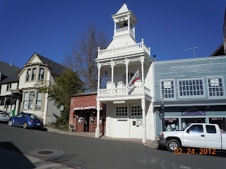
nevada city california fire house
Nevada City Firehouse No. 1
While exploring Nevada City you will want to add a stop at the old Firehouse No. 1 Museum.

This firehouse was built in 1861 and it housed the Nevada Hose Co. No. 1 from 1861 all the way to 1938. Everything from horse drawn wagons to modern fire engines rolled out of this fire house. The fire house is located at 215 Main Street. The Nevada County Historical Society established this building as its first museum, the Firehouse No. 1, in 1947.

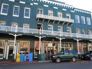
The National Hotel

The National Hotel is listed on the National Register of Historic Places. Out of all the old hotels in Nevada City, the National Hotel is the most historic.

Prior to being named the National Hotel, the structure opened in August of 1856 under the name of "Bicknell Block". The Bicknell Block housed just about everything of major importance during the early days. The stagecoach stop, post office and telegraph office. This hotel is considered one of the oldest hotels west of the Rocky Mountains that has been in continuous operation. When you step inside it's like a trip back to the Victorian era. The hotel is the site of California Historic Landmark No. 899 and is the most noted of the old hotels in the California gold country.
national hotel nevada city
National Hotel, Nevada City
When you tour Nevada City make certain to walk inside the National Hotel. You'll see Victorian era furnishings and decor throughout. Wall coverings and carpeting as well as numerous artifacts give the National Hotel the look of a Victorian museum.

As you can imagine, the National Hotel is still very popular as a place to stay with visitors to Nevada City. The National Hotel offers comfortable lodging in an old-fashioned setting. The hotel includes forty-two rooms and a Victorian dining room. The location is right in the heart of downtown Nevada City.

Being such a historic city as it is, Nevada City California is filled with historic buildings. Another pictured here is the Kidd-Knox Building, shown below. The first structure was built in 1850. It was a two story frame building. It originally housed a theater and a reading room on the second floor. That structure was destroyed in the great fire of 1856 and was replaced with a two story brick building.

Fires ravaged several gold mining era towns. The first structures built throughout the California gold region were built from wood. Effective fire fighting equipment was absent during the towns very first years and when fire destroyed much of Nevada City and other nearby towns, brick became the building material of choice. Today, you see many of these original brick buildings still standing.

Two additional related Western Trips articles are about the Grass Valley California gold mining town and the story of Sutters Fort in Sacramento.

Visiting Nevada City California

kidd knox building nevada city california
Kidd-Knox Building
Many people today travel to Nevada City  for weekend getaways.

Unique bed and breakfast inns, wine tasting rooms, art galleries and world class restaurants are among the attractions. Because of Nevada City's elevation in the Sierra Nevada, fall colors abound with the cooler temperatures and this is another reason why a fall weekend trip to gold country is a lot of fun.

One of the things that visitors to the California gold country soon realize is all of the fun things to do that are free. Nevada City California is one of a string of old California gold mining towns that bring history to life. Nevada City CA is located about 65 miles northeast of Sacramento. The drive is about one hour and twenty minutes.

California Route 49 and Route 20 offer a scenic detour to Interstate 80 while driving between Reno Nevada and Sacramento California. The driving route can be accessed from the west at Auburn California which is directly on Interstate 80.

Accessing this route from the east, look for either the Yuba Pass or Emigrant Gap exits high up in the Sierras. Driving distance from Emigrant Gap to Nevada City is about 32 miles and takes about forty minutes to drive. If time allows, this detour is great fun and takes you through very scenic Sierra Nevada country as well as through the old gold mining towns of  Nevada City and Grass Valley California. It's a scenic alternate route well worth the extra time.

(Article and photos copyright Western Trips)

Wednesday, March 28, 2012

The Atchison Topeka & Santa Fe Railroad Dining Car

cochiti railroad dining car
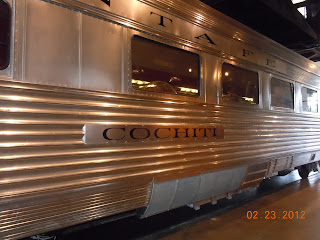
AT& SF Ding Car"Cochiti"
One of the things I've always thought remarkable was the relative short time between the massive westward migration in the U.S during the mid 1800's and the dangers involved such as Indian attack and possible starvation and the era of the railroad dining cars.

 In the course of thirty years or less, railroad dining cars appeared on the western frontier. Thirty years is not a necessarily a short time frame but the changes that occurred in the American West was absolutely astounding. The years between 1850 and 1900 saw some of the most dramatic changes in railroad travel and particularly travel in the western United States. One of those changes was the introduction of the dining car. In modern times today there are many who enjoy railroad dining which is why you have the opportunity to ride the several dinner trains offered around the U.S. It's a way to experience a piece of American history from the days of great national expansion.

The Atchison, Topeka and Santa Fe Railroad


The story of the Atchison Topeka & Santa Fe Railroad had a lot to do with a man named Fred Harvey and eventually with lavish dining car service. Many history books will tell you that the AT& SF Railroad was considered the blue-chip of all the nation's railroads. This route truly offered scenic train rides.The railroad to the country's southwest utilized the expertise of Fred Harvey to establish hotels and dining rooms along it's route. During the 1870's, eating establishments along rail routes had a deservedly bad reputation. This applied to both the food itself and the surroundings. As many people know, Fred Harvey changed that and the Atchison Topeka & Santa Fe benefited greatly. In fact, many people were known to opt for the dining car fare rather than eat at a railroad station.

railroad dining car china and silverware
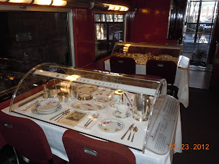
Sample of china and silverware in dining car
Fred Harvey did quite a lot in helping build the quality image of the Atchison Topeka & Santa Fe Railroad. By the same token, Harvey was aided by having such a large railroad as the AT& SF behind his efforts.

Santa Fe and Fred Harvey first became associated together in 1876 with a Harvey Lunchroom. This expanded to Harvey resort hotels after the turn of the 20th century. The dining car service on the AT& SF Railroad was long and successful and culminated in the lightweight extra-fare Super Chief of 1937 which is shown in the photos in this article.

Fred Harvey Manages the At & SF Dining Cars

Fred Harvey was so successful in managing the rail side eateries that the railroad asked him to put his magic to work on their planned dining cars. To Harvey, this was not ideal. Harvey initially didn't feel that the same level of quality could be served up on a moving train car.

Since the 1880's, dining cars became standard offerings on cross country trains heading west from Chicago. The AT& SF relied on the string of Harvey Houses along it's route. In fact, these Harvey Houses were strategically located to accommodate passengers during meal hours.

To put this in some perspective, railroads without the Fred Harvey eateries along the way put their passengers through quite an ordeal. At a stop, railroad passengers might have had up to one hour to find the nearest roadhouse to the train tracks and hope for the best. Unfortunately, the best sometimes wasn't all that good. This very fact is what gave Fred Harvey his early inspiration. The Fred Harvey customers usually were aware of one trademark of the Harvey dining rooms. Harvey's meals were served in sumptuous portions that provided a good value for the traveling public. All of a sudden railroad dining reached a new higher level. This and quality and the AT& SF scenic train trips was a winning combination.


Regarding the dining cars, Fred Harvey's quality food and service was first introduced on the California Limited, one of the great rail excursions. Later, the first class Super Chief also included dining cars staffed by Fred Harvey employees. The dining cars were quite lavish in decor with tablecloths and food served on fine china. Not only could passengers on the AT& SF Railroad enjoy the splendid southwest scenery while dining but they could also count on the legendary Fred Harvey quality.

Fred Harvey's efficiency on the dining cars was such that a Harvey dining car was known to be able to serve an entire train load of passengers in thirty minutes. This was quite remarkable considering the level of service offered. Railroad dining cars were not something found only on the AT& SF but what this railroad successfully marketed was the Fred Harvey reputation. With the great reviews his Harvey Houses had attained, marketing the AT& SF dining cars was not difficult. With so many railroads competing during the years of the late 1800's, something that would set one railroad apart from the other was a good management move.

There's a very good book available, The Harvey House Cookbook by George H. Foster that includes vintage recipes from the various Harvey Houses and the railway cars. The book includes over 200 recipes.

You should find the following two articles of special interest relating to the early railroads and Fred Harvey.
How the Pullman Sleeper Coach Improved Rail Travel and the story of Fred Harvey and the Grand Canyon's El Tovar Hotel. 

The Cochiti Dining Car


dining
"Cochiti" Dining Car Kitchen
Pictured in this article is the 36 seat "Cochiti" dining car of the Achison Topeka& Santa Fe Railroad.

This rail car was a new streamlined stainless steel car that was part of the railroad's famous "Super Chief" train that offered once a week service between Chicago Illinois and Los Angeles California.

The car and seven others were ordered by the railroad in 1936. All of the AT&SF cars were named after Native Indian tribes. The Cochiti was named after the Indian pueblo of Cochiti about thirty miles southwest of Santa Fe New Mexico.

The Cochiti dining car has been preserved and is on display at the famous California State Railroad Museum located in Old Town Sacramento California. The museum has done a great job in displaying this historic rail car. When you walk through the car you can see the kitchen area and all the table have been set with china and silverware. This is one of the most authentic rail car displays I've visited. This particular dining car has been set to it's mid 1940's condition.

Railroad dining cars today are quite different than the earlier cars in basic design. The Cochiti dining car was a one level rail car where the kitchen area was on one end of the car with the dining tables occupying the remainder. You might have a kitchen area with bar stools and then the table beyond. On today's Amtrak bi-level rail cars, you have the dining booths taking up most of the upper level with the kitchen area being on the lower level. Food is sent up via a dumbwaiter.

railroad dining car tables
AT& SF dining car table settings
When Fred Harvey passed away in 1901, his company owned 47 restaurants, 15 hotels, and 30 railroad dining cars. At it's very peak the Fred Harvey Company operated more than 80 Harvey Houses. As most people know, after World War Two, Americans took advantage of the expanding national highway system and passenger rail service went into a steady decline.

When you look back at the early days of railroading, it's interesting to explore the combination of the Atchison Topeka & Santa Fe Railroad and Fred Harvey. The AT& SF was certainly looked upon as being the nation's blue-chip railroad. Exactly how much of that reputation was attributed to Fred Harvey's efforts and how much to the railroad directors themselves should be credited is an interesting study.

Today, the route of the Atchison Topeka & Santa Fe Railroad can be experienced by traveling on the Amtrak Southwest Chief. While the dining cars are of course a bit different, you can still enjoy the wonderful southwest scenery that makes a trip like this a special train excursion. The Southwest Chief travels daily between Chicago and Los Angeles in both directions.It is one of the most scenic trains of all the Amtrak routes. Another interesting article you'll find interesting is a trip on Amtrak's popular Coast Starlight.

Some Great Places to Visit

amtrak southwest chief
Amtrak's Southwest Chief
There are several museums around the southwest that exhibit the Fred Harvey era. One is in Belen New Mexico, just south of Albuquerque. The Valencia County Historical Society's Harvey House Museum is located in the Harvey House Dining Room circa 1908 - 1939. The Building is listed on the National Register and is available for tours.

The Harvey family home located in Leavenworth Kansas is now owned by the Leavenworth Historical Museum and is now operated as the Fred Harvey Museum. Fred Harvey originally purchased the home in 1883. For a very unique stop on your vacation trip planner, in Florence Kansas, the very first Harvey House Hotel called the Clifton House and built in 1878, is now a museum and restaurant. The restaurant features Harvey girl waitresses, tour guides and vintage recipes. 


(Article and photos copyright 2013 Western Trips)


Monday, March 26, 2012

The Wells Fargo History Museum / A Western Trip to Old Sacramento

Wells Fargo & Company played quite a big part during the roaring California Gold Rush era and one of the best places to get a feel for the times is a visit to the old Wells Fargo agents office in Old Town Sacramento California. All of Old Town Sacramento is a State Historic District and you'll want to add it to your California vacation agenda if you're anywhere near Sacramento.

 Wells Fargo & Company

Wells Fargo is probably the most recognized name among the old stagecoach lines thanks to it's wide exposure in scores of western movies cranked out by Hollywood. Their red and gold nine passenger Concord stagecoaches became a symbol of western stage travel.

wells gargo museum in old sacramento
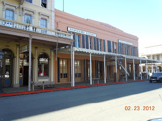
Wells Fargo location, Old Sacramento
 Over 150 years ago, Henry Wells and William Fargo founded a company that has become a legendary part of America. The company was originally a subsidiary of the American Express Company and offered banking and mail services to the California miners in the Sacramento area. Shortly after that in 1852, Wells Fargo opened up an express office and bank in San Francisco.

Wells Fargo began first as an express company where the company contracted with independent stage line owners. Eventually they built their own stage line with the familiar six horse Concord Wells Fargo stagecoaches representing the largest stagecoach service in the world.

The California Gold Rush and Wells Fargo


Like with many people and businesses, the California Gold Rush gave Wells Fargo it's big boost. One recognized truth about making money during the Gold Rush was that while some made a fortune prospecting for gold, others made a fortune catering to those searching for the ore. Wells Fargo is a very good example of this. Another company that grew during the gold rush days and is still around today is Levi Strauss. Levi Strauss produced their patented denim wear that was needed by miners who required durable wear that could take a beating.

Authentic Wells Fargo stagecoach, Old Town San Diego
As far a gold miners were concerned, the Wells Fargo offices offered them a safe place to store their gold.

When the California gold rush began, the statehood for California was still a year or two away and the issue of safety for ones valuable, gold for example, was needed. Wells Fargo offices provided a trusted and guarded place for a miner to store and ship out via express box his gold and gold dust. Locating and filing gold mining claims was one thing. Protecting and securing the claims assets was another thing.

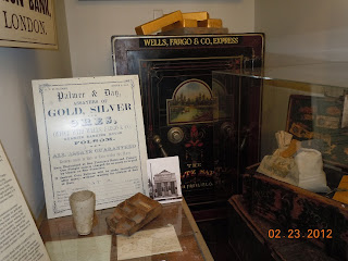
Wells Fargo Express kept scales such as the one shown in this article to provide accurate weight measurements for the local miners who did bring in their gold. Wells Fargo used precision balance scales manufactured by Howard ans Davis in Boston. As a side note, Howard and Davis also made the banjo clocks which were seen in all Wells Fargo Express offices and banks.

Stage Lines and the Civil War

wells fargo gold scale
Howard and Davis Gold Scales
The American Civil War changed everything for the Butterfield line since the Confederacy was very active in the American Southwest and normal stage service was questionable. The Butterfield assets had to be sent north to run over the Overland Trail through the Rocky Mountains. This is when Wells Fargo Stage Line was able to grow quickly

Before the Civil War, starting back in 1857, Wells Fargo and other express companies joined together to form the Overland Mail Company. This new enterprise was aggressive to say the least, establishing regular twice per week mail service between St. Louis and San Francisco. This was about the same time that the Butterfield Overland Stage organized for it's route through the southwest U.S. The Butterfield route went from St. Louis through Arkansas, Texas, the New Mexico Territory and then on to San Diego, Los Angeles and San Francisco.This route by all measures was a harder route to travel over.

The Old Southern Route

The old southern route was essentially desert travel. The central route had to not only cross the Rockies but also the formidable Sierra Nevada's to enter California. Financial complications occurred with the old Butterfield Stage Line which was renamed the Overland Stage Company.

In March 1860, the Overland Stage Company was taken over because of the debt owed to Wells Fargo and as a result John Butterfield was forced out of the business. His stage line assets were taken over by Wells Fargo and Company. With their handsome Concord coaches along with their leather strap suspension system, the Wells Fargo Stage Line was fast becoming the major stagecoach line. There would be many years of growth from this point on.

wells fargo concord stagecoach
Wells Fargo Concord Coach model
The stage line from California to the Mississippi was really connected by three stage lines initially.

Wells Fargo express rode the stagecoaches of the Pioneer Stage Line from California to Virginia City Nevada. The Overland Mail Company, which was taken over by Wells Fargo ran stagecoaches from Virginia City to Salt Lake City Utah. From that point eastward, passengers and mail was Ben Holladay’s Overland Express. That line ran through Denver Colorado to the Mississippi.

Wells Fargo achieved their stage line empire by taking over Holladay's Overland Express as well as the Pioneer Stage line. In 1868 this gave Wells Fargo a single stage line that ran from California to the Mississippi. The Concord coaches that ran over this long route were considered the finest of the era. These Concord stagecoaches traveled an average of five miles per hour and changed horses at "swing stations" every twelve miles.

In Comes the Railroads and Wells Fargo's Express Services

When the transcontinental railroad was completed in 1869, the mail and passenger landscape changed dramatically.

 Nevertheless, train tracks didn't go everywhere and Wells Fargo prospered by running their stages where the tracks weren't laid. They even contracted with independent stagecoach operators to carry their express boxes into more areas. In addition to this, Wells Fargo carried their express boxes on the rails themselves and with that became the largest express company in the world offering their services into new York. What was interesting with the Wells Fargo Express story is how they grew enormously by taking advantage of the ocean to ocean rail service. Instead of shrinking with the arrival of the transcontinental railroad they expanded. Instead of becoming smaller they actually grew larger.

wells fargo safe
Wells Fargo & Co. Express Safe in background
When they reached across the entire continent, in 1888 Wells Fargo offered their trademark “Ocean-to-Ocean” service. Wells, Fargo & Co. grew with the nation.  By 1910 the Company’s network included 6,000 locations and new offices in the Upper Midwest and Great Lakes regions.

The only thing that brought things to a grinding halt was World War One. Because of the war, in 1918 the United States took over all express services. When all was said and done, Wells Fargo was left with one bank in a San Francisco location.

Visit the famous Wells Fargo Museum's

Wells Fargo maintains several museums throughout the country.The Wells Fargo express agent office shown here, built along the Sacramento River,  is just one of many venues. The Old Sacramento office of course is very historic in it's own right for being so closely connected with the California Gold Rush and it's miners in the 1850's and the founding of Sacramento California.

You may also enjoy our article about the Cosmopolitan Hotel in Old Town San Diego, the city's oldest building.

There are nine Wells Fargo History Museums. The museums include real stagecoaches, real gold nuggets and many interesting exhibits. Admission is free to all the museums. In addition to the Wells Fargo Express office  in Old Sacramento, museums are located in San Francisco, Los Angeles, Portland Oregon, San Diego, Minneapolis, Anchorage Alaska, Phoenix and Sacramento. Adding a stop at one of the museums during your next vacation or road trip is a great way to have a fun and historically enriching experience.

(Article and photos copyright Western Trips)

Saturday, March 24, 2012

Big Sur and the California Highway 1 Bridges

Driving California Highway 1 along the Big Sur coastline is certainly one of the most scenic Pacific coast drives you can take. This is million dollar scenery and if you are planning a California vacation you will want to add this to your trip planner if at all possible. The Big Sur coast drive is spectacular and the bridges along Highway 1 are an interesting historical  story themselves. The following Big Sur photos will give you an idea of just how difficult it was to complete this coast highway.

The Concept of a California Route 1

bixby bridge big sur
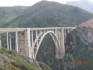
Bixby Bridge, Big Sur California
The concept of Route 1 Big Sur had it's beginnings in the very early 1900's. According to the Cambria California Historical Society, the idea for a road along the coast in Big Sur came from a Dr.John L.D. Roberts.

Dr. Roberts idea arose during the time he was responding to the SS Los Angeles that had the misfortune of running aground near the area of the Point Sur Lighthouse. It took the doctor hours to reach the scene and this convinced him that a coastal roadway needed to be built all the way south to San Simeon.

Dr. Roberts surveyed the area and estimated that a road would cost about $50,000. The Big Sur CA doctor was known to speculate in real estate and therefore had good reason to want a coastal highway. He well knew the spectacular beauty of the Big Sur coast and of course would directly benefit from a tourist industry that would surely follow. As it turned out, after enlisting help from people in power such as a state senator, plans were eventually approved for the project but on the grounds of building a military highway, not one for the tourist trade.

The Famous Bridges of Big Sur

Coming from the north on Highway 1 out of Monterey or Carmel California, the first bridge entering the Big Sur region you'll cross is the Bixby Bridge. Many feel this is the most scenic of all the Big Sur bridges. It's also considered the world's highest concrete single-span bridge.  The Bixby Bridge is over 260 feet high and over 700 feet in length. The bridge was constructed by the Ward Engineering Co. of San Francisco. It was completed on October 15th 1932 at a cost of  $202,334. It was estimated that about 45,000 sacks of cement were used for it's construction.
bixby bridge in big sur california
Bixby Bridge and Big Sur coastline

The Bixby Bridge was formally dedicated on November 27th of that year. Building this particular bridge was difficult especially at it's base. The foundation had to resist the waves which at certain times reached its base. The framework took two months itself to build. You can see from the photo at right the difficult and dangerous work it took to lay down the bridge foundation. Foundations had to be secured on the walls of steep cliffs.

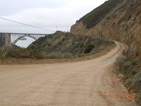
If you stop at this site for picture taking, one of the first things you'll notice is an unpaved road to the left just before the bridge. Interestingly enough, this was the road you had to take heading south prior to the Bixby Bridge's construction. Driving on this unpaved road that winds high around the canyon takes a vehicle with both high clearance and four wheel drive. At least that's what is recommended for a safe passage. Historians will note that at one time, prior to Big Sur Route One, being designated the coastal road, the passage was then called Route 56, or the Carmel-San Simeon Highway. The highway hugs the coast so closely that during World War Two a nighttime blackout was ordered there to prevent the coast from being spotted by Japanese submarines.


old route through Big Sur
Old road used prior to bridge
Because Big Sur Route 1 crosses many canyons and inlets, there are several bridges in the Big Sur region. Another one of these bridges is the Granite Canyon Bridge. The bridge was built in 1932 and spans 127 feet with a 24 foot width. This bridge like the others is a concrete span bridge. This bridge was built by George J. Ulrich Construction Company of Modesto for a cost of $33,700

The Garrapata Creek Bridge, about thirteen miles south of Carmel, has a 150 foot span about 85 feet above the creek plus one 25 foot approach span on the north and four on the south making the total length 285 feet. It was built by Hanrahan Company of San Francisco at a cost of $35,500 and O. R. Bosso was the resident engineer. The arch on this bridge carries the roadway about 100 feet over the creek. As you can easily see by the topography along the Big Sur coastline, any highway built will necessitate the construction of bridges that will span very high over the creeks it crosses. On the photo below you can see the fog hovering on the mountains which is characteristic of the Big Sur coastline.

big sur garrapata creek bridge
Garrapata Creek Bridge
This area of California's coastline is known for it's mountains virtually touching the sea. Another area similar is north of the San Francisco Bay area on Hwy 1 north of the town of Jenner. While there not these type of bridges constructed there, Hwy 1 is full of switchbacks that hug the edge of the mountains.

The Building of California Route 1

Appropriations for funding construction of Hwy 1 were approved by the state in 1919. Federal funds were appropriated and in 1921 voters approved additional state funds. An interesting side note is that a good deal of the road's construction was done by prisoners from San Quentin State Prison. Prison camps were set up at various points to house the inmate workers. Highway 1 was officially completed in 1937.

Constructed lasted some eighteen years and during the 1930's was helped with funding from the New Deal program. First being called the Carmel-San Simeon Highway, the road was renamed California Highway 1 in 1939. Over the years there have been some realignments with California Highway 1 but the road along the Big Sur coast has remained constant.

You may find the following three articles below related to the area around Big Sur interesting. 

Their links are Carmel By The Sea and a popular city just a few miles north of Carmel, Monterey California and it's harbor. 

Also see the Historic Custom House in Monterey

Even though the highway was completed in 1939, the Big Sur region remained one of the most remote areas in the country. Electricity didn't reach Big Sur until the 1950's and the area had just a few structures and few residents. Eventually, and for good reason, Hwy 1 in Big Sur was named California's first State Scenic Highway in 1965. Even today, Big Sur remains a relatively remote area although that stretch of Highway 1 brings thousands of tourists annually through the region. A great thing for tourists driving through is that there appears to be a good number of turn out areas where one can snap some pretty scenic pictures of the coastline.

granite canyon bridge in big sur ca
Big Sur Granite Canyon Bridge
The photo left is of the Granite Canyon Bridge which was built in 1932. This bridge is a bit north of the large Bixby Bridge eight miles south of Carmel. This is also a concrete arch bridge.

Visit Big Sur California

The Big Sur coast is noted for not having any urban areas. What you have are small groups of stores and or restaurants along with a gas station in a few areas.

 For those wishing to escape the urban life, if for at least a short while, then Big Sur needs to be on your trip planner. Weather is what you would expect for the central California coast. Due mainly to the ocean water, temperatures along the Big Sur coast don't change too much during the year with warm dry summers and cooler wet winters. Daytime temperatures usually high 60's to low 70's and in the 50's at night.

The bridges along Highway 1 through Big Sur CA is what made this scenic road possible in the first place. Hopefully you'll have the opportunity to enjoy this fun road trip and see the amazing string of concrete bridges built back during the days of the 1930's. Great coastal scenery, unique dining establishments, hiking trails, unique camping options and much more await you in fabulous Big Sur CA.

(Article and photos copyright Western Trips)

View Larger Map

Thursday, March 22, 2012

Grass Valley California / Things To Do In This Historic Gold Rush Town

downtown grass valley california
Main Street, Grass Valley California
Grass Valley California is an excellent stop to add to your California vacation planner. Grass Valley California is one of the finest restored gold rush towns in the Sierra Nevada foothills. Grass Valley is located on California historic highway 49 in Nevada County California. Grass Valley was settled in the years 1848-49 when gold fever hit and settlers from Oregon and emigrants from the east descended on the area. In fact, all along the Hwy 49 are towns that were virtually overnight by the California Gold Rush. When you're planning a California vacation or weekend trip and find yourself in the Sacramento area, adding a drive on Hwy 49 is an adventure in itself. The route is home to such famous gold mining towns as Sonora, Auburn, Nevada City and others.

The popular story about how gold was first discovered in Grass Valley CA is unique. One account says that a farmer looking for a lost cow turned over a large rock and discovered the yellow metal. It's interesting because I learner that prospectors of the era referred to gold as simply "yellow".

Grass Valley's history is not unlike many of the other gold towns found in the Sierra Nevada foothills. The beginnings were usually as a camp. When gold was discovered, the population of course increased, and not by a small amount, and then the camp evolved into a town. Like several other gold mining towns, Grass Valley CA suffered the destruction of fire. Fire did hit Grass Valley in 1855, after the town grew to a fairly large size, and the result was the destruction of some 300 buildings. Typical of many other gold towns, the buildings were built with wood and fire could spread quite easily. In 1855 the fire fighting resources in a town such as Grass Valley was primitive.

gold mining equipment
Hard-rock mining equipment with ore car
The two larger mines in Grass Valley were the Empire Mine and the Northstar Mine. these mines ended up operating for one-hundred years and the combined production was about $50 million.The old Empire Mine is now a California State Historic Park. The park consists of 845 acres. It includes 12 miles of trails for hikers, bikers and horseback riders. There are fourteen miles of trails. Also you'll see many of the original mine buildings, the owners cottage and the restored gardens.If this isn't enough, the Empire Mine State Historic Park also offers underground tours which link with an old mine shaft dating back to the 1860's.

In regards to the Northstar Mine, today Grass Valley tourists can visit the Northstar Mine Powerhouse and Pelton Wheel Museum. The Pelton Wheel on exhibit is said to be the largest one ever constructed. A Pelton Wheel is a water turbine which gathers it's power from moving water. It was invented by Lester Allan Pelton in the 1870's and while there were water wheels before Pelton's invention, his wheel was considered by most as being more efficient. Included in this museum are exhibits of hundreds of Sierra Nevada gold mining artifacts, including a working Stamp Mill and Cornish Pump.

You may know that the first mining that took place in Grass Valley and in many other Sierra Nevada foothill gold towns was placer mining. .This was the easiest, non invasive method. Gold was found on the ground and in stream soil. This was panning for gold. Eventually, the panning gold method decreased and underground hard mining was employed. As the underground mines grew, and this was an entirely different and sometimes dangerous endeavor than placer mining, skilled hard rock miners from Cornwall and Ireland were employed. These skilled immigrants settled in Grass Valley. Mine owners and managers mostly lived in nearby Nevada City, a short drive further north on today's Hwy 49.

One of the things I've enjoyed while visiting the old California Gold Rush towns is visiting their theaters or opera houses. The gold towns that had grown from camps were popular venues for actors and actresses from the era. The close proximity of the Sierra Nevada foothills to San Francisco allowed many performers to add the gold town circuit to their tours. Booming gold mining towns meant that there were plenty of people quite willing and able to spend money on entertainment. Grass valley was no exception and one of it's tourist attractions is the Lotta Crabtree House.  Lotta Crabtree was a very popular performer in the 1800's and eventually became quite a big star. History books will tell you she became the very first millionaire entertainer. Today, in San Francisco you can view the Lotta Fountain located at Geary and Market Streets. At her death in 1924, Lotta left an estate of $4 million in a charitable trust. Another popular actor who performed in the California gold camps was Edwin Booth, brother of John Wilkes Booth. Edwin was an actor of great ability and fame but his last name became a burden after the actions of his younger brother in 1865. Eventually he opened his own theater in New York with so-so success.

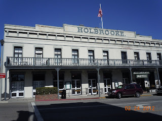
holbrook hotel in grass valley california
Historic Holbrook Hotel, Grass Valley
Another popular Grass Valley CA attraction is the Holbrook Hotel on West Main Street. The hotel burned down in the massive 1855 fire but was rebuilt in 1862. The Holbrook Hotel has the distinction of being home to the oldest bar in all of California. Among it's many visitors over the years were said to be Mark Twain, Jack London, Ulysses S. Grant, Benjamin Harrison and James Garfield. Today, the twenty-seven room hotel functions as a private enterprise and is a California Historic Landmark.

Another interesting building in Grass Valley California is the Nevada County Bank which was constructed in 1917 and renovated in 1975. The structure is noted for it's glass dome. The bank was acquired by Bank of America in the 1930's and operated as such until 1975. The building was originally built by the Rector brothers who at the time were also involved in Nevada City California banking enterprises. The bank building is located at 131 Mill Street in downtown Grass Valley.

nevada county bank building
Nevada County Bank Building
The entire town of Grass Valley today is one large historical site. There are so many historic landmarks to visit, excellent dining and hotels that a visit to the town can easily be one entire day of your California gold country vacation or week end trip. The best way to begin is to take a stroll from one end of Main Street to the other.

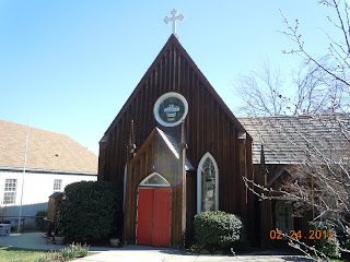
Another interesting stop in Grass Valley is the Emmanuel Episcopal Church. The Emmanuel Episcopal Church was established in Grass Valley in 1858 and is the oldest Episcopal church in California. The church is located at 235 South Church Street. Emmanuel's history is intertwined with the miners and pioneers that settled the Grass Valley area during the California Gold Rush.

emmanuel episcopal church in grass valley
Emmanuel Episcopal Church

The land which this church sits on was donated by the Gold Hill Mining Company and has been conducting services to this very day.

When you drive Hwy 49 and come across the other old gold mining towns you'll find similar sites like this church in Grass Valley. I think it's wonderful that many of these historic structures remain for future generations to explore and many, like the Episcopal Church in Grass Valley still conducts services.There is a Grass valley Museum which is located on the second floor of St. Joseph's Cultural Center. Here you can view clothing and art from the Victorian era. There's also a library, doctor's office, bedroom and a classroom. It's an interesting stop. The address is 410 South Church Street. The museum is operated by the non-profit Historic Mt. St. Mary's Preservation Committee. The building that houses the museum is a brick structure completed in 1866.

Grass Valley California has many buildings on the National Register of Historic Places and it's a terrific fun and educational vacation or short trip destination. Grass Valley is located about 57 miles east of Sacramento via Interstate 80 and Hwy 49. The easy and scenic drive takes a little over one hour.

(Photos are from author's private collection)


Tuesday, March 20, 2012

Railways in Texas / The Katy Railway


When reading about the history of trains, the Katy Railroad left a lasting mark in Texas. If you are familiar with the Houston area you know that a suburb is named Katy. Katy Texas took it's name from this railroad. Another interesting fact is that Houston's Katy Freeway follows the old route of this very busy railway.

katy railroad logo
The history of trains can be very interesting to explore because the railways at one time were the lifeblood of the nation. Before the trucking industry blossomed with the construction of the Interstate highways, trains were the primary way to ship goods. A town that was fortunate enough the snag a railroad line was truly a fortunate town. Railroads in Texas were critical especially when you consider the size of the state and the number of towns and large cities within it's borders.

The Historic Katy

The Katy Railroad was a train company that connected Missouri to Texas. In fact, the very first railway to enter Texas from the north was the Missouri-Kansas-Texas Railroad, often referred to as the MKT. The railroad was also often called the K-T. This was it's stock exchange symbol and was also the way it was called the Katy. The Missouri–Kansas–Texas Railroad was incorporated in 1870 and bought the southern branch of the Union Pacific Railroad which consisted of 182 miles of track. The MKT also acquired several other small railroads at the same time. The Union Pacific had gained approval for access into Texas in 1865. This was all a part of the massive railway expansion that took place all over the midwest and west after the Civil War ended.

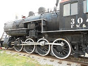
steam locomotive
Fort Worth & Denver steam locomotive
The MKT reached Denison Texas just south of the Oklahoma border, then Indian Territory, with regular train service in December 1872. Eventually the Katy laid track in Texas to serve Dallas, Fort Worth, Waco, San Antonio, Houston, Galveston, and Wichita Falls. Being the first railroad to reach Texas from the north, the MKt took advantage of this by advertising itself as "The Gateway to Texas". Anytime you explore the history of one railroad, you usually find out that it was filled with mergers, acquisitions, name changes and charters awarded by state governments. The Katy was no exception. In the case of the Katy, the railway did not become officially incorporated in the state of Texas until the year 1891. Prior to that it operated in the state under various subsidiary companies. Another interesting fact about the history of the railway was that it never received any land grants from Texas.

map of mkt railroad
Katy Railroad route map
During the first decade of the Katy Railroad operations, a lot changed as far as ownership. This was the era of railroad mergers and acquisitions. Almost like a game of chess. The Katy was bought by Wall Street's Jay Gould in 1880 who then turned around and leased it to his Missouri Pacific Railway Company. During the time Jay Gould owned the Katy it kept expanding it's line in Texas. Several smaller lines were acquired and the Katy Railroad expanded it's service to Dallas, Fort Worth, and Waco. It continued to make it's way eventually to San Antonio and Houston.Gould also picked up the Dallas and Wichita Railway in 1881 and by the year 1882 the Katy had over 600 miles of track in Texas. Again, railroad history is a story of ever changing ownership and the history of this train company is a perfect example. The Katy Railway route map shown above illustrates all of the different routes that eventually spread into parts of west Texas. Acquisitions of smaller railroads added many more towns and cities. To the south the railroad reached down to San Antonio and Galveston.

The Staged Crash of Locomotives

Some people may have read about one of the most strange publicity stunts ever involving a railroad. While lines like to Atchison Topeka and Santa Fe were busy promoting towns such as Santa Fe New Mexico with the hospitality genius, Fred Harvey, the Katy decided it would get a lot of publicity by crashing two large trains together. Indeed it did. Reportedly there were some 40,000 people in attendance to witness this event on September 15, 1896. To jazz things up a bit, one engine was painted in red and the other in a bright green. The trains rode around Texas for about a month before the event to help stir up publicity.


katy railroad crash
Katy train collision in Crush Texas
Unfortunately, it was reported that four people died as a result of a boiler explosion and flying debris. The police were there to keep people back at a safe distance but it appears they weren't held back enough. The trains crashed each going about 45 MPH. The public domain photo at right is of the crash. The flying debris shown is about what you would expect in this type of collision. The place where this explosive event occurred was named Crush Texas (temporarily). The site was three miles south of the town of West Texas, in the Waco area south of Dallas. To guarantee a large crowd, the railroad offered spectators from anywhere in the state of Texas train rides to the crash site for two dollars.

As a side note, the temporary site was named "Crush Texas" after a man named William George Crush. Crush was the general passenger agent of the Missouri-Kansas-Texas Railroad and was the one who came up this idea. After the train wreck, William Crush was fired from the Katy and when it appeared that no public fallout would occur he was amazingly hired back the very next day. In fact, songs were written regarding the train collision which remarkably confirmed the publicity value of this event regardless that four people lost their lives. Music composer, Scott Joplin, wrote a piano piece titled "The Great Crush Collision March".

In line with a large number of railroad mergers in the 1980's, the Katy Railroad was acquired by the Union Pacific Railroad in 1988. Then on December 1, 1989 the Katy was merged into the MoPac, and the MKT is now part of the Union Pacific Railroad system.

Another Western Trips article with photos you'll find interesting is the story of the Doodlebug Locomotive in Belen New Mexico.

See our photo article on our Trips Into History site, Texas Railroads / The Frisco Texas Special.

Learn More About the Texas Railroads

There are several places where you can see and learn more about this historic Texas Railroad. One is the Wichita Falls Railroad Museum in Wichita Falls Texas. Included in their exhibits is a MKT diesel electric switch engine. Also, two  Missouri-Kansas-Texas Railroad cabooses. There is also an excellent railroad musedum in a Dallas Texas suburb. The Museum of the American Railroad collects artifacts and archival material from the railroad industry to exhibit and interpret their significance in American life. When you're in the Houston or Galveston area you may want to make a stop at the Galveston Railroad Museum. This museum has one of the largest restored railroad collections in the southwest, and is known to be one of the five largest in the country. These museums will offer the visitor a very good time line of Texas railroad history.

(Photos of Katy logo and  FW& D steam engine are from author's private collection. Route map and photo of Crush Texas train crash are in the public domain)

Sunday, March 18, 2012

Sutters Fort / Things To Do in Sacramento California

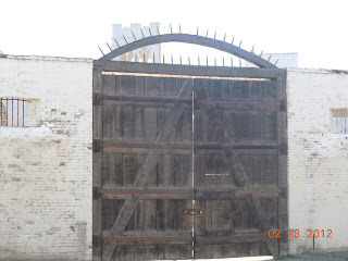
sutters fort gate
One of the gates at Sutters Fort
A low cost and quite fun stop during your California vacation is Sutters Fort in Sacramento. It's one of the things to do in Sacramento California and it's filled with Sacramento history. Outside of beautiful Monterey where the Spanish ruled Alta California, Sacramento and Sutters Fort was ground zero for the American occupation after the Mexican American War. Sutters Fort was the fortification built by John Sutter, a Swiss immigrant, in 1839. It was the very first non Indian structure built in central California. Sutter originally had  received an eleven league land grant from the ruling Mexican government. Much more land was eventually added to that amount. John Sutter named his California land holdings "New Helvetia". Today, Sutters Fort is a California State Historic Park and serves as an Indian museum. This structure really was the very start of the City of Sacramento.  The fort represents the history of California and Sacramento at a time of major change.

The building of the fort made a lot of sense. It was constructed on a rise near the river and provided some protection from hostile Indians. Not all were hostile, but a certain number were. Also, Sutters Fort became somewhat of a town center. It consolidated many of Sutter's enterprises such as a granaries, a blacksmith shop, store rooms and of course an arsenal.

Touring the fort today, one can stroll around and see these various enterprises within the fort walls as working exhibits of history. Exhibits and demonstrations are held on subjects such as fur trapping, sewing and mending and the art of blacksmithing. This California State Park is probably the most interactive of all State Parks and this helps make a visit there even more fun. Out of all the parks in Sacramento California, this is a must stop. Sutter's Fort Trade Store is operated by the Friends of Sutter's Fort in cooperation with California State Parks. All proceeds fund the educational programs at Sutter's Fort State Historic Park. The Trade Store is located within the fort. A lot of very interesting and educational items can be found there including books, earthenware and art. Fort Sutter schedules many special events and exhibits during the year and quite a few of them are interactive.

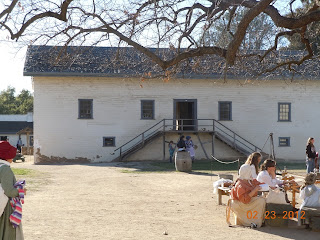
sutters fort building
Storehouse within Sutters Fort
Thanks to some forward thinking individuals under the name of The Native Sons of the Golden West, the restoration of Sutters Fort began in 1891 and was completed in 1893.  The fort was donated to the State of California and Sutter's Fort became a part of the California State Park System in 1947. Sutter's Fort stands today as the oldest restored Fort in the United States. 

Sutters Fort was also a meeting place of sorts. It was the destination used by immigrants traveling over the Sierra Nevada Mountains, stagecoaches and for a brief time the Pony Express. Sutters Fort was both a working settlement and a major landmark. Sutters Fort would also be the place that rescue parties departed from to try to save the stranded Donner party during the harsh winter of 1846-47. In the book, Anybodys Gold by author Joseph Henry Jackson, the fort was a citadel for Sutter that focused everything. It was his home and office and the place where he sat being the friend and patron of all the valley. here he had furniture purchased from the Russians at Fort Ross, a fireplace, a small table, pens and paper and a candelabrum which furnished light. He also had Indian blankets woven on the forts own looms.

boiling pot at sutters fort
Sutters Fort boiling pot
John Sutter came to California many years before the Gold Rush appeared. His background and interests were in farming, not mining. The land Sutter acquired through grants and other arrangements was cultivated and built into producing farm land. When gold was first discovered in California at a sawmill owned by Sutter, everything in his world changed. I think that most people are familiar with what occurred next and when the thousands of gold prospectors reached the Sierra Nevada foothills, it was more a disruption for John Sutter than anything else.

The latter 1840's was a time of great turbulence in northern California. Two big events occurred and they happened at about the same time. First was the gold discovery mentioned above and then it was the end of the Mexican American War which ceded California to the United States. During the Mexican American War and the famous Bear Flag Revolt in 1846 at the start of the Mexican American War, which was an American uprising against Mexican rule which was a bit similar than what occurred in Texas in 1836. The revolt was As it turned out, the Bear Flag Revolt was really unnecessary since the United States took over California after the end of the Mexican American War. What is notable about the Bear Flag Revolt was that it was encouraged by U.S. Army Major John C. Fremont and amazingly also by former Mexican General Mariano Vallejo.

covered wagon at sutters fort california
Covered wagon exhibit on the fort grounds
In regards to the California Gold Rush and Sutter, even though he didn't want anything to disrupt his farming and lumbering operations, when the gold was discovered he and another man put it to the test. Sutter learned that it was, in fact, gold. While still not wanting it to disrupt his other pursuits he did take action to gain ownership and title to as much land near the discovery as he could. While trying to keep the gold find secret, which seems impossible to begin with, a newspaper published a story of the find and it wasn't long before everything that Sutter had built up until that point was overrun by gold seekers.

There are two other articles that tell more about the history of gold rush towns that you should find interesting. They are the story of Auburn California, just to the west of Sacramento in the Sierra Nevada foothills and also the story of the steamships that carried both men and mail to the California gold fields.

As mentioned, the gold rush really destroyed the holdings of John Sutter. He lost a good deal of the land he had acquired during Mexican rule. To guard against possibly losing everything that remained he deeded his land to his son. Sutters son apparently had little interest in what was going on with the gold mining and concentrated on building a town by the name of Sacramento.Although the father wanted the new town to be named Sutterville, the town of course was named Sacramento.

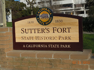
sutters fort sign The elder Sutter tried to petition the federal government for some type of restitution. Congress was debating a bill that would have given Sutter some $50,000 but nothing had been passed and he died in a Washington D.C. hotel in June of 1880. His body was transported back to his native Switzerland where he was buried in his hometown of Lititz.

What's both amazing and at the same time a tragedy was that the dreams of John Sutter and his "New Helvetia" were derailed by what was to many a financial bonanza like never seen before. Just about at the time that Sutter had built up his empire, the end of the Mexican American War would change the California power structure and the Great California Gold Rush would ignite on his land and bring about drastic changes he had no way to control.


If you have the opportunity to plan a California vacation, I believe you would have a great time exploring Sutters Fort and reliving the era of the 1840's, Mexican rule and California statehood. It's an excellent low cost, educational and fun opportunity for the entire family. Other great nearby trip stops are Old Sacramento on the banks of the Sacramento River and the California State Railroad Museum which is in Old Town. The Sacramento train museum is one of the areas top tourist attractions and one of the very best train museums in the United States. (Photos are from author's private collection)


Friday, March 16, 2012

Santa Fe Trail / The Santa Fe Plaza

When you have the opportunity to visit Santa Fe New Mexico, chances are you arrived by automobile or by air. Over 150 years ago, the trek to Santa Fe was not a vacation or weekend trip outing but a sometimes quite dangerous months long journey to sell merchandise in this Mexican province.

Today, when you arrive in Santa Fe and stroll around it's plaza, you're walking in an area that was the most busiest of places when the traders from the east arrived. They came in the early 1800's along the new Santa Fe Trail route, one of the earliest westward trails. They traveled from Missouri with wagons loaded with goods purchased from merchants back east with the hope of selling them at a profit in Nuevo Mexico. When they arrived in Santa Fe, they pulled their wagons into the plaza area.

The Journey that Ended on the Sante Fe Plaza

santa fe plaza
Palace of the Governors as seen across plaza
The earliest of these traders were individuals. Not too long after that, the trail would be filled with caravans owned and operated by commercial traders.

The Santa Fe Trail was a conduit to a whole new trading market. The merchandise was welcomed at the trails western terminus of Santa Fe because goods could be acquired much more quickly than from shipments from Mexico to the south. The caravans would arrive in Santa Fe and congregate in the plaza in front of the Palace of the Governors. Mexican officials would impose a tariff on the merchandise and would inspect for contraband.

The traders who, after a long journey and braving Indian attack, viewed Santa Fe for the first time saw a settlement with mud structures and very narrow and winding roads. Typical of most Mexican villages, the town center was a plaza surrounded by buildings. These were wild times and when the caravan and it's traders were in town it was like a fiesta. Fandangos were held mostly in private homes where both the music and dancing were lively and the drinking almost out of control.

The Perils of Traveling the Santa Fe Trail

palace of the governors in santa fe
Palace of the Governors, Santa Fe
Traveling on the Santa Fe Trail was not without incident. The biggest threat was from Indian attack.

According to the book, The Santa Fe Trail by author William E. Brown, Indian attacks during the trail's very first years amounted to attempts to steal livestock and food supplies. That changed in 1828.

The large caravans, carrying more merchandise than any previous one, traveled the trail that year and had an uneventful journey to Santa Fe. On the return trip to Missouri, when the caravan was roughly where today's Oklahoma and New Mexico border is, two traders rode ahead of the group of wagons and came upon a stream. At that stream they decided to take a nap. While sleeping, Indians crept up and shot both men with their own guns. Both men died and while the burials were taking place, a group of Indians appeared on the opposite river bank. The angry traders shot all but one of them. That Indians returned to their tribe and told of the shootings. Revenge raids followed shortly after and the caravan was essentially under attack all the way across the plains. They reportedly lost about one thousand head of livestock to the raids. The Indians who were shot by the river were most likely not the ones who killed the two traders since those individuals most likely would have made themselves scarce.

The second caravan traveling behind the one who lost the two traders also skirmished with the Indians. One trader was killed and scalped and the remaining traders eventually had to abandon their wagons and make it back to Missouri in the cover of darkness. Some made it back to Missouri on the edge of starvation. The loss in lives and equipment outraged the Missouri populace and the federal government was criticized for dragging it's feet in building military forts along the trail. Threats were present from various tribes with the Comanches most likely being the biggest. This outrage reached the ears of the new president, Andrew Jackson, who ordered military escorts for the planned 1829 caravans.

The Trail's Two Routes

palace of the governors
Palace of the Governors, northeast corner
Regarding the Santa Fe Trail itself, there were two major routes that traders could take.

According to the book mentioned above, The Santa Fe Trail, when you view the map of the Santa Fe Trail. one segment was called the Mountain Route and the other referred to as the Cimmaron Cutoff.

Traveling westbound, at a point not far west of Fort Dodge Kansas, the trail forked. The Mountain Route went west into Colorado and then southward through the Raton Pass where it rejoined the main trail near Fort Union New Mexico.

The Cimmaron Cutoff forked to the southwest over a very dry desert like land and also rejoined the main trail near Fort Union. While the Cimmaron Cutoff lessened the distance, the desert like topography made it a difficult journey and also heightened the chance of Indian attack. Regardless, history tells us that this was the preferred route.

The Mexican American War

During the Mexican American War in the mid 1840's, the Santa Fe Trail was more than a route of commerce.

To General Stephen W. Kearny, the Santa Fe Trail was also a route to conquest. At that time, the Santa Fe Trail represented a route into both Nuevo Mexico and Mexican Alta California. By the means of war with Mexico, which was sparked by incidents along the lower Rio Grande in Texas, the U.S. government had an opportunity to make good on Manifest Destiny. The Santa Fe Trail and the Spanish Trail beyond was the shortest route to the Pacific.

When the conquest of Mexico was realized in 1848, General Kearny set up operations in Santa Fe and oversaw the construction of Fort Marcy. Kearny felt that a fort was necessary to solidify the U.S. hold on the area and town. Fort Marcy, a short distance north of the Santa Fe plaza, represented the very first U.S. Army fort established in lands ceded from Mexico. Years later during the American Civil War, one of the most decisive battles in the southwest was fought at Glorietta Pass, between Santa Fe and Las Vegas New Mexico on the Santa Fe Trail.

santa fe trail historical marker
The photo at right is of the historic marker at the very end of the Santa Fe Trail. It's located near the plaza's southeast corner.

The end of the Santa Fe Trail of course was predestined. The railroad kept expanding westward and with each new railhead established the trail became shorter and shorter.

First the rail head of Abilene Kansas was established and then it was Dodge City Kansas near Fort Dodge. Both of these rail heads grew to be famous cow towns where ranchers drove their cattle to from Texas.

Santa Fe Prospered From the Railroad

Railroad expansion took on a feverish pace after the end of the Civil War. The rail route from Kansas to the southwest followed roughly the Santa Fe Trail. The railroad was built somewhat along the Mountain Route to Colorado and entered New Mexico through Raton Pass. There's a lot of history as to how the AT&SF obtained rights through Raton Pass at the expense of the Denver and Rio Grande Railroad.

It's an interesting topic we'll explore in another article. Along with the Santa Fe Trail and the results of the Mexican American War, the Atchison Topeka and Santa Fe Railroad was one of the major catalysts for the city's growth.

When the railroad was built to Las Vegas New Mexico, just about 60 miles east of Santa Fe, the old Santa Fe Trail was history. The trail of course was still used for wagons but traffic was only a fraction of earlier numbers.


columbus new mexico raid On a historical side note, the Atchison Topeka & Santa Fe Railroad mainline made it to Santa Fe using Lamy New Mexico about a dozen miles to the southeast. The railroad surveyors decided that the grade up to Santa Fe was prohibitive on a cost basis for the main line and Santa Fe was reached by a spur line from Lamy. You can still see that rail line today of which a small part of it is used by the modern New Mexico Rail Runner train.

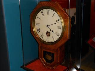
The clock shown at right is on display at the New Mexico History Museum in Santa Fe. The hole in the clock was said to be from a gunshot by a Villista during Poncho Villa's raid on Columbus New Mexico during the early 1900's. 

There's never a shortage of things to do in Santa Fe and stopping by the New Mexico History Museum, located directly behind the Palace of the Governors on the north side of the plaza, offers great historical exhibits about the city's past. Also, the museum inside the Palace of the Governors is also a great place to learn more about Santa Fe's Spanish rule of the region.

Being one of the very oldest settlements in North America, Santa Fe is one of the most historic cities you'll find in the United States and an excellent destination for your next western vacation or weekend trip.

(Article and photos copyright Western Trips)