Western Trips

Monday, July 30, 2012

Electra Texas / Electra Waggoner

The founding of what today is the town of Electra Texas was all about the Waggoner Ranch. Electra Texas was named for the daughter of W.T. Waggoner, son of the founder of the massive and very successful Waggoner Ranch. The ranch was originally begun by Daniel Waggoner in the 1850's , W.T.'s father. Daniel was born in Tennessee in 1828.

electra texas theater
Grand Theater, Electra Texas
By the 1880's the Waggoner Ranch comprised about a half million acres. As we described in our previous story of the Waggoner Ranch, the Waggoners were the beneficiary of large oil deposits found on their ranch land in 1911 . As a result, the ranch grew tremendously as did the family's wealth. Eventually, the ranch was placed in the W.T Waggoner Estate as a type of holding company for the family's many subsidiaries such as the Arlington Downs racetrack near Fort Worth Texas, horse breeding and the oil drilling operations.  

Electra Texas was also the beneficiary of this fortune. The Grand Theater shown at left was built in 1921 originally as an opera house.

Population there swelled after the oil was discovered. To put the population in perspective...in 1906 the town had a population of about 750 people. In 1936 there were more than 6,000 residents. Today, Electra has a bit over 3,000 residents. What was once the settlement of "Waggoner", and then "Beaver Switch", was eventually named "Electra" in 1907 in honor of W.T. Waggoner's daughter.

There's quite an interesting story about Electra Texas and about W.T. Waggoner's granddaughter, also named Electra. The grandaughter was the daughter of  E. Paul Waggoner and would later be known as Electra Waggoner Biggs. The first Electra was the namesake of the Wichita County Texas town, the granddaughter of W.T Waggoner ,Electra, actually had an automobile named after her and she achieved a good deal of fame in her own right. General Motors used the brand name "Electra" on their high end full sized Buick models produced from 1959 to 1990. The popular story was that John Biggs, Electra's husband, was the brother in law of Buick Motors president Harlow Curtice. The reported reason for his decision to name a car model after Electra was simply her beauty.

city hall electra texas
Today's, Electra City Hall
Electra Waggoner Biggs, who said she had wanted to be a sculptor ever since she was a kid, was an internationally known sculptor of great ability. Some of her art training was carried on in New York and France. During her lifetime she was commissioned to create busts of Harry Truman, Bob Hope, Dwight D. Eisenhower and several others. The most popular work created by Electra Waggoner Biggs could be the statue of Will Rogers on his horse "Soapsuds". The original statue was donated to the City of Fort Worth Texas and is on display at the city's Will Rogers Colliseum.  There have been three replicas of this statue recast. A replica is at Texas Tech University in Lubbock, in front of the Will Rogers Memorial in Claremore Oklahoma and at the Anatole Hotel near downtown Dallas Texas. Some of her early creations were displayed at Los Angeles, Paris and the World's Fair in New York.


electra texas
Today's downtown Electra Texas
For those traveling through north Texas west of Wichita Falls, the Red River Valley Museum in Vernon Texas has the largest display of her work in their Waggoner Room. The museum also has on display a replica of Electra Waggoner Biggs former art studio. Electra Waggoner Biggs passed away in 2001 in a Vernon Texas hospital.

Three additional articles you'll find very interesting are The Waggoner Ranch .... Red River Valley Museum in Vernon Texas and Wild Horses and Cowboys.

Electra Texas is located about 27 miles west of Wichita Falls on US Hwy 287. 

(Photos from author's private collection)

Sunday, July 29, 2012

The Harvey House / Alvarado

The historic Alvarado Harvey House in Albuquerque New Mexico was a unique luxurious railroad hotel for several reasons. The Atchison Topeka and Santa Fe Railroad along with their partnership with Fred Harvey established many hotels and eateries along the AT & SF route and with great success.

Albuquerque NM

alvarado harvey house in albuquerque
Alvarado Harvey House, Library of Congress
Albuquerque New Mexico was more than just another stop along the AT & SF route. Of major economic importance to Albuquerque was that the railroad made the town a "division" point.  In fact, Albuquerque was designated a division site three months before tha rails arrived. Albuquerque would go on to serve as the point where the AT & SF Railroad met the Atlantic and Pacific Railroad.

The Atlantic and Pacific ran west of Albuquerque and was partly owned by the AT & SF. By 1902, the Atchison Topeka would completely absorb the Atlantic and Pacific. The railroad industry had a history of merging with and absorbing other lines. This was true all over the U.S.

What the railroad's arrival in Albuquerque did to transform this town was not only amazing but quite quick. The center of Albuquerque prior to the railroad was what is today a popular tourist destination called "Old Town Albuquerque". As it so happened, the railroad built it's tracks about two miles east of Old Town in what would become the "New Town" area of Albuquerque. The economic impact was considerable to say the least. There was a time that Santa Fe had a larger population than Albuquerque. The railroad's entrance into Albuquerque and then assigning it as a division point caused the population numbers to flip the other way and now Albuquerque is New Mexico's largest city. In the book All Aboard for Santa Fe, author Victoria E. Dye describes how at one time before the railroad, Albuquerque resembled Santa Fe in many ways. The main difference was that it was not the end of the Santa Fe Trail but a stopover point. Santa Fe remained the main trade and governmental center for the territory.

The Railroad Grew Albuquerque


albuquerque transportation center
Today's Albuquerque Transportation Center
Not only would a train depot be erected but also offices for the division staff, freight buildings as well as repair shops.

In addition to the division buildings, the railroad and Fred Harvey opened the Alvarado Hotel Harvey House adjacent and north of the train depot. This was not just another Harvey House but the largest one in the chain. An Indian curio building was also erected along with the hotel in 1902 and at the same time a new depot building.

The Alvarado Hotel was built with wood frame and stucco. In the book, The Trains Stop Here; New Mexico's Railway Legacy, by author Marci L. Riskin, the author describes the Alvarado Harvey House, the Indian curio shop to it's south and the train depot to the south of that as being essentially one complex in the Mission Revival architectural style. This complex was condisered the heart of downtown Albuquerque. Fred Harvey's daughter Minnie was put in charge of the Indian Department to promote Indian arts and crafts. The Indian Curio Building displayed Indian handcrafts. The interior design of the hotel was created by Mary Colter who was the chief designer for the AT & SF Railroad. Colter made quite a name for herself completing twenty-one projects for Fred Harvey.

Mary Colter

Some of her noted work included the beautiful La Posada Harvey House in Winslow Arizona, the Phantom Ranch Buildings you see today at the very bottom of the Grand Canyon, the Lookout Studio, Bright Angel Lodge and the Hopi House, also at the south rim of the Grand Canyon. Mary Colter's buildings at the Grand Canyon were listed as a National Historic Landmark in 1987.

albuquerque rail runner station
Unfortunately, the hotel closed in 1968 and was demolished in 1970. Railroads didn't like to have vacant property for a variety of reasons. Liability for an empty building was one reason and another was the value of the lot their buildings sat on. In the case of Albuquerque, the site where the Alvarado Hotel was built was turned into a modern transportation center.

Today, the New Mexico Rail Runner train that runs between Santa Fe to the north and Belen to the south discharges Albuquerque passengers in front of the site that was the Harvey House. The transportation center provides connecting city buses for all parts of Albuquerque. Today, it's very easy to take the New Mexico Rail Runner to Albuquerque and connect with a bus that will take you the few miles west to Old Town Albuquerque. The train station today sits at the same site as the original and is the Albuquerque stop for Amtrak's Southwest Chief which runs between Chicago and Los Angeles.

Three additional Western Trips articles you may enjoy are La Castaneda Harvey House in Las Vegas New Mexico  El Tovar Harvey House at the Grand Canyon and Some Great Stops Along the old TX and NM Route 66.

(Modern Albuquerque Transportation Center photos from author's private collection)

AMTRAK SOUTHWEST CHIEF #3 ARRIVES IN ALBUQUERQUE NM VIDEO 


Thursday, July 26, 2012

Santa Fe Railroad / Super Chief

The Santa Fe Super Chief was the famous first class Pullman train for the Atchison Topeka & Santa Fe Railroad. The Super Chief transported passengers between Chicago Illinois and Los Angeles California in the most luxurious style of any railroad during it's time and was considered the flagship train for the AT & SF. The Super Chief was designed as a competitor to the streamlined "City of Los Angeles" named train operated by the Union Pacific Railroad.

The route of the Santa Fe Railroad Super Chief was essentially what today's route is for Amtrak's Southwest Chief. When the Super Chief began service in 1937 the schedule called for one run each week. When the Super Chief's popularity grew to it's highest, the train was scheduled once daily in each direction.

super chief train in albuquerque new mexico
Super Chief in Albuquerque, NM
The trip duration between Chicago and Los Angeles was 39 hours and 45 minutes, a great speed during the mid 1900's. This was the train often frequented by the wealthy and famous. The train became known as "The Train of the Stars" because it was used often by big name Hollywood celebrities. Many western movies were filmed during the 1940's and 1950's around Gallup New Mexico. The famous El Rancho Hotel, still in operation in Gallup, was the hotel of choice for the actors and actresses. The Super Chief train ran through Gallup on it's Chicago to Los Angeles round trip.

The same route featured the AT & SF "El Capitan". This named train was a non-Pullman sleeper train whereas the first class Super Chief featured the Pullman sleepers. The El Capitan was an all coach train. During the era of these new streamlined diesel trains running through the southwest, the train ride itself was a culture adventure. In fact, the El Capitan was so named to honor the Spanish Conquistadors who had originally settled much of the southwest and California. You can see the cultural influence the AT & SF had on the southwest and that which the southwest had on the Santa Fe Railroad Super Chief when you have the opportunity to view some of the artwork featuring this train with the scenic southwest backgrounds. In the year 1958, the Super Chief and the El Capitan were combined as one train and this configuration stayed in place until the end of AT & SF's passenger service in 1971.

No doubt, the Super Chief had a strong marketing arm behind it. A very interesting book, All Aboard for Santa Fe; Railway Promotion of the Southwest , 1890's to 1930's, by author Victoria E. Dye,describes quite a lot about the marketing efforts of the Atchison Topeka and Santa Fe Railroad all the way back to the early years with Fred Harvey. Dye explains how the railroad gained passengers by promoting the unique culture of the southwest region with artwork and photographs in popular magazines and journals of the era.

The Atchison Topeka & Santa Fe Railroad may have been the best railroad as far as promotion went. Very early on, the railroad teamed up with Fred Harvey who would go on to establish the Fred Harvey Company with a large string of eateries and hotels along the AT & SF route. Harvey went on and managed the dining cars for the AT & SF when this service was introduced in 1892 with the railroad's "California Limited". When the Super Chief began service in 1937, the Fred Harvey Company managed the dining cars from the first day.

super chief lounge car interior
Super Chief lounge car interior
Typically, the Super Chief had one dining car with a lounge car attached to handle passengers waiting for their dining reservation. To give you another idea of just how first class the Super Chief was, the famous Turquoise Room dome-lounge car was placed immediately in front of the dining car. These three cars, the lounge car mentioned above, the diner and the Turquoise Room dome-lounge car, allowed the Super Chief to truly offer it's passengers “a new world standard in travel.”

For those wishing to see an authentic AT & SF Super Chief dining car, the California State Railroad Museum located in Old Town Sacramento, has one on display where you can also take a walk through it's interior. If  your western trip happens to take you anywhere near Sacramento California, this is a great stop to make. All of the AT & SF Super Chief dining cars were named after Indian tribes or pueblos. The dining car on exhibit in Sacramento is named the "Cochiti" for the Native American pueblo just south of Santa Fe New Mexico. The California State Railroad Museum also displays a restored Super Chief diesel engine.

super chief cochiti dining car
AT & SF Cochiti dining car
The AT & SF Super Chief, when originally started up prior to World War Two, was set up with no passengers allowed to embark or disembark between Kansas City and Barstow California. This of course helped with the fast schedule the train was known for. During the war the rules did allow for passengers to get on and off at La Junta Colorado and Albuquerque New Mexico. When the war ended, the Super Chief allowed passengers to embark and disembark at all points along the route.

Three additional related articles you will find interesting are Fred Harvey and the AT & SF Civilize the Southwest. The Historic La Posada Harvey House in Winslow Arizona and the old Harvey House dining room in Slaton Texas, now a B & B.

Today, the history minded tourist can learn a lot more about the famous Super Chief at the Galveston Railroad Museum in Galveston Texas which is set to open in November 2012. There will be a restored Super Chief engine on display there as well as other AT & SF rail cars.

(Albuquerque and lounge car interior photos from the public domain. Cochiti dining car photo from author's collection)


Tuesday, July 24, 2012

Arches National Park Utah


arches national park
Formation in Arches National Park Utah
If your western trip happens to take you near the southeast part of Utah, you have a real treat in store. Arches National Park is geologically one of the most unique of all our national parks. The south end of Arches NP starts just a few miles north of the town of Moab Utah. This beautiful national park makes for a great family vacation stop providing not only one of a kind scenery but also many foot trails. Moab Utah is also home to Canyonlands National Park, about 35 miles west of the town. Many tourists to Utah make Moab a kind of base for their hiking, biking and river activities in that part of the state. For those wanting to find out how Moab received it's name from it's Mormon founding, the bible refers to an area east of the Jordan River as Moab.

One unique trait of Arches National Park Utah is that it lies on top of a large underground salt bed. In fact, according to the National Park Service, this salt bed deposited 300 million years ago on the Colorado Plateau, is what is responsible for the types of geology found there. The arches, the balancing rocks, spires and sandstone fins. Over millions of years, floods, oceans and winds covered and battered this area. The resulting debris from this action turned into rock that at some points was a mile thick. The enormous rock pressure caused the underlying salt bed to buckle and liquify and this shot the rock upward as domes. The enormity of this geologic shifting created the beautiful scenery you see today at Arches National Park. The park offers the beauty of contrasting colors and textures found nowhere else on earth. These Utah arches display amazing geologic sandstone formations.

formation
Balancing Rock formation
An interesting thing is that the park continues to change even today. New arches are being created and some old ones are being destroyed. According to the NPS, in 1991 a sixty foot long, eleven foot wide and four foot thick, rock slab fell from beneath Landscape Arch. More recently, in 2008, Wall Arch, located along the Devils Garden Trail collapsed. The NPS added that all arches are really temporary and that at some point erosion coupled with the force of gravity will crumble the arches. The very fact of the delicate nature of the arches and spires make this one of the most active national parks in the nation.

Most travelers to this region of the United States know that Indians inhabited the area for centuries. This part of the country is home to many ancient pueblo dwellings as well as petroglyphs and pictographs. These remnants of the Indians presence tell historians quite a lot about their pueblo civilization. These native Americans both hunted grew crops such as beans and squash. Arches National Park is located just north of the pueblo dwelling civilization and as a result there are no cave dwellings found there. Not too far south of Arches however at Mesa Verde National Park are some of the most stunning cliff dwellings found anywhere.

European settlement in southeastern Utah was not from the Spaniards to the south but from the Mormons. The Spaniards explored the area mostly to find routes from the Santa Fe area to their missions in California but did not build settlements as they did in Nuevo Mexico. The Mormons made an early attempt in the 1850's to establish a mission in today's Moab but ran into trouble with the Ute Indians. Eventually, Moab was founded by ranchers, farmers and miners in the last few decades of the 1800's.

Two related articles you will enjoy are Zion National Park in Utah and Mesa Verde National Park in Colorado.

rock
Arches National Park geology
This particular part of Utah, near the Four Corners area, is near to many national parks. I've found that a route can be driven from the Grand Canyon in northern Arizona, up to the Glen Canyon Dam outside Page Arizona and then west to Utah enabling you to take in Zion National Park, Bryce National Park and then eastward to Moab Utah and the national parks found there. Your western trip can then allow you an easy drive down to Mesa Verde National Park and nearby historic Durango Colorado. Leaving the east entrance to the Grand Canyon you want to go to Hwy 89 and drive north to Page Arizona. From Page, US Hwy 89A crosses the Colorado River and the Glen Canyon Dam. Hwy 89A will take you west to Zion National Park and will also take you north to Bryce Canyon. Drive north from Bryce Canyon on Hwy 89 to Interstate 70. Drive west on scenic Interstate 70 all the way to the US Hwy 191 exit and Moab is about 30 miles south. This is a multi day trip but allows you to visit many of our finest national parks all along the way.

Mesa Verde National Park is about 138 miles south of Moab via US Hwy 191 and US Hwy 491 outside of Cortez Colorado. Durango Colorado is about 48 miles east of Cortez on US Hwy 160.

(Photos are from author's private collection)

Sunday, July 22, 2012

Train Depots / Vaughn New Mexico

vaughn new mexico train depot
Old AT & SF train depot, Vaughn New Mexico
Old historic train depots are found today all over New Mexico.  While traveling in New Mexico I came across a railroad station in the town of Vaughn which goes all the way back to the era of the Atchison Topeka & Santa Fe Railroad and the famous Fred Harvey Company. Most people are well aware of the Fred Harvey Company and their highly popular Harvey Houses.

Many times we hear about the highly successful Harvey House hotels and eateries along the AT & SF routes such as the El Tovar at the Grand Canyon and the La Fonda in Santa Fe, but there were many more Harvey House eateries in much less popular tourist venues. One such site is the town of Vaughn New Mexico located about 100 miles southeast of Albuquerque. The railroad affiliated eatery in Vaughn happened to be the Las Chaves Harvey House. Today, Vaughn is not a town on the Interstate nor is it near any large metropolitan area but at one time this small town was not only home to a busy train depot but also the site of one of Fred Harvey's popular rail side restaurants. The Fred Harvey hotels and dining rooms made traveling on the AT & SF Railroad a much more comfortable experience.

atchison topeka and santa fe railroad sign
Santa Fe Railroad sign, Clovis New Mexico
The early importance of Vaughn New Mexico had much to do with cattle drives. At the time of the cattle drives in the 1880's, the town was a nameless site. The book, The Trains Stop Here: New Mexico's Railroad Legacy, by author Marci L. Riskin, tells the story of how the New Mexico Land and Livestock Company drove some twenty-thousand head of cattle from Texas to the Esatancia Valley to help supply the western forts. The trail is sometimes referred to as the Stinson Cattle Trail named after the manager of the livestock company. This was in 1882 and Vaughn New Mexico became a very important stopping off point.

Vaughn and the Belen Cutoff

Vaughn was also fortunate to be chosen as the division site for it's Belen Cutoff line. The Belen Cutoff essentially was a new route for the AT & SF with much lower grades than the main line which ran over Raton Pass on the Colorado- New Mexico border. Belen is located a short distance south of Albuquerque.The tracks to Vaughn from both the east and west were built at the same time. The rails from the west reached Vaughn in 1905 and from the east in 1907. The line ran from Texico on the New Mexico-Texas border next to Clovis New Mexico and ran west to Belen. The town of Vaughn today was given it's name at the time of the railroad entering the area and was named after a civil engineer named Major G.W. Vaughn. While the cattle drives are something from the past, today, Vaughn is at an intersection of the Union Pacific and Burlington Northern Santa Fe railroads making it an active freight train town.

The Vaughn New Mexico Depot

at&sf steam locomotive
Old AT & SF steam locomotive
The old Train depot was built in 1908 in a Mission Revival architectural style and an accompanying Harvey House was constructed the same year in the same style.While the Harvey House was very popular in this barren desert area, unfortunately it was torn down after it's closing in 1936. Fortunately, for the history minded traveler today, the old railroad depot remains intact and remains a great representative of the big passenger railroad era. The Las Chaves Harvey House claims one place in railroad dining history due to the exploits of aviator Charles Lindbergh. The story is that Lindbergh's plane experienced trouble with it's engine while flying over New Mexico in 1928. Lindbergh had been working on a flying route to southern California for the first transcontinental air passenger flight. This was the project consisting of a part airplane/ part train route across the U.S. On this particular trip Lindbergh made a forced landing near Vaughn and reportedly ate all of his meals at the Las Chaves Harvey House while waiting for his plane to be repaired.

Two related articles from our sites that you'll find interesting are The Historic Lamy New Mexico Train Station and the La Castenada  Harvey House in Las Vegas New Mexico. The AT & SF steam locomotive shown above is a 2-8-0 model manufactured in the year 1900 at the Richmond Locomotive Works. This locomotive is on display at the Old Coal Mine Museum in Madrid New Mexico.

Another Western Trips link you'll enjoy is Texas Railroads, the Katy Railroad and Rock Island Depots in Waxahachie Texas.

Vaughn New Mexico is at an elevation of 5,965 feet. The town is located about 30 miles south of Interstate 40. You can reach Vaughn from the Interstate via either US Hwy 285 at the Clines Corner exit or by US Hwy 54 from Santa Rosa.

(Photos from author's private collection)


View Larger Map

Friday, July 20, 2012

Western Trails / Doan's Crossing

One of the most historic sites you'll find regarding the days of the cattle drives and the Western Trails is found in a remote area of north Texas directly on the Red River. It's not a site you will just happen by but it is a site the history minded traveler just may wish to visit. The small settlement known as Doan's Crossing is on the Texas side of the Red River northeast of the town of Vernon Texas. To reach the site of Doan's Crossing, drive north from Vernon Texas on US Hwy 283 and at about 12 miles out of Vernon turn right on FM 924. Drive east on FM Road 924 until it intersects with FM 2916.

doan's crossing house
Doan's House at Doan's Crossing
Doan's Crossing was a strategic outpost on the Western Cattle Trail, sometimes referred to as the Texas Trail or the Great Western Trail and at some points even the Dodge City Trail. Doan's Crossing on the Western Trail consisted of a general store. It was the very last settlement before the cattle were driven up into Indian Territory, present day Oklahoma, on their way to Dodge City Kansas. Dodge City was the rail head and the final destination of these herds which had been driven north all the way from deep south Texas. The Western Trail was quite significant itself in as much as it was the longest cattle trail in the country. The trail can be traced all the way from the Rio Grande in south Texas to the Canadian border. Along the way there were many branches spreading into Wyoming, Montana and the Dakota's.The Great Western Trail was about 2,000 miles in length.

The cattle industry in Texas took off at the end of the Civil War. There was an abundance of cattle in Texas that had been increasing during the war years and when the war. When the war concluded there was a great demand for beef. The railroads were expanding west rapidly and the cow towns of Abilene Kansas and Dodge City were born. A good deal of the cattle drives were being shifted to western trails as opposed to the Chisholm Trail which also ran south to north but about 100 miles further east. The Chisholm Trail was directed toward Abilene Kansas whereas the Western Trail was directed toward Dodge City. The modern day tourist can pretty much follow the Great Western Trail by driving US Hwy 183/283 and looking for the historic markers about every ten miles.

monument at doan's crossing texas
Doan's Crossing Texas monument
Jonathan Doan and his nephew, Corwin, had operated a trading post at the site while trading with Indians to the north across the Red River. The Doan's did a good deal of trading near the Fort Sill area. The site along the Red River thus picked up the name of 'Doan's Crossing". This was a section of the Red River that offered easy fording. It has been reported that the Doans kept a record of cattle crossings and the peak year was said to be 1883 with over 300,000 head of cattle fording the Red River.

There are a few different interpretations as to who exactly established the Western Trail in Texas. First of all, it's understood that many trails followed old Indian trails which likewise often followed the trail of the buffalo. Exploration for suitable cattle trails often was a search for older trails. Accessibility to water of course was crucial for any cattle drive and buffalo and Native American trails would generally follow the water. The rancher who would be credited with establishing the trail was John T. Lytle who had opened a trailing firm. The business would supervise the trailing of herds for Texas ranchers to the northern rail heads, at that time mainly being Dodge City. Interestingly enough, Lytle found himself in this business after ill health caught up with him as a clerk in Bexar County Texas. Lytle first moved to a relative's ranch where the outdoors would hopefully improve his health. The next stop for John Lytle was the Civil War where he served in the Texas Cavalry. When the war ended he returned to his families ranch and then started one of his own. By the year 1871 Lytle formed his trailing business partnership and used the Great Western Trail for the drives northward.

doan's crossing cattle brands marker
Cattle brands on Doan's Crossing marker
The great cattle trails of the west had their heyday during the period after the Civil War up until the turn of the century. The purpose of the cattle trails were to drive the herd to rail heads for shipment east. The railroad expanded greatly during the last thirty years of the 19th century and with more rail heads, the shorter the distances of cattle drives. Two excellent books with detailed information about the early ranchers and the cattle drives are The Cattle Kings by author Lewis Atherton and Charles Goodnight: Cowman and Plainsman by author J. Evetts Haley.

You'll find these related articles interesting  regarding the cattle drives out of Texas in the late 1800's. Legendary Texas Panhandle rancher Charles Goodnight and the famous Waggoner Ranch of north Texas.

One other interesting thing about present day Doan's Crossing is the annual picnic held there usually the first Saturday in May. The event is a celebration and picnic with riders crossing the Red River at the same point that the Western Trail cattle drives did over a century ago.Those who are direct descendants of the Doan's  are crowned Queen and King at the yearly Coronation.The public is invited to attend this quite unique event. The most up to date information about Doan's Crossing, the Great Western Trail and scheduled western events in the area can be found at the Red River Valley Museum in Vernon Texas.

(Photos from author's private collection)

Wednesday, July 18, 2012

Towns in Arizona / Downtown Flagstaff

Flagstaff Arizona has the distinction of being either directly on or very near to many historic sites and attractions. For those enjoying a southwestern road trip, Flagstaff is located directly on Interstate 40 which makes it quite easy to take advantage of everything this northern Arizona town has to offer. The historic downtown area of Flagstaff is alive with activities, annual events, great restaurants and historic hotels such as the Weatherford Hotel shown in the photo below.

weatherford hotel in flagstaff
Weatherford Hotel, Flagstaff AZ
So how did this beautiful small town in Arizona at the foot of San Francisco Peaks get it's name? The story is that a group of easterners who traveled to the then new territory, just won as a result of the Mexican American War, came upon a spring at the base of the San Francisco Peaks. The pioneers were quite impressed with the area and communicated their discovery to the federal government. The group was impressed by the available water, the timber and the fact that there was suitable grasslands for cattle grazing. As a result, a project was started to build a road across northern Arizona that would help emigration to California.

A man of many accomplishments by the name of Edward Fitzgerald Beale supervised the building of this road. Beale's career included being a frontiersman, military officer, hero of the Mexican American War, explorer and Indian superintendent. Of special note in Arizona history of course is Edward Beale's surveying the land which would become the first wagon road through northern Arizona. Those traveling northern Arizona today will notice how directly westward Interstate 40 runs. Beale made some observations about the new road he had surveyed. One was that the road crosses the Arizona desert at it's narrowest point and that nowhere on the road is available water more than twenty miles apart. Edward Beale's road across northern Arizona would lead the way decades later to be a part of historic Route 66 as well as portions of today's Interstate 40.


downtown flagstaff arizona
Hopi Building and public square in downtown Flagst
During the era of western settlement of the southwest, Flagstaff was among other things a prosperous lumber town. In 1857, U.S. President Buchanan commissioned Beale to build a 1,000 mile road between Fort Defiance New Mexico, across northern Arizona to the banks of the Colorado River that was the border of California. Interestingly enough, Edward Beale headed west with the famous army Camel Caravan. This was a group of camels imported from Tunis as a sort of experiment in their possible military benefit at the request of Jefferson Davis, then Secretary of War. While the camels could travel for days without water, they apparently scared the horses and eventually the experiment was scrapped. It was said that the camels didn't present the romantic aura of a cavalry mount and this was another reason for it's discontinuance. Nevertheless, Edward Beale made history with his camel caravan while surveying for the proposed Arizona wagon road.

Two additional related historic articles we've published regarding northern Arizona are the El Tovar Hotel at the Grand Canyon and also the Lowell Observatory in Flagstaff.

flagstaff downtown
Shops in downtown Flagstaff
The Weatherford Hotel located just one block north of Route 66  was established in 1899 by John W. Weatherford. This impressive structure was built with brick per the new ordinances in Flagstaff because of devastating fires. In fact, fires were the number one problem with many western towns including most of the California gold mining towns. After fires burned early wooden structures to the ground, more and more buildings were erected with brick, stone and iron. Thanks to the hotel's current owners who saved this structure from being torn down, the Weatherford Hotel is operating today and treats guests with a trip back into history. The hotel's address is 23 North Leroux Street right in the middle of Flagstaff's historic downtown.

train depot in flagstaff arizona
Flagstaff Arizona train station
Another interesting historic site in the city of Flagstaff is the train station. The train depot serves to as both an active train station on the route of Amtrak's Southwest Chief running between Chicago and Los Angeles and as a tourist visitor center. Any information you need regarding your Flagstaff visit can be found at the train depot. The tracks are quite active with both Amtrak and the many BNSF freight trains passing by Flagstaff daily.

Flagstaff offers Arizona vacationers a hub to explore nearby sites such as the Grand Canyon to the northwest, the superb old west town of Williams Arizona on Route 66  which is also home to the Grand Canyon Railway and just a short drive west on Interstate 40 plus the world famous Lowell Observatory on the west side of town. In addition to this, popular Sedona Arizona is only a thirty mile drive south on Arizona Hwy 89-A. Add to this the many hiking trails in the San Francisco Mountains, which are the result of ancient volcanic eruptions, just north of Flagstaff and you have a great place to spend several days during your Arizona vacation.

(Photos from author's private collection)


View Larger Map

Sunday, July 15, 2012

Road Trips Ideas / Navajo County Arizona

Western Trips came across a truly fascinating piece of western history located in the northern Arizona town of Holbrook. If you're looking for road trip ideas in northern Arizona, this just might be it. Holbrook Arizona presents a good representation of an old western town during the latter 1800's and early 1900's.

The really good news is that Holbrook took steps to ensure that artifacts and general information of that era have been preserved for future generations. The focal point for your visit to Holbrook is the old county courthouse located at the northeast corner of Arizona Street and Navajo Boulevard. There are plenty of road trip destinations and if you're planning a road trip across America, and particularly along Interstate 40, then Holbrook is a great addition to your Arizona trip planner.

holbrook arizona museum
Old Navajo County Courthouse
The Navajo County Courthouse came into being in the year 1895 when Arizona carved out the county from a western portion of Apache County to be called Navajo County Arizona. This was also when Frank and Jennie C. Zuck donated a piece of land which was known as City Park. Bids were put out for the courthouse construction and the firm of Kennedy and Grim of Flagstaff Arizona won the contract.

With a new county office structure being built south of Holbrook in 1976, the old courthouse was eventually turned over to the Holbrook Historical Society. After artifacts were obtained from local residents, the courthouse was turned into the Holbrook Museum in 1981, and what a fine northern Arizona museum they built. Holbrook is located along Interstate 40 about 97 miles west of Gallup New Mexico. The town is on the southern border of the Navajo Reservation. There are too many old west stories that occurred in and around Holbrook, including one hanging on the courthouse grounds, to include in one article but we've come across a few you're sure to fine interesting.

It Happened in Holbrook

When you think about old west towns you might come up with names such as Tombstone, Deadwood or Laredo. In addition to these be sure to add Holbrook. Holbrook was known to be a bit on the violent side when it came to shooting things up. The town was shot up almost daily by a combination of outlaws, rustlers and drunken cowboys. In fact, some will tell you that Holbrook was the most violent town in the latter 1800's. In a period of one year it was said that twenty-six people met a violent death. Adding to this was a violent range war going on to the south of Holbrook involving cattle ranchers and sheep ranchers. Tombstone might be considered a peaceful town compared to what was going on in Holbrook at the time. As a side note, a great book about the frontier ranchers and how they dealt with rustling is The Cattle Kings, by author Lewis Atherton.

Sheriff Commodore Perry Owens

The first story occurs in the 1880's when Holbrook was part of Apache County Arizona and the newly elected county sheriff was a man by the name of Commodore Perry Owens. The public domain photo below of Owens shows his long hair and Winchester rifle. Owens, born in 1852, was given his name by his mother who wanted to honor the famous Commodore Perry of US Naval fame. Owens was charged with trying to stop the rustling which enraged the local ranchers. Owens, who carried two 45 caliber pistols on his hips and a Winchester rifle, was just the type of sheriff the ranchers wanted. He was a crack shot. With straw colored hair almost down to his hips, Owens stood out. His targets were the rustlers, many of who were chased out of Texas by the Texas Rangers, and the Navajo Indians who also were suspected of rustling and horse theft.

sheriff owens of arizona
Sheriff Owens
Commodore Perry Owens was involved in what has been named the Owens-Blevins Shootout, the most violent shooting in Holbrook Arizona history. In September of 1887, Owens rode his horse into Holbrook armed with a warrant for a man named Andy Cooper whose real name was Blevins. The warrant was for horse theft. Owens approached the rented home that Cooper and the extended Blevins family, brothers, wives and children, were residing at. Carrying his Winchester, Owens was on the porch of the house when he encountered Cooper just inside.

The exact course of events were a bit hazy but one thing led to the other and after about only five minutes several of the Blevins including the alias Cooper were shot. One brother survived his injuries but in this short time span one of the family, a fifteen year old boy, was also shot and killed. Andy Cooper who the warrant was named for was one of the killed. A coroners inquest ended up clearing Owens of the somewhat controversial  killings but, because of the death of the teen, Commodore Perry Owens did not seek reelection for another term as sheriff of Apache County. Owens took a job later as a security agent for the railroad but did come back in 1895 as the first appointed sheriff of the new county of Navajo. He served about two years at that post and eventually moved to Seligman Arizona to the west of Flagstaff and married.

Sheriff Wattron

The second story also involves an elected sheriff. In 1897 Francis Joseph Wattron became sheriff of Navajo County. Wattron was everything you might expect a western sheriff to be in a dime novel. Some would say that Wattron was a bit of a showman and took advantage of the popular perception of the western lawman. While Owens had his hip length hair and twin revolvers, Wattron had a bloodhound and a gold badge encrusted in diamonds. His deputy wore a sold silver badge. Flamboyant and humorous, Wattron played the role of sheriff quite well. He played that role as he thought the citizens wanted him to. The story about Francis Joseph Wattron that has made the history books of Navajo County Arizona pertains to a hanging he was charged with carrying out in 1899. The Arizona Penal Code obliged the sheriff to send out community invitations for the actual execution. In this particular case, Wattron sent out the following invitation not only to the local community but nationwide and to some dignitaries in Europe. The invitation as described in the book, The Western Peace Officer, by author Frank Richard Prassel, stated....."You are hereby cordially invited to attend the hanging of one : George Smiley, Murderer. His soul will be hung into eternity on December 8, 1899 at 2 o'clock PM sharp. The latest improved methods in the art of scientific strangulation will be done to make the surroundings cheerful and the execution a success". 

old navajo county arizona jail
Old Navajo County jail cell
Wattron's invitation was met with outrage by higher up officials and he was ordered by the Arizona governor to send out a new invitation. Much to his chagrin, Wattron complied with the governor's orders and sent out a new invitation that had heavy black borders on the paper. The new invitation included in part...."With feelings of profound sorrow and regret, I hereby invite you to attend the private, decent and humane execution of a human being,; name George Smiley; crime, murder. The said George Smiley will be executed on January 8, 1900 at 2 o'clock PM. You are expected to deport yourself in a respectful manner, and any flippant or unseemly language or conduct on your part will not be allowed. Conduct, on anyone's part, bordering on ribaldry and tending to mar the solemnity of the occasion will not be tolerated".  Sheriff Wattron made certain to send the governors new invitation late so that he would not receive it until the execution was already carried out.


Two additional articles we have on Western Trips regarding northern Arizona historical sites are the famous Fred Harvey La Posada Hotel in Winslow and the famous Lowell Observatory in Flagstaff. Also see our article on a visit to the world famous Desert Botanical Garden in Phoenix.

There are plenty of places to visit in Arizona. If your western vacation or road trip takes you by Holbrook Arizona, I would highly recommend a stop at this excellent museum. I think you'll find a lot of interesting things to explore there including the old jail adjacent to the old sheriff's office. This particular jail was constructed in St. Louis Missouri in 1898 at a cost of $3,000 and shipped to Holbrook by railroad. The courthouse is a fun and educational trip stop for the whole family.

(Photos are from author's private collection. Photo of Commodore Perry Owens is in the public domain)

Friday, July 13, 2012

Waggoner Ranch / An Historic Texas Ranch


waggoner mansion el castile
Waggoner Mansion, Decatur Texas
A busy highway corridor that stretches from Decatur Texas, northwest of Dallas, all the way to Pueblo Colorado also serves as a trip back to the days of the historic cattle ranches. US Highway 287 is the main highway for those traveling from the Dallas/Fort Worth area northwest to Amarillo Texas and beyond. This is a roadway that cuts through the land that at one time was home to famous Texas ranches such as the XIT, the JA Ranch and the Waggoner Ranch. Each of these ranches have their own unique story to tell. The XIT which spanned over 3 million acres was responsible for the funds that built the Texas state capitol building in Austin.

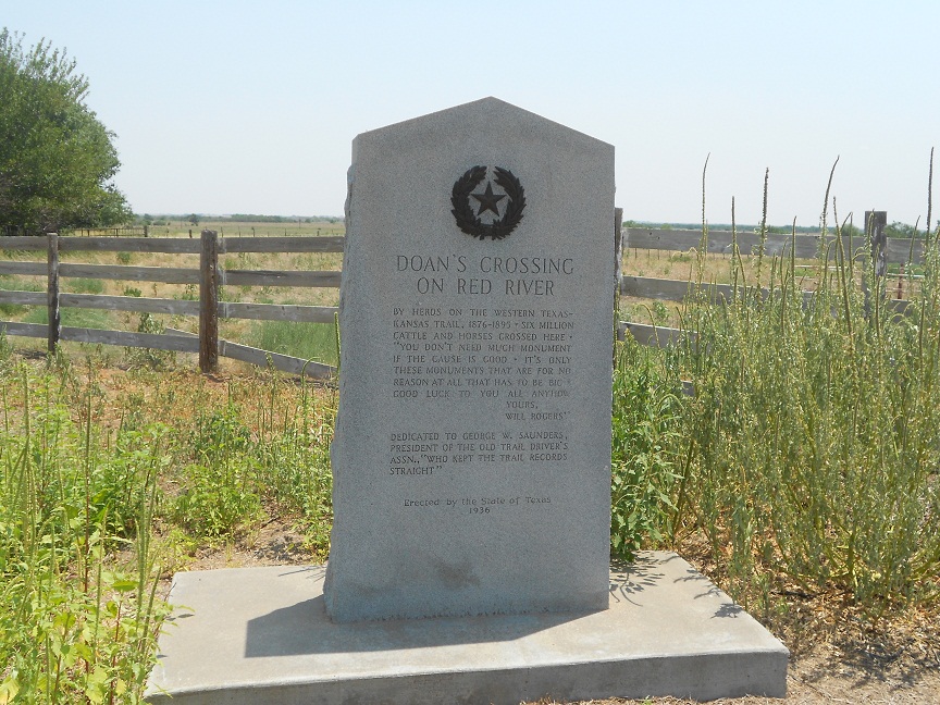
The JA Ranch is the story of the legendary Charles Goodnight, the founder along with Oliver Loving of the famed Goodnight-Loving Trail, who today is considered the Father of the Texas Panhandle. The Waggoner Ranch is the story of a father and son who built an enormously successful million acre ranch to the west of Wichita Falls Texas and then found out the ranch land was sitting on large oil deposits.

Good Trips Stops to Add to Your Road Trip Planner

red river valley museum
Red River Valley Museum, Vernon Texas
If your western road trip takes you to this part of Texas, you will want to consider setting some time aside to explore several museums and historic sites all along this stretch of US Hwy 287. Among the sites you'll want to add to your Texas trip planner are El Castile, the Waggoner mansion in Decatur Texas, the Red River Valley Museum in the town of Vernon, the town of Electra which was named after the daughter of W.T. Waggoner,the Goodnight Home in Goodnight Texas, the ranch home of famous Texas rancher Charles Goodnight and the Armstrong County Museum in Claude Texas just about twenty miles east of Amarillo. All of these sites and more are located on US Hwy 287. The El Castile mansion is located on the east side of Decatur on E. Main Street up on a small hill. Two of our related articles you'll find interesting are The Red River Valley Museum and the famous King Ranch of Texas. The show saddle photo shown below is on display in the Waggoner Room inside the Red River Valley Museum.

The Waggoner Ranch and the Three D Brand

The story of the building of the Waggoner Ranch is very interesting. Although taking place much earlier during the nineteenth century and early twentieth century, parts of the Waggoner story resemble fictional plot lines seen on the television show "Dallas". The Waggoner Ranch story began with a pioneering patriarch who passed on the family ranch business to his son and then on to the son's children. In this case, the father was Daniel Waggoner and his son, W.T. "Tom" Waggoner. The Waggoner Ranch registered and used the Three D Brand. In 1866 the brand was altered with the D's in reverse. This made the brand unique and harder to alter. A good move considering the cattle rustling going on at the time.

show saddle from waggoner ranch
Show saddle from Waggoner Ranch
Like many ranching stories, a single good chance event laid the seeds for what would become a true ranch empire in every sense of the word. In the book, Historic Ranches of the Old West, author Bill O'Neal tells the story of how Daniel Waggoner brought his family to Texas from Tennessee in the mid 1840's. Daniel's son, W.T., was born in 1852. The elder Waggoner was among the very earliest of Texas ranchers, having established himself prior to the Civil War. The only other Texas ranch of note I'm aware of established prior to the Civil War was the large King Ranch in southeast Texas.

In 1870 the father and son drove a herd of Longhorns from Clay County Texas, south of Wichita Falls, up to Kansas. At the time the Waggoners had a ranch in Wise County Texas and had wintered a herd in Clay County. The sale of the herd was quite successful and the pair returned to Texas with $55,000. It was from that success that they were able to move their ranch further west to the western part of Wichita County. Eventually their herd of cattle grew to the point that they had to lease grazing land in Indian Territory. The Waggoners leased some 650,000 acres in present day Oklahoma. In fact, several ranchers had leased land from the Indians including the legendary rancher Burk Burnett who is the namesake of present BurkBurnett Texas located in western Wichita County.

By the time W.T. Tom Waggoner turned twenty-seven years of age, his father turned over to him the ranching operations. Daniel Waggoner would have been fifty years old. The Waggoner Ranch began breeding Shorthorn cattle and then Herefords were raised beginning in the 1890's. By the year 1900, the Waggoner Ranch ran some thirty miles east and west and twenty five miles north and south. Most of the ranch land was in Wilbarger and Wichita Counties. During this time a part of the Waggoner land was sold off to farmers and additional new land was purchased. The family also built a mansion in Decatur Texas and named it "El Castile", shown in the photo at the top of this page. The home is still there today and although it is privately owned and no tours are available, it still attracts tourists today. If you're in the Decatur Texas area, about sixty miles northwest of Dallas, you might want to stop by and view this historic home.

The elder Waggoner passed away in 1904. Tom Waggoner then moved to Fort Worth to manage the family business but also spent time up in the Decatur mansion.

Oil Leads to New Wealth

The second major event for the Waggoner Ranch was the discovery of oil in 1903. The oil was discovered while the ranch was drilling wells for water. The water was badly needed for the 60,000 heads of cattle and every time they struck oil it was considered a failure. What was wanted was water not oil. Eventually, Tom Waggoner came to understand the value of his oil and after building the Waggoner Refinery, he also built a chain of gas stations sporting his Three D brand. The ranch formed an oil partnership at the time with Texaco. W.T. Tom Waggoner died in 1934.

Shop Amazon Warehouse Deals - Deep Discounts on Open-box and Used Sports Equipment


After his death, the ranch assets were so great and so diverse that the family's property was put into what was called the Waggoner Estate. The revenue from oil turned the ranch into a conglomerate of banks, oil wells, feed lots and horse breeding stables. Waggoner had also built Arlington Downs, a horse race track between Fort Worth and Dallas.

The Waggoner family also donated funds for civic projects. Author Lewis Atherton in his excellent book, The Cattle Kings, writes that the family donated three buildings for the campus of Texas Womens College which today is Texas Womens University in Denton Texas. The family also provided funds for the refurbishing and enlarging of the First Methodist Church of Fort Worth Texas.

electra texas
Theater in Electra Texas
The photo at right is of the old Grand Theater in Electra Texas. Electra Texas is at the site of the Waggoner Ranch and the town itself is the namesake of W.T. Waggoner's daughter "Electra".

The story of Electra Waggoner and W.T. Waggoner's granddaughter Electra Waggoner Biggs. is quite interesting in itself.

Please see our article on Electra Texas and the famed sculptor Electra Waggoner Biggs

Two additional Western Trips photo articles you may enjoy are on the links below... 

A Visit to "Cowtown" Fort Worth Texas

The Bluebonnets of Burnet Texas

The Waggoner Ranch continues operations to the day of this writing. The horse breeding operations are very successful. Due to a rift among the Waggoner heirs, some of whom wish to liquidate the ranch, a 1993 court order was issued to break it apart and sell it off. As of this writing there apparently has been no sale of this massive ranch. It is currently run by trustees. One of the very unique aspects of this ranch is that it has survived and prospered for so long under the same extended family ownership.

An interesting side note is that the world's largest ranch today is the 6,000,000 acre Anna Creek station in Australia. The largest contiguous U.S. ranch is the Waggoner Ranch in Texas.

Traveling on US Hwy 287 can be a very historic experience. There are many unique sites to visit in addition to the ones mentioned in this story. Before making the journey, be certain to set time aside for these fun and educational historic sites. Collectively, they tell much about the history of the early Texas ranches and the hard working people who built them.

(Article and photos copyright Western Trips)

Wednesday, July 11, 2012

Uranium Mining / Grants New Mexico

The funny thing about uranium is that when first discovered, it wasn't considered a valuable or useful ore. Officially, the mineral was discovered in 1789 although miners had been aware of it for many years, even centuries. The ore is heavy and because of that at one time it was even used as a door stop. It would be many years later that this ore and uranium mining would become valuable for the construction of nuclear weapons and also for providing fuel for power generation.

new mexico mining museum
New Mexico Mining Museum
In the U.S., the first uranium was discovered in 1879 in Colorado. According to the New Mexico Mining Museum, uranium is more abundant than gold or silver and is about as common as tin. Another interesting fact put forward by the New Mexico Mining Museum is that spent fuel from nuclear power plants can be reprocessed to provide about 50 percent more energy. It's also a fact that Madame Curie used uranium from the Colorado plateau uranium mines for her radium experiments during the late 1800's. While much of the deposits of uranium are spread thin, there are several places where it's much more concentrated thus making it economically feasible to mine for. Unlike many other ores, uranium is radioactive and this makes it's detection that much easier with the use of electronic detectors. Prior to World War Two, the ore was used for it's radium. A variety of uses for the radium included the manufacture of  watch dials and in several types of instruments. Radium is luminescent due to it's instability and it's also radioactive. The prewar years was during a time when the potentially harmful radiation effects of the mineral were not fully understood.


Today, most of the uranium being used by our reactors in the U.S. is being imported from Canada and Australia. There is very little production coming from U.S. uranium mines. It all started for New Mexico when a Navajo sheepherder in 1950 discovered uranium about fifteen miles northwest of Grants New Mexico. This discovery involved surface uranium and simply happened by chance. Grants is located along Interstate 40 about 77 miles west of Albuquerque. In addition to the spectacular scenery in this part of New Mexico, Grants is also the location of the very interesting New Mexico Mining Museum. If your western road trip takes you through New Mexico, particularly along Interstate 40, you will enjoy a fun and educational visit to this museum which will allow you explore in their underground mine shaft. Many authentic artifacts are on display such as the tools used by the miners including safety and detection equipment as well as an audio/video presentation. There's also an excellent exhibit in the mine shaft explaining how explosive charges were used.

gamma analyzer for uranium mining
Gamma Analyzer on display at NM Mining Museum
The city of Grants itself went through many phases of commerce. First as a railroad camp during the 1880's and then as an agricultural area due to the rich volcanic soils and then as a burgeoning uranium mining center. The uranium mining boom started in the 1950's and lasted all the way into the 1980's. The uranium belt in the Grants area is about 100 miles long and as much as 20 miles wide running in a southeast to northwest direction towards the Four Corners area. Although uranium mining has ceased in New Mexico, the uranium deposits are still considered large. The large price drop in uranium, mostly because of high grade foreign production, caused the U.S. uranium production to decline. It was reported that by the year 2001, there were only three uranium mines operating in the United States.

There is also a health risk associated with uranium mining which was recognized early on. In 1962, the federal government published a study which connected cancer with uranium mining. In 1969 the government set amounts of radon that miners could be legally exposed to. In 1990, the U.S. Congress passed the Radiation Exposure Compensation Act which offered compensation to miners adversely affected by mining. According to the Scientific American, the U.S. Environmental Protection Agency as of the end of 2010 is involved in an effort to assess 520 open abandoned uranium mines all over the vast Navajo Reservation in the American southwest. Many people believe that the number of mines is twice that figure. The main exposure of Navajo Nation people is their exposure to uranium through airborne dust and contaminated water for drinking.

underground uranium mining
Display showing blasting holes in underground shaft
The Manhatten Project was launched after scientist Albert Einstein convinced President Franklin Roosevelt that Nazi Germany was active in trying to purify Uranium-235 for atomic weapons. The U.S. program started shortly thereafter and ended up with a total cost of some $2 billion, an enormous amount in 1940 dollars. Ironically, while the Manhatten Project was working feverishly in Los Alamos New Mexico during World War Two, most of it's supply of uranium for experiments actually came from the Belgian Congo and some from Canadian uranium mines. The discovery outside Grants, some 140 miles southwest of Los Alamos, didn't occur until five years after the war. The discovery in New Mexico of large deposits ushered in a thirty year mining boom.

Two additional related articles you'll find interesting are the Turquoise Mines of Cerrillos New Mexico and the Los Alamos Museum.

If you haven't visited this unique museum, it is well worth the stop and it's a great side trip for the entire family. The New Mexico Mining Museum is located at 100 North Iron Avenue in Grants New Mexico.

(Photos are from author's private collection)
View Larger Map

Monday, July 9, 2012

Montana Ranches / The XIT

The famous XIT Ranch in the Texas Panhandle was one of the largest cattle ranches in the world. The very existence of this ranch and the 3 million plus acres it consisted of was responsible for the building of the Texas state capitol building in Austin. Texas was in great need for a new capitol building and the funds necessary for it's construction were acquired by selling this large acreage in the Panhandle region. The acreage was so vast that the XIT ranch range was between twenty and thirty miles in width.

Visit the XIT Museum

american cowboy
American cowboy, circa 1888
If your western road trip happens to take you to the Texas Panhandle region, a stop at the XIT Museum in Dalhart Texas is a good addition to your Texas vacation planner.

Dalhart is located about 85 miles northwest of Amarillo at the junction of Hwy 54 and Hwy 385.The XIT Museum was built in 1952, about forty years after the ranch ceased operations. Exhibits at the museum tell the story of life on the ranch, the large influence the railroad had in building the Panhandle settlements and the story of the county sheriffs who tried to keep law and order in a booming ranching region. The XIT Museum is also very involved in educational programs for students.

The XIT in Montana

Being a part of the Montana ranches is an interesting part of the XIT Ranch history. What was often overlooked was the XIT expansion north into the Wyoming and Montana area. This area specifically was ground zero during the Sioux War about a decade prior. This was the country where the Custer's Battle of the Little Bighorn took place in June of 1876.

 It was only after the Sioux War concluded and the Indians were on reservations that the cattlemen even had the opportunity to graze their herds this far north. Cattlemen had been aware for some time of the good grazing grasses found in Montana and Wyoming. The XIT entered Montana when John V. Farwell, head of the Capitol Syndicate, a group of British investors who owned the XIT, bought a ranch in 1890 in Custer County Montana, about sixty-five miles north of present day Miles City. This was the headquarters for the Montana XIT and to this was added 2 million leased acres.

The northern end of the XIT range was the Missouri River and the southern border the Yellowstone. Ten thousand head of steers were then sent north out of Texas. The difference of course for the cowboy was that there was little to do during the winter months until spring although most cowboys stayed in the XIT bunkhouses during the off season.

cattle branding
Old time cattle branding in the American west
You will find our article at tripsintohistory.com  Cattle Drives and Cowboys interesting as it separates the truth from the fiction as to the everyday life of the western American cowboy.

The excellent book, Historic Ranches of the Old West, by author Bill O'Neal, points out the opportunities the Montana cowboys enjoyed over their XIT Texas counterparts. By the 1890's the XIT Texas ranch was fenced and cross fenced. Open range ranching however was still going on in Montana and this appealed to many Montana cowboys.

Open Range Ranching

The open range method of ranching was disappearing rather fast and the Montana set up allowed cowboys to relive the way ranching was first conducted. Author O'Neal also points out the the massive XIT Ranch at it's peak in Montana had about 65,000 steers and 1,000 cows on the range. The cows were used for beef at the line camps. Another terrific book regarding the old ranches of the American west is The Cattle Kings, by author Lewis Atherton. Atherton goes into detail about the Montana cattle operations and the Montana Club.

The Montana Club was like many other private cattlemen clubs in the west except in Montana mining was very important thus the Montana Club was comprised of operators of both mines and ranches.Today, The Montana Club Building in Helena, Montana is the oldest private members only Club West of the Mississippi still in operation. The club began in 1893. The Original Montana Club had a library, card rooms, and reception rooms. The building was burned in a 1903 fire and was rebuilt the same year.The new building was designed by architect Cass Gilbert. If your western trip takes you to Montana, The Montana Club is located at 24 West Sixth Avenue Helena, MT.

See our Western Trips article on the link below...

A Little Known Old Wild West Show / Buckskin Bill

The Oncoming Settlers

XIT ranch cowboys
XIT Cowboys, 1891
After the turn of the century, even the old Sioux lands in Montana were beginning to see more and more settlers arrive. This had been a steady process and by 1909 settlers were encroaching on the XIT's leased range.

In addition to this, the XIT land was being sold part by part in Texas. The XIT owners, the Capitol Syndicate, had always planned for the eventual Texas land sell off which would pay off bond holders. This was a major part of the original business plan for the ranch. As more Texas land was being sold to settlers, the cattle count dropped and the need for sending cattle northward to Montana ceased. In October 1909, the XIT Montana operations sold off the last of their holdings in the region.

The XIT Ranch sold off the last of it's Texas cattle in November of 1912 and shortly after that the last of it's property was sold.

(Article copyright Western Trips. Photos and images in the public domain)