Western Trips

Thursday, June 30, 2011

The Pueblo Revolt That Drove The Spaniards Out Of The Southwest

There were many significant events in the early southwest and among the very major happenings was the Pueblo Revolt. This was probably the most adverse event in Spanish colonial history on the North American continent. It's a story of servitude and surprises. It's also a story of secrecy and violence. The story of the Pueblo Revolt is the most interesting revolution fought against a European colonial power on what is now American soil.

Visit Northern New Mexico


black mesa new mexico
Before I tell this story I want to point out that there are several historic sites in the state of New Mexico that I believe should be a part of any New Mexico vacation and are connected to our story.

Just two of these sites include the Jemez Monument west of Santa Fe and the Black Mesa northwest of Santa Fe shown at left. There is also the popular Petroglyph National Monument on the western edge of Albuquerque.

There are stories attached to all of these sites and I think you'll find both our story and a visit to these sites interesting and enjoyable. These are low cost trip ideas that are educational for the entire family and you'll be able to take some great photos. Links for these sites are at the end of our story.

North Come the Spaniards

As most of us were taught in our history class at school, the Spaniards were the first European power to explore the American southwest. First into Mexico and then northward.

There were Native Americans present for centuries just as there were throughout the continent. There are several similarities between the Spanish move northward and the Americans moving west under Manifest Destiny and the ensuing Indian Wars. Both powers sought to change the Native American way of life..to have it conform to their customs including religious beliefs. Both powers were met with considerable violence. Both powers also meted out violence. The Indian Wars conducted by the U.S. military, while not with the same religious overtones as the Spaniards presented, were not so much different than what transpired in Spanish New Mexico. It was just 200 years later.

Searching For Gold and the Franciscan's Presence


Coronado originally set out into the New World looking for gold and all kinds of riches. The Eldorado. He didn't find the gold he was looking for. Decades later the Spaniards made their exploration up the Rio Grande and established Nuevo Mexico. Gold wasn't found but what was found were the Pueblo Native Americans. Unlike most the plains Indians, the Pueblo people were not namadic. They built settlements and they built them with what the New Mexican tourist sees today..adobe structures. Along with their mud and straw like settlements they had their Kachina religion and they had their medicine men.

The Spaniards traveled with Franciscan Friars and their goal was conversion. To the friars the Kachina religion was simply idol worship and paganism and of course their goal was to usher the Pueblo people into Christianity. This was no different than what the Spaniards attempted throughout the southwest with the Navajos, Apaches, Hopi's and other tribes.


jemez mission new mexico
Over time some of the things imposed on the Pueblo population was drastic by any measure. They included forced servitude in the construction of missions and churches.

The picture at right is the San Jose Mission which is now part of a New Mexico State Monument. It was built around 1621. Many time the native Americans were forced to build these structures upon the same ground which their destroyed kivas had been on.

The kiva's were the ceremonial place where families throughout the pueblo gathered to practice the Kachina religion. In other words, it was a very sacred place. There was a lot of dissent and very strict rules were put into effect by the Franciscans. The Spanish in New Mexico levied very severe punishments to those who offered resistance.

Below left are excellent drawings of Kachina dolls from an 1894 anthropology book.

The Year 1680


kachina dolls


I think you'll find that anytime a people are put under servitude, especially for over 100 years, they conspire to lash back.

In the case of the pueblo people it was not merely servitude but their entire way of life was taken from them. This is a life and religion that developed over centuries. A century of this type of deprivation led to one of the biggest revolts of the 17th century. The Pueblo Revolt of 1680 was a rebellion that forced the Spanish to completely withdraw from Nuevo Mexico. After considerable bloodshed including the slaying of most of the friars, the Spaniards withdrew south along the Rio Grande back to the El Paso area and into Mexico.

For twelve years the pueblo people lived without the Spaniards. While they threw off their shackles of forced submission, at the same time there was no longer Spanish conquistadors to protect them against attack from other tribes such as the Apaches. Fighting between the tribes ensued.

Twelve Years After the Revolt


Then in 1692, Don Diego de Vargas led Spanish troops and priests back up the Rio Grande. The image below left is an undated oil painting of de Vargas that hangs in the Palace of the Governors on the Santa Fe Plaza.

As Vargas suspected, the pueblos along the way were abandoned. They were abandoned all the way north to the Cochiti Pueblo south of Santa Fe. He then advanced to the walls of Santa Fe. There were many Natives at Santa Fe and Vargas was prepared for a fight. There was no fight.

The inhabitants first thought the force were Apaches coming to attack. After they were convinced that these actually were Spaniards a long parley ensued whereby Vargas assured them that they came in peace and that the people who were responsible for the harsh treatment previously meted out years ago were no longer with their party. The Native Santa Feans accepted this and the result is what historians call the bloodless reconquest of New Mexico.

In about four months Vargas was able to reclaim almost all of the former colony. Although the first reentering of New Mexico was bloodless, trouble sprang up again when Vargas traveled back to Mexico in 1693. When he returned in 1694 he found that the Indians reneged on their agreements from 1692 concerning adopting Christianity and assimilating.

A Misunderstanding Leads To One Last Trouble


spaniard de vargas
One story is that the trouble began after false rumors were spread that the true intent of Vargas' arrival was to eventually annihilate the Indians. This was not true but Vargas was forced to put down another uprising however not to the magnitude of 1680. One of the encounters is as follows.


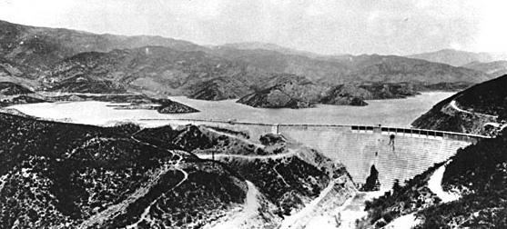
The rebel pueblos ended up congregating at Black Mesa which is located northwest of Santa Fe and about 20 miles east of present day Los Alamos. A picture of Black Mesa is at the very top of this post. When the Spaniards advanced on the Black Mesa in march 1694 they were met with arrows and rocks being thrown down from on top.

A mesa is not easy to scale and much harder when rocks are thrown over the side. Vargas made several attempts to scale Black Mesa at one point using ladders. His troops were met by boulders being rolled over the edge. Vargas' assault on Black Mesa lasted three weeks before his cold, worn out and low on ammunition troops trekked back to Santa Fe.

 It's interesting to note that Vargas did not chronicle this as a defeat. Eventually the holdouts on Black Mesa came down. The incident was regarded by the Spaniards more as a stalemate. What it did prove was that to take total control of the colony one had to control the high ground. A mesa does offer an excellent defensive position as long as there are enough supplies for the defenders.


There is much more to learn about the Pueblo Revolt of 1680. I encourage you to explore the event in greater detail. There are several excellent books that delve into different aspects of the struggle as well how the pueblo people were treated by the Spaniards.

As we all know, Spain eventually lost the territory to Mexico and Mexico in turn lost the region to the U.S. after the Mexican-American War. The end product is the state of New Mexico.

The links below are excellent for planning your New Mexico vacation. Also you can map the locations and retrieve directions with the Google Map driving direction box on this site. I hope you have the opportunity to visit many of these historic sites.

(Article copyright Western Trips. Photos and images in the public domain)


www.nmmonuments.org


www.indianpueblo.org/19pueblos/sanildefonso.html

www.palaceofthegovernors.org

www.santafe.org

Wednesday, June 29, 2011

Dodge City Kansas


 Dodge City Cattle Town

If your road trip takes you through Dodge City Kansas you have arrived at a site which exemplified the rapid growth of western America. Many of us first came upon Dodge City Kansas as the setting for the popular 1950-60's television series Gunsmoke. Here each week we saw U. S. Marshal Matt Dillon protecting Dodge from the outlaws ever present on the western frontier. Many of the episodes of course were pure fiction and pure Hollywood. By the same token some of the episodes gave us a slight glimpse into the kind of characters seen in real life.

Cowboys, ranchers, cattlemen, gamblers, swindlers, frontier merchants, common criminals, settlers from the east, European immigrants...all of these people passed through Dodge. So you ask...where is Dodge City?  Dodge City was at the very center of America's push west, particularly to the southwest. It was on a busy trail of westward moving commerce. This was an amazing town and an amazing time in America with colorful frontier figures like Buffalo Bill, Calamity Jane and Wild Bill Hickok. With this kind of frontier activity going on in Dodge it's also no wonder why the town eventually attracted lawmen like Wyatt Earp and Bat Masterson. That's a story you'll see on an upcoming post.

Dodge City Along the Santa Fe Trail


santa fe railroad logo
In our post regarding the California Water Wars, we pointed out how Los Angeles seemed to arise in an area that had no apparent geographic benefits at the time, including a good water source. Dodge City Kansas was probably the opposite. Dodge City was right at the crossroads of America's 1870's expansion.

The Santa Fe Trail passed by Dodge City. An interesting side note is that just a few miles north of present day Dodge tourists can view a two mile stretch of wagon wheel ruts dating back to the Santa Fe Trail days. It's supposedly the longest continuous path of wheel ruts still in existence. This is a must see when you visit Dodge City. Please see the Dodge City links at the end of our story. When the Atchison Topeka and Santa Fe Railroad ( early logo at left) made it a railhead in the early 1870's events really took off. Dodge City was a collecting depot for buffalo hides. Dodge City's southern plains location made it an ideal shipping point for Buffalo hides sent east to St. Louis. The Texas cattlemen drove their herds northward out of Texas' Palo Duro Canyon and below to the Dodge City railhead for shipment to Chicago. This included the famed Texas cattleman Charles Goodnight. The cattlemen in Colorado did the same. Also, being located between Missouri and New Mexico, Dodge saw thousands of travelers pass through via the railroad, some staying. The railroad was basically built along the Santa Fe Trail.

atchison topeka passenger train

A succession of army forts were built in the central Kansas area during the 1840's and 1850's primarily to provide protection for travelers on the Santa Fe Trail. It wasn't until after the Civil War that Fort Dodge was established and the nearby civilian settlement of Dodge City.

Dodge City traces it's beginnings to 1871 when a rancher built a sod hut near Fort Dodge. The cattleman was there to protect his herd. The railroad found it's way to Dodge City shortly after and the sod huts were replaced with buildings. Prior to this time since the 1850's, cattlemen drove their Texas Longhorn's and other cattle to either Witchita, Topeka or Abilene Kansas for shipment east. This process even became a bit complicated during the Civil War. Later there was the Great Western Cattle Trail that branched off from the Chisholm Trail and led right into Dodge. An interesting photo below left shows a pile of Buffalo hides from the early Dodge days getting ready to be shipped east on the rail line.

Dodge City and Deadwood

buffalo hides in dodge city kansas
When you study the history and beginnings of western frontier towns, Dodge City is somewhat different from towns such as Deadwood South Dakota and Virginia City Nevada. The population of Deadwood and Virginia City literally  exploded overnight. When gold and silver were struck in the nearby mountains, prospectors dropped what they were doing elsewhere and rushed there with all urgency. The first housing were tents. There certainly was no time to build permanent structures when the time was better spent hitting a lode of ore.


When looking at the birth of Dodge City Kansas, you have a town that grew from the decades long travel over the Santa Fe Trail. Dodge was actually an expansion from Fort Dodge located just a few miles away. In fact, the Army of the West had a law that prohibited military forts themselves from becoming centers of commerce. Civilians who wanted to settle near the security of an army fort would simply build a settlement one or two miles away from the fort itself. This was common and wasn't the case only with Dodge. Military forts such as Fort Kearney in Nebraska and Fort Laramie in Wyoming had prosperous towns spring up nearby.


Another difference with Dodge was that the Santa Fe Trail was traveled on many years before the Platte Road which runs through Nebraska. The Santa Fe Trail was built for commerce. The Platte Road seems to have served more as an immigrant trail for mid 19th century settlers heading on to the Oregon Trail. While the Santa Fe Trail certainly had it's dangers particularly from the Comanches, the Platte Road and it's Bozeman Trail offshoot were more affected by the Great Sioux Wars.

The Cattle Towns Grew Westward


at and sf railroad map
As in the case of all early rail heads, the western terminus kept moving westward. The map left shows the route of the AT&SF Railroad running southwest from Chicago. In July 1879 the railroad made it's way to Las Vegas New Mexico and with it's arrival Las Vegas also became a major cattle shipping site. With the railroad also came the outlaws, gamblers and swindlers that changed the face of that town as well.


Today of course, Dodge City Kansas is a prosperous modern city. The city has set aside a historic district that takes you back to the days of Wyatt Earp and Bat Masterson. It might even take you back to the days of U.S. Marshal Matt Dillon. You can still ride the train through Dodge on Amtrak's Southwest Chief that runs daily between Chicago and Los Angeles. Essentially on the same route as the old AT&SF Railroad. If you wish to read more about both Dodge City and it's place in Santa Fe Trail history I would recommend these two books.

(Photos and images from the public domain)

You may find the following related old west story interesting. The Tombstone Epitaph


www.skyways.org/orgs/fordco/dctourism.html

www.travelks.com

Amtrak Southwest Chief

Tuesday, June 28, 2011

Kit Carson And A Trip Through The Navajo Nation

new mexico territory map

 The New Mexico Territory

Shortly after the Mexican-American War in 1848, the areas we now know of New Mexico and Arizona became the New Mexico Territory. The United States was ceded this land at the end of the war. The territory at first comprised of both present day Arizona and New Mexico  and then after the Civil War for a variety of practical and political reasons was broken up into two territories as shown on the map.

New Mexico Territory and the Navajo

Kit Carson lived in this era. He saw the territory as one big expanse and then was there when it divided. The challenge in the New Mexico Territory was to bring the Indians under some type of control The Navajo Indians were the dominant and most forceful of the tribes. The Apache Indians were also active. The main difference concerning the Navajo is that they were quite organized. Navajo families had a head man and they made their way mostly  through livestock, farming and weaving. Also another fact about native Americans was that they had centuries of experience to organize. Native Americans history however was filled with wars and battle against each other for land and property and the alliances among the tribes changed several times. This was the culture of Native Americans throughout much of the southwest. The Navajo Indians were also respected as warriors by both the Mexicans and the newly arrived Americans.


The Navajos congregated near the present Four Corners area in far northwestern New Mexico and far northeastern Arizona. This was essentially their base and it's the general area of the present day Navajo Nation.

The Navajo and the U.S. Military

general james carletonIn the period 1861-1862 the Navajo Indians started to run wild. They raided New Mexico all the way down to the lower Rio Grande River and even went across it into the Mescalero country. The situation turned to chaos. The Navajo trouble really had been going on for some time. Back in 1860 the Navajos even raided Fort Defiance at night with about a thousand warriors. A night attack was very unusual. ( Fort Defiance is in present day Arizona (picture below right). The man charged with putting things back in order was General James H. Carleton pictured at left. Carleton was at that time the military head in the New Mexico Territory.

Many Years of Discontent

The Navajo Indians had a strained relationship with the white authorities dating all the way back to 1848. An Indian agent in the area even reported to his superiors that the Navajo's have not been at peace with the authorities since 1848 and that they signed six treaties that they broke before the papers could even be filed.

In fact, 1849 a Colonel Washington met the Navajos in the area of Canon de Chelly west of Santa Fe. The Navajo's ended up chasing Washington all the way back east to Santa Fe. They stole livestock along the way and pursued the soldiers almost to the Santa Fe plaza itself. The Mescaleros to the south were also on a rampage having attacked and killed a mail transport party traveling between Fort Stanton in the south and Santa Fe.

Colonel Kit Carson and His Navajo Expedition

fort defiance
Carleton was tasked with putting together several cavalry companies to stop the mayhem and get the Navajos back to their land near the Four Corners. Kit Carson was now a colonel and residing in Taos New Mexico. Carson was asked to join the campaign. He was also asked to recruit both Ute Indian warriors and the best Mexican guides he could find.

The Navajo expedition was staffed with good, veteran officers. The companies were scattered all about from Fort Union in the northeast to Fort Wingate near Gallup. Kit Carson was thoroughly familiar with all the habits of the Navajos and was just the person to join the campaign.

As a side note, we learned from a previous post regarding Kit Carson's personality, he was overruled several times when he requested leave to go back and visit Taos and also was admonished for not sending in weekly reports. Kit Carson was never able to be comfortable with the strict military discipline of the U.S. Army. Desk jobs were not to his liking.

The first military detachments left from Los Lunas heading west to Forts Wingate and Defiance. Below left is an interesting picture of Apache scouts at Fort Wingate in the 1880's. The trip to Wingate near Gallup was about 100 miles. Kit Carson was commanding about 1,000 troopers and obviously didn't relish the administration that goes along with that responsibility. An amusing story told was that one of the troopers wanted to buy whiskey from a local sutler. The trooper realized that his commander couldn't read manuscript and he thereby had someone write up an order for the sutler to sell him the whiskey. He presented the order to Col. Carson for his signature and Carson just signed it. Word spread and soon several troopers did the same thing with Carson and all of a sudden the sutler had a booming whiskey business going.


apache scout photoThe Navajos had been stealing livestock for quite some time and the army offered rewards for cattle, sheep and horses captured by the troops. Examples were $20 for every horse and $1 for each sheep.


Several skirmishes took place over several months and the Navajo Indians were fairly worn out. Some came forward suing for peace. Others fought it out. The military was winning in large part because of their superior arms.

The overall goal of the expedition was to drive the Navajos to Bosque Redondo.  The term means "round wood" at it was essentially a reservation in southern New Mexico where the Apaches had already been driven to. The army's basic demand to the Navajos was " give up or die"and those were the orders carson had when he met up with the navajo leaders. What ensued was a long, almost 400 mile walk, to the Bosque Redondo reservation. Many died during the journey. Similar to the efforts with the plains Indians, the army wanted these native Americans to settle down and take up agriculture.

 In fact, at Bosque Redondo the Navajos planted some 1,200 trees some of which are still standing. Kit Carson was anxious to go back home to Taos since the army life was not his forte. While he liked to serve and help the military which he did often and bravely, he simply disliked the regimented life and the regulations a soldier had to endure. The Navajos stayed at Bosque Redondo until 1868 when a peace treaty was signed and they then traveled back to the area of northeast Arizona where the Navajo Nation exists today.


navajo nation flag
As we all know today, the Navajos enjoy their own government within the Navajo Nation whose capitol is Window Rock, AZ.

The Navajo Nation flag is at left. This area is located in the far northeastern corner of Arizona and has been and still is visited by thousands of tourists every year. Beautiful pictures can be taken of the Window Rock itself which is a unique geologic formation. There are several excellent books available on both the Navajos and Kit Carson's involvement with the Native Americans in the southwest.

Visit the Navajo Nation and the Glen Canyon Dam

The town of Window Rock is located a short drive northwest of Gallup, NM. Driving west through the reservation you'll have the opportunity to view "hogans" which were and still are lived in by the Navajo. If you have enough time on your Arizona vacation you might want to visit the town of Page Arizona outside the west end of the reservation. Page is the location of the Glen Canyon Dam which is a great family stop. They offer tours of the dam and have a lot of interesting reading matter available about it's construction.
Kids can also get Junior Ranger badges by visiting the Dam. The Google Map driving direction finder on this site can map it out for you well. Below are some good links to find additional information about the Navajo Nation.

The Story of the Navajo Code Talkers

www.discovernavajo.com

www.newmexico.org

Window Rock, AZ Map


Monday, June 27, 2011

Kit Carson Of Taos New Mexico

Kit Carson is a name that anybody who is remotely familiar with the American West has heard many times. His exploits have been chronicled for well over 100 years. His name still lives on in many ways. If you have the opportunity to visit Taos, New Mexico you will see his name everywhere.

A Taos vacation is a treat in itself. There is the nearby Taos Indian Pueblo which attracts visitors from all over the world. Taos is an art community and the galleries are plentiful. Northern New Mexico is also home to the Carson National Forest. And there is the Kit Carson Home and the Kit Carson Museum as well as his final resting place. The Kit Carson Home and Museum rank at the top of Taos New Mexico attractions. If your travels take you to Santa Fe, a two hour drive to Taos is highly recommended. It's a beautiful car trip and you won't be disappointed.

The Legendary Kit Carson of Taos New Mexico
photo of kit carson
Kit Carson, pictured to the right, was a man with many careers. Fur trapper, mountain man, scout, soldier, Indian agent...his amazing adventures spanned all over the western U.S.

Kit Carson facts would fill a book and they have. We are planning to have further posts on the many adventurous exploits of Kit Carson, but in this post I wanted to focus on something that hasn't received the same exposure that his exploits have. It's interesting to take a look at the type of man Kit Carson was. What was he like to scout with? What was his personality like? What were his fears? I think it's an interesting story.

Kit Carson Turns Frontierman

Kit Carson was born Christopher Houston Carson on December 24, 1809 in Madison County, Kentucky, one of ten children.

The family then moved to rural Missouri. When he was 16 years old he left his Missouri home and became a frontier trapper. When he was 18 years old he met trapper Tom "Broken Hand" Fitzpatrick who was a partner with the legendary trapper Jedediah Smith ( shown below left) in the Rocky Mountain Fur Company. Jedediah Smith was credited with making the first overland journey to California while trapping.

The first time Smith was met warmly by the Spanish authorities but in his second expedition there he was not and didn't go back. Jedediah Smith was also the first person to enter the Oregon area overland. Jedediah Smith is also credited with the discovery of the South Pass Wyoming route through the Rocky Mountains along with Thomas Fitzpatrick. He was an amazing frontiersman and trapper and much more probably should have been written about Jedediah Smith. Possibly one of the reasons is that he died at the early age of 32.


jedediah smith frontier man
When trying to discover just what kind of man Kit Carson was, one of the best ways to do this is to find out what those who knew him, served with him and worked with him had to say.

What we do know is that leaving home at a relatively young age Kit Carson didn't receive a proper education and as a result was not able to read or write until his later years. That being said, what he lacked in formal education he was able to acquire a good amount as we say "street smarts". He learned the trapping trade as well as anyone and had very good instincts. Not a bad thing to have when you're trying to survive in a hostile wilderness.


So, how was Kit Carson described by some of his contemporaries?

Of Kit Carson's appearance...Mrs. Fremont, wife of the legendary explorer, noted " clear and fair, with light and thin baby hair, blue eyes, light eyebrows and lashes and a fair skin. He was very short and bandy-legged, long bodied and short- limbed". Kit Carson's official biographer, Dr. DeWitt Peters, wrote, "small in stature, but of compact framework. He had a large and finely developed head, a twinkling gray eye, and hair of a sandy color, which he combed back a la Franklin mode". "About as ready an appearing man as I ever saw. He looked as if he would know exactly what to do, if awakened suddenly in the night , ready for anything that might turn up at any moment" (J.H Wilber MS.,Bancroft Library).


christopher houston carsonHow about Kit Carson's habits? The novelist Emerson Hough wrote, "Carson was not a drinking man, and did not approve of drinking".

Robert C. Lowry, who was with Carson at Fort Union New Mexico, said that he was " not a drinker, nor yet was he a teetotaler".

Biographer Dr. Peter's said, " Quick to act, and never known to boast". Robert C. Lowry wrote about Carson, " A man of the most kindly and gentle spirit; unassuming,quiet, and the last person one would supposed to be possessed of qualities that made him famous".

Captain Smith H. Simpson of the army who became acquainted with Kit Carson in Taos New Mexico when he visited there on army business said that when in Taos Carson liked to shed his uniform and dress in civilian clothes. He also said that Carson was irritated when addressed with a title. He just wanted to be called Kit.

During his early years, because of his lack of education, in regards to writing, the best Carson could do was scrawl his name. His ability to read and write came after middle-age. Even with this handicap, reportedly Carson would join in at storytelling particularly after a few sips of punch. Like many frontiersmen of his era, Carson enjoyed sitting around the campfire smoking his ever present pipe.


Another interesting facet of Kit Carson's personality was that he possessed superstitions of both the white man and Native American.

As an example, it has been reported that when Carson took a shot at a game animal and missed he thought it was "bad medicine". Also it's been written that for whatever reason, Kit Carson would not start a venture on a Friday.

In regards to fear...it seems that all mountain men like Carson had to learn how to handle fear just in order to survive. There's a story told that Kit Carson was chased by a grizzly bear through the woods. He found a tree to climb and he climbed it. His first fear was that the bear would climb the tree after him. What happened was that the bear started to dig at the tree's roots to topple it and thus capturing it's prey. Kit Carson supposedly just stayed up in the tree for a very, very long time at which after many hours the bear gave up and left. It's these type of situations that build courage and if not courage at least the instinct to act quickly. You would have to conclude that instinct replaced fear. The photo below left is of modern day Taos New Mexico, considered the true home of Kit Carson.

view of taos new mexico
What we see in Kit Carson is a man who adapted to the frontier the best he knew how and he did it well. The lack of a formal education didn't hold him back and it's questionable how necessary a formal education was to survive in the western frontier during his era.

Kit Carson appears to have been a very friendly fellow who was always ready, willing and able to perform his duties. Whether he was leading a scouting expedition or simply a part of a band of trappers, he was willing to lend a hand and not pull rank.

While not big in stature, he made up for any physical disadvantages with sheer common sense and good instincts. He appears to have been an easy person to get along with whether that person was white, Native American or Mexican. Rather than a braggart, Carson was a modest man as shown for his dislike of formalities and titles preferring to be called just Kit rather than Lieutenant, his military commission given to him by President Polk. Every description I have seen put in writing describes Kit Carson as a pure gentleman.


The esteem he earned among his contemporaries assured that his name would live on indefinitely.
Today, while the Kit Carson Home and the Kit Carson Museum are located in Taos New Mexico, there are many places named after him. The town of Kit Carson Colorado, The Carson National Forest, the Kit Carson Park in Escondido California and there is a Kit Carson County in Colorado. Let's not forget that the capitol of Nevada is Carson City.


Kit Carson died much before his time on May 23, 1868 at the age of 58 in Fort Lyon, Colorado. The cause of death was listed a an abdominal aortic aneurysm. He was buried in Taos New Mexico next to his wife. His burial site is just a short walk northeast of his old home.


Hopefully this short description gives you a better idea of the real Kit Carson,. He was truly a legend in his own lifetime. We will be publishing more posts about the many frontier exploits of Kit Carson so please stay tuned. Below are website for the Kit Carson Home and Museum which will give you information to plan your Taos New Mexico trip.

(Article copyright Western Trips. Photos and images from the public domain)


www.kitcarsonhomeandmuseum.com

www.taoswebb.com

Sunday, June 26, 2011

History of Yellowstone

Yellowstone National Park became America's first National Park by an act of Congress in 1872. Everyone in the U.S. and many people worldwide have heard of the natural beauty found at Yellowstone. This natural beauty is what made this area of Wyoming a tourist mecca ever since.The park attracts several million visitors a year particularly during the summer months of June, July and August. A Yellowstone vacation has been a mainstay for American families for many decades. It finds it's way into many trip planners. The geyser Old Faithful has been thrilling vacationers for years and is one of the main attractions of Yellowstone.

Yellowstone's Early Years

yellowstone national park sign
As was the case with much public land during the time of massive westward expansion, commercial interests entered the picture. In the case of Yellowstone National Park, the encroachment onto public lands included hunters who were responsible for forest fires and for driving the wild game out of the park. Also fishermen using many hooks and lines, cattlemen bringing their herds onto park land for grazing and miners digging up the landscape.

This was a time before strict park rules were in effect and the policing of such a large area was next to impossible, at least not until the U.S. military was brought in. Forest rangers were not even established until the Theodore Roosevelt administration after the turn of the century.

There were several people responsible for the creation of Yellowstone National Park but one who stood out prominently was General Philip Sheridan. Sheridan certainly didn't have to ask the question of where is Yellowstone National Park? Sheridan was very familiar with the area. Being the commander of the Army of the Missouri since 1869, Sheridan was involved in most all of the exploration and military campaigns in the Wyoming/Montana region. It was Sheridan who was George Armstrong Custer's ultimate superior at the time of the Battle of the Little Bighorn in June of 1876. That battle took place about 100 miles northeast of the park's boundaries in southern Montana.

Policing the New Park

Sheridan was a proponent of using the army to police Yellowstone and put a stop to the large amount of poaching going on. The War Department was not as enthusiastic as Sheridan but they didn't put up strong resistance. Many people assume that the cavalry was on the frontier to fight Indians and protect traveling immigrants on the Oregon Trail. This they did, but they also had a history of being involved in civil policing for a long time. Catching criminals was not on their official list of duties but they did run across that from time to time. They also were involved in quelling civil disturbances which again was not their top priority for being there.

Sheridan knew the area well and realized it's cultural potential and starting in 1886 designated army troops to assume the policing duties. The photo to the right is of Philip Sheridan taken during the Civil War. The First Cavalry officially entered Yellowstone on August 20, 1886 headed by a Captain Moses Harris. Their Yellowstone lodging were simply pitched tents. After settling in their work was cut out for them since

conditions deterioratedgeneral philip sheridan rapidly over the previous decade. The first duty of his troops were to stop illegal hunters from driving wild game out of the park. The hunters were doing this by starting raging fires.

Exact rules to be enforced by park protectors were not put into legislation until 1894 but Captain Harris and his successors simply used common sense to protect Yellowstone. Troops patrolled the park land which with some additions grew to an area of 5,350 square miles of very rugged terrain. Violators arrested were generally locked up in guardhouses for a time and then usually simply freed.

In regards to tourists to Yellowstone, the army troops were instructed to be courteous, inform them about safety requirements and explain a bit about environment protection. Pretty similar to what park rangers do today. During the tourist season they patrolled the hiking trails but always kept a keen eye out for poachers. It goes without saying how rough this duty was for the soldiers. In addition to policing an area so vast, the troops stationed there had to withstand winters that could see temperatures as low as minus 40. During the winter months usually four privates under the command of a non commissioned officer resided in each of the log structured substations. There were no hotel accommodations in Yellowstone National Park during those times. Some troops died from exposure during winter duty and some other were frostbitten. 

Formal National Park Laws

Long overdue formal laws finally went in effect in 1900 when President McKinley signed the Lacey Act into law. This Act was sponsored by Iowa congressman John F. Lacey pictured below left. These new laws for public lands were really the starting point for more regulation to follow in the Theodore Roosevelt administration.

The Lacey Act was first signed into law by Grover Cleveland in 1894 but it lacked the teeth to be really effective. It allowed lawbreakers to be sent outside the park for civil prosecution but many times the prisoner was turned loose after reaching the park boundary. The law enacted in 1900 allowed for two year jail sentences and up to $2,000 in fines for violations. When visitors take a Yellowstone vacation today they are subject to hundreds of regulations in effect to protect our public lands. Today it's hard to imagine a National Park without formal regulations. In the 1800's it was one thing to proclaim an area a National Park yet quite another thing to keep it that way. The U.S. Cavalry rose to the occasion.

lacey act national parks
Finally there were laws on the books that the military could strictly enforce regarding the protection of wildlife, plants, geology and the public lands in general. After a few years the army sent more troops into Yellowstone and they were able to establish posts at all the major parts of the park.


The War Department changed it's earlier view of military involvement in the parks when in 1891 they ordered some troops of the Fourth Cavalry at San Francisco's Presidio into adjoining parks. Since Yellowstone, additional areas were designated as National Parks such as Yosemite and Sequoia.

With the California National Parks, the cavalry were present during the summer months but returned to the Presidio in winter because the lodging in Yosemite and Sequoia wasn't to the standards of Yellowstone. This military arrangement stayed fairly well intact until the year 1912 when the National Park Service was founded.  From that point on the parks were overseen by the Interior Department with park rangers like we see today.

Yellowstone's Old Faithful


old faithful at yellowstone
The image to the right is of Old Faithful Geyser in 1881. Old Faithful remains one of the most popular attractions in Yellowstone.

When you and your family have the chance to stay in a comfortable hotel in Yellowstone National Park, please look back in time and thank the U.S. Cavalry for it's sacrifices decades ago in helping to keep Yellowstone a beautiful place where we and future generations can visit.

A very good side trip near Yellowstone is Guernsey Lake State Historic Park Wyoming where excellent remains of Oregon Trail wagon wheel ruts can be seen.

Another very historic monument just northeast of Yellowstone, Pompeys Pillar, which features the etched signature of William Clark of the Lewis and Clark Expedition. These make a great companion visits while touring the Yellowstone region.

Another Western Trips article you'll enjoy regards the Chief Joseph Scenic Byway which should be a part of any trip to Yellowstone National Park. 

The Wyoming and Montana areas are great summer western trips destinations showcasing plenty of early western frontier history.

(Article copyright Western Trips. Photos and images in the public domain)


View Larger Map

Saturday, June 25, 2011

The California Water Wars/ The St. Francis Dam Failure And 1920's L.A. Noir

Los Angeles is America's second largest city. If you have the opportunity to visit L.A. you will never have difficulty finding interesting things to do. The L.A. area is home to Hollywood studios and the celebrities who make it what it is. There are many California historic sites and Los Angeles has many of them. You might sign up for one of the many tours of the star homes located all throughout Beverly Hills, Brentwood and the Hollywood Hills area. You may add a trip to Disneyland as part of your L.A. travel plans. You also will want to go to the beaches and possibly take a ferry boat to Santa Catalina Island just a short distance off shore. The interesting travel stops in Los Angeles are almost never ending. Don't forget Mulholland Drive which winds it's way through the hills to the northwest of the city. Mulholland Drive is named after a man named William Mulholland. In the 1920's Mulholland was the superintendent and chief engineer for the Los Angeles Water Department, then called the Bureau of Water Works and Supply. At first glance, that position wouldn't necessarily propel a man to widespread notoriety nor would it preserve his name on a major road artery through the city. It probably also wouldn't explain how the position of chief engineer for the water department would prompt the dedication of a fountain (photo below courtesy of WikiMaps) and a plaque in his honor. To understand why these monuments to Mulholland exist, you need to know about Los Angeles's past and what was important for it to grow into America's largest west coast city. You also need to know why the 1920's were L.A. Noir in true life. It's quite an interesting story.


The picture below the Mulholland Fountain photo is what Los Angeles looked like circa 1861. Like many towns in the once Spanish occupies southwest, there was a central plaza. Take a southwest American road trip and you will find these plaza's in many towns. I suppose they were the Spanish answer to our eastern town squares. Santa Fe, Taos, Las Vegas, NM....all of these have beautiful central plazas.

The L.A. area was first a settlement for Native Americans which really were the first inhabitants of all parts of America. After the Native Americans came the Spaniards with the first mission being built near Whittier in 1771 by Friar Junipero Sera. Years later Los Angeles was made the capitol of Alta California.


There were many things that made this area of North America desirable and not the least being the climate. Sunshine, warm temperatures and relatively low humidity made this area a good spot for settlement. The weather in Los Angeles ranks among the best in the country. Also ideal weather for growing citrus. We love those California oranges.

The one thing about Los Angeles that differs from the majority of early settlements was that there really wasn't a geographic reason for it's existence. As a comparison, San Francisco sits at the door to San Francisco Bay which is arguably the finest seaport in the world. St. Louis, MO was a busy Mississippi River port when the Mississippi was the main thoroughfare for American commerce. Houston, TX is a gateway to Gulf of Mexico commerce.New Orleans sits near the mouth of the Mississippi River.  Los Angeles had no natural water supply that a growing city requires and Los Angeles had no natural harbor to compete with other west coast seaports. It had to pay to have one built. The San Pedro port was man made.

Above all other things, the need for a reliable water supply is an absolute necessity for any city to grow. This was Los Angeles' problem from it's inception and with the population growing in leaps and bounds beginning with the arrival of the Southern Pacific Railroad in 1876 and oil being discovered in 1892. Los Angeles advertised through the Southern Pacific to lure people to the City of Angels. Th advertising pointed out the cheap land available along with the mild climate. Many people migrated to southern California believing that the climate would help with certain ailments. The population rose to 102,000 in 1900. Newspapers sprung up everywhere including the Los Angeles Times which is another interesting story in itself. The Los Angeles Times building even became one of Los Angeles' historic buildings. The need for more and more water was front and center. As a comparison, San Francisco had a natural water supply from the American River flowing out of the Sierra Nevada's into the Sacramento River. The two main usages of water were of course for the growing population and agriculture. Agriculture in southern California was a major industry and in the case of Los Angeles, the San Fernando Valley just to the north. At the start of the 20th century the San Fernando Valley was filled with farms and ranches. This population explosion was even before Hollywood became a destination. The film industry didn't move to the area until about the 1917-1920 period. The weather and the scenery was more to their liking compared to what they left behind in New York and New Jersey. We hear much about the California Gold Rush but the need to find water was Los Angeles' equivalent to digging for gold. It was really a life and death struggle for the city. It's with this backdrop that you can appreciate how the position of chief engineer for the Los Angeles  Department of Water and Power was not just any public service job.

The California Water Wars erupted when the water department, to satisfy their needs, planned on diverting water from the Owens Valley, located northeast of the city. They would divert water into resevoirs and channel it into Los Angeles via an aqueduct. One big problem however was that there were farmers and ranchers in the Owens Valley and they too needed water and weren't in the mood to give it up. Many of these farmers and ranchers had traveled to California for mining but when that didn't work out turned to agriculture.

The California Water Wars had it's beginnings when Frederick Eaton
( picture below left) was elected mayor of Los Angeles in 1898. Eaton's good friend, William Mulholland was then appointed superintendent and chief engineer of the Los Angeles Department of Water and Power. Both Eaton and Mulholland were self taught civil engineers. The water department was created by the new mayor. Both Eaton and Mulholland knew that there was a large amount of water runoff from the Sierra Nevada's into the Owens Valley. Their idea was that this water could be trapped and sent to Los Angeles by a gravity propelled aqueduct.

The story continues where Mayor Eaton, with inside information from a friend, knew of some irrigation projects in the Owens Valley involving the federal government. With this information he bought up land in the valley as a private citizen with the intention of selling it back to the city of Los Angeles at a huge profit. Additionally, Eaton lobbied President Theodore Roosevelt successfully to cancel the government local irrigation project. Meanwhile, Mulholland misled the people of the Owens Valley into believing that Los Angeles wanted it's water only for domestic purposes, not for it's own agricultural pursuits. While this was going on L.A. was buying up as many water rights they could, sometimes using bribery and intimidation. By 1905 they had enough water rights to enable construction of the aqueduct. This was not without alot of bad feelings mostly that the rights and land were purchased at unfair below market prices. Many believe Los Angeles paid less for the rights than they actually budgeted for. Some of this ill will resulted in violence such as  the attempted dynamiting of the aqueduct. The picture below right shows authorities discovering dynamite caches.

Supposedly the farmers who held out selling until 1930 received the highest prices for their water rights. That points out just how long the resistance lasted.


As part of the L.A.'s water supply transit system, the city built the St. Francis Dam in the mountains 40 miles northwest of the city. The construction lasted during 1924-1926 and was overseen by William Mulholland.


Just a few minutes before midnight on March 12th, 1926 the dam failed and what ensued was a catastrophe like non other the Los Angeles area had ever seen. Ironically, Mulholland had been at the dam site just a few days prior to the failure and this fact went on to haunt him for the rest of his life. In fact, during the prior year there were some cracks found in the dam and a bit of leakage however Mulholland and his crew felt that all was in safe limits. When the dam gave way, 12 billion gallons of water rushed through the San Francisquito Canyon and headed west to it's natural outlet in the Pacific Ocean. This deluge carried with it blocks of concrete, trees and homes. A deadly combination for anyone in it's path. Below left is a picture of the dam before the failure.


The result of this was the loss of life of 450 to 500 people. It ranks as the worst dam failure in U.S. history and the second largest disaster after the 1906 San Francisco earthquake. Blame was placed everywhere. The ill will from the Water Wars had many placing the blame on Mulholland for alleged bad construction management. After many hearings into the disaster, Mulholland was exonerated of all blame. The court of public opinion sometimes takes it's own course and regardless of the hearings outcome many continued to place the blame squarely on Mulholland and his political friends. The official blame however was placed on the geology itself. The hearing board came to the conclusion that the quality of the rock at the dam site was the culprit.

The end result of the California Water Wars was that Mayor Eaton was investigated but cleared of wrongdoing for his role in buying up Owens Valley land and water rights. His later supposed asking price to the city of $1 million for his Owens Valley holdings was the final blow that ended his friendship with Mulholland.  As for Mulholland, the St. Francis Dam failure marked the end of his career.

You may also be interested in our article on our Trips Into History website regarding the Hetch Hectchy dam and reservoir controversy in California.

The classic movie "Chinatown" which many of you may have seen is based on the California Water Wars during the 1910's and 1920's and is set in 1937 L.A  There was also  a sequel made called Two Jakes.

William Mulholland's legacy is controversial  only in as much as he was connected to the St. Francis dam catastrophe which a good a many people felt he was not responsible for. The positive side of the legacy was that he led the effort to bring much needed water to Los Angeles. It is with this legacy that he has been honored as the leading architect in the city's early growth.

When you explore the history of California you have to place William Mulholland on the list of important figures. Another interesting story about Los Angeles is the Doheney Teapot Dome Scandal.


When you're driving on Mulholland Drive L.A. you will know a bit more about the man whose street bears his name. The aqueduct system also has 107miles of bike paths which are enjoyed regularly by thousands of people. The Mulholland Fountain designed by Walter S. Clayberg in 1940  is located at the intersection of Riverside Drive and Los Feliz Blvd. in Los Feliz. It was declared a Historic-Cultural Monument in the City of Los Angeles in 1976.

(Photos are in the public domain)

Friday, June 24, 2011

John Muir And The Greening Of America

When you vacation particularly in California, you cannot help to see the visions of John Muir who many consider the first Green advocate in America. His legacy lives on in many of the beautiful scenic areas you enjoy while on your California road trip. These include Muir Woods in Marin County just north of the Golden Gate, the John Muir Home in Martinez California and of course Yosemite National Park.

Muir Vs. Commercial Interests

john muir
Pictured at left is John Muir in 1872. Muir was a preservationist. This is quite different from a conservationist. A preservationist works to keep things just as they are. On the other hand, a conservationist wants to use resources wisely but will accept the encroachment of industry. In contrast, the preservationist wants industry and civilization in general to leave things alone. No lumbering, no excavations, no damming of streams, etc.

As you can imagine this philosophy ran counter to the commercial interests during Muir's lifetime. His life spanned the era of rapid western growth. One excellent example was the timber industry. Logging in the late 1800's and at the turn of the century was on a tear. Trees were felled by the millions to supply housing for the rapidly expanding population that was heading west.

As I've noted in a few other posts on this site, there were no real logging methods employed during the early years. At least none that made sense. Forests were cut through with no regard to planting for the future. Fire hazards were great since there was no effort to clear debris after the cutting was completed. Many towns went up in smoke and people killed after hot, dry weather set limbs, stumps and sawdust ablaze.

The Beauty and Value of Nature


john muir photo
John Muir essentially spent his life trying to educate people about the beauty and value of nature. He wanted to keep it untouched and pristine.

Most of his wilderness adventures took place in California's Sierra Nevada Mountains. It was back in 1868 that he walked across California's San Joaquin Valley all the way to the high Sierra's that ignited his life long journey as America;s foremost preservationist. Muir communicated his beliefs  to the masses by giving speeches, writing books and essays and battling the lumber and mining interests.

He also battled water interests and tried to prevent them from damming rivers. Muirs writing career bagan in 1874 when he authored a series of articles entitled Studies In The Sierra. The picture to the right is of Muir in 1907.


John Muir wasn't the only voice battling commercial expansion into the wilderness, but he might have been the most extreme one. President Theodore Roosevelt was credited with taking over wide swaths of western land for the purpose of preserving it for future generations. It was in his administration that forest rangers were trained and hired to watch over these public lands. Roosevelt's close friend Gifford Pinchot was a leading advocate for keeping public lands public.

Roosevelt and Muir

muir and roosevelt
Roosevelt and Muir were friends. Muir's 1901 publication of Our National Parks is what first brought him to the attention of Teddy Roosevelt.  Both men would get together when Roosevelt's western travels would take him to California as the picture to the left shows. This picture was taken of Muir and Roosevelt in 1903 at Yosemite. It was at this meeting that the seeds were planted for Roosevelt's forthcoming conservation programs. Roosevelt's conservationist friend, Pinchot, was also a friend of Muir. Muir is credited with convincing Roosevelt to save the areas of Yosemite, Grand Canyon, Sequoia and Mt. Rainier from commercial exploitation. He was successful.


It should be noted that the actions Roosevelt ultimately took at the urging of Muir were not exactly easy. Anyone who has studied Roosevelt knows that he was not on very close terms with the business community. On the other hand, the majority of Congress was. He was met with many roadblocks along the way and it took a degree of compromising to get Roosevelt's environmental bills passed. Even after measures were passed there was still some resistance.


The friendship Muir had with both Roosevelt and Pinchot however was later strained when Muir felt that not enough was being done. Perhaps he felt that Pinchot was giving in too much to the businessmen. It was strained to the degree that Muir simply stopped speaking to them. As I already noted, there is a difference between true preservationists like Muir and general conservationists like Roosevelt and Pinchot. The conservationist will work with commercial interests and set up certain regulations. The preservationist wants commercial interests to just stay off the land.

The Sierra Club


A major achievement during Muir's life was his founding of the Sierra Club which is still going strong. The Sierra Club is probably what most people today connect with John Muir.

Founded in San Francisco in 1892, the Sierra Club is recognized as the most influential environmental organization in the United States. Their mission can be summed as...to explore, protect and enjoy the wild places on earth. There are chapters located across the U.S. with hundreds of thousands of members. John Muir served as the Sierra Club's president until his death in 1914. When you look back at everything John Muir did and everything he fought for, you can realize how the founding of the Sierra Club was his most significant achievement. We're now in the 21st century and the Sierra Club has been around since the 19th century. He certainly left his mark.


sierra nevada range
If you find yourself on a California vacation road trip or if you reside there and take a weekend trip, the reminders of John Muir are almost everywhere. You can visit Yosemite and Sequoia National Parks and be reminded that it was John Muir's efforts that saved these beautiful areas for public enjoyment. If you find yourself on a San Francisco vacation, there is Muir Woods just north of the Golden Gate Bridge in Marin County.


Make sure to also add the Muir House to your California trip planner. Below is a link to our Western Trips visit to the Muir National Historic Site...John Muir National Historic Site

Located in Martinez, CA which is across the Bay to the northeast of San Francisco. It is now the John Muir National Historic Site and includes the house where he lived and did almost all of his writing. The home was built by his wife's parents and he and his wife also resided there. In fact, he spent the last 24 years of his life there. Following are good websites to help plan your John Muir exploration while you're in the San Francisco Bay Area.

Also see our Western Trips visit to Muir Woods on the link below...

Muir Woods Hiking Trails


www.nps.gov/jomu

www.nps.gov/muwo


Sierra Club website   www.sierraclub.org

More historic travel ideas at www.tripsintohistory.com

(Article copyright Western Trips. Photos and images in the public domain) 


Wednesday, June 22, 2011

The 25 Year Long Apache War And What Many Believe Caused It


When traveling the Arizona highways there are more than a few reminders that this land was and is the home of the Apache Indians. Arizona today was once part of the New Mexico Territory and then the Arizona Territory before United States statehood.
apache indians


The Apache Indian Wars


There were many ways to start an Indian war in 1800's America. One way was to take land from the Native Americans and force them to live on reservations. Another way was to hunt the buffalo to near extinction thus taking away the most important source of their sustenance. Still another was to make a treaty and then break it. In the 1861 Arizona Territory a new way was found. That was to kidnap a chiefs family and hold it for ransom.

This story starts in 1861 when a Tonto Apache Indian party raided a ranch in far southern Arizona Territory. The raiders stole livestock and ended up kidnapping a twelve year old boy, a stepson of the rancher's Mexican wife.  The rancher told his story to the local military at nearby Fort Buchanan (the remains of which are pictured below right). The commander, a Colonel Morrison, ordered a Lieutenant George Bascom to take a large contingent of troops and locate the boy. It's thought that while the army (Morrison) wanted to make a concerted effort to find the boy and have the ranchers livestock returned, his main concerns were the raging Civil War back east. He may not have been involved as much as he should have been in the unfolding drama.

Lieutenant Bascom

A bit also needs to be said regarding Bascom's background and experience. A Kentuckian and recent graduate from West Point, he had just recently arrived in the Arizona Territory about three months prior. He was unfamiliar with the area and likewise unfamiliar with the Apaches. In other words, he was inexperienced on the ground. Likewise, the troopers assigned to accompany him were a new contingent of troops also inexperienced. Not a good combination to deal with a delicate kidnapping situation as future actions would reveal.

The Story Unfolds

Bascom was unable to locate the tribe or the boy.
Bascom's opinion however was that the raid and kidnapping was done by the Chiricahua Apaches which is what the rancher claimed.

His commander then ordered him to go after the Chiricahua's and do anything necessary to free the boy. That's a  fairly open order and alot of responsibility for a relatively new Lieutenant.

Bascom along with 54 troopers traveled to a location known as Apache Pass where a Butterfield Stage station was located. In fact, the two station attendants were familiar with Cochise who had a winter camp in the nearby rugged mountains. There Bascom sent word that he wanted to have a meeting with Cochise. Bascom and his men set up tents about a mile away from the stage station and awaited Cochise. Apparently Cochise, who had a reputation for honesty, was suspicious of the meeting and as a precaution took along several family members.
bascom hill site arizona

What happened next was probably not a good move by the army. When Cochise and his family arrived at the meeting site pictured to the left, Bascom arrested him. Cochise managed to escape from the troopers and in retaliation Bascom took captive five members of Cochise's family.


The Conflict with Cochise Grows


A short time later Cochise sent a message to Bascom pleading for the release of his family members. Lt. Bascom refused the request and simply sent word back to Cochise that his family would be released when he twelve year old boy was released. When Cochise received Bascom's reply, he went out with some braves and attacked and kidnapped three Americans. Cochise planned to trade the Americans for the release of his family. Bascom refused to negotiate with Cochise. Cochise was in a corner.


The situation just continued to escalate. Cochise, pictured to the right, decided to flee to nearby Sonora Mexico and on the way he killed the three American captives. Not a wise thing to do. This intensified the conflict.


apache wars
When Bascom came upon the remains of the murdered Americans he hung all five of Cochise's family members in retaliation. It's not entirely clear who exactly made that decision.

The moment Cochise learned of the killing of his family is commonly recognized as the start of the 25 year long Apache War. An interesting fact is that the Apaches from Arizona looked upon the Mexicans as there enemies, not the Americans. The antagonism toward the Mexicans was an offshoot of the years of Spanish rule. It was the Spaniards who originally explored the American southwest and it was the Spaniards who first changed the Apache way of life. This was the situation in the entire southwest, all the way from Texas to California.


Also see our Western Trips photo article on a Visit to Old Tucson

A Situation Out of Control


The act of the kidnappings and the escalation that followed went out of control. The killings of the kidnapped victims turned into a catastrophe that in all respects could have been avoided. When you consider what occurred, you almost have to ask if the higher authorities were involved or was the kidnapping of Cochise's family by Lt. Bascom a decision made by him alone. If it was a spur of the moment decision by an inexperienced young officer then the 25 year long Apache War may have been avoided.


apache chief geronimo
It should also be noted that the period from 1862 to 1886 when Geronimo (pictured left) finally surrendered was not the only period of conflict with the Apaches.

Skirmishes took place as far back as the 1840's and even after Geronimo's surrender there were small skirmishes up to about 1900. Most of the latter skirmishes resulted from the army trying to put wayward Apaches back on their reservation land.

Small fights also resulted between Apaches and miners and ranchers over suspected theft of livestock and property. The question really is would there have been conflicts with the Apaches regardless of the Bascom Affair? With settlers heading into the territory in large numbers there certainly would have been problems. Would the warfare go on as long as it did without the Bascom Affair? You be the judge. Nobody knows for certain.


Taking a vacation or short trip to Arizona is always enjoyable. The vistas are magnificent. Arizona is always near the top of any list with southwest travel ideas. The area where this story took place is in far southern Arizona. Cochise County is along the Mexican border southeast of Tucson. It's in the far southeastern corner of Arizona. The towns of Tombstone and Bisbee, AZ ( see our post on Bisbee on this site) are in Cochise County. The region is very arid, rocky and picturesque. It's an area that truly exemplifies the natural beauty of the southwestern United States.

Some Good Travel Stops


There are numerous historic areas in Cochise County. While I would say to visit as many as possible, I would recommend putting the following ones in your trip planner. The Cochise Hotel located in the ghost town of Cochise. Built in 1882 it served as a Wells Fargo station and a telegraph station. The Coronado National Memorial located 30 miles southwest of Bisbee. The San Bernardino Ranch ( now called Slaughter Ranch) near Douglas, AZ which is associated with early ranching in the Arizona Territory. Also the Fort Bowie National Historic Site which is located near Apache Pass.

(Article copyright Western Trips. Photos and images in the public domain)

APACHE INDIAN RESISTANCE-GERONIMO VIDEO