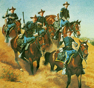
Western Trips

Wednesday, February 27, 2013

Homolovi Ruins State Park / Arizona


homolovi ruins state park
Homolovi I Ruins
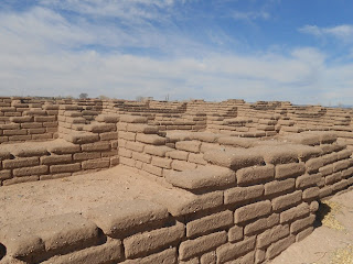
Western Trips visited the historic ruins at the Homolovi Ruins State Park in the northeastern part of Arizona outside of Winslow.  Walk the grounds were ancestral Hopi once lived. This was once the site of a very large Native American settlement. The Homolovi Ruins were once the home to the Hisat'sinom (Anasazi) in the 14th century. Homolovi or Homol'ovi is a Hopi word meaning "place of the little hills".  The Homolovi ruins are now a center of both research and preservation.

Homolovi Ruins Excavation

A 1985 to 1987 survey of about 13 square miles in the Homolovi Ruins State Park has documented more than 300 prehistoric sites. The survey shows a higher site density than was expected and indicates the long term use of the middle Little Colorado River Valley. After a long time in acquiring the land and completing the improvements, the Homolovi Park was dedicated and officially opened to the public on May 22, 1993.


homolovi ruins
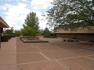
View from Homolovi Visitor Center
The site appears to have been continuously occupied by the Anasazi  sometime after 6000 BC. The first inhabitants were hunters and gatherers and lived in small, temporary campsites. Many centuries later, by 500 AD, the Anasazi became more sedentary and as such they built more permanent, semi-underground dwellings. At this time they began producing pottery. Sections of the site actually continued to be occupied  until about 1400-1500 AD. After that period the Ansazi, went back to the Hopi Mesa villages about 60 miles north of today's park. The major reason the Native people settled here at Homolovi was the availability of water from the Little Colorado River.

Ancient Pot Shards

The great ruins of Homolovi is covered with pot sherds just about everywhere. Fortunately for all of us the pot sherds for the most part have been left undisturbed by the visitors. You'll find them spread around the ground and in many instances placed on display on top of a flat rock. A major reason the park was created in the 1980's was to help protect the ruins and pot shards which were often vandalized.


anasazi ruins pot shards
Pot shards, Homolovi Ruins State Park
It appears that  people would come and dig on their own, find pots or sherds and sell them. The Hopi agreed that the creation of a state park at the site would help protect the ancient ruins as well as the pot shards. Taking pottery shards from the park is illegal. The park was established in direct  response to public concern about the devastation of the Homolovi sites by illegal collectors of prehistoric artifacts.

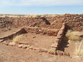
Homolovi Ruins State Park consists of four major pueblo sites, and as mentioned above inhabited by the Anasazi peoples sometime after 6000 B.C. and continuously between 1200 and 1425 A.D. The ruins are spread throughout the 340-acre park. On our Western Trips visit to the Homolovi Ruins State Park two of the ruins sites were opened for visitors. These were Homolovi ruins I and II.

Homolovi I

Homolovi I has a short loop trial going through the ruins. Most of these ruins are covered with soil to a large extent. There is a campground on the way to the ancient Homolovi I Ruins. The Homolovi I parking lot is located about one mile past the park campground and is next to the Little Colorado River.

homolovi park arizona
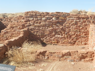
Kiva ruins, Homolovi II
Homolovi II

The trail at Homolovi II is also relatively short. This one is paved and should be wheelchair accessible. Homolovi II was a 1200 room village that at its peak housed 750 to 1000 people. 

Homolovi Ruins State Park is located fifty-five miles east of Flagstaff and just north of  Winslow. Arizona's Homolovi Ruins State Park has campsites, picnic areas and several excellent hiking trails. The park offers 52 RV sites and all except eight sites have electric hook ups. The Rv sites can accommodate vehicles up to 83 feet long.
There are around 52 RV sites and all but 8 sites have electric hookups. - See more at: http://www.thatsnotcamping.com/rv-camping-2/homolovi-state-park.html#sthash.Shd4E9l5.dpuf

Links to two additional Western Trips photo articles you'll enjoy are the Puye Cliff Dwellings located a short drive north of Santa Fe New Mexico and the Mesa Verde National Park cave dwellings in southwestern Colorado.

The Hopi people of today consider Homolovi, as well as other pre-Columbian sites in the southwest, to be part of their homeland. They continue to make pilgrimages to these sites, renewing the ties of the people with the land.
kiva ruins
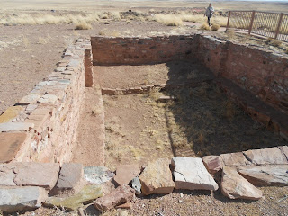
Excavated kiva at Homolovi Ruins State Park
Another interesting historic site in the park is the cemetery of Sunset. Sunset was a Morman settlement established in 1876. The settlement had the distinction of having the first post office on the Little Colorado River and was near an important ford of the river. Sunset was abandoned in the 1880’s. What remains today are the headstones in the small cemetery.

Getting to the Homolovi Ruins State Park

Homolovi Ruins State Park is located on the north side of Interstate 40 in Winslow Arizona. It is also close to Arizona Hwy 87. Winslow is located about fifty-five miles east of Flagstaff Arizona and about 1oo miles west of the New Mexico state line.

(Photos are from author's private collection)


View Larger Map

Friday, February 22, 2013

Coronado State Monument


kuaua pueblo ruins
Coronado State Monument ruins
Western Trips had the opportunity to visit the 700 year old site of the Kuaua Pueblo which is also the site of the Coronado State Monument in New Mexico. Coronado State Monument features the partially reconstructed ruins of the ancient Pueblo of Kuaua. Kuaua is a Tiwa Indian word for "evergreen."

The 1933 Excavation

The Kuaua Pueblo, located on the west bank of the Rio Grande north of Albuquerque, was first excavated in the 1930's by the Great Depression era WPA workforce. The excavation was directed by qualified archeologists. The excavation project at the Kuaua Pueblo came about when archeologists while digging discovered a site with three walls which turned out to be a pueblo kiva. Incredibly, the walls also had painted murals. The Coronado State Monument was established in 1935, just a few years after the WPA excavation began.


pueblo kiva
Kiva entrance
The Murals of Kuaua Pueblo

The murals were layered on sheets of plaster and peeled off the walls and were preserved. The murals which number thirteen are on display at the monument's Visitor Center. The murals are considered to be the finest examples of pre-Columbian art in North America. Native American and Spanish Colonial artifacts are on display in the Visitor Center which was designed by John Gaw Meem. Meem was born in Brazil in 1894 to Episcopal Church missionaries. He migrated to the United States in 1910 where he attended the Virginia Military Institute and graduated with a civil,engineering degree. In 1933 Meem was appointed as the official architect at the University of New Mexico in Albuquerque.

Coronado's Expedition of the Southwest and the Pueblo Indians

In the year 1540, Francisco Vasquez de Coronado set out from Mexico on his epic expedition which covered the present states of Arizona, New Mexico, Kansas and Texas. Many may remember that the Coronado Expedition was seeking the "Seven Cities of Gold". Unfortunately, Coronado never did locate those golden cities but he did come across many Native adobe villages.


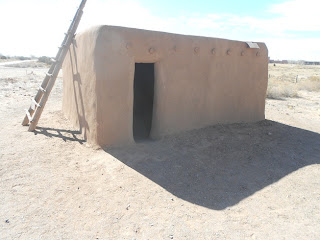
pueblo adobe
Restored adobe home
Much of the information about the Kuaua actually came from the journals written during the Coronado Expedition. More information was obtained from modern day pueblo Indians as well as from excavations from the late 1800's through the 1900's. It's thought that much of the Native population in the Rio Grande Valley migrated there from both eastern Arizona and southwestern Colorado because of the natural water of the Rio Grande. There the pueblos grew and subsisted on corn, beans and squash as well as edible wild plants.

Many historians believe that the Coronado Expedition wintered in the Rio Grande Valley where they discovered twelve Tiwa speaking pueblos. This cluster of pueblos is now called the Tiguex Province. While there is some disagreement among scholars as to where exactly Coronado camped in this area, many contend that the winter camp was at the site of the Kuaua Pueblo. Some also contend that the specific location was decided upon because of it's abundance of food.


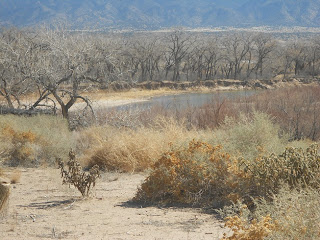
rio grande in new mexico
View of Rio Grande from Kuaua Pueblo
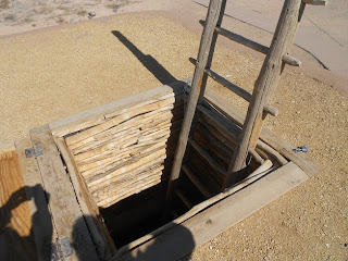
The Kuaua Pueblo was thought to contain about 1,200 rooms which were connected together in a roughly L shape around three plazas. Each plaza contained at least one kiva. The kivas were underground chambers that were used for ceremonial and social purposes.


It's interesting to note that after Coronado returned to Mexico City in 1542, it would be another fifty years before any Spanish conquistador would return to the region. In 1598 Juan de Onate journeyed north from Mexico City and established Santa Fe as the capital of “New Spain". Onate's party also included missionaries whose purpose was to convert the Native population to Christianity. The Spaniards also handed out land grants to settlers. The Native population was expected to provide labor and convert to Christianity while the Spaniards would protect them from attack by nomadic tribes. As the history books contend, this was the beginning of the subjugation of the pueblo Natives which ultimately resulted in the Pueblo Revolt of 1680.

Another interesting historical note is that the Coronado Expedition left behind three Franciscan padres  who were all martyred within two years.

Also see our Western Trips articles on the:

New Mexico Cliff Dwellings

Old Town Albuquerque Spanish Mission

Pecos National Historical Park Pueblo Ruins 

Things to See and Do in La Jolla California


coronado state monument
Coronado State Monument Visitor Center
Visiting the Kuaua Pueblo Ruins and the Coronado State Monument

Today's visitor to the Coronado State Monument can explore the Kuaua Pueblo ruins via a self guided walking tour. You will also be able to climb into a reconstructed kiva to see the reproduced murals. A good tip is to find out in the visitor center when one of the docents will be giving a kiva tour. This is a great way to explore the ruins and learn the history of the murals and the Kuaua Pueblo. This is the perfect addition to your New Mexico vacation planner as it's fun, educational and very low cost.

While touring the Albuquerque area you'll find the Coronado State Monument at Kuaua Pueblo easy to reach. Coronado State Monument and the Kuaua Pueblo ruins are located west of the town of Bernalillo on Hwy 550. The site is about a 19 mile drive north of Albuquerque. The quickest way there is via Interstate 25 and exiting at Hwy 550. The site is on the west bank of the Rio Grande about 2 miles west of the Interstate.

(Photos from author's private collection)


View Larger Map

Wednesday, February 20, 2013

Places to Visit in Dallas


Western Trips visited Dallas Texas and in particular downtown Dallas. Two of the interesting and new sites we visited were the fascinating Perot Museum of Nature and Science and the unique Klyde Warren Park. Both of these sites are geared to family outings and both offer fun and educational opportunities. If your upcoming Texas vacation includes Dallas I would recommend both sites for your Texas trip planner.

perot museum of nature and science
Perot Museum of Nature and Science, Dallas TX
The Perot Museum of Nature and Science

One thing that stands out at the Perot Museum which opened it's doors in December of 2012 are the amazing number of interactive exhibits. The museum is located in Victory Park, on the north edge of the downtown area and very near to the American Airlines Center. The Perot Museum of Nature and Science is a museum for all ages. It's virtually a living science lesson. There is something for everyone at this museum.

The museum covers five floors and features eleven permanent exhibit halls. The lower level of the building features a state-of-the-art, modular traveling exhibit hall; an education wing with six learning labs; a flexible space auditorium; and a children's museum including outdoor play space and along with a courtyard.


perot museum dallas exhibition hall
Exhibit Hall at Perot Museum
The Eleven Halls at the Perot Museum

The eleven halls within the Perot Museum of Nature and Science include the Moody Family Children's Museum...the Sports Hall...the Discovering Life Hall...the Being Human Hall...the Tom Hunt Energy Hall...the Texas Instruments Engineering and Innovation Hall...the Rees-Jones Foundation Dynamic Earth Hall... the Expanding Universe Hall...the Lyda Hill Gems and Minerals Hall...the Rose Hall of Birds and the T. Boone Pickens Life Then and Now Hall.

Some Fun and Educational Interactive Exhibits

Just to give you a few ideas of the fun and educational hands on exhibits at the museum, in the Sports Hall we took part in a timed race competing against professional football running backs.  This is where you can test your speed against a running Tyrannosaurus rex. Test your skill against the pros in throwing a football. These are just a few of the fun interactive exhibits at the Perot Sorts Hall.

perot museum of nature and science in dallas Texas
Running Track Interactive Exhibit at Sports Hall
In the Being Human Hall you have the opportunity to use your brain waves to launch a ping-pong ball. In the Texas Instruments Engineering and Innovation Hall you have the opportunity of programming a robot's moves on a computer. When we visited the Dynamic Earth Hall we had an opportunity to stand on a platform which recreated the tremors of various size earthquakes. In this hall there's also an exhibit which creates a miniature tornado which you can touch.

The Hoglund Foundation Theater

As part of your visit to the Perot Museum of Nature and Science you can view educational features and cutting-edge documentaries along with independent films. The Hoglund Foundation Theater accommodates 298 people in comfortable seats. When you visit the museum you can purchase tickets for both the museum and theater showing or for just a museum tour.

klyde warren park
Klyde Warren Park, Dallas TX
Klyde Warren Park

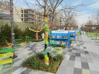
The Klyde Warren Park is located adjacent to the Perot Museum and on the northern edge of downtown Dallas. This 5.2 acre three city block long park was built on top of a downtown freeway. Construction began in 2009 and the park was opened in October of 2012. As of this writing, a portion of the park was still under construction.

The park is planned to include a restaurant and a performance stage. Jogging trails will also be completed along with a dog park, a playground and lots of green space. The park is meant to serve as a central gathering place for visitors and locals in downtown Dallas. Plans include daily events such as yoga classes, book signings and outdoor films and concerts. The activities offered at the Klyde Warren Park are free and open to the public. There is also free WiFi available in the park.

The restaurant at the Klyde Warren park is set to open in late summer of 2013. The Relish and Savor will function as both a restaurant and take-out cafe.


The Klyde Warren Park is managed by the private Woodall Rogers Foundation which is the name of the freeway running underneath the park.This very unique park in the downtown area of a major city is also on the edge of the Dallas arts district and as such is adjacent to several museums such as the Dallas Museum of Art, the Dallas Center for the Performing Arts and the Nasher Sculpture Center. As mentioned above, the Klyde Warren park is also next to the Perot Museum of Nature and Science.

klyde warren park dallas texas
Playground at the Klyde Warren Park
Links to three additional Western Trips photo articles about Dallas area attractions include the  

Interurban Electric Railway Museum..

The Victorian House at the Pioneer Homestead..

The Frisco Heritage Museum and the china of the Santa Fe Railroad dining cars.

Have Fun in Downtown Dallas Texas

There are plenty of fun and educational places to visit in Dallas. The two venues featured above are just two of the most recent and both are truly unique and worth a visit to.

We also came across an excellent walking tour of downtown Dallas Texas featured by National Geographic. This walking tour will take you pass many historic Dallas sites such as the J.F.K. Memorial, Union Station, the historic old courthouse, the original Dallas settler's home and the Sixth Floor Museum.

When your Texas travel plans include a visit to Dallas, the two featured sites above would be excellent additions to your vacation and road trip planner. These are only a few of the fun places to visit in Dallas.

(Photos from author's private collection)

Monday, February 18, 2013

Visit New Mexico / Our Lady of Guadalupe Shrine


our lady of guadalupe in santa fe
Our Lady of Guadalupe
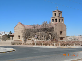
When you visit New Mexico and Santa Fe in particular, one stop you want to make is Our Lady of Guadalupe Shrine. The old Spanish church is even within walking distance from the plaza and is one of the most visited sites in Santa Fe. Our Lady of Guadalupe Shrine is in the Santa Fe Diocese of the Roman Catholic Church and is an active place of worship.

The Spanish settlers in Northern New Mexico were in many ways separated from the rest of the world for many decades. To help endure the hardship of living in such a remote and in many ways, dangerous region,  they depended on their religious faith.


First Built in 1777

Our Lady of Guadalupe Shrine has the distinction of being the oldest standing shrine constructed for Our Lady of Guadalupe, the Mexican patron saint, in the U.S. The first church was built in 1777 along the south bank of the Santa Fe River and was a simple small adobe structure.  The adobe walls are almost three feet thick, and among the sanctuary's religious art and artifacts is a beloved image of Nuestra Virgen de Guadalupe, painted in 1773 by Mexican master Jose de Alzibar. By the early 1800's the structure was in general disrepair and wasn't appropriate to use as a church.

our lady of guadalupe shrine santa fe new mexico
Our Lady of Guadalupe Shrine, Santa Fe NM
The History of Our Lady of Guadalupe

When the railroad arrived in Santa Fe in 1880, Archbishop Lamy dedicated the restored chapel to non-Spanish speaking Catholics. The Santuario was just down the road from the new railroad station and thus was in a position to welcome travelers who visited Santa Fe.

In 1884 a 575 pound bell was added to the church. Another bell was added in 1896. Archbishop Jean Baptista Lamy was the first Archbishop of Santa Fe. Archbishop Lamy first came to Santa Fe in 1851 just about five years after the United States took over the territory from the Mexicans. The Santa Fe Diocese was formed in 1853.The church served all the way to 1918 when it was then made an auxiliary to the the Cathedral Parish St. Francis. In 1931 the structure was again designated as a parish church but the small structure couldn't accommodate the growing population. As a result, funds were raised to build an entirely new Our lady of Guadalupe. The reconstruction was completed in 1961.


Beginning in 1961 the church was utilized for used for various secular activities. This usage continued until 1975. The property was deeded to the non-profit Guadalupe Historic Foundation in 1973 with the hopes of receiving grants for another renovation as the building was again in need of repair. The Guadalupe Historic Foundation eventually deeded the property back to the Santa Fe Archdiocese and continued to lease the building. When the lease was up in 2006, Our lady of Guadalupe Parish again returned to being a parish church. The parish church today is also utilized for cultural events such as lectures and concerts.


our lady of guadalupe statue
Our Lady of Guadalupe Statue
Statue of Our Lady of Guadalupe

When you visit Our Lady of Guadalupe you'll see a beautiful twelve foot, four thousand pound statue of Our Lady in front of the Sanctuario. The statue is there today because of a long journey from Mexico City to Santa Fe in 2008. The historic journey up from Mexico City followed the old Camino Real which was the route taken to Nuevo Mexico by Spanish settlers centuries ago.

Efforts to make the statue a reality began in 2001 when funds were secured for the project. The Our Lady statue, which you view today and which was dedicated in August 2008, was created by the Mexican artist and sculptor Georgina Farias de Arellano. She was selected over Northern New Mexico artists for several reasons. Georgina had a very strong devotion to Our Lady of Guadalupe and also planned to donate her creative fees.

Links to three additional Western Trips photo articles you'll enjoy are  the Loretto Chapel.....the History of Galisteo Mission.....and Old Town Albuquerque's San Felipe de Neri Church.


our lady of guadalupe shrine belltower
Our Lady of Guadalupe bell tower
The Historic 2008 Journey

The 2008 journey up from Mexico City with the newly created statue was a historic event for a few reasons. The likeness of Our Lady of Guadalupe first came up the Rio Grande when Padre Juan Ramirez traveled from Juarez to Socorro in 1663 with her image in his saddlebag. The 2008 journey with the new statue followed essentially the same route that Padre Ramirez traveled centuries earlier.

The 2008 trip up from Mexico City was particularly special for New Mexico. Today, the images you view of Our Lady in New Mexico and in Santa Fe seem to be everywhere. They are seen on shirts and posters and everything in between. The image of Our Lady of Guadalupe is the most often image seen if you stroll around Santa Fe. By the creation of the statue, it's long historic journey up from Mexico and it's home today in front of the oldest church in the United States dedicated to Our Lady of Guadalupe, Santa Fe residents and visitors, Catholic and non-Catholic, can enjoy this excellent and sacred piece of religious artistic work.

Our Lady of Guadalupe Shrine is located at 417 Agua Fria St Santa Fe, NM.

Good books to research the historic churches of New Mexico include Historic New Mexico Churches by Annie Lux and Lamy of Santa Fe by author Paul Horgan.

(Photos from author's private collection)


View Larger Map
Friday, February 15, 2013

Rail Pictures / Niles Canyon Railway


One of the most fun things to do is ride an historic train route. The Niles Canyon Railway that operates in the San Francisco Bay Area between Fremont California and the picturesque small town of Sunol is just such a ride.

sunol california railroad station
Niles Canyon Railway Station, Sunol CA
When you're visiting the San Francisco Bay Area this is a side trip you'll be glad you added to your trip planner. In addition to a scenic ride you'll be able to take some great rail pictures.

The Niles Canyon Railroad operates year round. The area of Niles Canyon in in the Eastbay area running from Fremont California westward to the valley.

The Era of the Railroads

The  Niles Canyon Railroad history goes all the way back to the year 1862, seven years before the completion of the first transcontinental railroad. The railroad's history includes both the building of the Central Pacific Railroad and the Western Pacific Railroad.

As it's name implies, the Niles Canyon Railway runs through scenic  Niles Canyon. Steam locomotives began traversing the canyon as early as 1865 via the Western Pacific Railroad. The Western Pacific started to build from San Jose north and eastward. As was the case with most railroads, mergers, acquisitions and new routes would emerge through much of the latter 1800's.

Eventually, the Western Pacific Railroad was bought out by the Central Pacific and the Central Pacific was taken over by the Southern Pacific.The Southern Pacific focus was more to the north around Martinez California and as a result the Niles Canyon railroad line became secondary. Having been a part of the legendary Central Pacific Railroad, today's Niles Canyon Railway line runs over what was once part of the transcontinental railroad.

niles canyon railroad
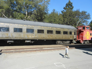
Old Southern Pacific Rail Car on Niles Canyon Railway
Another interesting fact is that the Niles Canyon route was the very first line for trains running eastward from the San Francisco Bay. It wouldn't occur until 1879 that the much shorter route from the Bay Area to Sacramento would be completed which ran through Benicia to the north.

Pacific Locomotive Association

Pacific Locomotive Association’s Niles Canyon Railway is operated  by this volunteer group for the purpose of preserving the atmosphere of Pacific Coast railroads.

 The Pacific Locomotive Association began in 1961 and operates several historic excursion trains in California. Another popular excursion railroad operated by the group is referred to as the "Skunk Train". This train runs between Mendocino California on the coast and the town of Willits. The formal name of the railroad is the California Western Railroad.

The Pacific Locomotive association made arrangements to begin a rebuilding of the Niles Canyon line in 1987. In 1988 the line was completed and excursion train service began between Sunol California and Fremont.


niles canyon railway
Niles Canyon excursion train
Historic Preservation

The Pacific Locomotive Association has an excellent collection of railroad equipment that has been accumulated since the 1960's. The locomotives and rolling stock collected went through restoration programs and train restoration continues as an ongoing project. The collection is found at the association's Niles Station located in Fremont.

This is the location you want to visit to see some spectacular restored rolling stock. The steam engines at Fremont's Niles Station includes a great exhibit of old Southern Pacific steam locomotives.

Just to give you an idea of some of the other rail cars collected by the Pacific Locomotive Association, they include, but are certainly not limited to, a 1904 80 foot Pullman Business Car, a 40 foot 1911 Pullman RPO (Railroad Post Office) Car, a 1907 69 foot Observation Car, q 1923 Pullman Interurban passenger car, a 1926 Pullman Heavyweight Sleeper, a 1923 60 foot Pullman Business Car and a 1926 Pullman Heavyweight Dining Car.


at & sf caboose
Vintage AT & SF caboose on Niles Canyon RR
Just to mention a few of the vintage locomotives in the Pacific Locomotive Association collection include a Western Pacific F7 Diesel, a Southern Pacific SD9 Diesel, a Southern Pacific 9011 Diesel, the Robert Dollar Lumber Company No. 3 steam locomotive, the Qunicy Railroad Company No. 2  steam locomotive and the Clover Valley Lumber Company No. steam locomotive.

Riding the Niles Canyon Railway

We have enjoyed riding the Niles Canyon Railway several times. As mentioned above, the railroad operates throughout the year and is a fun experience whether you go alone, with a small group or as part of celebrations such as birthdays. Another offering is a Sunday caboose excursion where parties can reserve the caboose for special occasions.


southern pacific locomotive
Southern Pacific 1423 at Sunol CA
Weekend excursions on the Niles Canyon Railroad operate January through October. During November and December you'll want to check out the Train of Lights evening trains. Groups can also charter a complete train. All information on schedules, special trains and fares can be found at the railroad's website www.ncry.org. The railway is listed on the National Register of Historic Places.

The scenery is beautiful, the rail line is historic and you'll be able to take some terrific rail pictures. Riding the Niles Canyon Railway is a great addition to a San Francisco area vacation or weekend trip. Make sure to check out their web site for special events.

Links to additional Western Trips photo articles you'll enjoy include Texas Train Rides on the Heartland Flyer....the historic  AT & SF 5000 Steam Locomotive and Amtrak's very popular Coast Starlight with it's historic Palace Car service..

(Photos from author's private collection)
View Larger Map
Wednesday, February 13, 2013

Painted Desert


painted desert scenery
Painted Desert
One of the most fascinating pieces of landscape lies within about a 120 mile by 60 mile area running southeast from near Tuba City Arizona to Holbrook Arizona. This is America's Painted Desert. The name for Arizona's Painted Desert comes from the bands of red, white and yellow sediments and bentonite clay of the Chinle rock formation, exposed by erosion. These beautiful formations stretch all the way southeast ending just beyond the Petrified Forest which the National Park Service manages along with the Painted Desert. Much of the painted Desert also lies within the Navajo Nation.

The Painted Desert Inn

The Painted Desert Inn has a long history which dates back to the era of old Route 66. One of the very best views of the Painted Desert are found at this site. Kachina Point at the Painted Desert Inn offers a terrific view of the unique colorful landscape.

painted desert
Painted Desert Visitor Center
Painted Desert Inn National Historic Landmark was at one time a trading post, a restaurant and an inn that served motorists traveling along  Arizona's Route 66. Today, the landmark serves as an excellent museum which also features demonstrations from Native American artisans on crafts such as rug weaving and silver smithing.  This National Historic Landmark is within Petrified Forest National Park. The Painted Desert Inn underwent a year and a half renovation and opened in May 2006. Today, there are no dining or inn facilities there but you'll enjoy the museum, it's bookstore and the artifacts on display. As mentioned above you'll also have an opportunity to take some stunning photos from this site. The Painted Desert is home to fossilized prehistoric plants and animals as well as dinosaur tracks and evidence of early humans.


painted desert inn
Painted Desert Inn
The inn is on a mesa which overlooks the large and colorful Painted Desert. The lodge was originally completed in 1920 by entrepreneur Herbert David Lore. The National Park Service bought the inn in 1935 and quickly began a renovation using the rustic aesthetic style so popular in park architecture of that era. The chief architect in this 1935 remodeling was a man named Lyle Bennett, one of the country's leading architects of the era. Work was done by men employed by the Civilian Conservation Corps, a group that did much construction and road building during the Great Depression.

The inn was constructed of wood and native stone in the Pueblo Revival style.  Flagstone terraces outside the building overlook the desert.  The building’s stone walls are more than two feet thick and finished with textured earth-toned stucco.  Included were flat roofs with parapets and Ponderosa Pine logs are along the walls and ceiling. Two special features of the historic Painted Desert Inn are Fred Kabotie murals and a mountain lion petroglyph. This petroglyph was discovered in the 1930's and is considered one of the finest, animated and lifelike depictions of mountain lions in the region.


painted desert inn interior
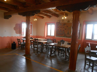
Interior look of Painted Desert Inn
Fred Harvey

Many time when you talk about the southwest during the early to mid 1900's, the name Fred Harvey emerges. Some would say that the combination of the Atchison Topeka and Santa Fe Railroad were responsible  for opening up America's southwest to tourism.

The Fred Harvey Company opened the inn in 1940. For two years, the inn offered Route 66 travelers food, souvenirs, and lodging that the Fred Harvey Company was famous for. Unfortunately, with the onset of World War Two the inn closed up in 1942. Much of this was simply due to the lack of resources which had been diverted to the war effort.

After the war in 1947, the Fred Harvey Company’s chief architect and interior designer, Mary Jane Colter, was given the task of  renovating the facility.  Mary Colter created a new interior color scheme and made other changes. Some of Colter's design changes included new plate glass windows to capitalize on the magnificent surrounding landscape. Any structure you build at the Painted Desert must have lots of windows. Also, as mentioned above, Colter arranged for Hopi artist Fred Kabotie to paint murals on the dining room and lunchroom walls that reflect Hopi culture. In addition to these fine renovations and historical touches, the popular Harvey Girls provided their legendary service at the inn. As was customary, the Harvey Girls served complete meals in the Painted Desert Inn dining room on spotless china. The Painted Desert Inn was designated as a National Historic landmark in 1987.

Links to additional Western Trips photo articles you'll enjoy are Arizona Route 66....La Posada in Winslow Arizona....Historic Downtown Flagstaff Arizona.

view of painted desert
View from the Painted Desert Inn

Recent Renovations

The most recent renovation of the Painted Desert Inn started in 2004 and as mentioned above was completed in 2006. This included new wiring, plumbing, structural upgrades including new flagstone on the terraces and more visitor conveniences.

Hiking the Painted Desert

The Painted Desert wilderness includes 43,020 acres of colorful mesas, buttes and badlands with scattered areas of grassland. One of the most popular hikes in the area is the Painted Desert Rim Trail which is a 1.2 mile roundtrip hike. This is considered an easy unpaved trail that goes along the Painted Desert rim between Tawa and Kachina Points.

Another very unique yet quite short hike is to the Puerco Indian Ruins and Petroglyphs. This is a half mile loop trail. The trail takes you to the ruins of a 76 room Anasazi pueblo. Some parts of the pueblo have been excavated. The trail begins at the Puerco Pueblo parking lot on the Petrified Forest Loop Road at mile marker 11 The mile marker is measured from the north entrance to the park off Interstate 40. A short paved trail leads from the parking lot to the ruins and petroglyphs.

These are only two of the several trails featured at the Painted Desert and Petrified Forest National Park.

The National Park Service also offers a series of off-trail guided hikes on Sundays in January, February, and March.

Getting There

The Painted Desert is a part of the Petrified Forest National Park. The north entrance to the park is directly off Interstate 40 about 20 miles east of Holbrook Arizona and fifty miles west of the New Mexico state line.

(Photos from author's private collection)


Sunday, February 10, 2013

Muir Woods Trails


muir woods national monumentLocated just twelve miles north of the Golden Gate Bridge, Muir Woods National Monument makes for a terrific day trip from San Francisco. The giant redwood trees are quite a sight and the Muir Woods trails are many.

The Importance of Muir Woods National Monument

There was a time before the 1800's when redwood forests covered many northern California coastal valleys. During the mass migration westward it became evident that there was a need to protect what was there. Many may recall that it was during the administration of President Theodore Roosevelt during the first decade of the 1900's when a good deal of western acreage was set aside for preservation. What today is Muir Woods National Monument was one of those sites.

Muir Woods actually came into being because of a donation of 295 acres to the federal government by a man named William Kent. Kent and his wife purchased land in this valley in 1905 for the very purpose of protecting the old growth forest that was there. President Roosevelt proclaimed this parcel of land a national monument in 1908. Kent also requested that the monument be named after John Muir, America's leading preservationist of that era and a resident of the San Francisco Bay Area.

muir woods hiking trails
Muir Woods Loop Trail
Today, Muir Woods National Monument is managed by the Golden Gate National Recreation Area. There is a visitor center and a self guided nature trail at the park's entrance.

The Ancient Redwoods of the Pacific Coast

The story of the redwoods on the pacific coast have much to do about the region's climate. During the summer months when rainfall is almost non-existent, the trees obtain moisture from the fog. The winter months in northern California are noted for it's generally regular rainfall. As a result, redwoods can only grow and spread during this type of northern California climate.

Fire is also a very important element for the forest's long term growth. Fire clears debris and growth from the forest floor and this allows redwood seeds to reach the soil and grow. Fire also destroys certain bacteria on the forest floor which would otherwise kill the seeds before they can germinate. Today, fire suppression has become a priority for a variety of reasons, protecting property being a major one. Before fire suppression became a goal, natural wildfires would occur perhaps every 20 to 50 years. To help keep the forests healthy, today's National Park Service will conduct prescribed burns.

Links to four additional Western Trips photo articles you'll enjoy and some that are close to Muir Woods include the...

Bodega Bay Coastal Hiking Trail

San Francisco's Fort Point

John Muir Home and National Park

White Pass Scenic Byway in Central Washington

muir woods redwood trees
Redwoods along the Loop Trail
Muir Woods Trails

There are several trails within Muir Woods National Monument that are great for hikers. Today's 560 acre park features six miles of  Muir Woods trails. Muir Woods is surrounded by Mount Tamalpais State Park and several trails extend through both parks.

The Loop Trail which begins at the visitor center is a very popular trail. Along it are Cathedral Grove and Bohemian Grove which feature the biggest trees in Muir Woods. Here the tallest tree is over 252 feet tall and the widest is over 14 feet. Some of these redwoods are over 1,000 years old with most of the mature trees being between 500 and 800 years old. Coast redwoods are known to grow in about a 500 mile strip extending from southern Oregon to California's Big Sur along the Pacific coast.

The Sun Trail, a 4.5 mile hike, is another excellent trail in the park. The Sun Trail is a loop that climbs to a steep hillside high above Muir Woods and then descends to the Main Trail.

The Ben Johnson Trail, a 5.2 mile hike, is another that  climbs up a grassy hill and then continues through old growth forest back to the Main Trail.

coastal redwood trees
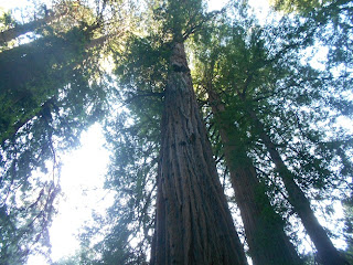
Some of the coastal redwoods are over 250 feet high
The following link will take you to the NPS Muir Woods Trail Map which you can download. Among other things, the trail map will show you what areas are paved and what areas permit horseback riding.

Getting to Muir Woods National Monument

From San Francisco, go north over the Golden Gate Bridge and continue on U.S. Hwy 101 to the exit that is for Route 1 to Mill Valley and Stinson Beach. After you turn left and cross under the freeway you'll continue to the second stop light. You'll see signage directing you to Muir Woods and Stinson Beach. Turn left at this light and continue through a residential area. You'll come upon the Panoramic Hwy at which you'll turn right. Again, you'll see signage directing you to Muir Woods. Take this scenic road to Muir Woods Road at which time you'll want to turn left onto it. After a series of turns you'll eventually come to the Muir Woods entrance where there's plenty of parking space.

cathedral grove muir woods
Loop Trail at Cathedral Grove
Camping is not allowed at Muir Woods National Monument but it is at adjacent Mt. Tamalpais State Park. There is also a horse camp site at Mt. Tamalpais.

Muir Woods is part of the Golden Gate National Recreation Area. This region offers a great number of  natural and cultural sites to explore which cover San Mateo, San Francisco, and Marin counties.


Muir Woods trails offer the hiker an adventure through some of the most scenic coastal forest found anywhere on the west coast. Because the trails are often flat and the main Loop Trail is relatively short, a visit to Muir Woods National Monument is an excellent educational side trip for the entire family and it's close to other fun coastal side trips.

(Photos from author's collection) 


BIOGRAPHY OF JOHN MUIR VIDEO 


View Larger Map

Saturday, February 9, 2013

Our Top Six Video Links


LITTLE BIGHORN BATTLEFIELD RIDE


CHASING THE UNION PACIFIC 844 STEAM LOCOMOTIVE


STEAMBOAT DELTA QUEEN


AN EXPLORATION OF OUR HISTORY (CALIFORNIA GOLD RUSH)


LIGHTNING FAST: THE STORY OF THE PONY EXPRESS


SANTA FE TRAIL NAT'L SCENIC BYWAY


Thursday, February 7, 2013

U.S. Cavalry Museum / Fort Riley Kansas


fort riley kansas historic buildings
First Kansas Territorial Capital Bldg at Fort Riley Kansas
Western Trips highlights the unique U.S. Cavalry Museum at Fort Riley Kansas. The museum is part of the  Army Museum System and is housed in a building built in 1855 that once was the headquarters of the famous U.S. Army Cavalry School. The building served as the Cavalry School Administration Building until 1957. In 1962 the building was turned into the Fort Riley Historical Museum. What you'll experience at the U.S. Cavalry Museum is the history of the American Mounted Horse Soldier from the Revolutionary War to 1950.The U.S. Cavalry Museum features exhibits and artifacts that cover it's history during this entire 150 year period.

Historic Fort Riley

Fort Riley Kansas, established in 1853, has the distinction of being one of three frontier army forts that still exist today as an active army base.The other two forts are Fort Sill Oklahoma and Fort Bliss Texas. The area of Fort Bliss also extends into New Mexico.

The history of Fort Riley as well as the history of most frontier military forts was all about "Manifest Destiny" and the westward migration along both the Oregon and the Santa Fe Trails. Interestingly enough, Fort Riley was deemed by it's surveyors as being generally near the center of the North American continent. For this very reason it was initially named Camp Center.

custer and washita massacre
Drawing of Custer's 1868 march to the Cheyenne village
In addition to the U.S. Cavalry Museum, Fort Riley is the site of historical markers, historical buildings along with monuments and statues.

One of these historical structures is the home of George Armstrong Custer while he served at Fort Riley. The restored house, it's rooms and furniture are made to look like they would have back when Custer lived there for a few years in the late 1860's. During this period Custer was involved in actions against the Cheyenne Native Americans in Kansas, Oklahoma and eastern Colorado. The most historically significant action that Custer was involved in during this time was the Battle of Washita River or also referred to as the controversial Washita Massacre which occurred in present day Oklahoma in 1868.

The Custer House was constructed in 1855 and is made of native limestone. It is the only double set of surviving officer's quarters from the fort's early history. The Custer House is open from Memorial Day to Labor Day on Saturdays from 10A to 4P and on Sundays from 1P to 4P.

Yet another good visit at Fort Riley is Custer Hill. This is the main troop area on Fort Riley. It's the area where Fort Riley's soldiers live and work. The site includes barracks, the motor pools and various military offices. 

buffalo soldier painting
Buffalo Soldier,  Magee painting
The Buffalo Soldiers

The Ninth and Tenth Cavalry, "buffalo soldiers", who were so active in the western frontier after the Civil War were also stationed at Fort Riley several times during their long history. The fact also is that the buffalo soldiers, established in 1866, served at many army posts during the latter 1800's from Montana to New Mexico and throughout Texas. Often they would pass through Fort Riley on their journey further west.


Links to five additional Western Trips articles you'll enjoy are below...

 Historic Fort Reno

 Frontier America

A Little Known Old Wild West Show 

The Man-Made Wonder in Sedona Arizona

Drive the 13 Mile Route 66 in Kansas 


1800s us cavalry uniforms
U.S. Cavalry field uniforms 1876
The U.S. Cavalry School

Western historians are aware that many army forts along the western frontier were closed when the Indian Wars concluded during the late 1880's and particularly in 1890. Fort Riley was saved from these closures when Lt. Gen. Philip Sheridan requested within his 1884 report to Congress that the government make the fort "Cavalry Headquarters of the Army." It was this action in 1884 and it's approval that solidified Ft. Riley as a major army post. This museum is open Monday through Saturday from 9A to 4:30P and on Sundays from noon to 4::30 P.

The U. S. Cavalry Museum

The 10,000 square foot U.S. Cavalry Museum. Along with a plentiful exhibit of artifacts include uniforms and weapons equipment. Exhibits also include excellent oil paintings from well known military artists. Also included is the museum's Old Glory Antiques & Crafts Gift Shop.

mountain howitzer
Mountain Howitzer replica
Fort Riley, being an active military base, requires all visitors to obtain a pass to enter the base. A photo ID is required to receive a pass. Cell Phone usage is not permitted while driving a vehicle on Fort Riley. There is no fee to visit the museum however donations are greatly appreciated.

Another good stop to make while visiting Fort Riley is the Fort Riley 1st Infantry Division Museum. This museum  tells the story of the First Infantry from its establishment in 1917 through the present day. The museum is open Monday through Saturday. from 10 AM to 4 PM.

Visiting Fort Riley 

Fort Riley is located about a one hour drive west of the Topeka in northeastern Kansas. Fort Riley is about a three hour drive from Kansas City.

Fort Riley is an excellent addition to any family western road trip planner. The U.S. Cavalry Museum and the surrounding grounds and museums at Fort Riley exhibit a very large amount of American frontier history and army cavalry artifacts.

(Photos of buffalo soldier painting and howitzer cannon are from author's collection. Remaining photos and images are from the public domain) 


US CAVALRY DOCUMENTARY VIDEO


View Larger Map