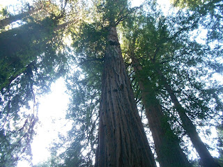
 Located just twelve miles north of the Golden Gate Bridge, Muir Woods National Monument makes for a terrific day trip from San Francisco. The giant redwood trees are quite a sight and the Muir Woods trails are many.
 The Importance of Muir Woods National Monument
There was a time before the 1800's when redwood forests covered many northern California coastal valleys. During the mass migration westward it became evident that there was a need to protect what was there. Many may recall that it was during the administration of President Theodore Roosevelt during the first decade of the 1900's when a good deal of western acreage was set aside for preservation. What today is Muir Woods National Monument was one of those sites.
Muir Woods actually came into being because of a donation of 295 acres to the federal government by a man named William Kent. Kent and his wife purchased land in this valley in 1905 for the very purpose of protecting the old growth forest that was there. President Roosevelt proclaimed this parcel of land a national monument in 1908. Kent also requested that the monument be named after John Muir, America's leading preservationist of that era and a resident of the San Francisco Bay Area.
 |
| Muir Woods Loop Trail |
The Ancient Redwoods of the Pacific Coast
The story of the redwoods on the pacific coast have much to do about the region's climate. During the summer months when rainfall is almost non-existent, the trees obtain moisture from the fog. The winter months in northern California are noted for it's generally regular rainfall. As a result, redwoods can only grow and spread during this type of northern California climate.
Fire is also a very important element for the forest's long term growth. Fire clears debris and growth from the forest floor and this allows redwood seeds to reach the soil and grow. Fire also destroys certain bacteria on the forest floor which would otherwise kill the seeds before they can germinate. Today, fire suppression has become a priority for a variety of reasons, protecting property being a major one. Before fire suppression became a goal, natural wildfires would occur perhaps every 20 to 50 years. To help keep the forests healthy, today's National Park Service will conduct prescribed burns.
Links to four additional Western Trips photo articles you'll enjoy and some that are close to Muir Woods include the...
Bodega Bay Coastal Hiking Trail
San Francisco's Fort Point
John Muir Home and National Park
White Pass Scenic Byway in Central Washington
 |
| Redwoods along the Loop Trail |
There are several trails within Muir Woods National Monument that are great for hikers. Today's 560 acre park features six miles of Muir Woods trails. Muir Woods is surrounded by Mount Tamalpais State Park and several trails extend through both parks.
The Loop Trail which begins at the visitor center is a very popular trail. Along it are Cathedral Grove and Bohemian Grove which feature the biggest trees in Muir Woods. Here the tallest tree is over 252 feet tall and the widest is over 14 feet. Some of these redwoods are over 1,000 years old with most of the mature trees being between 500 and 800 years old. Coast redwoods are known to grow in about a 500 mile strip extending from southern Oregon to California's Big Sur along the Pacific coast.
The Sun Trail, a 4.5 mile hike, is another excellent trail in the park. The Sun Trail is a loop that climbs to a steep hillside high above Muir Woods and then descends to the Main Trail.
The Ben Johnson Trail, a 5.2 mile hike, is another that climbs up a grassy hill and then continues through old growth forest back to the Main Trail.
 |
| Some of the coastal redwoods are over 250 feet high |
Getting to Muir Woods National Monument
From San Francisco, go north over the Golden Gate Bridge and continue on U.S. Hwy 101 to the exit that is for Route 1 to Mill Valley and Stinson Beach. After you turn left and cross under the freeway you'll continue to the second stop light. You'll see signage directing you to Muir Woods and Stinson Beach. Turn left at this light and continue through a residential area. You'll come upon the Panoramic Hwy at which you'll turn right. Again, you'll see signage directing you to Muir Woods. Take this scenic road to Muir Woods Road at which time you'll want to turn left onto it. After a series of turns you'll eventually come to the Muir Woods entrance where there's plenty of parking space.
 |
| Loop Trail at Cathedral Grove |
Muir Woods is part of the Golden Gate National Recreation Area. This region offers a great number of natural and cultural sites to explore which cover San Mateo, San Francisco, and Marin counties.
Muir Woods trails offer the hiker an adventure through some of the most scenic coastal forest found anywhere on the west coast. Because the trails are often flat and the main Loop Trail is relatively short, a visit to Muir Woods National Monument is an excellent educational side trip for the entire family and it's close to other fun coastal side trips.
(Photos from author's collection)
BIOGRAPHY OF JOHN MUIR VIDEO
View Larger Map

