Western Trips

Sunday, December 29, 2013

San Antonio Historic Hotels / The Crockett

Across the street from the Alamo in San Antonio Texas and just a short stroll to the famous Riverwalk is The Crockett Hotel, a National Historic Landmark and is on the National Register of Historical Preservation.  The hotel is also a member of the Historic Hotels of America.


crockett hotel san antonio
The Crockett Hotel, San Antonio, TX
If you're looking to stay in the center of activity The Crockett Hotel is in a perfect location. The hotel is walking distance to justa about all the attractions in the historic part of downtown San Antonio.

The Crockett Hotel in San Antonio

After the war with Mexico and when Texas gained it's independence the area where The Crockett Hotel now stands was converted from agriculture to commercial use. 

Historians mark the date of the first structure on this site as 1877. The cornerstone however is dated 1909 and was placed there by a fraternal organization, the Independent Order of Odd Fellows Lodge 11. What is unclear is whether a first 1877 structure was demolished and replaced with the building you see today in 1909. An interesting note is that a section of guestrooms that had been added for the 1968 World's Fair was afterwards demolished to enhance the pool area.


historic texas hotels
Interior area of Crockett Hotel
Most historians believe that this is the case and the building you see today, the original six story section, was constructed in 1909. It is believed that the Odd Fellows operated the hotel and used part of the building for fraternal meetings and events. A seven story wing was added to that structure in 1927.The building has gone through several interior renovations over the years, one in 1982 and another in 2007.When The Crockett was renovated in 1982 a seven story atrium was added to enclose the hotel's courtyard.

Talk about a place in Texas history, The Crockett is also located adjacent to another famous San Antonio hotel, The Menger. The Menger Hotel is one of the oldest and best known hotels in Texas and was opened in 1859. Similar to The Crockett, The Menger Hotel added wings in subsequent years.

The Crockett Hotel and it's 180 guest rooms is located literally on what was the Alamo grounds and battlefield  and is said to be haunted by the ghosts of the soldiers who fought in that famous battle of 1836. In that year the main plaza of the Alamo was about three acres in size. The Texans had a perimeter to defend that was about a quarter mile long. Today, when the Battle of the Alamo is discussed, the focus is put on the chapel or mission building when the field of battle really encompassed a wide area which included a lot of San Antonio. The west wall in front of the Alamo chapel faced the San Antonio River.


the crockett hotel
Hotel atrium area
The Battle of the Alamo lasted thirteen days during February and March of 1836. The Crockett stands on the southeast area of the old Alamo grounds and at a point where Davy Crockett and other Texas settlers defended the old mission.

The Haunted Crockett Hotel

As with many other thought to be haunted buildings, The Crockett Hotel has been known to have sudden cold spots appearing as well as faint whispers. These have been reported to occur throughout the hotel with the most active areas being several guest rooms, the lobby and the hotel bar. Guests and staff both have reported sightings of a man in a blue jacket similar to ones worn by soldiers during the 1836 battle.

See the Western Trips articles linked below for more San Antonio historic attractions...

Historic Attractions in San Antonio

The Missions of San Antonio

A Walking Tour of Historic Gonzales Texas

A West Texas Trip to San Angelo 

In the Center of San Antonio's Tourist Sites

In addition to the Alamo directly across the street from The Crockett Hotel and the Riverwalk adjacent to it, the hotel is a short stroll away from the La Villita Historic Arts Village and also one of San Antonio's oldest neighborhoods. This arts village of one square block has been in existence since 1939 and features all types of art...sculptures, oil paintings, pottery and much more. You'll also want to check out events planned at the arts village before your trip to San Antonio. La Villita Historic Arts Village is adjacent to the hotels and the Riverwalk. See their website at www.lavillita.com


Crockett Hotel entrance
If you take a boat ride on the San Antonio River along the Riverwalk, which is highly recommended, you'll learn quite a lot about San Antonio and the construction of the Riverwalk itself. The cruise is 35 minutes long and passes by the RiverCenter Mall which is the only mall in the U.S. that actually has a river running through it. Your cruise on the river will also pass through the Henry B. Gonzalez Convention Center and the Lila Cockrell Theater. 

The Crockett Hotel offers guests an opportunity to really step back into the unique history of San Antonio Texas and enjoy the attractions, both historic and modern, the city has to offer. Built on the grounds of the old Alamo battlefield, The Crockett Hotel is one of San Antonio's most popular hotels.

The Crockett Hotel is located at 320 Bonham at the corner of E. Crockett Street.


(Article and photos copyright 2013 Western Trips)


View Larger Map

Sunday, December 22, 2013

Visit Historic Sites of the Central Pacific Railroad


For those adventuresome travelers who really want to explore the historic sites of California and do it in a unique way, we want to introduce you to a recently published book that serves as a what's what and where regarding the historic Central Pacific Railroad and the transcontinental railroad.

The Central Pacific Railroad was the western link of the transcontinental railroad completed in 1869. The rail line that connected the Atlantic to the Pacific. The Central Pacific had the challenge of scaling the high and rugged Sierra Nevada and it's well known Donner Pass.  

california railroadsThe book Rails,Tales and Trails by author Bill George is a guide to the secret locations, fascinating people and historic towns of the old Central Pacific Railroad from Sacramento California to Reno Nevada. Bill George reveals insights and untold stories about the transcontinental railroad.The book is a combination travel guide and history story.

The book Rails,Tales and Trails is a companion piece to the film The Hidden Wonder of the World which has been broadcast several times on public television in Northern California and screened by libraries, schools and community groups. The book unveils and explains the significance the historic sites depicted in the film and offers detailed directions on how you can visit these sites. 

Rails,Tales and Trails includes never before told stories of the Central Pacific Railroad and explores and explodes certain myths associated with this railroad's historic construction.

The book and documentary film honor and remember the work of the great Americans who accomplished this historic feat.

donner summit sierra nevada
The Sierra Nevada
The excerpt below is taken from the book Rails, Tales and Trails...


Millions of people pass Red Mountain on I-80 every year and never give it a second look.Getting up it - even in a four wheeler-is not easy. It's a narrow one-lane road clinging to the side of the mountain.You never know who or what you'll meet around the next corner, like the giant logging trucks that make their way ponderously down the mountain. And if they are bigger than you the only option you have is to back down the mountain a bit. The road is very steep. In the first mile and a quarter it rises 900 feet. In total the route is only three and a quarter miles long, but rises 2,100 feet. Up, up it goes. The last few hundred yards are the hardest. Those last yards are like climbing stairs that shift under you. If you are up to challenging hikes though, the walk is a good one if you don't make it too late in the year. Wildflowers, butterflies, streams, and meadows are all nice additions to the gorgeous views. In summer the dirt is dry and the hike is very dusty and hot. Wear boots that support you since there is a lot of loose rock. Bring water.

On Signal Peak you will find a building that served as a fire look-out from 1909 until 1934. Watchmen lived up here, on round-the-clock duty looking for fires along the route, and dispatching emergency help via telegraph. To prevent Donner Summit's heavy snowfall (35 feet a year) from stopping train traffic, the Central Pacific built almost 40 miles of wooden snow sheds. Those snow sheds kept the tracks free of snow, but were also a fire hazard as they baked in the summer sun. Sparks from locomotives set them off and special fire trains were kept ready with full heads of steam to speed off and fight the fires. It is obvious why this was the lookout spot. You will get a spectacular 360-degree view, and from here you can see the miles of railroad line snaking through the mountains. It's the perfect place to relax and marvel at the beauty and complexity of the route. Be sure to bring powerful binoculars for a close-up look at the rail line. On a clear day you can see from the crest of the Sierra Nevada to the west and southwest into the Sacramento Valley and Coast Range, including Mount Diablo. You have a wonderful look at sparkling Lake Spalding, more than 2,500 feet below, sitting just to the west contentedly resting in its glacier-carved bowl of granite.  

More information about the book Rail, Tales and Trails and  the DVD documentary The Hidden Wonder of the World can be found at website www.transcoshow.com  

The website also contains more information on the transcontinental railroad along with a blog... Train Talk, The Transcontinental Railroad Blog.  

You may also enjoy reading a news review of the book Rails, Tales and Trails along with information about it's author Bill George. See the review on the following link... The Auburn Journal, Rails Tales and Trails 

leland stanford mansion
Old Leland Stanford Mansion, Sacramento, CA
Western Trips supports this project which we feel offers people a real unique opportunity to learn more about the Central Pacific Railroad, the beautiful Sierra Nevada and the transcontinental railroad. 

Furthermore, this book and documentary project highlights the historic sites along this rail route that still exist today as a living museum.The DVD and book will give you plenty of information on one of a kind historic sites that are sure to make your next trip to the Sierra Nevada region a fun and memorable one.

(Article and photos copyright 2013 Western Trips. Rails, Tales and Trails book excerpt and The Hidden Wonder of the World copyright Nimbus Films and Bill George)

Thursday, December 19, 2013

Visit the Dublin California Heritage Park and Museum

The ten acre Dublin California Heritage Park and Museum makes a very fun and interesting stop when you visit this San Francisco Bat area community.

old saint raymond church dublin california
Old Saint Raymond Church
When you visit this venue you'll be welcomed by well informed docents who will be able to give you a tour of the old historic Kolb House and point out other interesting buildings and exhibits spread throughout the large park grounds.

Other park exhibits include the Old St. Raymonds Church, the Murray Schoolhouse, the Sunday School Barn and the Pioneer Cemetery established in 1859 .The Pioneer Cemetery is found behind the church among oak trees and is one of the best maintained cemeteries in northern California.

The Dublin California Tri-Valley Area

The Dublin Heritage Park and Museum is located in what is referred to as the Tri-Valley area east of the Bay Area. This is an area about 25 miles southeast of Oakland. The town of Dublin, like many other pioneer settlements, had a few names before the last and final one. Today's Dublin, named after the city in Ireland, was once called Amador and Dougherty's Station.

The fast growing Tri-Valley area encompasses the towns of Dublin, Livermore, Pleasanton, Danville and San Ramon.  Interstate 580 and 680 cross in the Valley and have been a big catalyst to the areas modern growth. The Bay Area Rapid Transit (BART) also connects to the Tri-Valley making it home to many people working in cities all along the San Francisco Bay area.


dublins murray schoolhouse
Murray Schoolhouse and Museum
From a Mexican Land Grant to an American Town

The first settlement of Amador appeared in 1835 when a Mexican soldier named Jose Maria Amador was awarded a large land grant in the area. After the U.S. took possession of California in the late 1840's there was some confusion over granted land and what would prevail going forward. In the years following the U.S. take over the land grants were basically honored and a good deal of land was also sold to new settlers by the grant's owners. This was exactly how a settlement such as Dublin established itself and grew from what had been Amador's Ranch.

In 1852 a James Witt Dougherty purchased land just outside of present day Dublin and the name Daugherty and after the post office arrived in 1860 Daugherty's Station took root. At about the same time land was purchased from Jose Maria Amador by Michael Murray and Jeremiah Fallon.

Dublin itself came into being when a southern section of property purchased by Murray and Fallon split away and renamed itself in 1867 after Alameda County came into being.

As a historical side note, Jose Maria Amador who was born at the Presideo in San Francisco is the only Californian who has a city, a county, a valley and a school named after him.


kolb house dublin ca
Kolb House
Old St. Raymond Church

This historic church now located at the Dublin Heritage Park and Museum was constructed in 1859 and dedicated in 1860. The church was constructed by both the Fallon and Murray families. This church was at one time a mission church and a priest would ride to it from Oakland to conduct mass.

Today Old Saint Raymond Church has been renovated and is used for lectures,weddings, memorials, funerals and baptisms. Although renovations took place when you visit this church it remains unchanged in appearance since it's original construction in 1859. The church was placed on the National Register of Historic Places.

Murray Schoolhouse

Today the old Murray Schoolhouse resides in the Dublin Heritage Park and Museum. Originally this schoolhouse was built on land at the present site of Stoneridge Mall in Pleasanton. Because the original site was in a flood area the schoolhouse was moved to Dublin Canyon Road. The Murray Schoolhouse spent 100 years at this site as a one room schoolhouse before being moved to it's last and permanent site at the park.

kolb farm sunday school barn
Kolb Farm Sunday School Barn
The Historic Kolb House

Plans to move the historic Kolb House to the Dublin Heritage Park began in 2008. The Kolb House was part of the Kolb Farm located on Dublin Canyon Road.

This was on 350 acres purchased in 1911 from the Daugherty property. Also part of the Kolb Farm and also at the Dublin Heritage Park is the Sunday School Barn. Touring the Kolb House and the Sunday School Barn with it's many authentic artifacts of the early 1900's is quite interesting. The Kolb House contains a collection furnishings and fine china that the family used from 1864 to 1957.

The Craftsman home that you'll tour was one of those popular mail order structures of the early 1900's. Materials for these homes were shipped by rail from Sears Roebuck in Chicago and with an instruction manual were assembled. The buyer would provide the lot and the foundation. Many of these structures are still in use today.The Kolb House was a Craftsman Bungalow model. Volunteer docents are made available to give tours through the rooms of the Kolb House.

George Kolb moved to Dublin California from Bavaria in the mid 1800's.  Among other duties during the early years, George Kolb operated a general store and was a Dublin CA postmaster. When George Kolb passed away in 1933 the farm was taken over and operated by his son Harold. The Kolb Farm was in existence for about 100 years and was a significant part of Dublin's early growth.


antique farm equipment
Antique farm equipment from the Kolb Farm
Additional Western Trips articles of interesting and fun places to visit near Dublin are linked below...

A Visit to the San Ramon Valley Museum in Danville.

A trip to the Livermore Valley Wineries.

A tour of Pleasanton California.


Visiting the Dublin Heritage Park and Museum

There are plenty of interesting and fun venues in the San Francisco Bay area and the Dublin Heritage Park and Museum is one of them. The entire park is a beautiful setting to walk and explore the colorful history of Dublin California. 

The park is located at 6600 Donlan Way. This is at the corner of Dublin Boulevard and Donlan Way. This is an area north of Interstate 580 and west of Interstate 680.  The map below will show you where the Heritage Park is located within Dublin.

(Article and photos copyright 2013 Western Trips)


View Larger Map

Saturday, December 14, 2013

Wild Horses and Cowboys

It is a fact that just about everything about our colorful old west came about from the Spaniards. The western cowboy is truly a unique creation of North America but everything that the cowboy wore, used in his trade and rode on the range had it's origins from the time Spain and then later Mexico ruled most of the southwest.

horse and cowboy sculpture
Sculpture at American Quarter Horse Museum
The story is an interesting one and explains much of how our old west came into being. Before we tell our story we want to highlight a few excellent venues that also tell this story and suggest that they may be fun and educational additions to your next western trip.

Hubbard Museum of the American West

Located in beautiful Ruidoso New Mexico, the Hubbard Museum of the American West is an affiliate of the Smithsonian and lets the visitor experience the west through the influence of the native Americans, the Hispanic people and the old pioneers. The museum is perfect for young and old and takes you through the different stages of the old west. Plenty of antique artifacts and clothing are part of the exhibits. You'll also find many exhibits about the horse and it's role in the development of the American west.

The American Quarter Horse Hall of Fame and Museum

The American Quarter Horse Hall of Fame and Museum is located in Amarillo Texas directly off Interstate 40. When you're looking for things to do in Amarillo, it's a great stop. A perfect addition to your western road trip or vacation.  It's also at the headquarters of the American Quarter Horse Association.


downtown ruidoso new mexico
Ruidoso New Mexico
The XIT Museum

The XIT Ranch was at one time one of the largest ranches in the world spanning over 3 million acres. The ranch ran from the northwest corner of Texas southward along the New Mexico border for about 200 miles. The XIT Museum located in the Texas Panhandle town of Dalhart includes exhibits about the life and times on the old XIT Ranch as well as the development of the Texas Panhandle and the railroad that helped it grow. Dalhart Texas is northwest of Amarillo and about forty miles south of the Oklahoma state line and about forty miles east of the New Mexico state line.

The Pro Rodeo Hall of Fame and Museum of the American Cowboy

This fascinating museum is located in Colorado Springs, CO near the foothills of beautiful Pikes Peak. Several different halls are showcased here including the National Finals Rodeo Gallery, the heritage Hall and the Hall of Champions. The Hall of Champions honors cowboys in each rodeo event.

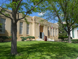
The Panhandle Plains Museum 

Located in Canyon Texas about twenty miles south of Amarillo, the Panhandle Plains Museum opened during the Great Depression in 1933. The museum is on the campus of West Texas A & M University. This museum is sometimes referred to as the Smithsonian with a Texas accent" and is very well worth the trip to Canyon Texas to enjoy. The museum and the town of Canyon is just a few miles west of Palo Duro Canyon State Park which is one of the most scenic areas of Texas.

Horses of the American West and Great Plains

spanish spurs
Exhibit of Spanish or California style spurs
The first horse that stood on the North American continent, at least after the last ice age, was brought here by the Spaniards about the year 1519. (It's thought that there were horses in what is North America millions of years ago but became extinct). This was the beginning of the Spanish conquest of Mexico and later it's colonization of present day New Mexico and California.

The Spaniards transported horses by ship from Spain. It's been said that the first time the Native people of Mexico saw a Spaniard riding on horseback that they were in awe. Many thought that what they saw from a distance was one beast, rider and horse being one animal. Much of the Spaniard's success in conquering the Mexican tribes was it's tactical advantage with the horse.

Wild Horses and Longhorn Cattle

The Spanish settler continued to move northward toward the Rio Grande. When he settled more to the north he brought his livestock with him. They had more livestock than they readily could use. Eventually the horses multiplied and bands of wild horses began migrating northward out of Mexico and into Texas. This was spurred even more when the Spanish abandoned horses in Mexico before their departure.


western cowboy saddle
Western Cowboy Saddle and gear
Wild bands of horses actually went far north of Texas and some of these, not all, were captured by the plains Indians. Some referred to these as Indian Ponies but they were not a separate specie. The same was true with the longhorn cattle also brought to North America by ship from Spain. There were wild cattle herds which migrated into Texas but not nearly as far north out of Texas as the horse.

Wild horses roamed the Texas landscape even during the time of Spanish ranching as did cattle. Without a real market for their cattle the Spanish rancher raised and branded cattle for local use. Supplying meat for the ranch and it's workers didn't require extensive herds and at the same time there existed ranch owned cattle there were also wild cattle herds. Some of these wild animals, horses and cattle, bred with ranch owned animals. All of these herds, wild and ranched, traced their ancestry to when Spain imported these beasts to North America during the sixteenth century.

Below are links to additional Western trips articles alwith more fun and educational trip stops...

Cattle Drives and a Tour of the Fort Worth Stockyards 

A Tour of the National Cowboy and Western Heritage Museum

A Trip to the Panhandle Plains Museum  

Three excellent books on the subject of the cowboy and cattle ranching include...

The Cowboy by author Philip Ashton Rollins.... The Cattle Kings by author Lewis Atherton and In the Days of the Vaqueros: America's First True Cowboys by Russell Freedman.


western roping saddle
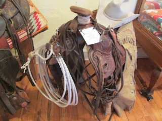
Western Roping Saddle
The Cowboy's Spanish Roots

When you view exhibits of cowboy gear, ropes, spurs, saddles, chaps, hats among other items, all have some type of Spanish and/or Mexican influence.The American cowboy obtained all the technique of his craft and the tools used in that vocation from Mexican sources. This included the horse he rode and the cattle he herded.

The cowboy's rope was at one time the reata or the lariat. These words are still used. The Spanish vaqueros and the American cowboys both practiced trick and team roping. This type of roping is still seen on western ranches as well as at rodeos.

Chaps were used for a practical purpose. Covering the cowboys trousers, chaps, generally made from leather, would protect the cowboy's legs from cactus, rocks and other obstacles while herding and at the same time adding a degree of warmth during the winter. The original chaps came from the Spaniards in Mexico who called them "armas".

While spurs were not an invention of the Spaniards, spurs used by the American cowboy were styled very much the same as what the Spanish vaquero used in North America.

canyon texas museum
Panhandle Plains Museum, Canyon TX
Hats that the cowboy wore actually differed as to the section of the country. In the southwest the hat's crown was left at full height. In the Northwest the crown was generally flat on top.

The riding saddle used by the old west cowboy went by several names. Some of these include range saddle, cowboy saddle, stock saddle and Mexican saddle. These saddle have been termed Moorish in theirs basic form and are very similar to what the Moors brought to Spain from Africa over one thousand years ago. These were all far different than the flat English Saddle and were not favored by the cowboy.

(Article copyright 2013 Western Trips)

Saturday, December 7, 2013

Driving the Beautiful Oregon Coast

Out of all the scenic drives you can enjoy a trip along the Oregon coastline has got to be one of the best. The stops we're highlighting along the way certainly do not represent all the scenic sites and stops you'll make but will give you a good sampling of the sites you'll see.

columbia river maritime museum
Columbia River Maritime Museum exhibit
Start Your Tour In Astoria

On the north end of this route you can begin at the mouth of the Columbia River where you'll view the dramatic Astoria Bridge which connects the states of Washington and Oregon.  In historic Astoria Oregon  itself a must stop is the fascinating Columbia River Maritime Museum. This museum concentrates on the Columbia River maritime history and is loaded with one a kind exhibits. You'll see and hear quite a lot of history concerning the well known and dangerous Columbia River Bar and how it's been navigated for centuries. This is a great museum to visit for young and old alike.

Drive South of U.S. Hwy 101

You'll find driving on U.S. Hwy 101 down the Oregon coast is one of the more scenic drives you;ll ever take. U.S/ Hwy 101 along the Oregon coast stretches for some 363 scenic miles. Heading south from the Astoria area you'll drive through the towns of Seaside and Cannon Beach, two very popular art and tourist towns located right on the beaches.


pacific coast oregon
Pacific Coast off Seaside Oregon
Drive further south along Hwy 101 to the town of Tillamook and make a point to visit the famous Tillamook Cheese Factory. The Tillamook County Creamery Association was organized back in 1909 to aid in quality control for factories that had operated throughout the county. Eventually these factories were consolidated in Tillamook. Starting at the Visitor Center you'll have an opportunity to see the famous Tillamook cheese produced. It's been said that the Tillamook Cheese Visitor Center is one of the most visited Oregon attractions.

Coos Bay Oregon

Along U.S. Hwy 101 you'll come to the town of Coos Bay, the largest town on the Oregon coast. Enjoy the Coos Bay Boardwalk, a wide variety of restaurant and lodging facilities and the historic McCullough Memorial Bridge. The bridge is 5,305 feet in length and was built in 1936. This is a cantilever bridge. It is the longest bridge on the Oregon coastline. Two annual events you'll want to check out at Coos Bay include the Jazz Festival held each March and the Oregon Coast Music Festival held every July.

oregon coast historic sites
Plenty of historic sites along Oregon's Coast Hwy
Bandon Oregon

Just a short drive down Hwy 101 from Coos Bay is the town of Bandon. The town received it;s name for the town of Bandon Ireland. The first settlement nearby was in 1873. Some travel sources have named Bandon one of the "Coolest  Small Towns in America". Gold was actually discovered nearby in 1851, at the time of the California Gold Rush further south and inland, but didn't have near the lasting effect that it did in California. 

Bandon-by-the-sea offers many unique shops which you can take in with easy walking from the town's renovated Old Town section.  On the beach loop road you'll view such scenic landmarks as Kitten Rock, Elephant Rock, Garden of the Gods and Table Rock. These sites are very representative of the many beautiful rock formations the Oregon coastline is so noted for.

Port Orford Oregon

Coming to Port Orford along U.S. Hwy 101 you'll come to a charming art and fishing town. In 1934 the Port Orford Lifeboat Station was constructed for the purpose of providing lifesaving services to Oregon's southern coastline. It's said that the town took it's name from a friend of Captain George Vancouver with the title the Earl of Orford.


oregon coast beach photo
Beachcombers love Oregon coast beaches
A stop to definitely make is to the Port Orford Heads State Park. At the park is a very unique museum operated by the Cape Blanco Heritage Society which includes an exhibit of a 36 foot motor lifeboat that was once used at the lifeboat station. Hikers will love this park as it offers excellent trails that will give you great views up and down the Oregon coastline.

Gold Beach Oregon

Fifty-five miles south of Bandon along U.S. Hwy 101 you'll come to the town of Gold Beach. The town's name was not hard to come by as it was named after the gold discovery there in the mid 1800's. Gold Beach is a very popular tourist destination as it offers year round fishing and jet boat trips up the Rogue River. On this jet boat trip which covers 104 miles don't be surprised to see wildlife like bears and bald eagles.

Gold Beach is located where the Rogue River enters the Pacific Ocean. Visit the Rogue River Museum which tells the story of this famous river and the departure point for the jet boat excursion.


towns on oregon pacific coast highway
Charming towns all along Oregon's Pacific Coast Highway
Brookings-Harbor Oregon

Brookings and the unincorporated town of  Harbor Oregon represents the southernmost stop on your Oregon Hwy 101 journey. The town is just six miles north of the California state line.

Sport fishing is a big draw to the area and a major industry is commercial flower growing. The Chetco River is located between Brookings and Harbor and offer plenty of boating and fishing opportunities. In addition, beachcombers will love the coastline. The area is widely known as the "Banana Belt" for it's average temperatures are considered some of the warmest on the Oregon coast.

You also may enjoy the additional Oregon and Washington Western Trips articles on the links below...

A Tour of Astoria Oregon 

A Tour of Columbia River's Bonneville Dam

Washington's White Pass Scenic Byway  


tillamook rock light oregon
1891 photo of Tillamook Rock Light
Oregon's Pacific Coast Highway offers to help make your Oregon vacation one to remember. The scenes are beautiful and your photo opportunities are endless. The 363 mile coastal route offers plenty of unique shops, restaurants and lodging as well as great camping spots.

Oregon coast beaches are known for their great sand dunes and unique rock geology. Some of the beaches are long an d wide and other others can be seen from cliffs rising high. Another feature of Oregon's Pacific coast beaches is that all 363 miles of them are free for the public to enjoy. One of the longest public access beaches found anywhere in the U.S.

More detailed information to plan your trip can be found at website www.oregon.gov


(Article and photos copyright 2013 Western Trips. Tillamook Rock Light photo in the public domain)


View Larger Map

Monday, December 2, 2013

Central Texas History Tour / Bastrop Texas

Located thirty miles east of Austin Texas, Bastrop is the county seat of Bastrop County. The areas settlement goes all the way back to 1804 when a fort was established along the Colorado River. This settlement was along the old San Antonio Road and was first given the name Puesta del Colorado. In 1804 the area was comprised of mostly Spanish soldiers.

bastrop texas buildings
Bastrop Texas
During the early 1820's a group of families migrated to the area of the fort as part of Stephen F. Austin's second colony. 

Bastrop Texas is a fun place to visit and it's filled with history. Stroll around the historic district and take in many of the historic buildings located all around it's downtown area. Explore the unique shops, landmarks and restaurants and you'll feel that you've stepped back in time. We've featured some of these historic sites below and hope you have a chance to visit Bastrop Texas.

Mexican Roots

The year 1804 would have been a period during the last years of Spanish colonization of North America and also prior to the revolution which expelled the Spaniards. Bastrop was laid out in the typical Mexican or Spanish style with a central plaza.

In 1832 after the Mexican government took control of the region, the settlement was renamed Bastrop in honor of Baron de Bastrop who originally obtained a Spanish land grant for the area.. A mere two years later the town was renamed yet again to Mina in honor of Francisco Xavier Mina, a Mexican hero and martyr during the revolution.

historic texas churches
One of Bastrop's historic old churches
Bastrop was incorporated as a town in 1837, shortly after the Texas Revolution which freed it from Mexican rule.This was also the time that slavery and the cotton industry arrived in Bastrop. Between 1850 and 1860 the population of Bastrop tripled and by 1860 (about one-third of the population were slaves) and the start of the Civil War the town had six churches.

Bastrop During the Civil War

It's interesting to note that the community of Bastrop voted against secession prior to the Civil War although Texas was aligned with the Confederacy.

The Fowler House in Bastrop which is now on the National Register of Historic Places was used as a military academy before the Civil War. This academy, known as the Bastrop Military Institute, opened in 1857 and trained men to fight for the Confederacy during the war. This house is also referred to as the Allen-Fowler House. When you visit Bastrop Texas the house is located at 1404 Wilson Street.

The Bastrop Opera House

Another interesting stop to make on your tour of Bastrop is the Bastrop Opera House. This historic theater in downtown Bastrop was built during the late 1800's. Essentially all of downtown Bastrop  today is an historic district.


opera house bastrop texas
Bastrop Opera House

Two Bastrop merchants, P. Otto Elzner and S.D. Green, joined together in 1889 to build the opera house for a cost said to be about $15,000. The design of the opera house was taken directly from the existing opera house in Taylor Texas, about thirty-five miles north of Bastrop. The first public event at the Bastrop Opera House took place on October 1, 1889.

At one point during the early 1900's, after Elzner lost the property, the building was converted into a motion picture theater. This lasted for decades until a non profit took over the structure due to unpaid taxes. After fundraising a plenty of volunteer labor the old building was restored into it's original splendor. The Bastrop Opera House is listed on the National Register of Historic Places and is recognized by the Texas Historical Commission. The Bastrop Opera House is located at 711 Spring Street.

The Bastrop County Courthouse

If you've explored Texas before you most likely know that the state has some of the finest old courthouses found anywhere and in a variety of architectural styles.

The Bastrop County Courthouse located at 803 Pine Street was constructed over the period 1883 and 1884. It's architecture is Renaissance Revival and it's architects were Jasper N. Preston and F.E. Ruffini.

confederate memorial bastrop texas
Confederate Memorial on courthouse grounds
The county's first courthouse was erected in 1851 but burned down in 1883. Fire destroyed a good number of the very first Texas courthouses which were mostly wooden structures. In 1892 a brick building was built adjacent to the courthouse to serve as a jail. This building functioned as a jail all the way until 1974 when it was converted to office space. The courthouse itself went through an extensive remodeling and electrical and plumbing updating in 1924.

Confederate Monument in Courthouse Square

The area of the Bastrop County Courthouse and it's adjacent buildings is referred to as Courthouse Square.

On the lawn in front of the courthouse you'll view a Confederate memorial. The Bastrop County Confederate Memorial is on the northeast section of Courthouse Square. The memorial is a white marble obelisk that rises on a square base. On the base are carved flags of the Confederacy. Confederate Memorial monuments were erected by the United Confederate Veterans and the United Daughters of the Confederacy after the Civil War. Texas has more than fifty Confederate memorials and statues erected.


old bastrop jail
Old Bastrop County Jail Building
Bastrop's Historic First Baptist Church

According to the Texas Historical Association, until 1834 Catholicism was the official religion in Texas. This of course was due to the Spanish occupation of the region.

It is a fact however that Baptism was preached in Texas as early as 1820. This particular preacher from Kentucky was ultimately arrested by the government but escaped before being tried in San Antonio. In 1834, not long before the Texas Revolution, the Mexican government did give Texans religious freedom.

The First Baptist Church in Bastrop was organized in 1850 by an elder from the Austin Texas church. Members at first met once a month. During the Civil War years the church suffered and membership was scattered. By the 1880's after the Reconstruction years, church membership was growing quite a bit.A frame structure was then built at the corner of Pecan and Chestnut Streets. In 1929 a new structure was built at the corner of Water and Farm Streets. It is on this property that the present church was constructed.

Additional Western Trips articles of Texas you'll find interesting are on the links below...

The Historic Driskill Hotel in Austin

Missions in San Antonio

The Nimitz National Museum / Fredericksburg

The West Texas Town and the White Buffalo


bastrop texas county courthouse
Bastrop County Courthouse clock tower
Visiting Bastrop Texas

A visit to Bastrop Texas is a trip into history. It's a step back to the early days of Texas. In addition to this, Bastrop is near to so many other historic sites and towns that it makes a great companion trip to other interesting areas. Bastrop is only thirty miles east of Austin Texas with such historic landmarks as the Driskill Hotel and the Texas State Capitol Building.

San Antonio and it's beautiful missions plus the popular Riverwalk is only about 80 miles south of Austin along Interstate 35. West of Austin and northwest of San Antonio is the heart of the Texas Hill Country with such attractions as Fredericksburg and it's Nimitz Museum of the Pacific. All of these towns and landmarks are a big part of early Texas history and make fine additions to any Texas trip planner.

(Article and photos copyright 2013 Western Trips)


View Larger Map

Friday, November 29, 2013

Scenic Drives Near Deadwood South Dakota

The Black Hills of South Dakota and nearby Deadwood forever will a focal point of old west history. The Black Hills was disputed territory between the Sioux tribes and the U.S. Government which would in a large way lead to the last great Indian war on the northern plains.

Scenic Black Hills
Today, the Black Hills of South Dakota and the town of Deadwood are extremely popular tourist destinations. This is a prime area to visit if you're planning a South Dakota vacation. The town of Deadwood South Dakota is close to several National Historic Sites. Mount Rushmore, one of the country's most visited national monuments, is located only about 49 miles south of Deadwood. Gillette Wyoming, to the west of the Black Hills and to the east of the Bighorn Mountains and about 106 miles west of Deadwood, was one of the largest coal mining areas in the country and still offers coal mine tours . The town is also well known for it's rodeos. All of the drives from the Deadwood area are very scenic and make great day trips.

Black Hills Scenic Drives

Two scenic drives into the Black Hills and the one's closest to Deadwood are the Devils Tower and the Spearfish Canyon Scenic Drives.

deadwood gem theater
Historic Gem Theater, 1878, Deadwood, SD
Spearfish Canyon Scenic Byway

Visitors to Deadwood will find the Spearfish Canyon Scenic Byway being the closest of the two to Deadwood. The gorge you'll view along this drive is composed of limestone which dates back even further than the rock at the Grand Canyon. U.S. Hwy 14A passes through the Black Hills and around Spearfish Canyon for twenty miles. Viewing of the canyon is best either early in the morning or late in the day to see the many colors. Some people stop off at the old town of Savoy to begin trail hikes to old mines and logging camps and past waterfalls. You'll also see several original buildings still standing from Savoy's frontier days.

Your drive along this scenic byway can begin at Spearfish South Dakota which is just about a 15 mile drive northwest of Deadwood and just south of Interstate-90. Driving south on the byway from that point you can stay on U.S. Hwy 14A all the way until it meets U.S. Hwy 85 /14. This would be about twenty miles south of Deadwood making your day trip a circle drive. Along the drive you'll find plenty of places to turn off the highway to enjoy the scenery and take some good photos. One popular scenic stop along the scenic byway is Bridal Veil Falls and the falls can be seen from the highway. Bridal Veil Falls is on the northern section of the Spearfish Canyon Scenic Byway and about 7 miles south of the town of Spearfish.

The Spearfish Canyon Scenic Byway through the Black Hills is a must thing to do if you're trip plans take you to Deadwood.

devils tower wyoming
1900 photo of DevilsTower
Devils Tower

Devils Tower is a U.S. National Monument and has the distinction of being the nation's first National Monument designated by President Theodore Roosevelt in 1906. Devils Tower is located in Wyoming about a 75 mile drive west of Deadwood with much of the way via Interstate-90. The National Monument covers 1,347 acres.

Historically, like much of the Black Hills, the Devils Tower was a spiritual site claimed by Native Americans. When pioneers headed west several treaties including those regarding the Black Hills were violated. The entire area was actually overrun when word of gold in the Black Hills spread east. Although the U.S. Army attempted to keep prospectors away their sheer numbers made it impossible. Attempts were made by the government to buy the Black Hills from the Sioux but were unsuccessful. The Battle of the Little Bighorn in 1876 and the defeat of Colonel George Armstrong Custer had many of it's roots in the Black Hills controversy.

Devils Tower, an internationally popular tourist site, has a visitor center and a bookstore which is open year round. Ranger tours to the monument are led during the morning. Visitors can also opt for a self guided tour around the monument's base. Camping facilities are available at the park seasonally.The tower rises 1,267 feet from the landscape floor. The tower also draws climbers from the world around. The monument's acreage is covered by both pine forests and prairie grasslands including plenty of interesting wildlife such as pronghorn and black tailed prairie dogs.

You may also enjoy the Western Trips articles on the links below...

Drive the Chief Joseph Scenic Byway

Idaho's Sawtooth Scenic Byway

spearfish canyon scenic byway
Views along the Spearfish Canyon Scenic Byway
  Geologists determined that the tower itself rose from beneath the ground after erosion took away the softer rock layers surrounding it. The tower is comprised of magma that solidified not far below the earth surface. The monument's visitors center exhibits a lot of detailed information about this geologic wonder.

To celebrate Devils Tower 100 year anniversary, a sculpture called Circle of Sacred Smoke was added bear the sites picnic area.

(Article copyright Western Trips. Photos and images in the public domain)


View Larger Map

Friday, November 22, 2013

Travel the White Pass Scenic Byway

Picturesque views of Mount Ranier, Mount St. Helens and Mount Adams in Washington state's Cascade range are what fun trips to the Northwest are made of. Traveling the White Pass Scenic Byway is one great way to achieve this.

mount ranier viewed from tacoma
Towering Mount Ranier
The White Pass Scenic Byway, one of America's great Scenic Byways, spans from Yakima in central Washington in the east to the area of Interstate-5 and U.S. Hwy 12 to the west. Hwy 12 is located about three miles east of the Interstate off exit 68. The entire route is 119 miles and passes through both the Gifford Pinchot and Wenatchee National Forests.

The Three Highest Peaks in Washington State

The White Pass Scenic Byway is also known as Washington's Volcano Playground. This is known as Washington's volcano country. This is because all three of Washington's highest mountain peaks, Mount Ranier, Washington's highest, Mount St. Helens, a National Monument with it's jagged crater and Mount Adams all are part of your White Pass Scenic Byway experience.

Mount Ranier itself boasts twenty-six glaciers surrounding it. Mount St. Helens last erupted in 1980 that shot ash into the atmosphere that circled the globe. Mount Adams at 12,276 feet offers a real wilderness environment with alpine lakes that's enjoyed by campers during the non winter months. Hiking is spectacular in this area with both long and short trails offered. According to scientists Mount Adams last erupted circa 550 B.C.

mount adams washington
View of Mount Adams from Mount St. Helens
A Summer and Winter Playground

Rivers, lakes and waterfalls can all be seen along this scenic byway. Wildlife viewing, hiking, fishing and snowmobiling, downhill skiing, rock climbing are among the many recreational opportunities available.

One of the many picturesque lakes along the route is Rimrock Lake which is east of White Pass. The White Pass Scenic Byway (U.S. 12) passes right along the north shore of the lake where boating, good fishing and camping are very popular. Lakefront tent and RV camping among the stunning tall pines is available in all seasons.

Most suggest that the time required to travel over the White Pass Scenic Byway from end to end be at least six hours. To fully enjoy the scenery and attractions your trip can easily be longer than this. With the lodges and camping available along the route your trip can easily span days and would be well worth it.

White Pass Summit and U.S. Hwy 12

White Pass Summit is crossed by U.S. Hwy 12. The elevation is 4,500 feet and the roadway is open year around. Driving U.S. Hwy 12 over this scenic route offers an exceptional experience for young and old. The highway travels through alpine country, river valleys, foothills and several small towns.


white pass washington ski area
White Pass Ski Area
Skiing and snowboarding enthusiasts can enjoy the White Pass Ski Area during the winter season which is located in Naches WA off Hwy 12 and just south of Leech Lake. The ski area offers a variety of terrain and some good bump runs.The ski area is quite large and the atmosphere is friendly and unpretentious. The White Pass Ski Area has a reputation for good snow, no long lines and plenty of runs. One of it's biggest attributes is no crowded skiing.

The Gifford Pinchot National Forest

This National Forest is named in honor of Gifford Pinchot, personal friend of President Teddy Roosevelt's and the creator of the National Forest Service in the early 1900's. So much of the public lands set aside for  public enjoyment today was a direct result of both Pinchot's and Roosevelt's drive for conservation.

Pinchot served as the first chief of the National Forest Service and later was Governor of Pennsylvania for two non consecutive terms. During his tenure under Roosevelt, Pinchot, who had a good relationship with John Muir, eventually disagreed with the famous preservationist as to how national lands would be managed.

The Gifford Pinchot National Forest comprises nearly 1.4 million acres and includes the Mount St. Helens National Volcanic Monument.

The links below are to additional Western Trips articles you;ll enjoy...

The Sawtooth Scenic Byway in Idaho

Historic Route 66 Landmarks

The National Scenic Byways

A National Scenic Byway is a road or connection of roads that the U.S. Department of Transportation recognizes for it's history, natural resources, wildlife, scenery and archeological importance. The America's Byways program was established by the government in 1991 for the purpose of preserving these historic and scenic roadways along with providing maps and useful information for the traveler.


white pass scenic byway map
Red line is U.S. Hwy 12 through Washington
Included in these scenic roadways are National Scenic Byways and All-American Roads. There are some 150 of these spread across the U.S. White Pass Scenic Byway is included under the National Scenic Byways. Other Washington state Scenic Byways include the Chinook Scenic Byway to the north of White Pass and the Coulee Corridor Scenic Byway east of the White Pass route.

The state of Washington has no shortage of tourist destinations. From the seaport of Seattle to the volcanic mountains inland, the National Parks and Monuments and some of the most scenic wilderness areas found anyplace in North America, Washington has it all for the western traveler. The White Pass Scenic Byway is just one of the many scenic drives found in Washington.

(Article copyright Western Trips. Photos and images are public domain)


View Larger Map

Tuesday, November 19, 2013

Idaho's Sawtooth Scenic Byway

National Scenic Byways are a collection of diverse roads where adventure awaits. These scenic Byways are found all over the United States and offer some of the best scenery, geology and historic travels you'll find anywhere. The Sawtooth Scenic Byway in the beautiful mountainous state of Idaho is one such trail you'll want to add to your western trip planner.


sawtooth mountains idaho
Idaho's Sawtooth Mountains and Redfish Lake
The Sawtooth Scenic Byway

This 115 mile Idaho journey covers diverse terrain. Everything from the desert to the mountains. Start your trip in the town of Shoshone and take a picturesque drive to Stanley Idaho. The Sawtooth Scenic Byway is the 100th National Forest Scenic Byway in America and is in an area east of Boise and north of Twin Falls Idaho.

Black Magic Canyon

Along your journey on the Sawtooth Scenic Byway heading just a short way north from Shoshone you'll come to the Black Magic Canyon geological area. Managed by the Bureau of Land Management, the entrance to this area is off Hwy 75 by both paved and gravel roads. Here you'll enjoy the sculptured rock and the black basalt. The Black Magic Canyon, carved by the Big Wood River, offers one of the finest examples of eroded river bedrock in the U.S. All of this is the result of thousands of years of erosion and a protected area today due to the efforts of the BLM during the 1990's to keep these historic rocks away from mining claims.

Hailey, Ketchum and Sun Valley

Your drive on the Sawtooth Scenic Byway will take you through the towns of Hailey, Ketchum and Sun Valley Idaho.

Hailey is a four seasons destination in the Rocky Mountains. Located in central Idaho, Hailey is in the Wood River Valley. It's a hiking, biking and skiing destination and is surrounded by the Sawtooth National Forest.

american falls dam in idaho
Sawtooth American Falls Dam
Located in central Idaho about eleven miles north of Hailey on Hwy 75 is the town of Ketchum Idaho. Here you'll find art galleries, great scenery and you're just a couple of miles away from Sun Valley.

Among things other than great outdoor recreation, Sun Valley Idaho was the residence of author Ernest Hemingway. On Trail Creek Road just north of Sun Valley and one mile east of the lodge is the Ernest Hemingway Memorial. The memorial was built in 1966 by Hemingway's family and friends and features a bronze bust of the author. The memorial is open year round.

Redfish Lake

The alpine Redfish Lake is located in the Sawtooth National Recreation Area in Custer County Idaho. The lake got it's name after the Sockeye Salmon that at one time returned there from the Pacific Ocean and in such enormous numbers that the lake took on a red glow. While the Sockete salmon is now an endangered specie, this beautiful mountain lake is home to great recreational opportunities with lodging, boat rentals and camping being large tourist draws. Redfish Lake is located west of Hwy 75 and just about seven miles south of Stanley Idaho, the northern terminus of the Sawtooth Scenic Byway.

idaho salmon river canyon
A 1945 view of Sawtooth's Salmon River Canyon
Stanley Idaho

Stanley Idaho, located between the Salmon River and the Sawtooth Mountains, is at the northern end of the 115 mile long Sawtooth Scenic Byway. The town sits in a very picturesque part of Idaho with the Sawtooth Mountains as a background. The area was first visited in the early 1800's by fur trappers from the Hudson's Bay Company. The town is named after a Civil war veteran named John Stanley who led a group of gold prospectors through the area.

Stanley and the surrounding area offer unique shops and restaurants, hiking and biking opportunities as well as fun river rafting adventures. If you travel to Stanley you'll want to see the Sawtooth Hotel that was established in 1931. The hotel features old country style mountain lodging and dining and has been doing this ever since it's opening over eighty years ago.

Two additional scenic drives are featured on the Western Trips articles linked below...

The Beartooth National Scenic Byway

A Drive Along the Columbia River Gorge

boise state capital
State Capitol, Boise Idaho
More Idaho Scenic Byways

At the northern end of the Sawtooth Scenic Byway at Stanley Idaho, adventurers have the opportunity to enjoy additional scenic and historic drives. Going east and northeast out of Stanley is the Salmon River Scenic Byway. The northern end of this drive is at the Montana border. This was an area visited by the Lewis and Clark expedition in the early 1800's.This route follows the Salmon River through the Salmon-Challis National Forest.

Going west and southwest out of Stanley Idaho is the Ponderosa Pine Scenic Byway. The route runs between Stanley and the state capital of Boise. On this route you'll have a chance to pan for gold in Idaho City. The Ponderosa Pine Scenic Byway cuts through two Idaho wilderness areas, the Sawtooth Wilderness Area and the Salmon-Challis National Forest. You'll find plenty of campgrounds and have excellent fishing opportunities along this Scenic Byway.

(Article copyright 2013 Western Trips. Photos and images are in the public domain)