Western Trips

Tuesday, August 28, 2012

Santa Clara de Asis / California Spanish Missions

Western Trips takes a road trip to the beautiful and historic Mission Santa Clara. The Santa Clara Mission is located on the scenic campus of Santa Clara University in the South Bay city of Santa Clara California. Santa Clara is located about 45 miles south of San Francisco and only about 4 miles west of San Jose. There's quite a lot of historic significance of this site.


santa clara mission
Mission Santa Clara
The Mission Santa Clara de Asis was one of the twenty-one missions built in California. The English translation of the mission is Mission of Saint Clare of Assisi. This particular mission was built by the Franciscans in 1777 and that same year it's bells were sent to it by King Charles III of Spain. Today, the mission serves as a Catholic church within the diocese of San Jose and also serves as a chapel for the university.

The story of the California Spanish missions started with the founding in 1769 of the very first mission in San Diego, Mission Basilica San Diego de Alcala. That first mission was founded by Father Junipero Serra. The second mission in the string that would eventually total twenty-one was the mission at Monterey California which soon after was relocated to Carmel California and named Mission San Carlos Borroméo del río Carmelo. It's also referred to often as the Carmel Mission and is located along the Carmel River. The last mission constructed and the northernmost is Mission San Francisco de Solano located in the town of Sonoma.

Mission Santa Clara de Asis cross
Mission Santa Clara Cross
As was the case with all of the Spanish missions, the goal ws to reach out to and Christianize the Native population. The missions worked hand in hand with the Spanish military. The Spaniards adopted the theory of pacifying the local Indian population by their conversion to Christianity. The mission work would also introduce new subjects to the Spanish colony. For the most part, the Spanish mission in California served as both a religious and military outpost. By the year 1803, the mission had an Indian population of over 1,200. At that year it was estimated that thousands of cattle, sheep and horses grazed on the adjacent land along with significant agriculture operations.

Mission Santa Clara de Asis was the eighth Spanish mission built in Alta California. Santa Clara University where the mission is currently located has the distinction of being the first college in Alta California. The Santa Clara Mission college was established in 1828. When the Spaniards were driven out of Alta California in the 1820's due to the Mexican Revolution, the missions were secularized and went through a period of decline both in missionary work as well as upkeep of the structures. When the United States took possession of Alta California as a result of the Mexican American War, the missions found new life. The new American presence in California left a lot of questions to be answered, most notably was the question of who owned what since so many land grants had been given out by the Mexican government. In 1851 the church petitioned the U.S. government to return original mission holdings, much of which had been ceased by the Mexicans. As a result, the U.S. did return a bit over 1,000 acres to the church.
Mission Santa Clara de Asis
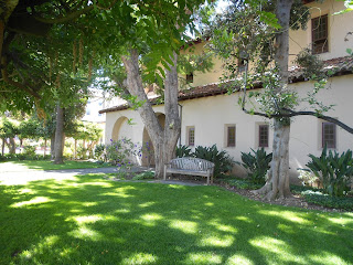
Mission grounds
The Mission Santa Clara was placed under the supervision of John Nobili SJ representing the Jesuits. The Jesuits had previously been expelled from Baja California by Spain and replaced by the Dominicans. This was well before the first mission in Alta California was built in 1769. The task of building those missions starting with the one in San Diego were handed over to the Franciscans.

An interesting fact about Mission Santa Clara was that the mission was ruined and rebuilt six times. This was due to a series of fires and earthquakes. Even though there were so many of these disruptions the mission was never abandoned. The current location is actually the fifth home for the mission which originally was built on the banks of the Guadalupe River near today’s intersection of U.S.Highway 101 and the Mineta International Airport runway. Eventually the church was built on higher ground where it resides today. The last fire that destroyed the mission occurred in 1925 and destroyed the church that was built in 1828. The present mission was rebuilt in 1929 and was consecrated the same year. A college on the site was reestablished in 1851, just one year after California gained statehood and that institution grew into today's Santa Clara University.

Mission Santa Clara de Asis is today at the very heart of Santa Clara University. This private non-profit Jesuit institution of higher learning has over 150 years of history. Actually, two colleges appeared on the scene shortly after the gold rush and statehood. Today's Santa Clara University is one and the other established in 1851 was California Wesleyan College. The latter received the first state charter and Santa Clara University soon afterward. In 1912, the name Santa Clara College was changed to Santa Clara University. The school was an all male institution until 1961.

130 year old wisteria vine at santa clara mission
130 year old wisteria vine at Santa Clara Mission
Visiting the Santa Clara Mission and the campus of Santa Clara University is an historic, scenic and fun side trip to any vacation or visit to the San Francisco Bay Area. The other two missions relatively close by are Mission San Jose which is located in Fremont California and Mission Dolores in San Francisco proper.

Another interesting site you'll see while exploring the Santa Clara University campus is the Ricard Observatory. The first telescope was in operation in 1890 and today the existing observatory was built between 1924-1928. The observatory is named for Jerome Sixtus Ricard, S.J.. Father Ricard was famous for making a connection between sunspot activity and terrestrial weather.

Two additional articles we've published on Western Trips which you'll find interesting are Mission San Juan Batista and the Sonoma Mission in Sonoma California.

Two excellent books on the Spanish missions are The Spanish Missions of California by author Megan Gendell and The California Missions: A Complete Pictorial History and Visitor's Guide by the Editors of Sunset Books.

(Photos from author's private collection)


Sunday, August 26, 2012

Puerto de Luna / Historic New Mexico


If your western road trip or vacation takes you through New Mexico on Interstate 40, there's a very unique and historic site just a few miles south of Santa Rosa New Mexico which makes a great side trip. The town of Puerto de Luna sits just 10 miles south of Santa Rosa on State Hwy 91. Puerto de Luna traces it's history all the way back to the 1540 Coronado Expedition, the early Spanish exploration of the Southwest whose aim was to search for the Seven Cities of Gold. The rumor of these golden cities were passed on to the Spaniards by the Indians of Mexico.

new mexico landscape
Beautiful landscape on way to Puerto de Luna
The historic site of Puerto de Luna lies along the lush green valley of the Pecos River. The story is that Coronado's expedition built a bridge across and camped along the Pecos River at the town's current site. The story continues that Coronado saw the moon rise through a mountain gap to the east and exclaimed "Puerto de luna!," In Spanish, that translates to "gateway of the moon" and it's been said that how the town received it's name. Although the story persists, history doesn't offer any concrete proof that the town actually got it's name in this manner. The story with a bit more documentation is that the town received it's name because the Luna family lived at the mouth of Puerto Creek during the 1860's and later moved to the town's present location thus the name Puerto de Luna. The town was officially organized in 1863.

One interesting fact that you wouldn't think possible when visiting this small settlement today, is that at one time Puerto de Luna was a large growing town with some 1,500 inhabitants during the 1880's. The town in fact was the county seat for Guadalupe County New Mexico and had it's very own post office as early as 1873. Like with the rise and fall of many towns in the 1880's, the railroad played a prominent role. When the railroad came through that portion of New Mexico, Puerto de Luna was bypassed and the town that benefited was Santa Rosa to the north. Santa Rosa, also on the banks of the Pecos River became the population center when the Rock Island Railroad and the Southern Pacific Railroad joined their lines in 1902 there for completion of the joint Chicago to Los Angeles passenger service. That jointly operated train was named the "Golden State" and operated all the way until 1968.

nuestra senora del refugio church in puerta de luna
Nuestra Senora del Refugio Church
When the National Highway System was created in the 1920's, and particularly the famed Route 66, even more people passed through and settled around Santa Rosa and the city was then the county seat of Guadalupe County. Route 66 also brought Hollywood to it's doorsteps. Among other film projects shot in Santa Rosa was the train scene in the film adaptation of John Steinbeck's novel "The Grapes of Wrath".

Among the sights to see today in Puerto de Luna is the Nuestra Senora del Refugio Church which was originally constructed in 1882. Mass is still conducted daily at this historic church.

There is also a Billy the Kid story tied to Puerto de Luna. This was generally Billy the Kid country, with Billy's burial site being only a 62 mile drive to Fort Sumner to the southeast. As further evidence of the towns connection with the Kid, there's a road today in the village named Kid Lane. As for the Billy the Kid story and Puerto de Luna, you have to consider the large war that had been going on to the south in then Lincoln County New Mexico. The Lincoln County War was against two factions that competed for control of the area, both economic and political.

adobe building in new mexico
Adobe structure in Puerto de Luna
The Kid was aligned with one of the opposing sides and was wanted for several murders. He was eventually arrested by legendary New Mexico lawman Pat Garrett. During the Kids transportation up northward to Las Vegas and Santa Fe, Garrett and the shackled Billy allegedly spent a night at the home of Don Alejandro and Dona Secundina Grzelachowski in Puerto de Luna. Billy the Kid was no stranger to the town as he had been a customer of the Grzelachowski general store and also was alleged to have a few friends in the town. Sometime after Billy the Kid was bound over for trial in Messilla New Mexico he escaped from jail. Lawman Pat Garrett eventually caught up with him and the Kid was killed in an exchange of gunfire near Fort Sumner.

Another interesting feature found in Puerto de Luna for the modern day tourist are the authentic adobe structures to be found there. Most of what you see today in the southwest are modern adobe buildings that are essentially made from plaster. Real adobe made during the 1800's and prior were a mixture of straw and mud. These have obviously deteriorated over the centuries and the ones you'll see today are in ruins. nevertheless, they are interesting to view and you'll see several in and around Puerto de Luna.

Two additional related articles we've published at Western Trips and ones you will find interesting are The Lincoln County War and a Visit to Fort Sumner.

(Photos are from author's private collection)

Thursday, August 23, 2012

Hydraulic Gold Mining / Pelton Wheel


Western Trips visited Nevada City California, one of the more famous of old California gold mining towns, to learn more about hydraulic mining for gold. Located in the beautiful Sierra Nevada mountains, Nevada City is home to many historic sites and one of those is the Miners Foundry built way back in 1856.

Nevada City California is one of the best towns in the Sierra's to experience the California gold mining era. The town has done a superb job in keeping and restoring some of the more famous gold era historic sites such as the National Hotel, the Nevada Theater and the Miners Foundry just to name a few.

national hotel in nevada city
National Hotel
Getting to the Gold

There were several ways of finding gold in old California. Placer mining, tunneling and hydraulic mining were among those. Placer mining was the first stage. This was what the first of the Forty Niner's did to find gold. Placer mining is basically surface mining. Placer gold was the easiest gold to find. The problem was that at some point the easy diggings would play out and another method would be required. This is where hydraulic mining comes in and it had it's heyday in the early 1860's. What is hydraulic mining?

The best description of the effects of hydraulic gold mining can be found in the book Anybody's Gold by author Joseph Henry Jackson. Jackson describes the effects of hydraulic mining as a wholesale change of the landscape. This type of mining actually tore down mountains and filled the rivers with red mud. It was essentially an extension of placer mining except it was on a grand scale and made permanent changes to the topography which was very visible to the naked eye.

water cannon from the gold rush
Water Cannon display at Nevada City California
Hydraulic mining washed away entire hillsides. As more water became available, new and larger nozzles were developed which led to the California's  "Monitor". This was a giant nozzle, braced on a rig, that had so much pressure it was said that it could tear the side of a mountain away in a few minutes. It was a water cannon. The water was compressed into a nozzle that was from one inch to eight inches in diameter. In one of the volumes of his History of California, historian Hubert Howe Bancroft described that an eight-inch Monitor could throw 185,000 cubic feet of water in an hour with a velocity of 150 feet per second. This was an incredible force. There's another story out there that says that a man could not swing a crow bar through a six inch stream from the Monitor. Obviously an enormous amount of water was used and on top of that the hydraulic mines operated twenty-four hours a day being lit at night with bright lights or even locomotive lights.

One effect of hydraulic mining on such a large scale was that the tons of sediment put into the rivers caused them to widen and change channels. Floods occurred in the Sacramento Valley. This filling of the rivers with red mud also interfered with steamboat traffic between Sacramento and Marysville.

gold rush hydraulic mining
21- inch Gate Valve to control water flow from 1880
While handsome profits were being realized by the mining operators, the process was at the expense of the populace and regulations had to be enacted. Although it was well understood that the hydraulic mine operators contributed millions of dollars into the state tax receipts, hydraulic mining in California was virtually forbidden by 1884 per a decision from the U.S. District Court in San Francisco. This was about thirty years after it all began. This was a direct result of widespread popular protests of which farmers who experienced floods were a big part.

The Pelton Wheel

Hydraulic mining of course required water and this led to other possibilities. Generally, water was brought down from the higher elevations and channeled through a hose.

pelton wheel in nevada city california
Pelton Wheel exhibit at Miners Foundry

An invention that really is the father of hydro power is the Pelton Wheel. The Pelton Wheel is named after it's creator, Lester Allan Pelton in the 1870's.  The Pelton Wheel shown in this article is an exhibit at the Miners Foundry in Nevada City California. The wheel is an impulse turbine. It's purpose is to generate power from flowing water. The momentum of the water flow turns the turbine. Very large Pelton Wheels, sometimes referred to as water wheels, are used today in our hydroelectric energy plants and today's operations are a direct result of the first Pelton Wheel.

Four additional articles from Western Trips you'll find interesting are the gold mining towns of Grass Valley California and Auburn California. Also, Breckenridge Colorado / Mining and a Year Round Resort and   They Called It Hangtown For Good Reason 

Nevada City California is located 60 miles northeast of Sacramento on Hwy 49. This is about 28 miles north of Auburn California which is on Interstate 80. Traveling from Reno Nevada, take Interstate 80 to the CA Hwy 20 exit which is about 58 miles west of Reno. Nevada City is about 26 miles west on CA Hwy 20. If you want to learn about finding gold the way the miners did with hydraulic mining, Nevada City California and the Miners Foundry is a good addition to your Sierra Nevada trip planner.

(Pelton Wheel photo is in the public domain. Remaining photos are from author's private collection)

Tuesday, August 21, 2012

Arizona Route 66

Our western road trip takes us to northern Arizona and it's old historic Route 66. Route 66, the main route from Chicago to Los Angeles during the years prior to the Interstate Highway system, actually started out as a series of wagon trails leading settlers to the southwest.

painted desert in arizona
View of the Painted Desert
 As the years went by, the wagon trails linked together to form a direct route to the west coast. In Arizona, as in several other states, portions of Route 66 were often called by other names. In Arizona that name was the Beale Wagon Road. More or less, the Beale Wagon Road was a straight line route across northern Arizona, fairly similar to today's Interstate 40. The wagon road was given it's name  from Lieutenant Edward Fitzgerald Beale who in 1857 was assigned the job of building a wagon road across New Mexico and Arizona near the 35th parallel. That same road today is vey close to the Interstate 40 and the old Route 66 alignments.


painted desert inn
Painted Desert Inn
The surviving portions of Route 66 still feature many historic landmarks, and in northern Arizona, National Parks and other historic sites can be found near the old "Mother Road" in just about every direction. One fun stretch of the old Route 66 is the portion from the New Mexico order to Williams Arizona, just south of the Grand Canyon. The Navajo and Hopi Indian Reservations, historic old west towns, National Parks, frontier trading posts, a world renown observatory and a wildlife park are just some of the things to do  and enjoy along Arizona's old Route 66.

West From the New Mexico Border 

Staring out west from the New Mexico border,the historic Hubbell Trading Post as well as Window Rock Arizona, the Navajo Nation capital, and the scenic Canyon de Chelly (promounced da-shay) is to the north. Exiting Interstate 40 on US Hwy 191 North, about 30 miles inside Arizona, will take you north toward the Canyon. Further west, directly off Interstate 40, is the exit for the Petrified Forest National Park and the Painted Desert. The photo above is of the Painted Desert Inn, built in the late 1930's and was operated for a time by the Fred Harvey Company. The building was designated a National Historic Landmark in 1987. These are located about 20 miles further west from the Hwy 191 exit. If you're on Interstate 40 and have not visited these, they are definitely must stops. The visitor center is just about a half mile north of the Interstate and you'll enjoy the video presentation in the small theater area.

You should find our Western Trips article on the Hubbell Trading Post very interesting.The trading post was and is on the Navajo Reservation. Also see a visit to the Desert Botanical Garden / Phoenix

The Old West Town of Holbrook 

navajo county museum in holbrook arizona
Old Navajo County Courthouse Museum
The next stop west is Holbrook Arizona which is about 30 miles west of the Petrified Forest exit. Holbrook is a very interesting old frontier town with plenty of history. Make a stop at the old Navajo County Courthouse which is a great museum along with the old jail still intact. This was a jail built in the east and shipped by rail to Holbrook. It's an interesting exhibit and the museum is full of artifacts from 1800's and early 1900's Holbrook.

See our related article on Holbrook Arizona and Navajo County.

Winslow Arizona and the La Posada

Arizona has the distinction of having more preserved old Route 66 pavement than any other state. When you drive west from Holbrook, you can pick up a portion of Route 66 at the Joseph City exit which will continue west to Winslow Arizona at which time the old highway runs straight through town. A stop at La Posada, the old Harvey House and still a famous operating hotel, is well worth the stop.

la posada in winslow arizona
La Posada Hotel staircase, Winslow
 The hotel is adjacent to the BNSF rail tracks and a stop for Amtrak's Southwest Chief. The hotel is beautiful and you'll get plenty of good pics and most likely will want to check in for a night. Winslow was built as a railroad town and at one time was a Santa Fe Railroad division point. It's no longer a division point but is very busy with BNSF freight traffic going and coming from the west coast. Many people visit La Posada via the Southwest Chief. See our Western Trips article on the historic La Posada.

Flagstaff on Route 66

Flagstaff Arizona is about 57 miles west of Winslow. Flagstaff is located at the base of the scenic San Francisco Peaks and was directly on old Route 66 which still passes through the middle of town. Santa Fe Avenue is the Old Route 66 through town. Driving westbound on the Interstate, you can pick up Santa Fe Avenue by taking the I-40 Business exit on the east side of town. Santa Fe Avenue will take you right to the historic district of downtown Flagstaff. Flagstaff must stops in addition to the downtown historic district is the old AT & SF train depot which houses the Chamber of Commerce and now serves as the depot for Amtrak's Southwest Chief train. On the west side of Flagstaff is the world famous Lowell Observatory.

lowell observatory telescope
One of the large telescopes at Lowell Observatory
You can take guided walking tours of the grounds and telescope buildings and have the opportunity at night to view the universe through one of their powerful telescopes. The observatory is located on Mars Hill and it's a great vacation or side trip stop for young or old. The portion of old Route 66 that you can still drive through Flagstaff would be from Interstate 40 exit 204 west of town which will take you through Flagstaff and you'll enter Interstate 40 at exit 191. 

You'll enjoy our Western trips visit to the Lowell Observatory.

Williams...The Gateway to the Grand Canyon

Going further west on Interstate 40 toward Williams which is where the Grand Canyon Railway begins on it's trip to the Grand Canyon's south rim. If you're traveling westbound on the Interstate, old Route 66 runs from Exit 165 to Exit 161. Parallel one-way streets run through downtown. Bill Williams Avenue which goes eastbound is the old Route 66. Another interesting travel fact is that all of downtown Williams Arizona is on the National Register of Historic Places. There's a relatively new wildlife park which is a lot of fun and it's just east of Williams at 1500 East Route 66.

bearizona
Bears at Bearizona
The park is named Bearizona and allows visitors to experience animal wildlife all from the comfort and safety of your own vehicle.It's really a great side trip and also offers live bird shows with the Bearizona staff. Bears, bison, wolves and many other animals are seen in their natural habitat. It makes an excellent addition to a family road trip through northern Arizona.

Eighty Seven Original Miles of Route 66

The largest stretch of Route 66 that remains today in Arizona runs from Seligman, to Kingman. In Seligman, the old Route 66 alignment is Railroad Avenue and when you enter Kingman, the road becomes Andy Devine Avenue. The distance of old Route 66 between the two towns is 87 miles and takes about one and one-half hours to drive. Since this is such a long stretch of the old Mother Road, it's very popular as an alternative to the Interstate. Lots of old sites from the highway's glory days are still there to see.

One of the things so unique about the old Route 66 through Arizona is that it can comprise an entire vacation considering all of the sites along the way. Many people of course pass through this part of the state quickly on Interstate 40 but if you have the time, there's plenty of sites and things to do that can easily make a one or two week vacation.

(Photos from author's private collection)


Saturday, August 18, 2012

Santa Cruz California Boardwalk


The Santa Cruz California Boardwalk is not only an amusement park but it's also an historic site. The Santa Cruz Boardwalk is the oldest amusement park in California that is still in operation. The park takes up 24 acres on the coast of Monterey Bay and adjacent to the municipal wharf which features several excellent seafood restaurants. As you can see from the photos, the Santa Cruz Boardwalk is very scenic.

The park which began operating in 1907 would be one of several beachfront amusement parks along California's coastline. At San Francisco, in the late 1800's an amusement area opened up on the Pacific Ocean west of the city. By 1926 it was named Playland-at-the-Beach. This was at a time when many might ride the electric urban railways for a day of amusement on the shoreline. This was the era before Disneyland, Knott's Berry Farm and Great America.

santa cruz beach boardwalk
Santa Cruz Beach Boardwalk
Santa Cruz California is located on beautiful Monterey Bay. Today, the entire area from Santa Cruz southward to Carmel is one of the most popular vacation destinations for Californians and people world wide. Even before amusement parks appeared, Santa Cruz, as early as 1865, was noted for it's bathhouse near the mouth of the San Lorenzo River. People traveled to Santa Cruz to enjoy the touted health benefits of bathing in salt water and the number of bathhouses' grew. During the mid to latter 1800's, bathing in certain natural waters including hot springs, was thought to be extremely therapeutic. Hot Springs in Arkansas and outside Las Vegas New Mexico were just two of many well known locations for hot mineral baths. The salt water baths in Santa Cruz were just as popular in the late 1860's. From the 1860's to the end of the century, more shops opened up in Santa Cruz catering to the tourist trade.

roller coaster at santa cruz california
Present day Roller Coaster
The origins of the present day Santa Cruz Beach Boardwalk is all about the story of Fred W. Swanton. Swanton acquired land in 1903 in a town that already had a tourist trade and reputation built by the bathhouses. With this land and it's scenic location, Swanton started the Santa Cruz Beach, Cottage, and Tent City Corporation. Not long after that Swanton, one of the best promoters of his time, added a casino, pinball games and rides. Eventually the area was known as the Santa Cruz Beach Boardwalk. With these holdings, Swanton became a one man Santa Cruz tourist booster. He traveled far and wide promoting Santa Cruz as a tourist destination and was credited in getting none other than Teddy Roosevelt to visit Santa Cruz. With the cooperation of the Southern Pacific Railroad, Fred Swanton conducted a brass band traveling promotion tour on special trains. Swanton also had the foresight to promote Santa Cruz to the early movie industry which was growing each year. Many people called Swanton's Boardwalk the Coney Island of the West. In many ways it was.

In 1908, a year after the park's fabulous grand opening, Fred Swanton had constructed a four minute  coaster ride called the "L.A. Thompson Scenic Railway". This coaster was replaced in 1924 with the "Giant Dipper" which was a modern type roller coaster. As the years past, more rides were introduced along with more games. Indoor swimming was added with "The Plunge" which lasted until 1963.

neptunes kingdom in santa cruz california
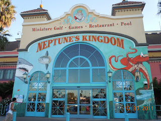
Neptune's Kingdom arcade
Business, like most businesses, suffered during the Great Depression years, however, over the decades, the Santa Cruz Boardwalk grew with more rides and more technology. Additionally, the Boardwalk was a popular venue for Miss California Pageants as well as concerts from big names like Lawrence Welk, Tommy Dorsey, Gene Krupa and Benny Goodman just to name a few.

Like many amusement park funhouses across the U.S., the Santa Cruz Boardwalk had it's "Laughing Sal"  with her loud boisterous laugh. Sal was built in the early 1930's by a company in Pennsylvania. She was built with paper mache, cams, springs and gears and was one of the most popular amusements in the 30's and 40's. Sal's laugh was such that she had the habit of scaring children. If nothing else, kids remembered the first time they saw Sal.

Today's Cocoanut Grove opened in 1907 as the Casino with 1,200 people in attendance at the grand opening . This was also the venue in the 1930's and 1940's which featured the big band concerts as well as concerts geared to the younger audiences beginning in the 1960's. The Cocoanut Grove was also the venue for the Miss California Pageants and was designated a California Historic Landmark in 1989.

santa cruz california beach in 1904
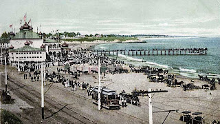
Santa Cruz Pier showing trolley line, 1904
The Santa Cruz Public Wharf is adjacent to the park and is in easy walking distance. The wharf is great to visit when at the park and, as mentioned above, offers a fine selection of restaurants.

Two other of our articles you'll enjoy are Mission San Juan Batista and the John Steinbeck Center in Salinas. Both are good companion stops along with your trip to the Santa Cruz Boardwalk.

You may also enjoy our travel article on Beautiful Tomales Bay California.

There's an excellent book available on the subject, California Theme Parks by author Alex Miller which details the history of theme parks in California and how important they are and were to 1900's California. Miller explains how these amusement parks came to be and the big role that roller coasters played in their appeal. Another good read on the subject is The Santa Cruz Beach Boardwalk: The Early Years-Never A Dull Moment, by author Chandra Moira Beal.

(Photos from author's private collection. 1904 photo from the public domain)

Friday, August 17, 2012

The Doodlebug / Railroad in New Mexico

Short haul passenger railroad development took many forms during the first half of the 1900's. The railroad engine pictured in this article was named "The Doodlebug". It was also called the ATSF M190 and was operated on many short routes throughout the southwest by the Atchison Topeka and Santa Fe Railroad during it's time of service.

About the Doodlebug

doodlebug train m190
At & SF Railroad M190
The name "Doodlebug" was often used to describe any self propelled railroad car. They were considered motorcars. These were quite different from steam locomotives. Doodlebugs were gas/electric engines generally used on short distance routes. These were routes that the railroad was expected to serve but too short a distance to be economically feasible with regular steam locomotives. The Doodlebugs were self contained units that usually could provide room for mail and passengers although some designs had the engine pulling one or two rail cars.

Today, The Doodlebug, ATSF M190,  is on permanent display in Belen New Mexico. If your western trip takes you near Belen, which is just 33 miles south of Albuquerque along Interstate 25, it's well worth a stop to view this historic railroad engine. The train engine now on display in Belen's Doodlebug park has quite a history of service. During the 1930's and 1940's this particular train ran on a route between Albuquerque New Mexico and Belen to the south. It was considered a commuter route.The AT & SF M190 was built in 1932 by the Electro-Motive Corporation. This particular Doodlebug was essentially a baggage compartment train with a 900 HP gas engine. The M190 had the power to pull perhaps four passenger rail cars. In 1949 the engine was changed to diesel.

The AT & SF M190, during it's service life also served other cities and towns. During part of the 1950's and 1960's, the M190 was one of two trains on the Clovis to Carlsbad New Mexico run. I understand that this Doodlebug may also have seen service in El Paso during the 1960's before returning to Belen and retirement.

The Doodlebug Moves From Sacramento to Belen

atchison topeka and santa fe M190
Doodlebug
One interesting story about this particular Doodlebug was how it found it's way to Belen New Mexico. After the M190 was retired from service in 1968, it found it's way to the California State Railroad Museum in Sacramento California.

It was at the museum rail yard that the old AT & SF M190 was parked awaiting restoration before display. Today, the California State Railroad Museum is probably one of the finest railroad museums in the world. They have fascinating displays of restored rail cars and locomotives under roof. If you have visited there you will know what I mean. If you have not, I would highly recommend a stop there if your travels take you to Sacramento.

When the old AT & SF Railroad M190 motorcar was discovered at the California museum, efforts were made between the governors of both states to return the historic rail motorcar to New Mexico for restoration and exhibit. When all was worked out for the return of the M190 in 2007, arrangements were made for the motorcar to be transported by flatbed train car to Belen. The M190 traveled down the San Joaquin Valley from Sacramento and over the Tehachapi Pass east of Bakersfield. From there it was straight across the Mojave Desert to Needles California and a pretty direct line from there to Belen.


doodlebug
It's appropriate that the AT & SF M190 be exhibited at Belen New Mexico where the motorcar saw so much service. Belen is also a terrific place regarding trains in general. Belen New Mexico is home of the old Belen Harvey House dining room which is now a terrific railroad museum.

In addition to this, the Belen Harvey House Museum has a fantastic model train display that covers three rooms near the rear of the building. Many great railroad artifacts are displayed including an old AT & SF switching panel, Harvey House memorabilia and uniforms from the Harvey Girls era.

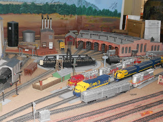
The model railroad exhibit displays the Belen rail yard as it looked with the roundtables during the 1950's and 1960's. They also have a model of the New Mexico Rail Runner which is a one of kind exhibit. The Belen Model railroad Club has built an excellent exhibit and hit's definitely worth a visit. All of the Historic sites. including the Doodlebug Park, can be found on the "Walking Tour Map" available at the Harvey House Museum facing the rail yard.

Three other articles on Western Trips you'll find interesting are the Belen Harvey House Museum ... Donner Pass Train  and Some Great Stops Along TX and NM Route 66.

To reach Belen from Albuquerque, drive south on Interstate 25about 30 miles and take exit 195. Follow the I-25 Bypass to NM 314 W and follow that to Reinken St. This is the center of Belen and the Doodlebug and Harvey House Museum is about a half mile to the east. This is also the area of the busy Belen BNSF rail yard.


NEW MEXICO RAILRUNNER EXPRESS #514 LEAVING BELEN NM VIDEO


(Photos from author's private collection)


Thursday, August 16, 2012

The Fur Trappers and Mountain Men

The fur trappers and the mountain men had a plethora of equipment, much of which was created while on the trail. Two specific items that came to good use in the wilderness were powder horns and knives. The powder horn was exactly what it's name implies. It was horn that carried the black gun powder used in their muzzle loader rifles. It was an animal's horn that was capped at the open end. They lasted for years throughout the world. It wasn't until the introduction of breech loading firearms that the powder horn became obsolete.

powder horns
Powder Horns with artwork
In the excellent book Firearms, Traps, & Tools of the Mountain Men, author Carl P. Russell paints a quite detailed picture of the fur trappers and mountain men along with a explanation of the tools of their trade and the importance of these implements not only for the trade business but also for their very survival in the wilderness.At the end of this article I've listed several museums and venues which exhibit excellent displays of these historic tools.

The Powder Horn

Among representative examples of these tools were powder horns, knives as mentioned above, hatchets and the many styles of beaver traps. Powder horns, implements to store gunpowder, were hollowed out animal horns. In North America these usually came from buffalo and cows. Mountain men did have the time to construct these tools and also had time to place some very attractive artwork and symbols on many of these such as the example shown in this article. In a real sense, much of the artwork on these horns tell about the life of the person who made them. As far as utility, using an animal's hollowed horn to keep gunpowder made a lot of sense since a horn is naturally waterproof and protected against an unexpected spark to ignite the powder.

powder horn artwork
Powder Horn artwork
There were many uses for animal horns throughout the centuries. Sample items could be spoons, combs, dippers, scoops, message horns, blowing horns, small cups, and sometimes book covers. In addition to being containers for gunpowder, the animal's horn was excellent for being  containers. They could be used to hold salt, rum and other similar quantities.

You can find antique powder horns for sale today an many have distinctive artwork. You can also find several good powder horn makers today who sell their products at mountain men and fur trapper festivals staged throughout the country. Another good book regarding powder horns is Powder Horns: Fabrication and Decoration by author Jim Stevens. The book has many photos about shaping and decorating powder homes and explains various techniques.

Knives of the Fur Trapper 

Fur trappers and mountain men were also very attached to their knives. Knife designs like the one's shown here had specific purposes and were essential to their trade. Author Carl P. Russell states that the basic knife of the 1800's mountain man had a lot of characteristics similar to knives in the period as early as 1,000 B.C. The early European knives were usually made of bronze whereas the 1800's mountain man's knife was made from iron. Probably the dagger was the knife that had the more of it's roots tied to ancient times. The design of the bowie knife is another. A knife generally had a specific purpose whether it be skinning, butchering or simply hunting. Among the selection could be bear knives, clasp knives, bowie knives or long knives. Knives often had certain personal characteristics that differentiated them from one person to another. It's been said that many fur trappers and mountain men could tell who a knife belonged to by just looking at it. It's also said that a knife was so personal to these mountain men that one would backtrack for miles looking for one that was lost.

mountain men knives
Various handmade Mountain Man knives
Beaver Traps

Between 1820 and 1840 there were an estimated 3,000 mountain men throughout the American west. The all important beaver trap enabled the fur trapper and mountain man to make a living through the trading of furs. While there were several styles of beaver traps used, the general method of capture was fairly the same. Claws would grab and eventually drown the animal. A steel trap attached to a chain would be set just under the water with a scent on the end of a branch stuck into the river bank just above the trap. A beaver could smell the scent from a great distance and when trying to get to the source on the branch would be caught in the claws of the trap. As the animal would move the steel trap into deeper water, the animal would drown. A fur  trapper might set out several traps and come back at a later time to check his catch.

fur trading post
Fur trading at Ft. Nez Perce, 1841, Pub. Domain image
The book, Firearms, Traps, & Tools of the Mountain Men, explains that beaver trapping went on in America long before the time of the mountain man. Indians trapped for furs but it was when the mountain arrived on the scene that steel traps were employed. In fact, Indians acquired steel traps through trading with the white fur trappers. Nobody knows for sure when the first steel trap entered North America but many believe it may have been in the French colonies in Nova Scotia and along the St. Lawrence River.

While the heyday of the western American mountain man was a few decades starting around 1820, these individuals were a great aid for the emigration westward that would take place from the 1840's onward. Many served as guides for pioneers heading out over the Oregon Trail and also for the army. Most cavalry expeditions from the 1850's to the 1880's regularly employed seasoned mountain men and traders along with Indians as scouts. As an example, Buffalo Bill Cody was used as a scout with the General George Crook Yellowstone Expedition in 1876 after the Battle of the Little Bighorn.

coyote fur hat
Coyote hat in middle of photo
Mountain Men Collections

Many authentic mountain man tools are in private collections but there are also many held by museums and historical societies around the U.S.

One of the very finest museums in the west which chronicles the life of the mountain man/ fur trapper is the Mountain Man Museum in Pinedale Wyoming. The area around Pinedale was one of the most active during the mountain man era and many a mountain man rendezvous took place in this region along the Green River.

Another is the Adirondack Museum in Blue Mountain Lake, New York. This museum features ongoing programs in such things as boat building and wilderness living.

If your western trip takes you to the northwest, you'll want to add Fort Vancouver in Washington state just across the Columbia River from Oregon. Not far from Fort Vancouver is Fort Astoria, once part of the American Fur Company and at the mouth of the Columbia River in Oregon.

Another venue with a wide collection of frontier artifacts is the Natural History Museum at the University of Kansas in Lawrence.

Other articles you'll find interesting are the Frontier Trail Wagon Ruts at Guernsey Lake Park in Wyoming and Wild Bill Hickok and the shootout at Rock Creek Station Nebraska.Also, the story of Kit Carson and the Kit Carson Home and Museum in Taos New Mexico.

(Photos are from author's private collection. Indian fur trading image from the public domain)


Monday, August 13, 2012

Montezuma's Castle / Las Vegas New Mexico


montezuma Hotel in New Mexico
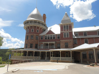
Old Montezumas Castle and Hotel
Western Trips takes a fun and scenic road trip to Las Vegas New Mexico and Montezumas Castle. The largest and one of the most historic structures in Las Vegas New Mexico is the old Montezumas Castle, just a few miles north of the plaza area. The building is also referred to as the Montezuma Hotel. The site where this magnificent hotel was built in itself comes with a lot of history. In the late 1800's when people thought of the Montezuma Castle they thought of the hot springs available there for guests. In fact, in the mid 1800's the site was originally named Hot Springs and the hot mineral water found there in abundance coming up from underground was considered quite beneficial for health. Travelers near and far flocked to the Hot Springs when possible.

Long before the Spaniards, Mexicans and Americans gravitated to the area, the mineral springs were well known among the Native Indian population. In the excellent book Gateway To Glorieta: A History of Las Vegas New Mexico, by author Lynn Irwin Perrigo, PhD, describes the many quite diverse uses of the site called Hot Springs and the many groups that occupied Montezuma's Castle. Montezuma's Castle in many ways mirrored the growth and subsequent ups and downs of the scenic area around Las Vegas New Mexico.

montezuma hotel dining room
Fred Harvey Dining Room in the Castle
Two Anglo's took over the site of the hot springs in the 1840's as a land grant from the Mexican authorities. They built a small bath house and charged a fee for it's use. This was shortly before the U.S. Army would seize control of the territory as a result of the Mexican American War. By 1956 the property was seized because of debts owed and the US Army had control of the property until 1864 when another new owner took over. The property would change hands often up until the railroad came to Las Vegas. When that occurred a lot changed. A Boston investor purchased the site of Hot Springs in 1879 with the AT & SF being his controlling partner. By 1880 both a new bath house and a four story hotel was constructed. What happened after 1880 can best be described as a series of fires followed by a series of rebuildings.

Just one year after it's completion, the new bath house burned down. A new bath house was constructed along with the large hotel mentioned above. The hotel had some 240 guest rooms. This hotel burned down in 1884 due to a naptha gas fire. It burned to the ground in under one hour. After this second fire, a new hotel was built one year later up on the hill overlooking the river and the small power plant. If these rebuildings were not enough, another fire burned out the top of the new hotel but firemen were able to save the first two floors. The hotel was repaired but now had been reduced to three floors but offered 400 guest rooms and 90,000 square feet. In the meantime, the Montezuma Hotel contracted with Fred Harvey to manage both the hotel and it's dining service.

montezuma hotel porch
Massive porch alongside Montezuma Hotel building
Certainly, with Fred Harvey's partnership with the AT & SF Railroad, The Queen Anne styled Montezumas Castle no doubt offered some of the freshest food in the area.The Queen Anne style of architecture and furnishings was popular in the United States during the latter decades of the 1800's,

The most prosperous years for Montezumas Castle would have been from about 1884 to 1900 with the exception of a few years in the 1890's due to the Great Financial Panic of 1893. When the Montezuma originally opened in 1880, there were many visitors to the area that came for health reasons. Doctors suggested to victims of consumption that a dryer climate, like that found in New Mexico and all over the southwest, would be advantageous to their health. These benefits were promoted heavily in railroad brochures. Many people who could afford the rates traveled by railroad to Las Vegas New Mexico and Montezumas Castle. By about 1900, there were several other resorts available to the west of Las Vegas, therefore the Montezuma lost some business. As an example, the AT & SF along with Fred Harvey opened the El Tovar about 1905 at the south rim of the Grand Canyon. In addition to this, the Atchison Topeka and Santa Fe Railroad along with Fred Harvey opened the large La Castaneda resort and dining room adjacent to the Las Vegas train station. The empty historic La Castaneda still stands at this site today where passengers traveling on Amtrak's Southwest Chief can get a glimpse of as they past through Las Vegas.

mineral baths at montezuma new mexico
Hot mineral baths at Montezuma Castle site
During the 1900's, Montezumas Castle went through several new ownerships and had several different uses other than that of a hotel. The Montezuma Hotel closed down in 1903. After that it was vacant for long periods. The chain of ownership during the 1900's included the YMCA, the Southern Baptist Church who then sold it to the Catholic Church which used the property until 1972. After being vacant for ten years, Montezumas Castle was bought by Armand Hammer for use as a United World College. Armand Hammer restored the old Montezuma Hotel building and it's a very impressive and beautiful structure as you can see from the photos in this article. The United World College operates at this site to the present day. Guided tours are available on the weekends.

You will find the following two related articles interesting. On our Trips Into History site we've published the Historic Plaza Hotel in Las Vegas New Mexico and on our Western Trips site we have the Miramont Castle in  Manitou Springs Colorado.

You may also enjoy our Western Trips article on the Rock & Roll Hits Recorded in Clovis NM.

Still today, people travel to the site where natural hot springs are available to the public at no fee. These are outdoor springs with walkways and are very accessible.The old Montezuma Hotel and Castle which is now a United World College is locate six miles northwest of the Las Vagas plaza on State Route 65 which can be accessed from Interstate 25. Las Vegas New Mexico is about 60 miles east of Santa Fe on Interstate 25.

(Photos are from author's private collection)


Saturday, August 11, 2012

Belen New Mexico Harvey House


belen new mexico harvey house
Belen Harvey House Museum
Western Trips found a great addition to your New Mexico travel planner. The Harvey House in Belen New Mexico, one of the eighty-four Harvey Houses in the nation, served meals to Atchison Topeka and Santa Fe Railroad passengers from 1910 to 1940. The railroad built down to Belen in 1880 and the town  had been a very busy railroad town and today still is. When the Belen Harvey House was operating for the railroad, the entire area around the depot and the dining room was an active depot district. The Harvey House, in addition to being a dining room and residence for the Harvey Girl workers, was also a center of civic activity. Fred Harvey had a good arrangement with the railroad. The story is that the railroad would split the building costs for any new construction with Harvey. The AT & SF would also set aside space on their trains for the free transportation of meat, seafood, produce and supplies and equipment needed to operate a dining room. This no doubt allowed Harvey to gain the reputation of quality dining he attained.

In the book The Train Stops Here; New Mexico's Railroad Legacy by author Marci L. Riskin, the author points out that the exact date of the dining room's construction is unknown but most likely 1910 due to the fact that this was the time of substantial traffic increase in Belen because of the building of the Belen Cut-Off. Fred Harvey had already built the large Alvarado Harvey House in 1902. The Belen Cut-Off ran almost straight east-west between belen and Clovis New Mexico on the Texas border. The cut-off, which only cut six miles from the distance between Chicago and Los Angeles, became the preferred way to ship freight. The grades encountered on this route were much less than the Santa Fe's mainline passenger route that crossed over Raton Pass on the New Mexico-Colorado border and over Glorieta Pass near Santa Fe.

belen new mexico railroad museum
South side of old Belen Harvey House facing depot
The two-story Belen Harvey House was built in the Mission Revival style which you will see in many of the surviving structures around the state.This Harvey House was constructed with a basement which came in handy for storage. This was one of the few structures in Belen with a basement since the water table was high. Reportedly, the Belen Harvey House did have some problems with water entering the basement. The dining room could seat over 60 diners and included a U-shaped counter that was seen in some other Harvey dining rooms such as the one in Slaton Texas. The bricks for the platform in front of both the depot and Harvey House were constructed using Coffeyville and Trinidad bricks. There was also a beautiful lawn on both the north and south side of the building. This was something very unique and welcomed by Belen which has a general high desert landscape. Today, the old Harvey House operates as a museum, and a very well appointed one. The address is 104 North First Street.

belen new mexico model railroad display
The museum is filled with artifacts, photos and posters depicting the passenger railroad era of Belen. The exhibits are both railroad and town related. You will also be treated to a magnificent model train display which has been created in several rooms in the rear of the museum. The unique model railroad display shows the layout of buildings and the rail yards during the early 1900's. All of this was created by the Belen Model Railroad Club and it's definitely worth a visit. Another fine exhibit on the first floor of the museum is a replica of a Harvey Girl bedroom exactly the way it would have appeared in the 1920's. Among the many railroad exhibits inside the Harvey House museum is an authentic Santa Fe Switching Panel of the era shown below. You'll be able see old time tables of the AT & SF trains, a conductor uniform, a Harvey Girl uniform, telegraph equipment, residence rooms on the second floor and a host of other very interesting and authentic exhibits.

railroad switching panel
AT & SF Switching Panel
The Fred Harvey Company stopped operating the dining room in 1935. When they departed, local citizens continued to run the dining room until about 1940. Activity picked up during World War Two with the transportation of soldiers and the old Harvey House was opened to make box lunches for troops passing through on the railroad.

After the war, the AT & SF converted the building into a book reading room and card room for railroad employees and a place for them to just socialize. The building was vacant for many years until 1982 when the Valencia County Historical Society saved the structure from the wrecking ball. As an example, the old elegant and large Alvadado Harvey House in Albuquerque was unfortunately demolished in 1970.  After the society took over the building they restored the interior and set it up as an excellent museum. If your travels take you anywhere near Belen New Mexico, this truly is a must stop.

Three related Harvey House articles we've published are The Slaton Texas Harvey House, the La Castaneda Harvey House and the La Posada in Winslow Arizona.

Belen remains a very active rail yard for the BNSF Railroad today. Belen is a major maintenance and  refueling point for freight trains traveling between Los Angeles and Texas. It's estimated that some one hundred trains move through the Belen rail yard each day picking up cars, switching and refueling. It's a very busy place. Today's Amtrak Southwest Chief that travels between Chicago and Los Angeles over the old Raton Pass AT & SF main line cuts off to the west shortly before reaching Belen. Long distance passenger service no longer passes through Belen but there is a great short distance alternative with the New Mexico Rail Runner. The Rail Runner offers commuter train service from Belen in the south all the way up to Santa Fe in the north.

See our article on the historic Doodlebug locomotive on display in Belen.

(Photos from author's private collection)

Thursday, August 9, 2012

Monte Rio / Russian River Getaways

Rave Sports Sea Rebel Kayak - Water Sports Equipment (Google Affiliate Ad)
Take a scenic drive west of the Sonoma Wine Country on River Road and you'll come across a quaint and historic town by the name of Monte Rio. Monte Rio California is along the winding Russian River where canoeing and kayaking is a popular summer past time. River Road follows the Russian River to it's mouth on the Pacific Ocean at the town of Jenner and can be accessed at the River Road exit on Hwy 101 just north of Santa Rosa California. The drive is beautiful, filled with trees and hills and the meandering river on your left as you head for the coast. Russian River getaways have long been a popular northern California trip idea.

At one time the town of Monte Rio was named "Montrio". That was the name given in 1902 when the railroad built a train depot and hotel on the Russian River. When the post office first opened in 1924, the town's name was changed to Monte Rio. Today, Monte Rio is a tourist destination. In the late 1870's it was in the middle of the bustling Redwood timber industry and as such was on a stop of the North Pacific Coast Railroad which ran from Cazadero to Sausalito to the south on San Francisco Bay. From there people and cargo were transported by ferry to San Francisco. Both regular and narrow gauge railroads built into the area. The regular or broad gauge line was completed in 1909. By this time the forests had been heavily logged and vacation lots were offered for sale. Along with the logging industry there was quicksilver mining. This was another name for mercury. Among other applications, Mercury was used in barometers and thermometers.

Rio Theater, Monte Rio CA
For a relatively small town, Monte Rio has several very interesting sites to explore. One is the old Rio Theater. The theater is housed in a Quonset hut. A man named Sid Bartlett built the theater during 1949 and 1950. Bartlett was a local Monte Rio merchant who decided to build the theater with a surplus Quonset hut from World War Two although the one he used never was actually deployed in the war. The Rio Theater today is quite a unique theater in several ways. The concession stand sells hot dogs with sauerkraut along with usual theater food. Part of the theater is also a restaurant that's open for breakfast five days per week. The theater's inside is lined with art showcasing the Russian River area. The outside of the Quonset hut has a large mural of the Monte Rio area.

Another great site at Monte Rio is the Russian River Hall. The live theater was formerly named the Pegasus Hall and is used for live performing arts. The Russian River Hall produces such events as plays, concerts, art shows and standup comedy. The location is 20347 Highway 116, Monte Rio. Check out their website for the current schedule of plays and other events. www.russianriverhall.com.

Russian River Hall
When you have the opportunity to visit the Russian River area and particularly Monte Rio, an excellent restaurant to stop in at is the Highland Dell Lodge located directly on the south river bank across from the town. The Highland Dell Lodge is both a hotel and restaurant and is perched up on a hill on the riverbank. Along with great food, the Highland Dell Lodge has an outside deck and offers some of the best river views in the area. Monte Rio is located about twenty miles west of US Hwy 101 on River Road. The River Road exit on Hwy 101is about 6 miles north of Santa Rosa California. Santa Rosa is about 55 miles north of San Francisco.

Following are Sonoma County California related historic sites you will find interesting. Our articles on these are the Luther Burbank Home and Gardens in Santa Rosa, the great wine town of Healdsburg and Railroad Square in Santa Rosa CA

If you're reaching the Russian River area from Hwy 101, there are plenty of great stops along the way on River Road. Martinelli Winery is located about four miles west of Hwy 101 on River Road and further west is Korbel Champagne Cellers on River Road east of Guerneville. Guerneville itself is a great area for kayaking and canoeing and offers Johnsons Beach with boat rentals available. A visit to Monte Rio and the Russian River communities makes an historic and fun western side trip.

(Photos from author's private collection)
View Larger Map