Western Trips

Wednesday, February 29, 2012

Redwood National Park / Northern California

giant redwood tree
Giant redwood tree
Redwood National Park is one of our most unique National Park that any list of western trip destinations must include it. The native people of California's northern coast called the redwood area home for thousands of years.

 Traditional homes of the region's Native Americans usually were built using planks split from fallen redwoods. Today, Redwood National Park, which was officially established in 1968, is really a string of lands which are operated by both the state and federal government and in this fascinating setting you'll find some of the world's tallest trees. Some redwood trees are actually five stories higher than the Statue of Liberty. Redwood National Park can really be called Redwoods National Park since there are several adjoining parks all together.

The Redwood Tree

One of the mysteries of the redwood tree is it's root system. The root system of the redwood tree is very shallow, especially when you consider the great height the mature tree attains. There is no tap root and the other roots may only go down six to twelve feet. The major roots are about 1 inch in diameter. and they typically span 50 to 80 feet. The redwood can live an astounding 2000 years, can weigh up to 500 tons, and reach over 350 feet in height. There is no other tree on earth with these type dimensions.

redwood tree trunk
An enormous redwood tree trunk
The north coast of California is an ideal place for redwoods to grow and flourish. Areas of moderate summer temperatures, no freezing, lots of winter precipitation and fog are ideal locales for redwoods and fairly accurately describes the northern California coast.

This area of California receives an average of 70 inches of precipitation per year with 90% of it during the period between October and April. These are the California monsoon months. During the summer months rain is almost nonexistent. Speaking of water, a 200 foot redwood tree with a trunk 5 feet in diameter holds about 34,000 pounds of water.

Another few interesting facts about the redwood is that the oldest trees are not necessarily the oldest and the trees needles on the lower part of the tree are different than those on the upper portion.

Redwood National and State Park

One very popular activity in Redwood National and State Park is hiking. In fact, California National Parks offer some of the best hiking trails found in North America. If you enjoy hiking you'll absolutely love this park. Several scenic trails are there for the hiking.

The Redwood National Park and the smaller state parks that surround it have over 200 miles of hiking trails covering an elevation change of over 3,000 feet. The Lost Man Creek Trail is one of the favorites. This strenuous ten mile groomed trail takes you on a former logging road with steep grades and switchbacks in the southern portion of the park. You'll cross Lost Man Creek on a bridge affording excellent views of the stream below. Mature redwood trees line most of this hike. To access Lost Man Creek Trail, find the marked trail head at the Lost Man Creek Picnic Area on Lost Man Creek Road, or a second access point on Bald Hills Road.

stand of redwood trees
Sunlight creeps in through the redwoods
Another fun trail in the Redwoods National Parks is the Rellim Ridge Trail. This trail crosses through the northern side of Redwood National Park and the Jedediah Smith Redwoods State Park. The 4.3-mile trail has two trail heads. The south trail head is past the gate on Hamilton Road, and the north trail head is just past the west end of Howland Hill Road. The moderate hike is not steep but there are several non-level grades. After you climb to the ridge you'll have a great view of the Crescent City California harbor.

A perfect trail for novice hikers is the flat Crescent Beach Section in the Coastal Trail section of the park. This 3.5-mile trail is almost entirely flat and great for a family hike. The trail ends at a beach, where hikers can search for shells or walk along the water. Some hikers view Roosevelt elk grazing in the prairie areas next to the beach.. Access the trailhead at the Crescent Beach picnic area on Enderts Beach Road.

Campers will note that all of the camping sites in Redwood National Park are operated by the state. There are four developed campgrounds but without trailer hookups. Bear precautions need to be adhered to at all campgrounds. Food and scented items, such as toothpaste need to be kept either in the trunk of your car or in metal food containers. Bear proof canister are available to borrow from information centers.

Visiting Redwood National Park

Getting to Redwood National Park and the State Parks is easy by driving US Hwy 101 from either the San Francisco Bay Area or from Oregon. Orick California is the southern gateway to the Redwood National and State Parks. U.S. Hwy 101 runs right through the middle of Orick. The northern gateway to the park is Crescent City California near the Oregon border. Crescent City is also where you'll find lodging at a variety of rates. Something to fit just about every budget.

As with almost all National Parks, you'll be able to enjoy interpretive programs. These programs cover everything from trees to tide pools. Be sure to check at park headquarters for the schedules of campfire programs and other activities throughout the year as well.These are some of the fun things that make a trip to Redwood such a great family getaway and educational as well. 

While in northern California you may also want to explore the historic Lava Beds National Monument and the story of the Modoc Indians as well as the Luther Burbank Home and Gardens in Santa Rosa, about 60 miles north of San Francisco. 

(Article and photos copyright Western Trips)


View Larger Map

Monday, February 27, 2012

Monterey California / From the Spaniards to the Sardine Industry

monterey california coast
Monterey Peninsula Coast
Well known as one of the most spectacular tourist destinations on the California coast, Monterey California also has a history dating back to the very origins of what was then Alta California.

Today, a vacation or weekend trip to Monterey brings thoughts of a beautiful bay, great seafood, the famous Cannery Row, the scenic Seventeen Mile Drive and, if you're a golfer, some of the finest golf courses in North America. Many people no doubt remember Cannery Row as being the namesake of one of the most popular novels written in America by Monterey County's famous author John Steinbeck. A very good side trip as part of your Monterey vacation is the Steinbeck Center located in nearby Salinas California.

The Monterey Shore and Marine Life

The Monterey Bay area is a natural marine sanctuary. The Monterey Bay National Marine Sanctuary is a Federally protected marine area offshore of California's central coast. The area stretches from Marin, just north of San Francisco proper, to Cambria. The shoreline length is 276 miles. According to the federal government, it is home to numerous mammals, seabirds, fishes, invertebrates and plants in a remarkably productive coastal environment. One of the more popular sites for both tourists and locals is the world renown Monterey Bay Aquarium. The Monterey aquarium attracts visitors from around the world.

Monterey and It's Whales

Monterey California is another excellent place to set out for a day of whale watching. Monterey California is actually one of the best whale watching sites on the entire west coast.

 In some locales on the coast sightseerers often have to go a fair distance out to catch sight of the whales. Along the Monterey coast whales can often be seen offshore with the naked eye. One of the reason for this is that the area is home to the Monterey Submarine Canyon. This area is like the Grand Canyon undersea. It's the perfect habitat for many whale species and this underwater canyon allows them to come relatively close to shore.

For those wanting to go on whale watching excursions, there are several tour boats which depart Monterey harbor daily. When you're on your whale watching expedition there's also a good chance you'll see dolphins which are around Monterey Bay year around.

Another side note for music lovers. Jazz enthusiasts go by the thousands each year to the Monterey Jazz Festival held in September.The festival takes place at the fairgrounds and is a world renown event with top notch talent.

Monterey Was Settled By The Spanish

monterey whale watching
Monterey whale watching
Monterey California has a very historic past which was at the very center of the regions exploration, settlement and development.

When the Spaniards were first exploring and then settling Alta California, Monterey was chosen as their seat of provincial government. In fact, the mission at Monterey which was then relocated to present day Carmel, was among the first three missions established by Father Junipero Serra in the province.

Monterey was the capital of Alta California from 1777 to 1849, first under the Spaniards and then under the government of Mexico.The presidio of Monterey was actually built there by Alta California's first governor as a defense against a suspected Russian invasion. The Russians had long been involved in the fur trade to the north above the San Francisco area. An invasion of course never occurred. The Russians came south to about 100 miles north of the Bay Area.

Monterey's Seafood Canning Industry

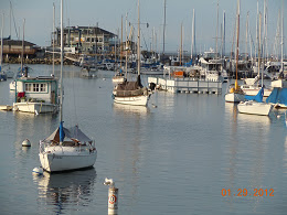
monterey california harbor
Monterey California harbor
There was a time when Monterey was the center for the sardine industry. In fact, sardines were much larger for Monterey than anything like tourism. Unfortunately, what was thought to be the over harvesting of this fish essentially depleted both the sardine and the abolone. That finding would be challenged by later studies by marine biologists.

Historians generally place the origins of Monterey's large sardine industry with the opening of the F.E. Booth Company plant in the year 1902. Before coming to Monterey, Booth had operated a salmon canning plant in Pittsburg California just east of San Francisco. Soon afterwards, a man by the name of Knute Hovden arrived from Norway and teamed up with Booth and the areas canning industry really took off.

In 1904, an Italian fisherman named Pietro Ferrante arrived in Monterey and brought with him what is known as the "lampara net". According to the Aquarium of the Pacific, a lampara net "is a surrounding net with the center bagging part in the form of a spoon with two lateral wings making it possible to retain the school of fish when the two wings are hauled up at the same time". When Ferrante had arrived, the canning facilities were in place, the only problem was finding a way to have a steady supply of fish to can.

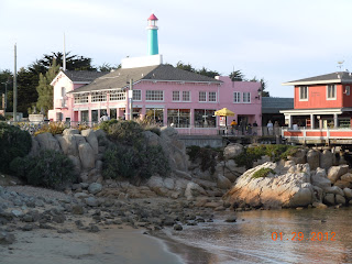
cannery row in monterey
Monterey's Cannery Row
Nevertheless, the sardine canning industry continued to grow by leaps and bounds. Knute Hovden eventually opened his own canning plant and by the year 1918 there was a total of nine plants in operation on Cannery Row.

 By 1945 there was some nineteen plants operating. Monterey was truly the largest fishery center in the entire western hemisphere. The entire California west coast had a massive amount of canneries, over a hundred in total, that stretched from San Francisco all the way down to San Diego. This was a very large industry with thousands of workers. During the industry's peak year which was considered to be 1936-37, a total of 3 million cases of packed sardines were estimated to have been produced.

The Sardines Disappear

Sardines spawned off of Baja California and during the summer would travel from there all the way north to Alaska. In the fall and winter months they would return south to Baja. For Monterey, the peak sardine fishing season was in the fall. The fishing off the California coast appeared to have hit the peak in 1937 and then beginning in the 1940's and continuing through the 1950's, the annual catch began declining. The catch in the Pacific northwest was the first to collapse and then slowly down the coast the sardines just began to disappear. By the late 1950's the sardine had disappeared from southern California waters. What caused this? Was it over harvesting?

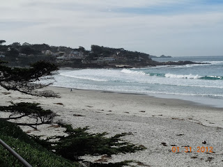
carmel california beach
Beach at Carmel CA
Marine biologists of course conducted many studies into the phenomena. By studying scale deposits off of southern California, the biologists suggested that there were some nine major sardine recoveries and collapses over about 1,700 years. They also determined that each of these cycles lasted about sixty years.

They also discovered that cold water ocean cycles favor anchovies and warm water cycles sardines. While over harvesting certainly can deplete supplies, the biologists found that sardines can simply disappear regardless. The various studies seem to point out that both sardines and anchovie supplies ebb and flow. They also indicate that at current, the sardine supply may very well be in the recovery stage.

Visiting the Monterey Area

fishermans wharf in monterey
Monterey's Fisherman's Wharf
Monterey California is a relatively short 2 hour drive south of San Francisco.

A good number of people who travel to San Francisco include Monterey in their vacation planners. It's a beautiful part of the United States with a wide variety of both scenic and historic sites.

Driving down from the San Francisco Bay area, many people stop off at Mission San Juan Bautista. Another great visit of course is the town of Carmel California just to the south. Further south but an easy day trip there and back is Big Sur California with a coast line like no other.

 If you happen love golf, then you'll find the Monterey area to be one of the finest golf venues in America. Monterey California is really a must vacation stop when on the west coast. Lodging in Monterey and Monterey dining can be found in all price ranges.

(Article and photos copyright Western Trips)

Saturday, February 25, 2012

The Canadian West / The Fur Trade

calgary alberta
Calgary Alberta, circa 1885
The story of the Canadian West, it's exploration, the fur trade and it's settling is a story about Fur trappers, the Hudson Bay Company and the Canadian Pacific Railway. In some respects, it followed a pattern similar to the settling of the American West but in some others it was quite different.

The Canadian Pacific Railway was just as important as was the Union Pacific, Southern Pacific and a few others in the U.S. While the fur trade was key to both countries, what appears to be the biggest difference in the settling of the two frontiers was the role of the military.

During the last years of the 1800's, the American frontier literally was no longer considered a frontier. At least that was what the U.S, Census Bureau declared in 1890. The year of 1890 witnessed the massacre at Wounded Knee which most historians point out was the last of the Indian Wars, although what happened at Wounded Knee could hardly be called a war. A small scale uprising probably describes it better.  Regardless, after 1890 the American West was considered settled. Between the emigration west on the Oregon Trail, the Gold Rush in California and in the Black Hills and elsewhere had already brought thousands upon thousands of people to the American west.

Settling Western Canada

The west Canadian provinces, while there were some settlers, was still largely unsettled in the 1870's.  In fact, during the latter 1800's and into the 1900's, the Canadian government actually ran an advertising campaign to point out the many benefits of heading to the Canadian west. The campaign was named "The Last Best West" and ran between the years 1896 to 1914. The ads were placed in European, British and American newspapers. The campaign had good results. Millions of settlers headed into western Canada during those turn of the century years. The transcontinental railroad was in place having been completed in 1885 in the Canadian west so relatively comfortable transportation to the western provinces was in place. To fully understand the start of this settlement in the Canadian West, an understanding of the Hudson Bay Company's dominance must be explained. From the earliest days to about 1870 the Hudson's Bay Company controlled what are now Canada's western provinces.

Just like the American west, the fur trappers and traders were the first to blaze the trail. During the 1820's and 30's the Hudson's Bay Company, out of it's Fort Vancouver base at the mouth of the Columbia River, controlled nearly all trading operations in the Pacific Northwest. In fact, freelance trappers would have been acting illegally.

The Early Hudson's Bay Company Monopoly

completion of trans canada railroad
Completion of Trans Canadian Railroad
In the earlier years, the Hudson's Bay Company reportedly put out a study declaring that the land in western Canada was unfit for agricultural purposes. Perhaps the report was slanted to help keep out the farmer. The report of course was proven to be untrue. Regarding the Hudson's Bay Company monopoly, there was a contentious trial in 1849 against a trapper who was accused, by the HBC, of trading in illegal furs. The trader was found guilty of breaking the Hudson Bay monopoly, but because of an angry armed crowd present during the trial, the judge didn't fine the defendant.

This trial was probably the key event that turned the tide against the HBC monopoly and, by 1870, the government dissolved the monopoly altogether and opened up trapping to anyone. This was also an event that opened up the Canadian West to farming as well.  It was that year, 1870, in which the Canadian government purchased the rights to the Northwest from the Hudson Bay Company. This move in 1870, beyond a doubt, created opportunities for Canadians in the east who had been thinking of heading west. As mentioned above, the completing of the western railroad first to Winnepeg, then on to Calgary and eventually into British Columbia accelerated settlement. To give you an idea of the railroad's major role in settling western Canada, Canadian Pacific agents operated in many overseas cities. Immigrants were often sold a package that included passage on a Canadian Pacific ship, travel on a CP train, and land sold by the Canadian Pacific Railway. .

Also see our photo article on Fort Vancouver and the Hudson's Bay Company.


fort vancouver washington
Historic structure at Fort Vancouver
Looking into another aspect of western settlement in Canada, comparing it to what had occurred in the western U.S. had to do with the buffalo. The buffalo represented the western plains Indian's most precious source of sustenance. This was true in Canada and the U.S. While the fur trade brought new prosperity to western Indians of Canada, the killing of ever larger numbers of bison altered their way of life dramatically. As more animals were killed for food and then for a market for buffalo robes in the United States, the numbers of bison reached extremely low levels. In one year alone, about 100 000 bison were slaughtered in western Canada. By the year 1870 the bison was almost extinct on the Canadian plains. Also, just as in the U.S., diseases which were carried west by the emigrating Europeans is estimated to have wiped out up to 90% of some Canadian bands. The chef diseases were smallpox, measles, and whooping cough.

Western Canadian Ranches

canadian pacific railway ad
The year 1870 was also a pivotal year for Canadian ranching. Just as in the U.S., the western ranching industry had the encouragement of government. During 1881 the Canadian government passed an act which allowed anyone to lease up to 100,000 acres at a cost of just one cent per acre per year. Granting or leasing acreage at a very low cost was something done by both the Spaniards and the Mexicans to help settle their territories in Texas, New Mexico and Alta California. The method proved successful for them as well as for the Canadian government decades later.

The ranch land was leased and the cowboy entered the western Canadian culture. While the Canadian cowboy and his American counterpart dressed similarly, there were a few distinctions. The history books point out that, unlike their American brothers, the Canadian cowboy seemed not to have the same negative baggage. Some might say that quite a bit written by the dime novelists of the era embellished the "negative' exploits of the American cowboy. I think that when all was said and done both the Canadian cowboy as well as his brothers to the south put in a hard days work for their wages.

Wild West Fugitives in Canada

outlaw bill miner
Bill Miner, date unknown
An interesting historical note is that two of the more famous American Old West lawman figures, Bat Masterson of Dodge City Kansas and Seth Bullock of Deadwood South Dakota  ere both  born in Canada. The frontiersman and Wild West showman Buffalo Bill Cody's father was originally from Canada. As far as outlaws go, the Sundance Kid, a member of the Wild Bunch, spent some three years near Calgary Alberta.

Often times the border was a bit porous but nevertheless the RCMP seemed to have a good idea who was around. The fleeing to Canada by American outlaws most likely offered an opportunity to hang low for a while without an American posse on their tail. One of the more famous of Canadian frontier bandits was a man by the name of Bill Miner. Miner actually spent a lot of time in American prisons before he moved up to British Columbia. It seems that Bill Miner liked robbing and especially robbing trains. The interesting thing is that after Miner was eventually caught by the Royal Canadian Mounted Police and tried in court, he picked up a following of supporters. It seems that many thought it wasn't that bad of a deed trying to rob a Canadian Pacific Railway train. This was believed to be the first train robbery in British Columbia. While it reminds one of the Robin Hood story, Bill Miner apparently was not a Robin Hood. It also reminds one of the bank robberies years later in the U.S. by Bonnie and Clyde when some people at the time felt that the banks deserved robbing. In many respects, the growth of the Canadian frontier and the lawless element that growth attracts is similar to what transpired in the American west.

Sitting Bull's Flight into Canada

The Canadian West was also a refuge for other than old west outlaws and gang members. The great Sioux Chief Sitting Bull as an example fled with many of his people to Canada after the Great Sioux War with the U.S. Army in 1876. Sitting Bull eventually went back and surrendered in the U.S. when both the lack of supplies and the harsh winters took their toll. After reentering the U.S., Sitting Bull actually spent four months touring with Buffalo Bill Cody's famous Wild West.

map of vancouver 1898
1898 map of Vancouver, British Columbia
A western road trip through Canada whether it be to Winnepeg Manitoba, Calgary Alberta, Vancouver British Columbia or anywhere in between can be a great adventure and quite a learning experience. When visiting Canada's western provinces, there are also several excellent museums that you may want to add to your vacation trip planner. This list below is just a sampe list. There are many more museums and terrific sites to put on your vacation itinerary.

In Winnepeg you'll find the Winnepeg Railway Museum. The museum's stated goal is to preserve Winnepeg's railroad heritage. Among other artifacts, the museum is home to the first steam locomotive on the Canadian prairies. Also in Winnepeg is the Living Prairie Museum. Here you will learn much about the ecology of the area prior to settlement and later urbanization.

In Calgary, a must stop for the history minded is the Fort Calgary Historic Park. This is the site of the 1875 North West Mounted Police fort. This forty-acre park includes an interpretive centre, with ongoing excavation and reconstruction of the original fort. Also in Calgary is the Glenbow Museum. In addition to a research library are exhibits relating to Native culture, Western settlement, early farming, and the oil industry.

A National Historic Site in Vancouver is Gastown, the city's oldest neighborhood. Gastown features charming cobblestone streets, an antique steam clock, and brick facades. A statue commemorates Gastown’s founder, “Gassy Jack” Deighton, who opened a saloon there in 1867.

Very popular is the Vancouver Maritime Museum. Among many other educational and fun exhibits are ones regarding shipwrecks and the early fur trade which was so much a part of Canada's early frontier history. British Columbia and Vancouver was a bustling maritime community and there's much to see and do there.

For those that have the time to explore Canada by rail, the transcontinental Canadian Pacific Railway may very well be North America's most scenic route. The route of the CP though the beautiful Canadian Rockies makes for a very memorable exploration of western Canada.

(Article copyright Western Trips. Fort Vancouver photo from Western Trips collection. Remaining photos and images from public domain)

Wednesday, February 22, 2012

Zion National Park Utah / A Western Road Trip

zion national park
If you're looking for an adventurous national park in Utah then Zion might be just the thing.

Zion National Park located in southwestern Utah presents some of the most scenic canyon country found anywhere in the U.S. I had the pleasure of taking a road trip to Zion and it makes a great addition to any summer vacation planner.

Zion National Park occupies a unique geographical area  located at the junction of the Colorado Plateau, Great Basin and Mojave Desert provinces. Because of this, both the wildlife and vegetation is quite diverse.

Zion National is Park Near Several Interesting Sites

Zion National Park is located near to several other parks and historic sites. Zion sits to the north of the Grand Canyon, to the south of Bryce National Park and to the west of Page Arizona, the Glen Canyon Dam and the Lake Powell recreation area. Most people who visit Zion also add these vacation stops to their itinerary. Amazingly, even though they all are in basically the same part of the American southwest, each of these National Parks mentioned are very different from the other. Because of this, a visit to all three during a southwest vacation makes for a great time.

The estimate is that Zion National Park receives about 3 million visitors per year and a good portion of these are from outside the United States. If you haven't traveled to Zion before, you may want to allow yourself three to five days for your visit.

Simply staying inside your vehicle and driving through Zion is a great tour in itself. I've drove this more than once. In Zion Canyon, the rock walls tower 2,000 to 3,000 feet above your car. As with all National Parks, there are excellent hiking trails at various skill levels and always a favorite, ranger guided tours, really give you plenty of options to explore the park. Zion National Park hiking trails are some of the most scenic in the southwest.

The History of Zion National Park

zion national park scenery
Some interesting history about Zion National Park includes how it got it's name. Pioneers who tried to homestead there in the latter part of the 1800's gave it the name "Zion" which is a Hebrew word for safety or a place of refuge.

 Ironically, the area offered very little in terms of agricultural opportunities due to the poor soil and occasional flooding. The first cabin was built in Zion in 1863 by Mormon pioneer Issac Behunin. The canyon where he built his cabin now bears his name.

The southern Utah and northern Arizona area of the American southwest was long ago seen as a tourist destination. The Grand Canyon received a big boost with the arrival of the Atchison Topeka & Santa Fe Railroad and it's hospitality genius Fred Harvey. You may enjoy our story of Fred Harvey and the El Tovar Hotel at the Grand Canyon.

At about the same time, the first decade of the 1900's, tourism potential for Zion was recognized. In 1909, a presidential executive order designated the area as Mukuntuweap National Monument. The problem was that visitors couldn't get there because of bad roads and the nearest rail head being some one hundred miles away. The monument's name was also changed to Zion National Monument in 1918, and in 1919 the monument was expanded and designated a National Park.

Visiting Zion National Park


zion national park utah
During the course of a year, weather in Zion National Park is pretty diverse. The average temperature at Zion National Park is 75 degrees Fahrenheit, ranging from 52 degrees in January to a high of 100 degrees in July.

The air is arid and dry making Zion a great winter park, though you should take the precaution of being prepared for winter driving conditions from November through March. Zion National Park weather also changes dramatically dependent upon the elevation. The major tourist months at Zion are May through September.

Tourists to Zion have a very convenient way to get into the park from Springdale Utah. Springdale is located directly at the southern entrance of the park where visitors can use a park bus to get to the lodges and trail heads within Zion. Springdale has a vast array of lodging and dining at various price ranges and I found it an excellent place to stay and enter Zion from. It was originally settled as a Mormon farming community in 1862. Today, Springdale is entirely oriented to the tourism industry.

Hiking and Trail Heads

One of the things we've enjoyed at Zion are the hiking trails along the Virgin River which flows through the park. The river is a natural gateway to explore many of the great sights at Zion. The sandstone cliffs you see while hiking along the river provides absolutely incredible scenery. These are self guided trails and the bus route can transport you to most of these trail heads. The state of Utah offers a variety of landscapes, geology, and recreational opportunities and I think you'll find Zion National Park to be one of your favorites to explore. Another convenient exploration of Zion is the Riverside Walk which is suitable for smaller children and even strollers. Zion has a hiking trail for everyone.

Camping is Popular at Zion National Park

Zion National Park campgrounds are popular. In regards to camping there, Zion National Park has three campgrounds. Campers love Zion and the campgrounds are usually full by early afternoon on weekends and holidays. During the summer months of June, July, and August, the campgrounds are virtually full every night. Planning your camping trip to Zion ahead of time is advisable. Also note that there are several campgrounds outside but very near to the park.

zion lodge
Zion Lodge
As a side note, regarding Zion National Park lodging, there is only one lodge located within the park.The Zion Lodge features historic cabins with two double beds, full bath, gas log fireplace and private porch. The lodge also offers motel rooms in addition to the cabins and the Red Rock grill for dining. The lodge is a beautiful structure.

Getting There

People drive to Zion National Park from either the east or west. Interstate 15 is to the west of Zion and the area of Page Arizona and the Glen Canyon Dam would be to the east.

Below are driving directions to the park's entrance from either direction. Zion lodging and dining is available in the park or in Springdale Utah directly at the park's southern entrance. Springdale has a wide variety of lodging and camping facilities nearby and makes it very easy to access the park.


From the west: Interstate 15 passes west of Zion and connects with SR-9 just north of St. George. From there SR-9 travels through the towns of Hurricane, Virgin, and Springdale before entering Zion Canyon.
From the east: US-89 passes east of Zion and connects with SR-9 (The Zion-Mt. Carmel Highway) at Mount Carmel Junction. From there SR-9 travels through the park's east Entrance and into the Zion-Mt. Carmel Tunnel before descending into Zion Canyon.

(Article and photos copyright Western Trips)


Hotels, motels, Inns, bed and breakfasts and campgrounds accommodate a variety of tastes and budgets.


View Larger Map

Monday, February 20, 2012

Rail Roads / Electric Interurban Railways

Today's commuter to and from San Francisco from the East Bay communities rides on a modern system called BART. The Bay Area Rapid Transit uses electric power from a third rail. No overhead wires. It's fast, sleek and travels to San Francisco and back within tubes put under San Francisco Bay. In the earlier years of the 1900's, getting around the Bay Area was a bit more complicated. The building of the massive San Francisco-Oakland Bay Bridge in the 1930's changed all that. Before getting into the story of how the interurbans built and operated their electric trains across the San Francisco Oakland Bay Bridge, I should point out that there are many excellent museums to visit in the area where you can learn much more about the subject. The history of the railways also includes the successful operation if urban electric trains. These were not the great steam locomotives but electric street cars.

Restored 1900's streetcar
If you have the opportunity to visit or vacation in the San Francisco area, the the Western Railway Museum located on Hwy 12 between Fairfield and Rio Vista California is a must see. The location is about an hours drive northeast of Oakland. Another is the San Francisco Railway Museum which is located near he south end of the Ferry Building. If your California vacation or weekend trip takes you to Sacramento, then a stop at the California State Railroad Museum is time well spent.The Museum is located at the corner of Second and "I" Streets in Old Sacramento. You will also be interested in the story of the Texas Electric Railroad which explains the power conversion needed to provide DC current. Also the unique story of the how cities grew from horsepower to electric power.

san francisco streetcar
San Francisco Streetcar (author's collection)
The San Francisco Bay area is geographically unique. Boats and bridges were and are quite necessary. Before the San Francisco Bay Bridge was constructed in 1936, ferry boats were the way to travel into the city. The ferry business on the bay was booming. Within the communities in the East Bay area as well as in San Francisco proper people used streetcars. These were simply electric street cars. As part of the history of railways, the consolidation of the electric street car linesiturned them into interurban rail lines. When the Oakland Bay Bridge (this name is also used) was built an entirely new method of trans-bay transportation would begin and the electric trains were a big part of it.

The three years of San Francisco Bay bridge construction started in 1933 and cost $77 million dollars to build. Prior to the bridge's completion there had been electric interurban railroads on both sides of the bay. With the bridge completed in 1936, it was time to connect the east bay with the city of San Francisco with a rail track directly across the bridge. A new page in history was in store for the Bay Area electric trains.

Actually, the early designers of the bridge specifically made space along the south side of the lower deck for two tracks. It was a given that the bridge would handle electric train traffic. The rail facilities for the bridge line was financed with $15 million of bonds through the Reconstruction Finance Corporation. This line was put under the direction of the California Toll Bridge Authority. The line extended just under seven miles from the east side of San Francisco Bay to a terminal in San Francisco.

oakland bay bridge construction
Oakland Bay Bridge under construction
It was evident that construction of this line over the bay would have to be flexible. The reason was that the electric railroads that ran in the area used different voltages. There was not one standard voltage. The Interurban Electric ( a subsidiary of the Southern Pacific Railroad ) which ran in the east bay communities was using 1,200 volts whereas the Key System, was a consolidation of several smaller streetcar lines assembled in the late 1890s and early 1900s line and was using 600 volts. A third system operating, the Sacramento Northern,whose lines spanned all the way from Oakland through Sacramento and up to Chico California, used three voltages, 600, 1,200 and 1,500. It should be noted that over the previous years there was a good deal of consolidation of various interurban lines and some ownership changes. The Key System went through many changes with various names used but the line was mostly referred to as the Key System, even after some reorganizations.

When construction started on the tracks, which was after the roadway sections were completed, it was evident that a multi-voltage system would have to be installed. How to deliver different voltages on the bridge was the question.  Several options were outlined and studied. Some consisted of multi-voltage overhead lines plus a third rail. In other words, overhead lines that would be delivering different voltages to different railways. Quite complicated and expensive to build and operate. The option chosen was a combination third rail with an overhead line to deliver one voltage. The third rail was to deliver 600 volts and the overhead wire 1,200  This option was the less costly and also made it easier to bill each rail line for the power used..

The next step in planning was to devise a routing system for all three lines which would bring them together into the bridge yards. The Sacramento Northern cars were using the Key System tracks making that part much easier. The Interurban Electric was eventually rerouted to a curving elevated track going over the Southern Pacific mainline tracks and joining existing tracks in Emeryville.

san francisco oakland bay bridge
San Francisco-Oakland Bay Bridge
Before the cross bay system got up and running there was a control system put in place which told the engineer his maximum allowed speed. All three electric rail systems operating over the bridge had these systems installed in their cars. The control system was essentially a signal panel with illuminated numerals which gave out the maximum allowed speed for each section of rails. To guard against over speeding the control panel had an "NS" on it's lower part with a white light below it that went on when the train was operating at maximum or beyond the maximum  allowed speed. There was also a low pitched warning whistle that would go off on the GE manufactured control systems if the maximum speed was exceeded. The cars with a Westinghouse made control system would hear a bell. Keeping the rail cars at a safe speed was obviously very important. Failure of the engineer to slow down when necessary resulted in having an emergency brake applied.

As far as the history of railways is concerned, the entire control system was, for the era, was fairly advanced in design. Sensors were placed on the rails at various intervals. The sensors were able to detect passing trains and send coded information to receivers on the train cars. The train receivers just transferred the information into the control panel of each train. The control panel then adjusted speed limits.

Another interesting and very necessary item was the "train describer". This feature of the control system identified every destination for every train. When a train left the San Francisco station for, example, it's destination would be sent to the Bridge Yard Interlocking Tower. The operator in the tower would then know how much time would elapse before the train entered the interlocking yard area. The "train describer" would be able to show the destinations of the first three approaching trains as well as the presence of up to seven additional trains behind those. It was very important to know which trains were where at any given time. With this information it was then possible for the tower operator to plan all of their routes accordingly. This was necessary since trains were enroute to many different places after crossing the bridge. The "train describer" was also very helpful at the west end of the San Francisco-Oakland Bay Bridge because the Key System trains had to be separated from the other two lines because it was using a separate terminal lead track. all of this may sound a bit confusing but when three different lines were all crossing the bridge, sorting them all out was absolutely necessary. Very similar to what an air traffic controller does today. As a historical side note, it's interesting to learn that all of the train designations for the Interurban Electric line were in numerals. The Key System trains all were assigned letters and the Sacramento Northern cars were all assigned the letter "N". These identifiers were placed on the left front end of the car on a metal disc.

modern street car
Present day San Francisco streetcar (author's collection)
The standardization of all rail cars traveling over the San Francisco-Oakland Bay Bridge included more than just the signaling equipment. In addition, all cross bay electric train cars had to have special coupling apparatus for the rapid adding and cutting off of cars on the bridge. The standard coupling in use wouldn't be enough. Window wipers were installed on all 86 cars using the bridge as well as the 15 control trailers. Also added to these cars was an emergency lighting system with their own generators.

The San Francisco Terminal building was planned as far back as 1932. The structure selected was a state sponsored plan and was built was facing Mission Street between First and Fremont Streets, The cost was about $2.3 million. The first "official' test run for the bridge crossing was held on September 23, 1938. a group of Southern Pacific and Interurban Electric officials went on a special train from Oakland Pier. They then transferred to a Key System car for the trip across to San Francisco. The Key System car was used in this instance because at that time the power system that was energized was only at 600 volts of overhead power. This was about the only time that the Key System ran over the bridge with it's pantograph raised for power. Several more test trips over the bridge occurred over the next several weeks using various configurations with baggage cars, etc. In the middle of January 1939 all testing was completed and the cross bay interurban service was ready to start carrying passengers. As with all new systems, some problems emerged during the first several weeks and months. Some were of a technological nature and others were simply due to the inexperience of some trainmen. As is always the case, the problems were eventually remedied and the new cross bay train route was a great success.

Friday, February 17, 2012

The Western Frontier Women / Life on the Ranch

cattle roundup
Montana cattle roundup

The big ranches of the American West grew in both size and number during the years right after the end of the American Civil War. Not that there were no ranches prior to this. What was probably the largest ranch in the world in the late 1850's was the enormous King Ranch in the corner of southeast Texas, south of Corpus Christie. In the case of Mr. Richard King and his King Ranch, he was a bit caught up in the events of the Civil War.

Texas was on the side of the Confederacy during the war and so was King, or at least he knew he'd better be considering where he was residing. King's ranch was raided several times by Union forces in Texas considering it a stopping off site for traveling and resupply for southern forces. In fact, Union forces arrived at one time with orders for his arrest. Supposedly King had been tipped off on the raid and was nowhere to be seen when the Union officers arrived at his ranch.

The King Ranch in southeastern Texas and the XIT Ranch in the Texas Panhandle were the two largest ranches in Texas and both have very unique stories about how they came to be. Life in the old west was quite different than in the cities of the latter 1800's.

The Frontier Woman

trail drive
Colorado Trail Drive, 1898
So much has been written concerning famous and/or infamous women of the American west that the life of the average hard working frontier women has been largely ignored.

Women on the frontier made significant contributions. There are some interesting stories about the introduction of women on the American western frontier and particularly as wives of ranchers. These were not what one might consider women cowgirls. These women of the old west weren't involved in stagecoach robberies like Pearl Hart in Arizona and they weren't noted for frontier scouting among other things such as with Calamity Jane and they didn't hang out with known outlaws like Belle Starr.

What the frontier woman did do was work hard in difficult settings and contributed in a big way to the civilizing of the west. To understand the settling of the American frontier outside of Hollywood stereotypes, a look at how the wives of ranch owners adapted to their new surroundings is quite enlightening. The presence of someone in the old west who could cause a cowboy to act more gentlemanly had to be appreciated.

For the most part, women married to ranchers were brought into the frontier "after" the male established himself. Conditions were rough in the decade after the Civil War and the man striving to get a herd together and start a ranch had all he could do to provide suitable living conditions for himself. Most aspiring ranchers thought the conditions just too harsh and dangerous for their wife or new bride. The idea at the time was to establish oneself in the ranching industry and then return to one's hometown to find yourself a bride, or if you had a wife, make arrangements to take her out west. This was the beginning of adventure for many a frontier woman.

Mrs. Charles Goodnight

In the book "Cattle Kings" by author Lewis Atherton,several good observations were made as to the type of woman that a rancher seemed to gravitate towards. For the most part, they seemed to chose a like minded wife. The rancher himself was a strong individualist, one of the reasons he got into ranching in the first place, and many times this was the type of partner they preferred.


Cowgirl Lucille Mulhall
A good example was Charles Goodnight, one of the more successful ranchers in the Texas Panhandle region. Prior to ranching in Texas, Goodnight established a ranch in Colorado and married for the first time only after that ranch was up and running. Mrs. Goodnight was an adventuresome pioneer woman and the ranch life in Colorado seemed to satisfy her. Unfortunately, the financial panic of 1873 pretty much bankrupted Goodnight and while he took care of all his debts he sent his wife to live in California.

His plans were to bring her back when he reestablished himself at another location. He did reestablish himself in the Texas Panhandle at Palo Duro Canyon, a fairly remote area, and wished for her to hold back until he could make the living arrangements a bit more civilized. To this request she refused. When she arrived at the new ranch after a long hard overland journey, she found that the nearest female ranch woman was some eighty miles away.

Not shying away from adventure it seems that Mrs. Goodnight spent much of her time as a frontier woman patching the clothes of cowboys and tending to the quite small and non-luxurious home. What's quite interesting is that Mrs. Goodnight did indeed enjoy adventure and didn't shy away from the hardship such remote living naturally brings. A woman who chose this way of life did so without guarantees. The hope was that after a few years of very hard work in inhospitable surroundings, prosperity would eventually come and the days ahead would be better. Some ranch women did attain this and some others did not. This is why a ranch owner needed a certain kind of wife. One who was willing to take on the same gamble.

The Frontier Woman Helped In the Success

cowgirl poster
Cheyenne Cowgirl poster
How successful a rancher was pretty much dictated what the rancher's wife had to endure. Pioneer women were met with a variety of circumstances. The wives of some of the bigger ranchers no doubt had workers present who do a lot of the chores for them. If that wasn't the case, then a ranch woman might a life filled with drudgery. Cooking, sewing, fetching what water was available for washing and in many cases helping her husband with regular cowboy duties could be a typical day in some ranch women's life. It really was a life of voluntary sacrifice with the hope of better days ahead. In a sense, the pioneer women were taking a big gamble.

Another western rancher of the post Civil War era was George Littlefield. The ranch was in the area of Gonzales Texas.

In the year 1869 the Littlefields were struggling earning about $150 per year by farming. Littlefield was an ex Confederate officer and Mrs. Littlefield came from a southern plantation and was accustomed to the rural life. Becoming a frontier woman may not have represented that big of a change.

She lived a harsh life on the early farm but things changed dramatically after they became involved in cattle ranching. The Littlefields represented what the successful, and perhaps lucky, rancher could achieve. Over the early 1870's Littlefield drove cattle to Kansas rail heads and expanded his enterprise. Over the years he had several ranches throughout Texas and into New Mexico with the LIT being one of his biggest. At one time his cattle branded LFD grazed over an area of Eastern New Mexico the size of the state of Rhode Island.

George Littlefield's wife, the former Alice Payne Tillar, was one of the luckier frontier women who saw success after years of harsh living. Alice enjoyed being involved with philanthropy and probably was responsible in a large degree for George's many charitable contributions. They had two children but unfortunately both were lost during infancy. Most likely as a result of their misfortune with their own small family they were very close to his extended family, paying for the college education of all of his many nieces and nephews. The Littlefields employed many of the extended  family as managers in theirs many cattle ranching concerns.

Live and Let Live

The rancher was not only an individualist but likewise had a live and let live attitude. Societal norms were often a bit different away from urban life. Author Lewis Atherton in his aforementioned book, Cattle Kings, points out some instances where the frontier life didn't quite fit the lifestyle of a few ranch women who settled there.

A man by the name of Deacon Wade and his wife settled on a ranch very near Theodore Roosevelts' Maltese Cross property in the Dakota Territory. The Deacon and his eastern raised wife, now living a new life in the old west, insisted that people adhere to the customs back east even though they were now residing in the "wild west". The deacon's wife pretty much insisted that her social standards be adhered to by others, no matter what their social background was. The story goes that on one evening when she was hosting dinner for a group of neighbors including Roosevelt, Mrs. Wade insisted that the future president wear one of her husbands coats at dinner. It seems that Roosevelt, in the midst of the Dakota Territory, didn't feel a coat was necessary nor comfortable. Mrs. Wade of course insisted and the tale is that Roosevelt avoided her in the future. Eventually, the Wades, both husband and wife, found the wild west not to their social liking and returned to the east.

Mrs. Lang

ladies side saddle
Ladies Side Saddle (From author's collection)
There's another interesting example which is the opposite of the Wade's experience on the frontier. Another rancher by the name of Gregor Lang was a neighbor of the Wade's in the Dakota Territory. Lang's wife came from a well-to-do British middle class society which she left to make a life on the American frontier.

As they say, "the presence of women brought real civilization to the frontier". When the new frontier woman, Mrs. Lang, arrived on the Dakota ranch, the diet, grooming and language used by the cowboys, all improved greatly. The mere presence of a woman changed the working environment for the better. Mrs. Lang kept her British middle class habits but only extended them to those around her as an example rather than forcing her guests to conform. In other words, while setting a positive example she still maintained a live and let live attitude to others. While she encouraged better manners she never had the air of superiority. Everyone around her including the cowboys felt quite comfortable in her presence. She adjusted quite well to life in the old west. This was in stark contrast to the Wade's intolerance. This demonstrates the positive effect women played on the frontier as long as they respected the code of live and let live.

Ranchers seemed to enjoy more marriage stability than others in the west. Many believe that this was the result of the ranchers marrying those from their same social strata. It was important that ranch women shared the same ideals of their husbands. There were a good number of Europeans who not only invested in American ranching but also traveled to America to establish their own ranches. A man named Pierre Wibaux and his English wife built a ranch in the Dakota Territory. When he had to spend a winter in France on business, his wife was totally capable of running the ranch in his absence. This tells us that Mrs.Wibaux had the same individualist and adventuresome instincts as her husband. Without this compatible arrangement it's doubtful a marriage could have lasted on the ranching frontier.

Augusta Kruse

kohrs ranch in montana
Grant-Kohrs Ranch, Montana
A good example of some frontier women adapting to western ranch life was the case of Augusta Kruse. The frontier woman Augusta Kruse married a Montana rancher by the name of Conrad Kohrs.

Kohrs first established his ranch in Montana and then traveled back east to marry Augusta who he had known previously when both lived in Europe. Although Augusta would be considered a city woman, she traveled out west with her new husband and seemed to adapt to the life fairly well. She took care of the household tasks, replaced the cook so she could assume that duty. Her first child was born without any professional medical assistance, but at the birth of the second, Conrad Kohrs, her husband, was in the position to pay $1,000 to bring a doctor to the ranch to supervise the delivery. The Kohrs couple were quite compatible on their ranch because they simply enjoyed the same things. Kohrs was a very successful rancher and this no doubt helped but without their common interests and Augusta's willingness to immerse herself in the household responsibilities their experience may have not been as pleasant.

Some Excellent Travel Stops

There are several very good sites in the west that can give you more understanding about the frontier female's contribution in helping to civilize a rather non-civilized environment. One excellent stop to add to your vacation trip planner is the Grant-Kohrs National Historic Site. This site is open year-round. Activities include guided tours of the main ranch house, ranger talks, exploring the ranch buildings, walking trails, and kids activities. The Grant-Kohrs Ranch is located directly off Interstate-90 midway between Yellowstone NP and Glacier NP in Deer Lodge Montana.

Another great place to add to your road trip planner is the Pioneer Museum of the Gallatin Historical Society in Bozeman Montana. The Pioneer Museum offers a variety of changing exhibits portraying earlier days in the Gallatin Valley.

In Oklahoma you will want to stop in at the Pioneer Woman Museum in Ponca City. The Pioneer Woman Museum highlights the history of women in Oklahoma and their influence on the development of the state and nation. Ponca City is located in north central Oklahoma. 18 miles south of the Kansas border.

(Article copyright Western Trips. Photos are public domain unless otherwise noted)

Tuesday, February 14, 2012

Luther Burbank / Horticultural Societies

luther burbank home and gardens
Luther Burbank Home and Gardens
We have another excellent stop to add to your Sonoma County California wine country tour. It's the highly popular Luther Burbank Home and Gardens located in the downtown area of Santa Rosa California.

Santa Rosa is the county seat of Sonoma County and located about 60 miles north of San Francisco on US Hwy 101. Santa Rosa is surrounded by wonderful vineyards, wineries and tasting rooms which make it a great place to visit.

The Luther Burbank site consists of three structures at the four acre site originally purchased by Burbank.  The Luther Burbank Home is a modified Greek Revival structure where Burbank lived from 1884 to 1906. Burbank's widow, Elizabeth, moved to the cottage from another house they built nearby after his death and kept the original furnishings and many interesting artifacts.

Touring the Gardens

The second structure is the Carriage House. This of course was originally used to store carriages. It went under renovation in 1986 and is now a museum. The museum has various quite interesting exhibits as well as a gift shop. It's also where you can register for tours.

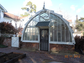
The third building on the property is the Greenhouse. Luther Burbank designed and built the greenhouse himself. When you visit the greenhouse you'll also see a replica of his office and many of Burbank's tools.

Luther Burbank

luther burbank home
Luther Burbank Home
Luther Burbank can be said to be Santa Rosa's most world renown figure. Many referred to Burbank as Santa Rosa's "favorite son". He was also sometimes referred to as "the plant wizard", a name which it was said he didn't particularly like.

Luther Burbank was America's premiere botanist and horticulturist pioneer. His achievements in cross breeding plant varieties were second to none.

Born in Massachusetts in 1849, Luther Burbank ended up spending 54 years in Santa Rosa.

 It's been said that many of the scientists of his day criticized Burbank because he supposedly didn't keep the kind of records that the science community liked to see in those days. Burbank was known to be more concerned with the results he obtained rather than keeping more detailed logs. Regardless, Luther Burbank received grants from none other than Andrew Carnegie to help fund his work on crossbreeding plants. According to various Burbank biographies, Carnegie provided the grants despite reservations from a few of his advisers because of their displeasure with Burbank's methods.

Burbank's Achievements

Over his lifetime, Luther Burbank introduced more than 800 new varieties of plants, over 200 varieties of fruits and a large variety of nuts, vegetables, nut grains and ornamental flowers. His esteemed status brought many visitors to his home and gardens during his lifetime. Included were relatively close neighbors such as Jack London who resided just to the southeast of Santa Rosa outside of Sonoma California.

 London's residence and grounds are now the Jack London State Historical Park. It's a good combination road trip along with the Luther Burbank site. The list of visitors to travel to Santa Rosa to see Burbank at the turn of the century is a veritable list of the who's who of the era. They include William Howard Taft, King Albert of Belgium, William Jennings Bryan, John Muir, John Burroughs, and Edwin Markham.

In addition to this, during the 1906 National Education Week Convention week in San Francisco, the local Santa Rosa California newspaper, The Press Democrat, reported that some 2,000 visitors were expected at the Burbank home and gardens. The city of Santa Rosa gained a lot of attention with Burbank's presence and, according to the book "Santa Rosa: A Nineteenth Century Town", a special souvenir Burbank spoon was cast, designed by Santa Rosan John Plover and offered for sale in John Hood's jewelry store. If you have an opportunity to find this book, it's a great read and filled with a plethora of Santa Rosa history. The book has four authors. Gayle LeBaron, Dee Blackman, Joann Mitchell and Harvey Hansen.

luther burbank greenhouse
Burbank Greenhouse
According to several history books of Santa Rosa California, Luther Burbank advertised himself as "the nurseryman south of the iron bridge".

Santa Rosa was known as an excellent area for agriculture and when the railroad came through town business was booming. Santa Rosa was a large agricultural shipping center.

 Burbank had an interesting observation concerning agriculture in the area. He was quoted as saying, " The region of Santa Rosa at the time of my coming was preeminently a wheat country and the farmers in general were far more interested in cereals than in fruit of any kind". There were exceptions to the rule and an eager young Luther Burbank enjoyed working with them.

Essentially, Luther Burbank's ideas and methods changed the face of agriculture both around Santa Rosa and Sonoma County as a whole.

Another interesting story about Luther Burbank was his supposed belief in supernatural powers, at least in regards to plants. Some said that Burbank had a mystical personality. He vaguely referred to a communication with plants. Even those who didn't necessarily believe in the power of plants as a spiritual healing vehicle, at least not to the degree many thought Burbank believed, were still dumbfounded when most of downtown Santa Rosa was demolished in the big earthquake of 1906 and Burbank's new greenhouse was barely touched.

Honors Bestowed

During Luther Burbank's lifetime he received a large number of degrees and was involved in social organizations. Burbank was a member of the Bohemian Club, a very elite and prestigious club with members being the most notable and powerful people of the era. His neighbor, Jack London, was a member of the Bohemian Club which had annual gatherings each summer in western Sonoma County California.

Luther Burbank received a Doctor of Science degree from Tufts College and the California Academy of Sciences named him an honorary member. In the year 1905, the California Association of Women's Clubs lobbied successfully to have Luther Burbank's birthday, March 7th, declared Arbor Day in California.

The Santa Rosa Property

luther burbank exhibits
Luther Burbank Exhibits
The historic Luther Burbank property shown in the photos on this page was given to the city of Santa Rosa by Burbank's widow when she passed in 1977.

The site is managed by the Luther Burbank Home and Gardens Association, a non-profit. Luther Burbank also owned a farm in the town of Sabastopol California which is only a few miles west of Santa Rosa and a short drive.

Luther Burbank bought the farm site in 1885. The farm is called the Gold Ridge Experiment farm and was originally as large as eighteen acres when owned by Burbank. Today, three acres remain of this historic site.

The main reason Burbank purchased the Sabastolpol land was simply that he needed more room to conduct his experiments than what the Santa Rosa property allowed. The second reason was it's location. Sabastopol California is relatively near the Pacific coast. In this part of California you can have marked climate changes in areas not too far apart. This is all because of the ocean's influence. As an example, Santa Rosa California could have a sunny day and at the exact same time the coast, about twenty miles away, could be socked in with fog. The weather in Santa Rosa California can be very much different than a location perhaps fifteen miles closer to the Pacific.

There is no question that the climate at the farm site, to some degree, is a bit different than what Burbank might have experienced when working on his experiments. To give you an idea of just how busy Burbank's Gold Ridge Farm was, during it's peak time of operations, the farm had 60,000 experiments in the works and a crew of from fifteen to twenty workers. The Gold Ridge Farm is located at 7781 Bodega Ave. about 1 mile west of Main Stree) in Sebastopol  The site is open to the public. Gold Ridge Farm is owned by the city of Sabastopol and is operated by the Western Sonoma County Historical Society.

Visiting Sonoma County

cactus in burbank gardens
Large cactus in Burbank Gardens
When enjoying a California vacation and you have the opportunity of visiting California's beautiful Sonoma County, you will have a grand time touring the Luther Burbank Home and Gardens and have the chance to learn much more about America's most famous botanist.

 Two excellent Sonoma County side trips to combine with a visit to Santa Rosa would be the Jack London State Historical Park just outside of the town of Sonoma and the other would be the historic Buena Vista Winery, also just outside Sonoma California. The Buena Vista Winery is considered Sonoma Counties very first commercial winery.

(Article and photos copyright Western Trips)

Location of Santa Rosa California


View Larger Map