Western Trips

Saturday, March 30, 2013

Benson Arizona


Western Trips makes a visit to Benson Arizona, a town whose history goes back to the days of Wyatt Earp and old Tombstone Arizona as well as to the building of the Southern Pacific Railroad. Benson history is truly that of the old west and if you happen to be traveling through southern Arizona it's a stop you want to make.

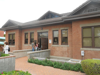
benson arizona train station
Benson Arizona train station and Visitors Center
Benson Arizona is located along Interstate 10 about 45 miles east of Tucson and only about 24 miles north/northwest of Tombstone Arizona.

The earlier settlement in the area was named the San Pedro River Station on the east bank of the San Pedro River. The San Pedro River has the distinction of being one of only two rivers which flow north from Mexico into the United States. A tribe of Pima Indians called the Sobaipuri who had dwelt there for several hundred years inhabited the San Pedro Valley. A Spanish missionary, Father Kino brought Spanish culture to the San Pedro Valley in 1692. This was years after the Spanish had already settled into New Mexico up along the Rio Grande. Father Kino brought with him not only the missionaries but also herds of cattle.


A Stop on the Butterfield Stage Route

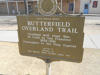
The Butterfield Stage Line followed what was referred to as the Butterfield Trail through southern Arizona. The Butterfield stage depot was constructed in the late 1850's about one mile north of the present day Benson.  This depot required fortification and housed eight soldiers and provided a stopover east of Tucson. As many know, the Butterfield Overland Mail Stage Line had a short lifetime due to the outbreak of the American Civil War. The Butterfield Stage Line was quite unique in as much it traveled the southern route from Missouri to San Francisco in some twenty-six days. The federal mail contract is what put Butterfield in business with passenger transportation being a secondary factor.
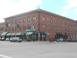
benson arizona photos
Downtown Benson AZ
When the Civil War ended many Anglo settlers migrated to the San Pedro Valley. At the very same time the U.S. Army was at that time fighting a tough campaign against the Chiricahua Apaches from Fort Bowie. Today Fort Bowie is a National Historic Site where visitors can explore the artifacts and ruins. Visitors can tour the ruins of Fort Bowie, view the exhibits inside the visitor center, bird watch, and hike the trails. Fort Bowie National Historic Site is about 73 miles east of Benson Arizona and just south of Interstate 10. The hike to the fort ruins is about three miles.


The Benson-Tombstone Stage Robbery

Almost anyone who has delved into the old west history of southern Arizona has heard about the stage robbery on the Benson-Tombstone Stage Route in 1881. The robbery took the life of stagecoach driver Bud Philpot and became one of the events that led to the Earp-Clanton gunfight at the O.K. Coral.

Interestingly enough, a good part of the old Benson to Tombstone Stage Road still exists today. Some of the route passes through ranch land and other portions through BLM land. During the late 1800's the stage road to Tombstone made a stop at what is today the old silver mining ghost town of Contention City in Cochise County. Today only a few foundations and adobe walls can be found there. The ghost town is now part of the San Pedro Riparian National Conservation Area and is managed by the BLM.

Eventually, a Wells Fargo stagecoach station was established in Benson in 1885.

Events for your Trip Planner

san pedro valley museum
Two Annual Events in southern Arizona to add to your vacation planner include Vigilante Days in Tombstone Arizona On August 9th and 10th 2013. This annual event commemorates a part of Tombstone's unique heritage. Activities include a 10k run, reenactments, street entertainment, gunfight competitions, hangings and a chili cook-off. For more information visit their web site at  www.Tombstone Vigilantes.com

Another date to mark on your calendar is the Benson Overland Stage Festival and Car Show. The date is Sunday October 12th and 13th 2013. On October 12th and 13th will also be the Benson Rodeo. For more information visit website www.bensonvisitorcenter.com


benson arizona restaurants
Horse Shoe Cafe, a great dining stop in Benson
Benson Arizona and the Southern Pacific Railroad

The building of the Southern Pacific Railroad meant the founding of Benson in 1880. Benson history has everything to do with the railroad in as much as the town is named after Judge William S. Benson of California who was a friend of Charles Crocker, president of the Southern Pacific. Crocker was one of the Big Four who built the Central Pacific Railroad which represented the western leg of the first transcontinental railroad.

The gold and silver mining was the original basis for the Benson economy. Several more rail lines were built into Benson that it became somewhat of a railroad hub. For instance, In 1881, Benson became the terminus for the Sonoran Railroad, built by the Santa Fe Railroad, that ran all the way up from the seaport of Guaymas, Mexico. With this amount of traffic and people going through Benson, hotel, saloons, livery stables, merchandising establishments and restaurants grew considerably.

benson az southern pacific depot
Late 1800's photo of Benson's Southern Pacific RR Station
Kartchner Caverns State Park

When you visit Benson Arizona you'll also want to plan a visit at Kartchner Caverns State Park. This is an amazing limestone cave that was discovered in 1974. This is actually a "living cave". Calcite formations continue to grow. Tour guides will offer a fascinating glimpse of this underground landscape. Camping and picnic space is also available. Kartchner Caverns State Park is located 45 miles east of Tucson and 13 miles south of Benson on State Hwy 90.

Links to two additional Western Trips photo articles you'll enjoy are Old Town Tucson and the Tombstone Epitaph.

Benson Arizona Visitors Center

Today, the Benson Arizona train station, also the Amtrak station, which serves the Amtrak Sunset Limited, is filled with all the information you need to have a rewarding and fun visit. The Sunset Limited runs between Los Angeles and New Orleans. The Benson Arizona Visitors Center is located in the middle of town at 249 E. 4th Street. The Visitors Center prides itself at being a beautiful replica railroad depot using many of the same architectural features as the original depot that was built over 100 years ago.

If you're traveling through southern Arizona there's a great deal of interesting stops that were part of the great American western expansion. Lots of historical sites and interesting museums. Benson Arizona is one you'll definitely want to add to your Arizona trip planner.

(Photos from author's private collection)
View Larger Map

Tuesday, March 26, 2013

Old Tucson


congress hotel old town tucson
Hotel Congress, Old Town Tucson AZ
There's one thing about Tucson Arizona that differentiates it from many of the other towns in southern Arizona and New Mexico. While the Southern Pacific Railroad certainly added to the growth of Tucson, the difference is that Tucson was a key settlement long before the arrival of the railroad.

At one time a Papago Indian village stood where present day Tucson is. The first Jesuit priest visited the Tucson area in 1692 and the Franciscans followed after that. In 1775 the Spanish constructed a fort at present day Tucson. So where some towns grew in direct relationship with the Southern Pacific Railroad, the story of Tucson is very different. During the American Civil War years, at one time Tucson served as the capital of the Confederates western Arizona region.


tucson arizona train station
Tucson Arizona train station
Any road trip through southern Arizona should include a stop in Tucson. In fact, there are so many things to do in Tucson that a visit certainly warrants more than just one day. Located along Interstate 10, Tucson Arizona is certainly an easy place to reach. The La Casa Cordova is Tucson's oldest house and highlights the city's Spanish and Mexican heritage. At the same time, the Old Tucson Studios testify to Tucson's connection with the wild west frontier.

Old Town Tucson is a good place to begin your visit. Like many Old Towns around the United States, the location usually represents the immediate area where the town was first established.


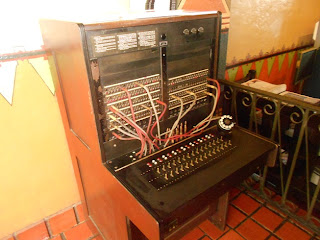
old telephone switchboard
Old Telephone switchboard at Hotel Congress
Hotel Congress

Now here is an old hotel with quite a history. The Hotel Congress, located in Old Town Tucson and across the street from the Tucson train station, in itself is a living piece of Tucson history.

The Hotel Congress is a historic building located in downtown Tucson and built in 1919. The train station directly across the street at the rear of the hotel was constructed in 1907. The Hotel Congress building was added to the National Historic Register in 2003. The hotel is a valuable part of the Old Tucson community.


Hotel Congress and John Dillinger

One of the best stories regarding the history of the Hotel Congress dates back to 1934 and involves the bank robber John Dillinger. Apparently Dillinger and his gang traveled out to Tucson after committing a series of bank robberies. Their intent was to hide out for awhile and let things cool down. The gang of course checked into the Hotel Congress using aliases. What they couldn't control was a fire that started in the basement of the hotel and spread up to the third floor where they were staying. After being contacted by the front desk regarding the spreading fire the gang escaped via the hotels fire escape ladder. The gang was captured when they tried to retrieve luggage from the fire officials. As it turned out for Dillinger, he was eventually transferred to an Indiana jail where he managed to escape from. Eventually Dillinger met his end at the hands of federal agent Melvin Purvis in Chicago.


Tucson arizona hotel congress interior
Hotel Congress lobby area
The Hotel Congress is conveniently located downtown and is extremely well restored right down to the rotary dial phones in the rooms. The Hotel Congress is also home to a Tap Room, the music venue Club Congress and an excellent restaurant. Club Congress is a music venue attached to the historic hotel. The music venue was opened in 1985. You'll also find a great patio for food and beverages and it's a good place to people watch.  It's a very active hotel and if you're looking for a great time all under one roof in Old Tucson then the Hotel Congress should be on your Tucson trip planner.


The Old Tucson Studios

This is a site you want to be sure to visit when in Tucson Arizona. The Old Tucson Studios is a replica of an old western town that was built in 1939 for the movie "Arizona". The studios have also been used for many western movies and TV films. The studios offer visitors stage coach rides as well as rides on a narrow gauge railroad. Also see the staged old west gunfights and stunt performances. Also see Old Tucson’s very own “silent” movie star, The Reno locomotive. The locomotive is stationed at the north end of Old Town Tucson. The Reno has more than 100 film and television credits. From Interstate 10 exit at Speedway Blvd and head west following signs to Old Tucson. From Interstate 19 exit at Ajo Way (AZ 86) and head west following signs to Old Tucson.


southern pacific locomotive
Southern Pacific locomotive #1673
The Southern Arizona Transportation Museum

The Southern Arizona Transportation Museum is also located in Old Town Tucson adjacent to the train station. The museum address is 414 N. Toole Ave. Tucson, AZ. Here you can explore much of the town's railroad history regarding the Southern Pacific Railroad.  

Outside of this Old Town Tucson museum is the famous Southern Pacific Railroad locomotive #1673. Southern Pacific locomotive #1673 is one of 105 of its type originally numbered 1615-1719. During it's operation on the Southern Pacific it traveled over one million miles, primarily in freight service in the Southern Arizona region. The locomotive was built by Schenectady Locomotive Works in New York in the year 1900. The SP locomotive #1673 was retired in 1955 and donated to the city of Tucson. In December of 2000, the old engine and tender were brought home to the historic Southern Pacific depot in downtown Old Town Tucson.

Links to three additional Arizona Western Trips photo articles you'll enjoy are a visit to Old Town Scottsdale Arizona ... a visit to historic Prescott Arizona.and Hiking the Crescent Moon Ranch Trail in Sedona

(Photos from author's private collection)
View Larger Map

Saturday, March 23, 2013

Railroad Museums


Whenever you visit the western United States you're going to have many opportunities to visit railroad museums. Many are located in old historic train depots and others are in dedicated railroad museum buildings. Western Trips has visited several of these very interesting museums and we wish to share some of the fine displays we've come across.

old ctc railroad control
CTC System on display in Tucson AZ
Some of the fascinating displays at several of these museums are of vintage railroad equipment. This was vital equipment for an expanding railroad system and equipment manufactured before the digital age although during it's time the equipment was considered state of the art.

Before the advent of today's Advanced Train Control System there were structures or sometimes called towers which housed a system of gears and switches that were used to keep trains on the right track and avoid disastrous collisions.


railroad control panels
Railroad Control Panel Exhibits

If your road trip plans happen to take you to Tucson Arizona, you may want to stop by and see the switching control panel exhibit on display inside the Tucson Amtrak train station. The control panel shown above and to the right was manufactured by the Union Switch and Signal which was a division of the Westinghouse Air Brake Company.

 It is an old Southern Pacific Railroad Dispatcher's CTC Console. The "CTC" stands for Centralized Traffic Control. The exhibit shown here is a relay based CTC. Centralized traffic control for railroads began in 1927 with the New York Central Railroad. The CTC like the one shown here controlled railroad interlockings and the traffic flows in Tucson Arizona.

This CTC display and other old railroad artifacts are inside the Tucson Arizona train station in the Old Town area of the city. Also, the Southern Arizona Transportation Museum is also located in Old Town Tucson adjacent to the train station. The museum address is 414 N. Toole Ave. Tucson, AZ.


railroad switch lamp
Railroad switch lantern lamp
Railroad Lamps and Lanterns

There was a time that railroad safety relied on the use of lanterns and lamps. This was the time before digital traffic control and GPS. This was also a time after semaphores were used to control rail traffic. Semaphores came into being during the 1860's. As far as the lamps were concerned, the color of the light pretty much told the story. Railroad lamps and lanterns communicated signals at night between trains and stations. Without a signal system set in place there is essentially no way for a railroad to operate.

Railroad lamps and lanterns came in a variety of styles. The lamp shown in this article is a color light switch signal lamp. This is entirely different than the single light railroad lantern where the positioning and or movement of the lantern itself  by the railroad man conveys a command.

railroad signal lanterns
Signal lamp and lantern styles and uses
The color light railroad lamps would be positioned at various points along the rail track. These were meant to be in fixed positions and not hand held. The lamps function was to tell the condition of the track ahead of the train. To give you an idea of how many different railroad lamps and lanterns there were and are, these include classification lamps, train order lamps, bridge lamps, marker lamps, and switch lamps.

A switch lamp's position was mechanically linked with the position of the railroad switch, so that the lamp automatically indicated which way the switch was aligned. The accurate position of the lamp was essential for a train to pass safely. The kerosene fuel for the lamp had to be refilled regularly by nearby railroad employees. Although kerosene lamps were still used into the 1950's, electric lighting for these lamps became common in the 1890s-1900s especially along very busy routes.

The diagram above shows some of types of railroad signaling and devices. A fine museum with a great collection of vintage railroad equipment is found in Frisco Texas, a northern Dallas suburb.  The Frisco Heritage Museum in Frisco Texas is a good addition to your Dallas or northern Texas trip planner. Part of the railroad collection at the Frisco Heritage Museum are china dining sets that were used on the Atchison Topeka and Santa Fe Railroad in their Fred Harvey dining cars.

Links to four additional Western Trips photo articles you'll enjoy are the famous Santa Fe Railroad Super Chief, the Atchison Topeka and Santa Fe Railroad historic dining cars, a trip on Amtrak's Coast Starlight which operates between Los Angeles and Seattle. and Railroad Square in Santa Rosa CA


new mexico  rail runner model train
NM Rail Runner model train in Belen Harvey House Museum
The San Francisco Chief

The San Francisco Chief was a named train of the Atchison Topeka and Santa Fe Railroad.

One of the best places to learn more about this train and the AT & SF Railroad is at the Harvey House Museum in Belen New Mexico. Belen is Spanish for "Bethlehem".

The museum is also home to the Valencia County Historical Society and the Belen Model Railroad Club which has an amazing model train display filling several rooms in the rear of the museum. If you're a model railroader then a stop at the Belen Harvey House Museum is a must stop if traveling near Albuquerque. Belen is located about thirty-six miles south of Albuquerque on Interstate 25.

The San Francisco Chief began operations in July of 1954. The route was the longest passenger itinerary offered at 2,554 miles between Chicago and the San Francisco Bay Area. The route ran between Chicago and Amarillo Texas where connections could be made. Connections from Amarillo could be made to Lubbock and from Clovis New Mexico to Houston, New Orleans and Dallas/Fort Worth Texas.


 Harvey Girls living quarters
Harvey Girls living quarters exhibit in Belen NM
From Clovis New Mexico the route followed the Belen Cut-Off straight across New Mexico to Belen, Gallup and then to Ash Fork Arizona, west of Flagstaff. At Ash Fork connections could be made to Prescott and Phoenix to the south. The town of Ash Fork was originally established as a siding for the Atlantic and Pacific Railroad during the late 1800's, later to be operated by the AT & SF. From Ash Fork Arizona it was west to Barstow California in the Mojave Desert and then up to Oakland California via Bakersfield, Fresno and Stockton California.

The Harvey House Museum in Belen is a great stop to add to your New Mexico vacation planner. In addition to this excellent museum, the Belen rail yards today are serve as the largest BNSF inspection yard on the southern transcontinental corridor linking Southern California and Chicago. When you visit the Harvey House Museum which faces the BNSF rail yard you'll see quite a lot of rail traffic. It's estimated that about 100 trains per day pass through the Belen rail yards. The BNSF operation today in Belen extends almost three miles in length.

In addition to the above named railroad museums, some very good books on the subject of old railroad operations and equipment include Walking Old Railways by author Christopher Somerville and History of the Atchison Topeka and Santa Fe Railway by author Keith L. Bryant Jr. 

(Photos from author's private collection)

Tuesday, March 19, 2013

Scotttsdale Arizona


downtown scottsdale az
Old Town Scottsdale AZ
Beautiful Scottsdale Arizona

Scottsdale Arizona is one of those Southwest destinations places that is surrounded by the beauty of the Sonoran Desert. Scottsdale, a town with well over one hundred art galleries, a large variety of craft shops and a wide selection of restaurants is one of the most popular of all Arizona vacation destinations. Many people today travel to Scottsdale to take advantage of it's many championship golf courses. Others travel there to take advantage of it's very mild winter weather along with the unique shopping opportunities found there.

Scottsdale and Chaplain Winfield Scott

It's believed that the area of Scottsdale Arizona was at one time occupied by the Hohokam tribe at around 1 A.D. At about the year 1500, the Hohokam, who had constructed canals and were an agrarian society, abandoned the area. It's believed that drought and perhaps internal conflicts caused the abandonment.

Scottsdale, officially incorporated in 1951, is named after Chaplain Winfield Scott, a retired veteran of the American Civil War. Chaplain Scott served as a pastor in Leavenworth Kansas from 1865 to 1872 when he moved to a pastor's position in Denver Colorado. Eventually Scott became an army chaplain at several outposts and retired while posted in Arizona in 1888.

bischoffs gallery scottsdale
Bischoff's At The Park Gallery
Scott bought farmland at this arid location north of Tempe in the year 1889. Scott did well in promoting the fertile land which he successfully produced fruit from and by the year 1896 there were enough families in the area that a school system was established. Many of the settlement's original settlers recruited by Scott from the East and Midwest were educated and fostered cultural activities. The towns people also did a great deal during the early 1900's in supporting artists and writers. Ranching also took hold in the area especially after 1916 when a local businessman began ranching on some 44,000 acres north of the town site. This ranch, the DC Ranch operated continually through the 1950's.

Winfield Scott was one of the Salt River Valley's most successful growers and shippers. The location was favorable for fruit growers because of it's irrigated desert location and mild climate. Scottsdale has always been dependent on ground water for it's overall water supply. Today, Scottsdale meets its water demands primarily with surface water.


scottsdale historical museum
Scottsdale Historical Museum
The Scottsdale Boom

In 1947, Scottsdale established their Chamber of Commerce for the goal of attracting tourism and to enhance it's identity to the Old West. The Scottsdale Chamber adopted the slogan " West's Most Western Town".

Most point to the 1970's as the start of the real boom years for Scottsdale. As an example, in 1960 Scottsdale had about 10,000 residents. Ten years later in 1970, Scottsdale boasted some 67,000 people. By 1970 the town also increased it's land size by twelve times it's original. An interesting fact is that in 1970 Scottsdale also had about 7,000 horses which by law had the right of way over motorized vehicles. Scottsdale Arizona is bordered by Phoenix to the west and the McDowell Mountains on the east.


Old Town Scottsdale

Today, the popular commercial district is named Old Town Scottsdale, a very unique business area with palm trees and flower beds. Old Town Scottsdale is located on the original town site of Scottsdale at the southeast corner of Scottsdale and Indian School Roads. A walk through Old Town takes you back to the western days when the town was established more than 100 years ago.

scottsdale blacksmith shop
Blacksmith Shop, Old Scottsdale
The story of the blacksmiths shop you'll see today at the southern end of Old Town was that it was originally approved  to only be built on the edge of town by the town fathers who didn't relish it in the middle of town. This was not a requirement in most any other western town.

Links to two additional Western Trips photo articles about Arizona attractions are a Visit to Prescott Arizona and Downtown Flagstaff.


Sites to See in Old Town Scottsdale

Old Town Scottsdale offers many good restaurants, nightclubs, bars, hotels, stores, activities, and of course, people watching.  There's plenty of art galleries and if you're looking for a unique piece of southwest jewelry you'll find it in one of Scottsdale's unique shops.According to the city's web site Scottsdale’s vibrant downtown is considered the finest urban center in Arizona. It is home to more than 90 restaurants, 320 retail shops and more than 80 art galleries.

Among the sites to add to your Scottsdale Arizona vacation planner is the Scottsdale Historical Museum located at 7333 E Scottsdale Mall in the center of Old Town. The museum is housed in a 1909 grammar school building. Permanent exhibits in the museum is the Winfield Scott Exhibit, the One Room Schoolhouse, an antique barber chair, a tent kitchen display and many more items from Scottsdale's past.


scottsdale az carriage rides
Carriage rides in Old Town Scottsdale
The Old Adobe Mission Church. The church is located at 7655 East Main Street near the south end of Old Town. The Old Adobe Mission, established originally as Our Lady of Perpetual Help Church, celebrated it's first mass in 1933. This was the first Catholic church in Scottsdale. The church became a parish in 1948.

Taliesin West.  This was architect Frank Lloyd Wright's winter home and studio. The home is on 550 acres at the foothills of the McDowell Mountains. See the gardens, terraces and walkways which connect the buildings. The site is located at 114th St. and Cactus Road.

Scottsdale Civic Center and Mall. See sculptures and fountains and a pond among landscaped lawns. On the mall is the Scottsdale Center for the Performing Arts. The mall location is at Drinkwater Blvd and 2nd Street.

For those desiring to take a walking tour of Scottsdale, walking tour guide maps are available at the Scottsdale Chamber of Commerce.

Scottsdale’s McDowell Sonoran Preserve which is located on the northern border of the city is the largest urban wilderness area in the United States and offers more than 60 miles of trails through the scenic desert terrain.

If your Arizona vacation plans happen to take you to the Phoenix area you will want to add Scottsdale to your trip planner. Scottsdale is a terrific place to visit, perhaps take a carriage ride, and snap plenty of good photos.


(Photos are from author's private collection)

Sunday, March 17, 2013

Attractions in Arizona / Prescott


prescott arizona
Along the plaza, Prescott Arizona
Attractions in Arizona are aplenty and the scenic city of Prescott is one of them. 

Prescott Arizona is located in a very scenic area of north central Arizona. This mile high city was at one time the capital of Arizona Territory. Here at Prescott you can enjoy four mild seasons and enjoy events that are scheduled throughout the year. Like many small cities in the southwest, Prescott offers plenty of recreational opportunities as well as fun boutique shopping, great restaurants and a long history. Prescott is a nice blending of old west history and a very enjoyable climate. Adventure and culture can be found everywhere around Prescott.

Prescott Arizona had its start in the Spring of 1863 when Joseph R. Walker and a group of explorers and prospective gold miners arrived near the headwaters of the Hassayampa River. On May 10, 1863, at a location some six miles south-southeast of this current Prescott Plaza, twenty-five members of the Walker Prospecting and Mining Company created regulations and laws that would form the first government of the first Arizona mining district in what eventually would be Yavapai County.

hotel st michael prescott az
Historic Hotel St. Michael
  
An Important Town in the Arizona Territory

Very unique to Prescott, the town is known as a settlement that was built entirely of wood and inhabited entirely by Americans. This indeed was unique to the southwest. The town received it's name in honor of William Hickling Prescott, an American historian. Among Prescott's books were The History of the Reign of Ferdinand and Isabella the Catholic and The History of the Conquest of Mexico. William Hickling Prescott was also a colonel during the Revolutionary War known famously  for his order to his soldiers, "Do not fire until you see the whites of their eyes".

Prescott became the capital of the Arizona Territory in 1864. The town held that title until eventually losing it's capital status in 1867 to Tucson. Eventually the capital would be moved to Phoenix in 1877. This would have been a few years after the Confederate occupancy of southern Arizona during the American Civil War. Prior to 1864 the Arizona Territory was a part of the larger New Mexico Territory. During these years, Prescott had it's share of old west characters and events. Visits by both Doc Holliday and Wyatt Earp and far too many stagecoach robberies were all part of Prescott's and the new territory's history.


sharlot hall museum prescott
Sharlot Hall Museum
Visiting Prescott AZ

In addition to some very historic structures in Prescott are several excellent museums you'll want to stop at. These include the Sharlot Hall Museum named after it's founder, Sharlot Mabridth Hall. The poet activist and politician is recognized as Arizona's very first historian. By 1907, Sharlot Hall was determined to save Arizona's history and began plans for the museum. The museum exhibits include seven historic buildings as well as a fine collection of both Native American and pioneer artifacts. The museum and it's grounds, located just one block south of the Prescott plaza is also the site of numerous public events and festivals.


The Phippen Museum, a fine arts museum, is another stop to add to your Prescott Arizona trip planner. The Phippen Museum hosts an Annual Western Art Show and Sale, usually around May, that also includes a live auction. Artists include both new and established names who create art of the American West. The Phippen Museum also offers public tours of it's current exhibits the first Saturday of every month.

prescott az plaza
"Rough Riders" statue in Prescott AZ Plaza
Remarkably, Prescott Arizona now has some 800 structures on the National Register of Historic Buildings. Exploring some of these is another fine addition to your Arizona vacation planner. The historic Hotel St. Michael on Prescott's Whiskey Row was built on the same site of the smaller Hotel Burke which burned down in 1900. Whiskey Row was an infamous downtown district up until 1956. The brick and stone Hotel St. Michael opened it's doors in 1901 as a luxury accommodation and included as guests such well known figures as author Zane Grey and western actor Tom Mix. The Hotel St. Michael, located on the southwest corner of the square opposite the courthouse is a very good example of western architecture of the early 1900's. The downtown plaza on which the Hotel St. Michael and other historic buildings are located  is known as the heart of Prescott.


Yet another must see visit is to Mount Vernon Street. This is where you'll view Prescott's numerous restored Victorian homes. Several of these are now bed and breakfast inns. The Mount Vernon Street District is located west of the courthouse and contains numerous original Victorian homes on it's tree shaded street.

whiskey row in prescott arizona
View down Prescott's historic Whiskey Row
If you're planning on visiting Prescott Arizona during the summer months you may want to check out the rodeo held during the Prescott Frontier Days in early July. Prescott has the distinction of being the location of the World's Oldest Rodeo which celebrates it's 126th year in 2013. 

Links to three additional Arizona Western Trips photo articles you'll enjoy is a Visit to Montezuma Castle National Monument just a short drive east of Prescott ... Visit to Downtown Flagstaff Arizona....and Hiking the Crescent Moon Ranch Trail in Sedona

Getting to Prescott Arizona

Prescott is located in the Bradshaw Mountains in central Arizona. The city is located about 90 miles north of Phoenix. Both Phoenix and Flagstaff Arizona to the north is about a one and one-half hour drive from Prescott.  From the Arizona towns of Sedona and Jerome, Prescott is about a forty-five minute drive.

From Phoenix, take Interstate 17 north to the AZ 69 exit and go west. From Flagstaff to the north, take Interstate 17 southbound to the AZ 169 exit and go west.

For a fun, adventurous and historical trip to Arizona make sure to add Prescott to your Attractions in Arizona to visit vacation planner.

(Photos from author's private collection)


View Larger Map

Monday, March 11, 2013

Mesilla NM and the Mesilla Valley


mesilla new mexico church
Basilica of San Albino
Mesilla New Mexico is both the most visited old community in southern New Mexico as well as one of the most historic. If your travels through New Mexico take you through the southern part of the state, a stop at old Mesilla is well worth your time. Old Mesilla, founded around 1849, which at one time was the most populated settlement between San Antonio and San Diego, is located just a few miles south of Las Cruces NM.

Mesilla, A Very Unique Location

Mesilla's location placed it in the direct path of many historical events of the mid 1800's. Some of these included the border dispute with Mexico itself after the end of the Mexican American War. Add to this the fact that Texas actually made claim to the area before the Civil War and then the invasion by Texas Confederates during the early years of the American Civil War. In addition, during the days of the New Mexico Territory, Mesilla's distance from the capital at Santa Fe and the more populous northern New Mexico area meant that lawlessness was a major factor to contend with not to mention a running battle with various Apache tribes.

old mesilla nm courthouse
Site of old Mesilla courthouse on the plaza
As to the legality of it's location, Mesilla New Mexico officially became a part of the New Mexico territory only after the Gadsden Purchase was consummated in the 1850's. This was when the U.S. paid Mexico (Santa Ana) seven million dollars to secure a strip of land extending from the Texas border westward to Yuma Arizona. The Gadsden negotiations finally settled where the U.S. border would be with Mexico. It was also the last time the U.S. would acquire land as part of "Manifest Destiny".

Mesilla New Mexico also has the distinction of having been along the old Butterfield Stage Coach route which operated for a short time just prior to the Civil War. There was a lot of history in this small area of southern New Mexico.

Another interesting fact about Mesilla NM is that at one time the town was along the west bank of the Rio Grande but due to flooding, and a new course set by the river, the town ended up east of the river.


mesilla new mexico plaza
Shops along the historic Mesilla plaza
The Confederate Invasion and the Apache Wars

The Apache tribes were another significant issue for Mesiila NM as well as that of the entire Mesilla Valley. Apache raiding was a major problem for the settlement of Mesilla as well as neighboring ranches and settlements in the valley. The onset of the Civil War made the matter worse. While the Confederates from Texas swept into the valley along with the subsequent closure and capture of Union forts in the region, the Apache raiding increased. The Confederate forces assumed the task of protecting the civilians from Indian attack, but because they were preoccupied with the Civil War itself, civilians were generally left to their own protective devices.

A good many civilians who occupied the Mesilla Valley were Confederate sympathizers. The local Mesilla newspaper ran editorial after editorial supporting the southern cause as well as a push for a new Arizona Territory.

butterfield stage line in new mexico
Butterfield Stage Coach marker on Mesilla plaza
For years during the late 1850's there were several efforts by people in the southern part of the territory to carve out their own government as the "Arizona Territory".  This actually occurred when the Confederates invaded and took temporary control of southern New Mexico Territory naming Mesilla it's capital. This all went on while the Apache Wars were in full swing. If anything, the Civil War and the temporary withdrawal of U.S. troops made the Apache matter much worse for Mesilla Valley residents. It seems that the Confederates had no better luck, and probably worse luck, than that of the Union forces in trying to quell the Apache raids.

Links to more Western Trips photo articles you'll find interesting are An Adobe Home and the historic town of Las Vegas New Mexico.


colonel ountain home in mesilla nm
Renovated Colonel Albert Jennings Fountain home
Visiting Mesilla NM

When you drive to old Mesilla, one of the first things you'll notice is the beautiful cathedral on the north end of the plaza.This is the Basilica of San Albino.The church was originally built of adobe in 1855 and the current structure was erected in 1906. The church was designated a basilica in 2008.

Another very interesting and historic structure is the old home of Colonel Albert Jennings Fountain. Colonel Fountain moved to Mesilla in 1873 and practiced law. He served as a member of the territorial legislature, a judge, a special prosecutor, a district attorney and a deputy court clerk. Fountain was a staunch Republican. The old Colonel Albert Jennings Fountain family home was located two blocks northwest of the Mesilla plaza. The restored and renovated home is now privately owned.

In 1896, Colonel Fountain and his eight year old son disappeared in the White Sands area while returning to Mesilla from Lincoln New Mexico after Fountain helped in the prosecution of notorious local cattle rustlers. Neither Colonel Fountain nor his son were ever found. While some evidence of wrong doing was discovered along and off the trail. Three suspects were eventually brought to trial but were acquitted for lack of evidence. The disappearance and suspected murders had both criminal and political overtones. A very good book on Colonel Albert Jennings Fountain and the circumstances of he and his sons disappearance is Murder on the White Sands: The Disappearance of Albert and Henry Fountain by author Corey Recko.

oldest brick structure in new mexico
Oldest brick structure in New Mexico
The Oldest Documented Brick Structure in New Mexico can be found on the southwest corner of the Mesilla plaza. The structure was built in 1860 by Augustin Maurin using bricks from his own kiln. He was murdered in his apartment by robbers in 1866.

On the southeast corner of the plaza is a structure which reportedly was at one time the courthouse which was the venue for the trial of Billy the Kid for the murder of Sheriff Brady of Lincoln. The structure today houses the Billy the Kid Gift Shop. A few doors down from the old courthouse is the William Bonney Gallery which housed the jail where Billy the Kid was held during his trial.

Just south of the Mesilla plaza is the Fountain Theatre. The Fountain family operated the Mesilla Valley Opera House and also built the Fountain Theatre. Today the theatre is operated by the Mesilla Valley Film Society.

Old Mesilla makes an excellent addition to your New Mexico road trip. As mentioned above, Mesilla and the Mesilla Valley happened to be at the crossroads of many very significant southwest historical events. Mesilla and Las Cruces New Mexico are located near the intersection of Interstate 10 and Interstate 25 and just a short distance north of El Paso Texas.

(Photos from author's private collection)


View Larger Map
Saturday, March 9, 2013

California Hiking Trail / Joshua Tree National Park


california hiking trail
Start of the Mastodon Peak Trail
Western Trips had the opportunity to visit one of California's most unique National Park. Joshua Tree National Park located in Southern California is a great visit for anyone looking for a fun California hiking trail plus a site with scenic geological forms and quite unique vegetation. If these are what you're looking for as part of a Southern California road trip, then Joshua Tree National Park makes a fine addition to your trip planner.

The Meeting Place of Two Deserts 

The Colorado Desert,, a western extension of the Sonoran Desert, is found in the southern and eastern parts of the park. The southern boundary of the Mojave Desert reaches across the northern section of the park.

The Colorado Desert is of lower elevation than the Mojave. Most of the desert lies below 1,000 feet elevation. It's lowest point is in the Salton Sea at 275 feet below sea level. The area is known for it's strong winds and rather sparse rainfall. From northwest Mexico, the Colorado Desert, a part of the Sonoran Desert, encompasses approximately 7 million acres.


joshua tree national park
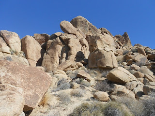
Rock outcroppings, Joshua Tree Nat'l Park'
The Mojave Desert spans an area that includes southwestern Utah, southern Nevada, northern Arizona and southern California. While the Mojave is the highest of the two deserts averaging an elevation of between 2,000 and 5,000 feet, it's lowest point is found in Death Valley at an elevation of minus 282 feet. As with the Colorado Desert, the Mojave Desert is known for it's strong winds and sparse rainfall. 

Hiking Trails

Joshua Tree National Park features six official hiking trails. They are the 16 mile round trip Boy Scout Trail, the 3 mile round trip 49 Palms Oasis Trail, the 4 mile Lone Horse Mine Trail, the 7.2 mile Lost Palms Oasis Trail, the 3 mile Mastodon Peak Trail and the 3 mile Ryan Mountain Trail. In addition to these , thirty-five miles of the California Riding and Hiking Trail pass through Joshua Tree.

The trail featured in this article is the Mastodon Peak Trail which is in the southern section of the park. Like many of the Joshua Tree hiking trails, part of the fun is in the history that surrounds the entire area. The Mastodon Peak Trail is a three mile loop which begins at Cottonwood Spring. Cottonwood Spring is located just seven miles from the park's south entrance and at one time was an important water stop for miners and freighters. The first mention of Cottonwood Spring goes back to an 1875 gold mine claim. Because water was a necessity for mining, several gold mines were located in the area of Cottonwood Spring.

mastodon mine in california
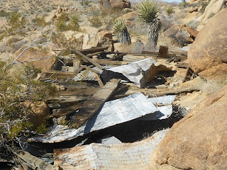
Remains of old Mastodon Mine
The Mastodon Peak Trail leads you to the peak where you'll have one of the best views in the park. To the southeast is a very good view of the Salton Sea. Near the peak you'll also come across the old sealed off Mastodon Mine. The mine was constructed in 1934 and had a 45 foot inclined shaft. The Mastodon Mine was owned by the Hulsey family until 1971. At that time the mine and property was taken over by the National Park Service.

The Mastodon Peak Trail is an interpretive trail that highlights a great deal of the desert flora and fauna. This particular hike is easy to combine with the Lost Palms Oasis Trail. The trail runs through a canyon with many palm stands. Both trails begin just off the Cottonwood Spring parking lot. Like with all hiking trips, the National Park Service advises to stay on the trails and bring along plenty of drinking water.

Bicycling is allowed in the park on both paved and unpaved roads but is not allowed on hiking trails.


joshua trees
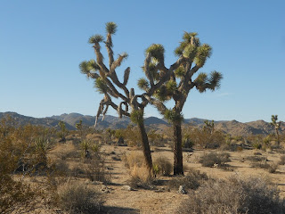
Joshua Trees in the scenic desert park
Joshua Trees

Joshua Tree National Park is an 800,000 acre desert park. The unique Joshua Tree is found in the western section of the park. The name "Joshua Tree" was first given this particular plant by the Mormon settlers who traveled across the Mojave desert in the mid 1800's. The name was chosen because it reminded the settlers of a bible passage where Joshua raises his hands to the sky in prayer. The Mormon settlers traveled to the area of today's Joshua Tree National Park with the goal of raising cattle and gold mining. The limbs and trunks of the Joshua Tree were used for fencing and corrals. The tree was also used for fuel for the steam engines used for ore processing.

The Joshua Tree is a member of the Agave family. The Joshua Tree is a monocot in the subgroup of flowering plants that includes grasses and orchids. The Joshua Tree starts life by seeding along with the required well timed rains. Along with this, the tree requires a winter freeze. It's thought that the freeze damages the growing end of the branch and allows for flowering. The flowering then creates more branches. The Joshua Trees you'll see inside the park which are straight stalks indicate that they never bloomed. The tallest Joshua Tree within the park stands some forty feet tall.

The Joshua Tree is an important part of the overall Mojave Desert ecosystem. The Joshua Trees provide a home for several insects, mammals, birds and lizards.

Links to two additional Western Trips articles you'll enjoy is the story of Death Valley Scotty and Scotty's Castle and the Rhyolite and Goldfield Nevada Mining Boom.


joshua tree national park visitor center
Visitor Center at Twenty Nine Palms, CA
Visiting Joshua Tree National Park

The park is located about 140 miles east of Los Angeles California. Two park entrances to Joshua Tree are off California Hwy 62 at the towns of Joshua Tree and Twenty Nine Palms. The third entrance is at the south end of the park off Interstate 10 about a thirty three mile drive east of Indio California.

A visit to Joshua Tree National Park offers a multitude of experiences. Whether you're hiking the scenic trails, camping at one of the park's campgrounds, exploring the truly unique desert flora and fauna, some of which is only found at Joshua Tree, or enjoying the rugged rock outcroppings and historic sites, Joshua Tree National Park is the perfect addition to your southern California family vacation planner.

(Photos from author's private collection)
View Larger Map
Wednesday, March 6, 2013

Montezuma Castle / Arizona


montezuma castle arizona
Montezuma Castle
Western Trips had the opportunity to explore one of the most fascinating cliff dwelling locations in the southwest. Montezuma Castle is a must stop when touring Arizona and is very easy to reach. Located about 95 miles north of Phoenix Arizona and about 56 miles south of Flagstaff and just a few miles east of Interstate 17, Montezuma Castle features a well preserved village carved into the rock about one hundred feet high. This site is considered one of the best preserved in all of North America. Bring your camera along during your visit and you'll be able to get some amazing photos.

The twenty room Montezuma Castle is considered the showpiece village although the National Park Service points out that at one time there were perhaps eighty-five additional rooms to the ones you see today. It's estimated that some 150 people inhabited the village at one time.

When you visit Montezuma Castle you are experiencing the world of the Pre-Columbian Southern Sinagua. This was a prehistoric culture who lived as hunters and gatherers in the Verde Valley for thousands of years. Advances in both agriculture and architecture in the valley are credited by the influence of the Hohokam tribe residing to the south and the the Northern Sinagua peoples to the north.

montezuma castle cliff dwellings
Cliff dwellings built under protruding rock
The Life of the Cliff Dwellers

There are no written accounts as to the daily life of the cliff dwelling people of this age however there is a lot of speculation as to what it would have been like. Residents may have entered through the door and then used ladders to go from room to room. A family may have resided in one room with little furnishings and mats to sit and sleep on.

Occupations that were prevalent were agriculture and weaving as well as hunting and gathering. The hunting and gathering supplemented the first two. Which tribe member was responsible for what task most likely depended on age and stature within the village. Inhabitants were known to have grown corn, beans, squash and cotton. The second occupation was weaving using the cotton grown in the valley. The cotton grown there turned out to being some of the finest cloth in all of the southwest. This cloth and salt which was excavated from nearby mines were traded among neighboring tribes. Many of these tribes traveled hundreds of miles along the river that led to the general site of Montezuma Castle.

montezuma castle national monument
Montezuma Castle paved hiking trail
It's thought that the women created pottery mostly for storing food. They may have also added plaster to the walls that kept insects out and protected the structure.

Families would grind corn, make baskets and pottery and dry skins. 

At night, the cliff dwellers lit fires within their rooms for heat and a glow was seen out side the windows and doors. 

The Cliff Structures

Montezuma Castle is noted for it's "T" shaped doors. Interestingly enough, the T shaped doors is common with the Puebloan people who occupied the Four Corners region but not so with those from central Arizona.  Archeologists are uncertain whether this was an original door or added on to later.

Cliff Dwellings were typically built under protruding portions of cliffs. At Montezuma Castle these are limestone cliffs. These cliff dwellings and the surrounding area of 826 acres were declared a U.S. National Monument in 1906.

beaver creek arizona
Beaver Creek flowing past cliff dwellings
Leaving the Ancient Cliff Dwellings

Some stories contend that the ancient people of the southwest vanished sometime around 1425 A.D. What is known is that during the late 1300's many societal changes took place and the native population decided to move. As to why the exodus took place is still not fully understood and archeologists continue to study the subject. The reasons could be one or a combination of several occurrences. Changing climate, depletion of water resources, religious differences, disease, could all be reasons to explain the exodus. The National Park Service however points out that, at least in the case of Montezuma Castle, inhabitants may have left the village in small groups over time. There is no single date known when everyone left at one time. It's thought that many joined together to become the modern day Hopi and Zuni tribes.


Interesting links to additional Western Trips photo articles relating to the southwest cliff dwelling peoples include the Puye Cliff Dwellings in New Mexico, Bandelier National Monument just north of Santa Fe New Mexico and Mesa Verde National Park in southwestern Colorado. 

Visiting Montezuma Castle National Monument

Montezuma Castle National Monument is open seven days a week from 8A to 5P. The park is closed on Christmas Day.

montezuma castle cliff dwellings in arizona
Montezuma Castle Visitor Center
Start your exploration of Montezuma Castle in the park's Visitors Center. Entrance fees for Montezuma Castle are collected inside the park Visitor Center. Inside the visitor center of Montezuma Castle National Monument you will find a fully stocked bookstore operated by a private, non-profit organization called Western National Parks Association. All of the profit from those sales stays in the park to help support park operations. The Visitor Center museum includes exhibits and artifacts including tools that  depict the lifestyle, history and culture of the Sinaguan Indians who built Montezuma Castle.

Ranger programs are offered daily and a self-guided, 1/4-mile paved loop trail leads you past an incredible 5-story cliff dwelling, through a fascinating sycamore grove and along spring fed Beaver Creek, one of only a few perennial streams in Arizona.

Montezuma Castle is a great addition to your Arizona vacation planner and is a fun and educational visit for the entire family. As mentioned above, it's location just off Interstate 17 and between Phoenix and Flagstaff make visiting the monument easy.

(Photos are from author's private collection)


View Larger Map