Western Trips

Showing posts with label Native Americans. Show all posts

Saturday, January 10, 2015

Killdeer Mountain Four Bears Scenic Byway / North Dakota Travel

The 64 mile Killdeer Mountain Four Bears Scenic Byway is found in one of the most scenic areas of western North Dakota. This scenic byway runs from north of Manning, ND, to Highway 22 through the town of Killdeer to Highway 23, then east of New Town, ND.

Scenery along the Scenic Byway
Not only is this a very scenic drive but there are also several interesting stops along the way to make your North Dakota trip a fun and educational experience.

Below we have highlighted just a few of the many sites to visit along the Killdeer Mountain Four Bears Scenic Byway.

The Fort Berthold Indian Reservation  
 
The Fort Berthold Indian Reservation is home to the  Mandan, Hidatsa, and Arikara Native Americans and is located in New Town, North Dakota on the Missouri River system.. The total area of the reservation is approximately 980,000 acres. 

The first to arrive in this area were the Arikaras in the late 1700's.  They were joined later by the Hidatsa who were originally a part of the Crows who left the Hidatsa and relocated further west. The Mandans were originally from the Ohio Valley before moving west. The Mandans were described in detail in the Lewis and Clark Journals. 


Mandan Dance Lodge at Fort Berthold
Three Affiliated Tribes Museum

The Three Affiliated Tribes Museum is located four miles west of New Town, ND along Hwy 23. Make a stop here and see their collection of exhibits and learn about the history and culture of the
Mandan, Hidatsa, and Arikara Native Americans. 


This museum located on the Fort Berthold Indian Reservation about 4 miles west of New Town, ND on Hwy 23. The museum's collection will give you a good idea of the life and history of these Native American tribes.
 

Little Missouri State Park
 
Here is an excellent place to view the rugged Badlands terrain in western North Dakota.

The Little Missouri State Park is located 17 miles north of Killdeer, ND on Hwy 22.. Most of the Little Missouri State Park is only accessed by hiking or horseback. This makes the park unique plus there's 47 miles of trails. Horses can be rented at a stable next to the park. The park's size is 4,592 acres and camping is allowed with some sites offering electricity and some sites more primitive.


 The Killdeer Mountain Battlefield State Historic Site

Located about 10 miles northwest of Killdeer, North Dakota is the  Killdeer Mountain Battlefield State Historic Site.

The battle took place on July 28-29, 1864. The opponents were about 2,200 U.S Army troops against the Santee and Teton Sioux. While this battle took place during the time of the American Civil War, the aim for the U.S. Army Cavalry was to attempt to put down ongoing trouble with the Sioux. The Sioux in this area had fled Minnesota earlier. This battle was actually a reprisal for the Sioux troubles in 1862 Minnesota that resulted in the largest mass hanging in U.S. history in Mankato. See our Western Trips article on the Minnesota Massacre on the link below...

The Minnesota Sioux War of 1862

 
While the Sioux put up a strong fight, the tide turned for the Union troops and the Sioux eventually began to flee in what would be about a nine mile running battle in all directions. Many Sioux were killed in battle but also many escaped along the rugged terrain. The Battle of Killdeer Mountain was a resounding victory for the army but as settlers and miners continued heading west over the ensuing years, the war certainly wasn't over. Custer's Battle of the Little Bighorn against Sioux tribes would occur some 12 years later.

There is a sandstone slab monument and flagpole mark part of the July 28, 1864, battlefield.  Two headstones honor soldiers who were killed in the cavalry charge. 


See additional Western Trips articles on the links below..... 

Visit the Old Spanish Trail Highway Through the South 

Drive Idaho's Sawtooth Scenic Byway 

Drive Route 66 in Kansaa

Our reference material and some very interesting reads regarding North Dakota includes.....History of North Dakota by author Elwyn B. Robinson.....Dakota : The Story of the Northern Plains by Norman K. Risjord.....The Warriors of Killdeer Mountain by James Willer.....The Most Scenic Drives in America, Newly Revised and Updated : 120 Spectacular Road Trips by the Editors of Readers Digest. 

Little Missouri River through North Dakota
The Scenic Byways of North Dakota 

North Dakota, traversed by the Lewis and Clark Expedition, was admitted to the Union in 1899. 

Today, North Dakota offers many historic sites and museums, tremendous recreational opportunities plus some of the most beautiful scenery along it's Scenic Byways.

North Dakota has ten scenic byways including the Theodore Roosevelt National Park North Unit Scenic Byway, the Sheyenne River Valley National Scenic Byway, the Turtle Mountain Scenic Byway, the Standing Rock National Native American Scenic Byway and several others. For more detailed information see website.....http://www.parkrec.nd.gov/byways/byways.html


(Article copyright Western Trips. Photos and images in the public domain)

Sunday, April 20, 2014

Visit the Shawnee Mission State Historic Site / Kansas

The Shawnee natives were living in the Ohio Valley as early as the late 1600s. The Shawnees were considered fierce warriors. They were the more feared and respected of Ohio's natives. In fact, the Shawnees battled from the 1600’s until their forced departure from Ohio in 1832.

shawnee indian mission
Shawnee Methodist Mission, East Building
As American westward migration spread from the eastern seaboard settlement the Native Americans were uprooted, a relocation program that would last until at least 1890. Regarding the Shawnees, between the years 1831 and 1833, the U. S. forced the Shawnees to give up their land in Ohio. The U.S. government sent the natives to reservations in Oklahoma and Kansas, a destination for many Native American tribes.

When the Shawnees gave up their eastern lands they received about 1.6 million acres west of Missouri. This was of course west of the frontier line at the time and the area was generally referred to as the Great American Desert.

The Shawnees Request a Missionary

In July 1830 Chief Fish, leader of the Missouri Shawnees, requested a missionary through their Indian agent George Vashon.

The missionary society began in 1830. Reverend Thomas Johnson, a Methodist minister, was appointed missionary to the Missouri Shawnees and his brother William, missionary to the Kansas tribe.

shawnee mission kansas
Shawnee Mission North Bldg.
The Reverend Johnson, who was originally from Virginia, suggested to the missionary society that one central school be built to serve many tribes. A site was chosen was were a branch of the Santa Fe Trail passed through the Shawnee lands. Shawnee Mission was established as a manual training school attended by boys and girls from Shawnee, Delaware, and other Indian nations from 1839 to 1862.

Classes were held six hours each day except Saturday and Sunday. On Saturday teaching was limited to three hours. The boys worked in the shop or on the farm, usually for five hours a day. The girls helped with the sewing, washing, and cooking. The students, as a rule, went to bed at 8 p.m. and rose at 4 a.m.

Mission School Construction

When construction began, about forty hands were employed, and the buildings were soon under way. Brick-kilns were put up for the burning of brick, while some were shipped from St. Louis. Lumber was produced at their own local sawmill.

The manual training portion of the school ceased in 1854. In 1858 Reverend Thomas Johnson turned the school over to his oldest son, Alexander, who ran the mission until it closed in 1862. Shawnee Mission was one of the earliest, largest, and most successful mission schools in pre-Territorial Kansas and the West.

conestoga wagon exhibitThomas Johnson was murdered at his home in Missouri on January 2, 1865. The murderers were believed to have been Southern sympathizers who apparently were angered when Johnson, a pro slavery man for many years, had sworn an oath of allegiance to the Union at the start of the Civil War. Johnson County is named for Thomas Johnson and was one of the first counties established in the Kansas Territory in 1855. Both  the old Oregon-California Trail and the Santa Fe Trail passed through the county.

See the Western Trips articles on the links below...

Remembering the Shawnee Trail

The Minnesota Massacre / Start of the Indian Wars

Visiting Shawnee Indian Mission State  Historic Site / Fairway Kansas

The State of Kansas took over the mission property in 1927. Since that time it has been administered by the Kansas Historical Society. Today it is operated as Shawnee Indian Mission State Historic Park. The location is 3403 West 53rd, Fairway, KS. This is just in the southern edge of Kansas City.

This is a site you will want to add to your western vacation planner. This historic park is quite interesting and makes a great family trip stop. It's a must see when you're in this area of Kansas.

thomas johnson shawnee mission
Rev. Thomas Johnson
Exhibits in the East Building and North Building

Begin your tour in the East Building, which includes the Visitor Center, store, and several exhibits. Discover the story of the Johnson family, Indian agents and missionaries, Kansas settlement, Bleeding Kansas, Overland trails, and the Civil War.

Exhibits in the North Building tell the story of the emigrant Indians in Kansas-—such as the Iowa, Kickapoo, Potawatomi, and Sac and Fox. Objects include woven baskets, beadwork, drums, and other folk art made from techniques passed down through generations of Kansans with American Indian ancestry.

Tours

Site tours are provided by site administrator. For groups of more than 10, two weeks notice is requested. School groups can also schedule guided site tours with two weeks notice.

(Article copyright 2014 Western Trips. Photos and images in the public domain)


Wednesday, February 12, 2014

Visit the Gallup Cultural Center / New Mexico

The Gallup Cultural Center was a project put together by the Southwest Indian Foundation and the city of Gallup New Mexico. If your western travels take you through Gallup you will want to add this venue to your trip planner. You'll find the Gallup Cultural Center filled with exhibits and information about the people who inhabit this part of New Mexico.

gallup cultural center
Gallup Cultural Center
In addition, the Gallup Cultural Center serves as a compete community center with it's Gallup Visitors Center, the Storyteller Museum and the Master's Gallery. There is also a gift shop and cafe.

The Southwest Indian Foundation

The Southwest Indian Foundation was started in 1968 by Fr. Dunstan Schmidlin.The overall goal of the foundation is first, to recognize the great human potential of each individual; and second, to offer those in need a hand - not a handout.

The SWIF assistance is strictly limited to Native Americans - with priority given to the elderly, handicapped, and families with dependent children. Along with the Navajo people, we also serve the Zuni, Hopi, and other pueblo tribes of the area. According to the SWIF website their services include: Substantial school grants and individual tuition assistance, homes for battered women and children, home repair and wood stove installation, Christmas food baskets for needy families, alcohol counseling, and emergency assistance in the areas of food, clothing, heating fuel, and temporary shelter. For more information about the Southwest Indian Foundation see their website at www.southwestindian.com


gallup new mexico attractions
Gallup Cultural Center Amtrak Station
The Gallup Cultural Center

The Gallup Cultural Center resides inside the restored 1918 Atchison, Topeka & Santa Fe Railway station. This was also a Fred Harvey House. In 1923 Santa Fe Railroad architect Mary Colter's fabulous El Navajo hotel was added on to the depot on it's west side. Mary Coulter is known to have designed most of the Fred Harvey Houses throughout the west. The hotel was demolished during the 1950's to help widen Route 66.

In 1996 the City of Gallup turned to the Southwest Indian Foundation requesting the Foundation take possession of the historic and newly renovated Sante Fe Depot. The City asked the Foundation to turn the building into a Cultural Center. Today, this fine cultural center draws thousands of tourists annually. It's the perfect place to gain knowledge about the Native American people and the region.


Gallup Cultural Center Exhibits and Programs

With a focus on American Indian culture, arts, and crafts, rotating exhibits from local artists fill the galleries, while educational tours of the area are also available. A 10ft-tall bronze sculpture of a Navajo code-talker shown in this article honors the sacrifices made by many men of the Navajo Reservation during WWII. A small theatre screens films about Chaco Canyon and the Four Corners region. Both of these sites make great additions to your travels around this part of New Mexico.

In the summer there are live Indian dances every night at 7:00pm.

See the Western Trips articles on the links below... 

Visit Red Rock State Park just a few miles east of Gallup NM

Gallups' Historic El Rancho Hotel

A Visit to Winslow Arizona

The Storyteller Museum

The Storyteller Museum within the Gallup Cultural Center allows visitors to explore trains, weaving, sandpainting, Historic Route 66, silversmithing, and more. Included are in-depth audio interviews with experts.


gallup new mexico native american museum
Entrance to Gallup Cultural Center on old Rte 66
red rock state park new mexico
Scenery at Red Rock State Park
Gallery of the Masters

The exclusive "Masters Gallery" contains the art of the "Reunion of the Masters"; and in keeping with their mission, 25% of all sales go back into the Children’s Art Scholarship and School Awards program.

The "Reunion of the Masters" is a non-profit organization made up of a group of world-renowned Native American artists from the Four Corners area. They are painters, sculptors, weavers, potters, and more from the various tribes in our area

Visiting Gallup New Mexico

Gallup New Mexico represents everything that makes a New Mexico vacation a fun experience. Historic structures like the El Rancho Hotel, the Gallup Cultural Center described in this article, mountain biking and hiking trails and Native American products are all found in and around Gallup.

navajo art exhibit
Native American art exhibit
A very easy to reach destination, Gallup is located along Interstate 40 about a 2 hour and 10 minute drive west of Alburquerque and about a 2 hour and 50 minute derive east of Flagstaff Arizona.

Add a trip up to Window Rock Arizona as part of your Gallup visit. Window Rock is just 26 miles northwest of Gallup and can be reached in about 30 minutes. Window Rock Arizona is the capital of the Navajo Nation. The Navajo Nation consists of the largest Native American tribe in North America. The town is a great venue for educational, historical and cultural enrichment for the entire family

The Gallup Cultural Center is located at 201 E. Historic Rte. 66

(Article and photos copyright 2014 Western Trips)


View Larger Map

Tuesday, June 25, 2013

Springerville Arizona


Springerville Arizona was settled in 1879 and grew all around a trading post owned by a man named Henry Springer. It wasn't uncommon for western settlements to grow from trading post sites. The town is located in the Round Valley of northeastern Arizona.

casa malpais museum
Casa Malpais Museum, Springerville, AZ
Springerville's early industry revolved around cattle and sheep ranching. If your road trip takes you through this scenic part of Arizona a stop at Springerville is well worth your time. The town which sits at an elevation of 7,000 feet is located at the junction of US 60 and State Highways 180 and 191.

Springerville's Ranching History

Springerville's ranching history is a colorful one. If you've heard about the famous Magdalena Cattle Trail, Springerville Arizona resided at the western end. This was a cattle trail that ran all the way from Springerville Arizona to Socorro New Mexico and the rail lines there. The Magdalena Trail through New Mexico had the same importance as the Chisholm Trail and the Goodnight-Loving Trail which both originated in Texas.

The Magdalena Trail is also called the "Magdalena Stock Driveway". This cattle trail was a designation of land by the federal government for allowing enough area for ranchers to drive their herd to the rail heads. In several places the driveway could extend five to ten miles in width. This large area allowed ample forage for the herd. This land was open range. No fences whatsoever.


renee donnet exhibits
Furnishings in the Renee Donnet exhibit
Springerville Arizona's Lady Rancher

Another interesting piece of ranching history involving Springerville Arizona has to do with a lady by the name of Mrs. Renee Donnet. Born in France and able to speak five languages, Mrs. Donnet, who was raised to be a pianist, came from a prominent European family. Many questioned how a woman from this background could end up being one of the world's largest ranchers. In fact, most of her friends thought her Arizona adventures were temporary and that she would eventually return to either New York or Paris. Neither occurred.

Mrs. Donnet's first husband was an heir to the Sears-Roebuck fortune. In that marriage she was given the choice of residing in either Chicago or Philadelphia. The marriage ended in divorce. Her second marriage was to a surgeon by the name of Dr. J.V. Donnet. Donnet had cattle interests in Arizona and practiced in a Phoenix hospital. 

When you visit Springerville Arizona you'll want to stop by two very interesting museums. These museums will give you an excellent picture of the ranching industry that was so big to the area as well as a glimpse of the life and career of Mrs. Renee Donnet.

old steinway piano
Donnet Steinway Grand Piano
Mrs. Renee Donnet died in Switzerland in 1969. She had been away from Springerville for some twenty years. Mrs. Donnet's ranching career had begun during 1940 and 1941. The first ranch purchased was the A-K Ranch near Arlington Arizona. Then it was the Fry Ranch outside of Tucson. Next was the White Mountain Hereford Ranch and then the Cowden Ranch. Mrs. Donnet purchased four different ranches in Arizona totaling about 70,000 acres. In addition to this she operated grape and sheep farms in southern France.

After her death the then Mrs. Renee Cushman willed her furnishings and artwork collection to the local Latter-day Saints Church. The exhibit at the Casa Malpais Museum which is explained below came from that collection.

The Casa Malpais Museum

In downtown Springerville you'll want to stop by the Casa Malpais Museum. The museum features ancient artifacts excavated from the ancient ancestral pueblo. The museum features pots, projectile points, jewelry, stone tools, books and interactive media. You'll also want to view their short film regarding the Springerville area.


springerville az museum
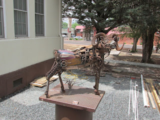
Artwork outside Casa Malpais Museum
 In the Casa Malpais Museum you'll also be able to view many pieces of furnishing and artwork donated by Mrs. Donnet. You'll view some very interesting European art which was part of the Donnet collection. Some of the antique furniture is the work of master craftsmen, with elaborate inlays of wood, metal, and tortoise shell. The exhibit also features a beautiful 1922 Steinway grand piano once owned by Mrs. Donnet. The Donnet exhibit is found in two rooms of the complex. This museum is located at 418 E. Main Street.

The Little House Museum

Located just a few miles west of Springerville Arizona is the Little House Museum. The museum is located on the X Diamond & MLY Ranch. This two story museum features exhibits about both ranching and pioneer life. Along with this the Little House Museum also exhibits a rare collection of automatic musical instruments. At his site tours to archaeological digs and petroglyphs are also available. The X Diamond Ranch is located off of Arizona Highway 260 about a ten mile drive west of Springerville.

butterfly collection
Museum's Butterfly collection
Another very interestingstop to make in Springerville is to one of the twelve Madonna of the Trail monuments created by sculptor August Leimbach. Starting in 1927, the German sculptor Leimbach placed one monument in twelve different towns in the U.S. The Springerville Arizona monument is across from the Post Office on Main Street.

August Leimbach with his sculptures marked the national Old Trails Highway from Maryland to California. Each of the statues were dedicated during the years 1928 and 1929.


Below are two links to more Western Trips photo articles you may enjoy.

A Visit to Winslow Arizona

The Theodore Roosevelt Indian Boarding School

Visiting Springerville Arizona

One thing to recognize when visiting Springerville Arizona is it's proximity to the White Mountains and the recreational opportunities there. The Sunrise Ski Resort is also located in Apache County and is about a 27 mile drive southwest of town via AZ Hwy 260 and 273.


round valley courthouse arizona
Round Valley Courthouse, Springerville, AZ
One of Arizona's top tourist areas is the Pinetop-Lakeside locale in the White Mountains. Pinetop-Lakeside is about 44 miles to the west of Springerville. Pinetop-Lakeside is surrounded by the beauty of the White Mountains, the Apache/Sitgreaves National Forest and the White Mountain Apache Indian Reservation. Hiking, biking, horseback riding, hunting and fishing are all popular Arizona tourism recreational activities in this Ponderosa Pine area of Arizona.

Another very interesting site to add to your trip planner in this part of Arizona is Fort Apache. Located about 63 miles southwest of Springerville, Fort Apache features a Native American museum, several very historic structures from the fort's operational years as well as buildings of the Theodore Roosevelt Indian Boarding School which was established there in the 1920's. The school still functions today.
 

(Content and photos copyright Western Trips)


View Larger Map

Saturday, June 22, 2013

Arizona Indian Reservation


Fort Apache located in the foothills of the White Mountains of Arizona offers a very interesting travel stop. The fort was established in 1870 at the confluence of the east and north forks of the White River. This was a very important military outpost in the center of the White Mountain Apache homeland and today is within an Apache Arizona Indian Reservation.

One of the most interesting aspect of Fort Apache is what was established there in the latter years of the fort's existence. This was the Theodore Roosevelt School, established in 1923 by an act of Congress.

roosevelt fort apache school
Theodore Roosevelt School cafeteria building
The Theodore Roosevelt School

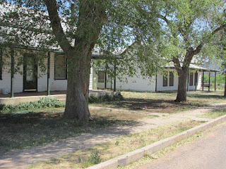
Today when you visit Fort Apache there are a great many of it's historic structures still standing. It's a fascinating and very scenic place to visit. The fort actually had several names prior to it being designated Fort Apache. At one time the outpost went by the names of Camp Ord, Camp Mogollon and Camp Thomas.

The school's first students were actually Navajo Indian children but eventually the school was attended by Apache children exclusively. The school was within the Apache Arizona Indian Reservation. This was a boarding school administered by the Bureau of Indian Affairs. Interestingly enough a school still operates today at the same site as a middle school, under the administration of a school board selected by the  Apache Tribal Council.

Naming this school in honor of former president Theodore Roosevelt was quite fitting. Having spent a good deal of time in the west operating a cattle ranch,taking part in several hunting expeditions and meeting several Indian leaders in person, Roosevelt was more acquainted with Native Americans than any other president before him.

indian school fort apache
Boy's Dormitory Building
One very significant change that Roosevelt promoted as president was giving Native Americans preference in attaining teaching and medical service positions on the reservation. Prior to this the people who filled these positions worked under Civil Service classifications. While Roosevelt strongly defended Manifest Destiny this was a big step in Native American self governance. Theodore Roosevelt was also known to appoint people with actual native American knowledge to the post of commissioner of Indian Affairs.


Fort Apache Historic School Buildings

When you visit Fort Apache today you'll notice several large buildings on the eastern side of the fort.

Some of the buildings you'll see are the cafeteria building that was constructed in 1948. This building still serves as a cafeteria today.

You'll also see the Girl's Dormitory building that was built in 1932. The construction of this building was by the work of the Works Progress Administration during the early years of the Great Depression.


theodore roosevelt indian school
Girl's Dormitory Building
Another very large structure on this Apache Arizona Indian reservation is the Boy's Dormitory Building which was also constructed by the W.P.A. in 1932. The building was constructed with sandstone from a nearby quarry. Prior to the buildings construction the school used the old Cavalry barracks to house students.

Eventually new schools were constructed nearby and the students attending the Theodore Roosevelt School were transferred to these. After the transfer of the Apache students, the site became a boarding school  for students of many tribes. It remains open today.


The links below are to three additional Western Trips photo articles you'll enjoy.

Historic Old Tucson Arizona

A Visit to Old Town Scottsdale Arizona

A Man-Made Wonder in Sedona Arizona


fort apache buildings
Fort Apache Officers Quarters Bldg.
Visiting the old Theodore Roosevelt Boarding School

Fort Apache, the site of the Theodore Roosevelt School and in an area within the Apache Arizona Indian Reservation, is located in one of the most scenic parts of Arizona. The White Mountains area of northeastern Arizona is a very popular tourist and recreation area. This is also a part of Arizona that has the largest stand of Ponderosa Pines.

People also enjoy this part of Arizona which offers a respite from desert heat and features crystal clear streams. During winter the area also offers skiing opportunities. Arizona's White Mountains offer visitors a part of the state that experiences four seasons.

Fort Apache and the Theodore Roosevelt Boarding School is located just east of Arizona Highway 73 and about four miles south of the town of White River. The fort is about 190 miles north of Tucson and about 175 miles east of Phoenix.

fort apache museum
Fort Apache Museum and Visitors Center
The Fort Apache Visitors Center was opened in 1969.This is also the White Mountain Apache Cultural Center and Museum. This is a must stop while at the fort. The museum displays a large collection of artifacts, photos, manuscripts and other information about Apache history and culture. 

Another nearby site you'll want to include in your trip to Fort Apache are the Kinishba Ruins. The ruins are a National Historic Landmark and are located just four miles west of the fort. The Kinishba Ruins are what remains of a pueblo village that was once occupied by ancestors of today's Zuni and Hopi pueblo tribes. The site was designated as a National Historic Landmark because it's an excellent example of what a settlement was like by agricultural puebloans. The site was initially excavated during the 1930's and was partially rebuilt. This historic site dates back to 1200 to 1400 A.D.

(Content and photos copyright Western Trips)


View Larger Map

Wednesday, February 27, 2013

Homolovi Ruins State Park / Arizona


homolovi ruins state park
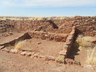
Homolovi I Ruins
Western Trips visited the historic ruins at the Homolovi Ruins State Park in the northeastern part of Arizona outside of Winslow.  Walk the grounds were ancestral Hopi once lived. This was once the site of a very large Native American settlement. The Homolovi Ruins were once the home to the Hisat'sinom (Anasazi) in the 14th century. Homolovi or Homol'ovi is a Hopi word meaning "place of the little hills".  The Homolovi ruins are now a center of both research and preservation.

Homolovi Ruins Excavation

A 1985 to 1987 survey of about 13 square miles in the Homolovi Ruins State Park has documented more than 300 prehistoric sites. The survey shows a higher site density than was expected and indicates the long term use of the middle Little Colorado River Valley. After a long time in acquiring the land and completing the improvements, the Homolovi Park was dedicated and officially opened to the public on May 22, 1993.


homolovi ruins
View from Homolovi Visitor Center
The site appears to have been continuously occupied by the Anasazi  sometime after 6000 BC. The first inhabitants were hunters and gatherers and lived in small, temporary campsites. Many centuries later, by 500 AD, the Anasazi became more sedentary and as such they built more permanent, semi-underground dwellings. At this time they began producing pottery. Sections of the site actually continued to be occupied  until about 1400-1500 AD. After that period the Ansazi, went back to the Hopi Mesa villages about 60 miles north of today's park. The major reason the Native people settled here at Homolovi was the availability of water from the Little Colorado River.

Ancient Pot Shards

The great ruins of Homolovi is covered with pot sherds just about everywhere. Fortunately for all of us the pot sherds for the most part have been left undisturbed by the visitors. You'll find them spread around the ground and in many instances placed on display on top of a flat rock. A major reason the park was created in the 1980's was to help protect the ruins and pot shards which were often vandalized.


anasazi ruins pot shards
Pot shards, Homolovi Ruins State Park
It appears that  people would come and dig on their own, find pots or sherds and sell them. The Hopi agreed that the creation of a state park at the site would help protect the ancient ruins as well as the pot shards. Taking pottery shards from the park is illegal. The park was established in direct  response to public concern about the devastation of the Homolovi sites by illegal collectors of prehistoric artifacts.

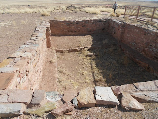
Homolovi Ruins State Park consists of four major pueblo sites, and as mentioned above inhabited by the Anasazi peoples sometime after 6000 B.C. and continuously between 1200 and 1425 A.D. The ruins are spread throughout the 340-acre park. On our Western Trips visit to the Homolovi Ruins State Park two of the ruins sites were opened for visitors. These were Homolovi ruins I and II.

Homolovi I

Homolovi I has a short loop trial going through the ruins. Most of these ruins are covered with soil to a large extent. There is a campground on the way to the ancient Homolovi I Ruins. The Homolovi I parking lot is located about one mile past the park campground and is next to the Little Colorado River.


homolovi park arizona
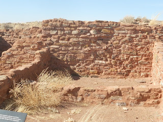
Kiva ruins, Homolovi II
Homolovi II

The trail at Homolovi II is also relatively short. This one is paved and should be wheelchair accessible. Homolovi II was a 1200 room village that at its peak housed 750 to 1000 people. 

Homolovi Ruins State Park is located fifty-five miles east of Flagstaff and just north of  Winslow. Arizona's Homolovi Ruins State Park has campsites, picnic areas and several excellent hiking trails. The park offers 52 RV sites and all except eight sites have electric hook ups. The Rv sites can accommodate vehicles up to 83 feet long.
There are around 52 RV sites and all but 8 sites have electric hookups. - See more at: http://www.thatsnotcamping.com/rv-camping-2/homolovi-state-park.html#sthash.Shd4E9l5.dpuf

Links to two additional Western Trips photo articles you'll enjoy are the Puye Cliff Dwellings located a short drive north of Santa Fe New Mexico and the Mesa Verde National Park cave dwellings in southwestern Colorado.

The Hopi people of today consider Homolovi, as well as other pre-Columbian sites in the southwest, to be part of their homeland. They continue to make pilgrimages to these sites, renewing the ties of the people with the land.

kiva ruins
Excavated kiva at Homolovi Ruins State Park
Another interesting historic site in the park is the cemetery of Sunset. Sunset was a Morman settlement established in 1876. The settlement had the distinction of having the first post office on the Little Colorado River and was near an important ford of the river. Sunset was abandoned in the 1880’s. What remains today are the headstones in the small cemetery.

Getting to the Homolovi Ruins State Park

Homolovi Ruins State Park is located on the north side of Interstate 40 in Winslow Arizona. It is also close to Arizona Hwy 87. Winslow is located about fifty-five miles east of Flagstaff Arizona and about 1oo miles west of the New Mexico state line.

(Photos are from author's private collection)


View Larger Map

Friday, February 22, 2013

Coronado State Monument


kuaua pueblo ruins
Coronado State Monument ruins
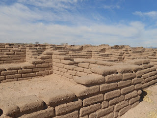
Western Trips had the opportunity to visit the 700 year old site of the Kuaua Pueblo which is also the site of the Coronado State Monument in New Mexico. Coronado State Monument features the partially reconstructed ruins of the ancient Pueblo of Kuaua. Kuaua is a Tiwa Indian word for "evergreen."

The 1933 Excavation

The Kuaua Pueblo, located on the west bank of the Rio Grande north of Albuquerque, was first excavated in the 1930's by the Great Depression era WPA workforce. The excavation was directed by qualified archeologists. The excavation project at the Kuaua Pueblo came about when archeologists while digging discovered a site with three walls which turned out to be a pueblo kiva. Incredibly, the walls also had painted murals. The Coronado State Monument was established in 1935, just a few years after the WPA excavation began.


pueblo kiva
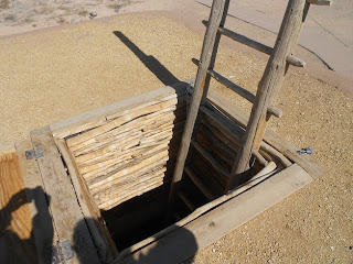
Kiva entrance
The Murals of Kuaua Pueblo

The murals were layered on sheets of plaster and peeled off the walls and were preserved. The murals which number thirteen are on display at the monument's Visitor Center. The murals are considered to be the finest examples of pre-Columbian art in North America. Native American and Spanish Colonial artifacts are on display in the Visitor Center which was designed by John Gaw Meem. Meem was born in Brazil in 1894 to Episcopal Church missionaries. He migrated to the United States in 1910 where he attended the Virginia Military Institute and graduated with a civil,engineering degree. In 1933 Meem was appointed as the official architect at the University of New Mexico in Albuquerque.

Coronado's Expedition of the Southwest and the Pueblo Indians

In the year 1540, Francisco Vasquez de Coronado set out from Mexico on his epic expedition which covered the present states of Arizona, New Mexico, Kansas and Texas. Many may remember that the Coronado Expedition was seeking the "Seven Cities of Gold". Unfortunately, Coronado never did locate those golden cities but he did come across many Native adobe villages.


pueblo adobe
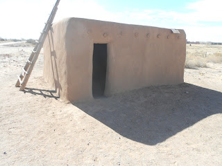
Restored adobe home
Much of the information about the Kuaua actually came from the journals written during the Coronado Expedition. More information was obtained from modern day pueblo Indians as well as from excavations from the late 1800's through the 1900's. It's thought that much of the Native population in the Rio Grande Valley migrated there from both eastern Arizona and southwestern Colorado because of the natural water of the Rio Grande. There the pueblos grew and subsisted on corn, beans and squash as well as edible wild plants.

Many historians believe that the Coronado Expedition wintered in the Rio Grande Valley where they discovered twelve Tiwa speaking pueblos. This cluster of pueblos is now called the Tiguex Province. While there is some disagreement among scholars as to where exactly Coronado camped in this area, many contend that the winter camp was at the site of the Kuaua Pueblo. Some also contend that the specific location was decided upon because of it's abundance of food.


rio grande in new mexico
View of Rio Grande from Kuaua Pueblo
The Kuaua Pueblo was thought to contain about 1,200 rooms which were connected together in a roughly L shape around three plazas. Each plaza contained at least one kiva. The kivas were underground chambers that were used for ceremonial and social purposes.


It's interesting to note that after Coronado returned to Mexico City in 1542, it would be another fifty years before any Spanish conquistador would return to the region. In 1598 Juan de Onate journeyed north from Mexico City and established Santa Fe as the capital of “New Spain". Onate's party also included missionaries whose purpose was to convert the Native population to Christianity. The Spaniards also handed out land grants to settlers. The Native population was expected to provide labor and convert to Christianity while the Spaniards would protect them from attack by nomadic tribes. As the history books contend, this was the beginning of the subjugation of the pueblo Natives which ultimately resulted in the Pueblo Revolt of 1680.

Another interesting historical note is that the Coronado Expedition left behind three Franciscan padres  who were all martyred within two years.

Also see our Western Trips articles on the:

New Mexico Cliff Dwellings

Old Town Albuquerque Spanish Mission

Pecos National Historical Park Pueblo Ruins 

Things to See and Do in La Jolla California


coronado state monument
Coronado State Monument Visitor Center
Visiting the Kuaua Pueblo Ruins and the Coronado State Monument

Today's visitor to the Coronado State Monument can explore the Kuaua Pueblo ruins via a self guided walking tour. You will also be able to climb into a reconstructed kiva to see the reproduced murals. A good tip is to find out in the visitor center when one of the docents will be giving a kiva tour. This is a great way to explore the ruins and learn the history of the murals and the Kuaua Pueblo. This is the perfect addition to your New Mexico vacation planner as it's fun, educational and very low cost.

While touring the Albuquerque area you'll find the Coronado State Monument at Kuaua Pueblo easy to reach. Coronado State Monument and the Kuaua Pueblo ruins are located west of the town of Bernalillo on Hwy 550. The site is about a 19 mile drive north of Albuquerque. The quickest way there is via Interstate 25 and exiting at Hwy 550. The site is on the west bank of the Rio Grande about 2 miles west of the Interstate.

(Photos from author's private collection)


View Larger Map

Wednesday, January 16, 2013

New Mexico Pueblo / Pottery


new mexico scenery
Scenery at Ghost Ranch, NM
Visiting New Mexico offers the traveler many excellent venues to view artifacts from the early pueblo era.

The New Mexico pueblo has been and remains a large part of southwest American culture. Over the centuries, many interesting artifacts have been uncovered all over the southwest and fortunately there are several unique museums that make great additions to your New Mexico vacation planner.

One very interesting southwest pueblo culture and the one highlighted in this article, dates back to between 1000 and 1300 AD. These were the Gallina people. The Gallina culture dates well before the Spanish occupation of the southwest and was located in the north central region of New Mexico.


florence hawley ellis museum
Florence Hawley Ellis Museum of Anthropology

This is a museum that you want to add to your New Mexico vacation planner for several reasons. The Florence Hawley Ellis Museum of Anthropology is located at Ghost Ranch in northern New Mexico. Florence Hawley Ellis was one of the first women to receive a PhD in anthropology. Ellis received her PhD from the University of Chicago in 1934 and made beautiful Ghost Ranch her home. Dr. Ellis was also a  long time professor of anthropology at the University of New Mexico in Albuquerque. Dr. Ellis was involved with and led Ghost Ranch archaeology excavations from 1971 until 1990. Many people may also remember that Ghost Ranch was home to the artist Georgia O'Keeffe.

The Florence Hawley Ellis Museum of Anthropology features exhibits covering a very wide range of Native American artifacts. Some of these are highlighted below.

bandelier black on white pottery
Bandelier Black on White
What Happened to the Gallina People?

Information about the Gallina is scarce. One of the most sought after answers pertaining to the Gallina culture was why did it simply disappear? Most studies of this subject point to the the year 1275 AD as the time the culture vanished. The Gallina settlers either left the region or were exterminated. It's a fact that almost all Gallina ever discovered appeared to have been killed.

One possible scenario from historians claim that they may have been murdered by the Anasazi. What is known is that whatever happened to these people, if conflict with the Anasazi did occur, the victors moved on and didn't seem to occupy the Gallina land.

The Gallina Artifacts

On the standpoint of Gallina artifacts, there are several interesting exhibits on display. The Gallina culture left us evidence of their architecture, pottery, tools, shells and stone pipes. The Gallina architecture, for example, consisted of both surface structures and pit houses. A typical village might have from five to twenty homes. The villages were also known to have a north to south orientation.

shoe pot pottery
Shoe Pot
Bandelier Black on White

The large Bandelier Black on White shown in the photo above is a storage jar. The Rio Grande region potters created distinctive local varieties of this pottery. This pottery employed black mineral paint which was believed to be prior to 1200 AD. After 1200 AD black vegetal paint was mostly used. The paint was used against a white, off-white, or a light gray background. The Black on White Pottery appeared to die out after 1750 AD. The Bandelier name attached to this pottery is indicative of the area where it came from. Today's Bandelier National Monument is very nearby the Rio Grande where most of the pueblo people had settled.

Shoe Pot

The shoe pot shown above was a cooking vessel. The shoe pot is a asymmetrical vessel with the opening at one end, and typically a handle at the rim of the opening. These pots were used all over Mexico and into present day New Mexico.

gallina water container pottery
Gallina Water Container

Another interesting pueblo pottery artifact is the Gallina Water Container. The container shown in the photo was used for exactly what it's name implies. Gallina Pottery was of two kinds. Utility wares and decorative wares. It's interesting to note that vessels such as this have been and are used to study the movements of the pueblo people. In this case, the movement of the Gallina. Most contend that the utility vessels and the decorative vessels really originate form different times. The ceramic conservatism evident in Gallina ceramics as opposed to other pueblo peoples is one reason why the Gallina have been thought to have been both geographically and culturally separate from other New Mexican and southwest pueblos.

Two additional Western Trips photo articles you'll find interesting area a Visit to the Puye Cliff Dwellings just a short drive northwest of Santa Fe New Mexico the very unique Mesa Verde National Park in southwestern Colorado.


Visiting the Florence Hawley Ellis Museum of Anthropology

This very unique museum is located on the grounds of Ghost Ranch. Ghost Ranch is located about 47 miles north of Santa Fe New Mexico. The drive from Santa Fe is about one hour.In addition to exhibits from local artists, the Florence Hawley Ellis Museum of Anthropology displays ancient artifacts from Paleo Indian culture of 10,000 years ago through ancestral Puebloan periods to present time pottery and weavings.

Today, Ghost Ranch is a conference center set in one of the most beautiful parts of New Mexico. Ghost Ranch serves also as both a retreat and an educational center. Many courses are offered during the year. Some can be commuted to and others offer accommodations and meals at the ranch.

If you haven't already, you may just want to add a visit to New Mexico and it's many pueblo sites and archeological museums to your upcoming vacation planner.

The map below will show you the exact location of the museum and Ghost Ranch.

(Article and photos copyright Western Trips)

Thursday, January 10, 2013

Attractions in New Mexico / Cliff Dwellings


northern new mexico
Beautiful valley view from Puye Cliff Dwellings
Travel attractions in New Mexico are everywhere. For the southwest American tourist, New Mexico is filled with an abundance of great historical sites.

New Mexico pueblo culture dates back several centuries and along with the pueblos many people visit annually are sites of long ago cave ruins. The cave dwelling peoples occupied northern New Mexico as well as the Four Corners area in the northwestern part of the state.

Puye Cliff Dwellings

One very interesting site to  visit, and well worth it, are the Puye Cliff Dwellings just a short drive northwest of Santa Fe. The ancestors of the modern day Santa Clara Pueblo residents at one time made the Puye Cliff Dwellings home. Pueblo Indians inhabited this area from about 900 AD up to the year 1580, about the time that the Spaniards started to colonize Nuevo Mexico. Other cliff dwelling sites were established on the Pajarito Plateau about the same time.


puye cliff dwellings
Puye Cliff Dwellings, NM
The Puye Cliff  Dwellings consist of two levels of dwellings as well as surface structures. The first level is about one mile long and the second level about 2,100 feet. The cliff dwellings were carved out of volcanic rock. At one time there was an estimated 1,500 people residing at Puye. Today the site is a National Historic Landmark.

The site that you'll visit has been an historical attraction for decades. Puye Cliffs is located on the Santa Clara Pueblo Indian Reservation west of Espanola, New Mexico. When you visit this site you'll see an old restored Harvey House which was erected in the 1930's during the era of Fred Harvey motor coach tours in northern New Mexico. Today, the old Harvey House is utilized as an interpretive center.

The Santa Clara Pueblo is located about ten miles to the east of the cave dwellings. Historians believe that the eventual exodus from the cliffs to the east was due to severe drought conditions. Puye Cliff Dwellings are the ruins of the "post Anasazi" era. It's not entirely understood why, but when the pueblo peoples abandoned Chaco Canyon New Mexico and Mesa Verde Colorado, they moved in several directions and inhabited other cliffs in smaller groups. For those traveling in the southwestern Colorado area, a trip to the stunning Mesa Verde National Park is a must to witness more of the cave dwelling examples.

puye cliff dwellings harvey house
Old Harvey House entrance to Cliffs
Following are links to three additional Western Trips photo articles you'll enjoy. Scenic and Historic Jemez Springs ... Los Alamos Laboratory Historic Site. and Some Great Stops Along Old Route 66.


Visiting Puye Cliff Dwellings


One of the great things about touring northern New Mexico, particularly between Santa Fe and Taos, is the number of historic landmarks.

Very near to the Puye Cliff Dwellings is Bandelier National Monument which among other things features cave dwellings cut into it's rocks. Bandelier National Monument is just a twenty-four mile drive southwest of the Puye Cliffs Welcome Center.


los alamos historical museum
Los Alamos Historical Museum
Los Alamos New Mexico is only about a 16 mile drive west of Puye Cliffs and features both the Bradbury Science Museum and the Los Alamos Scientific Laboratory National Historic Landmark District, established by the National Park Service.

Further west about 38 miles from Los Alamos is Jemez Springs which is noted for it's natural hot springs baths and the ancient Indian ruins that you can explore and stroll through.

Puye Cliff Dwellings Guided Tours


To begin your trip to Puye Cliffs, purchase tickets at the Welcome Center located at Hwy 30 and Puye Cliff Road. This is at the bottom and across the Rio Grande from historic Black Mesa. The cliff dwellings are about seven miles further west of the Welcome Center on Puye Cliff Road. On your drive to the Puye Cliff Dwellings you'll enjoy the expansive views of the Santa Clara Native Americans' historic areas. This is quite a scenic part of New Mexico.

Guided tours of the cliff dwellings are offered by knowledgeable guides who'll direct you along a steep paved trail from the Harvey House to a level of dwellings and ruins on the face of the cliff. Another guided tour offered is the ride to the top of the mesa. The tour covers how ancestral Tewa people used to live hundreds of years ago. It's a very educational tour and van access is available. You'll also find interesting exhibits in the Old Harvey House.

If you're searching for one of a kind attractions in New Mexico, a visit to the unique Puye Cliff Dwellings is a perfect add on stop while visiting the Santa Fe and Taos area.


(Article and photos copyright Western Trips)


View Larger Map