Western Trips

Monday, September 30, 2013

Revisiting the Old West Cattle Trails


chisholm trail marker
Sign along the old Chisholm Trail in Round Rock TX
The cattle industry in North America grew rapidly after the Civil War ended in 1865. There was not only a pent up demand for western beef but regions like Texas had a vast oversupply of cattle. While Texas ranches, among them the King Ranch of southeastern Texas, did help supply beef to the Confederate forces by driving cattle to Confederate states, the Texas herds multiplied during the war. The war cut off access to eastern markets. When the Civil War finally ended and the railroads built west across Kansas, fortunes could be made by enterprising cattlemen.

The peak years of the great cattle drives were the twenty years between 1866 and 1886. That being said, Texans were known to drive cattle eastward toward New Orleans as early as 1836. In 1853 there was a successful cattle drive all the way from St. Louis to the port of San Francisco which seems incredible.

After the Civil war the potential for profit was so great that a good deal of investment money came from overseas, Scottish and English investors being the top two sources of capital. The first post war rail head destination for Texas cattle was Abilene Kansas. The rail heads continued to build westward to Wichita, Dodge City and even to Las Vegas New Mexico just 60 miles east of Santa Fe.

Today, tourists visiting the west and southwest can see many reminders of the great cattle trails.


chisholm trail round rock texas
Surviving structure along the trail in Old Round Rock
The Chisholm Trail

The Chisholm Trail ran from southeastern Texas near the San Antonio area north past the towns of Austin Texas, Round Rock, Salado, Denton and across the Red River at Red River Station and into Indian Territory past present day Duncan Oklahoma on it's journey to the rail head at Abilene Kansas. The trail followed closely to today's Interstate 35. The Chisholm trail was named after Jesse Chisholm who owned trading posts in western Oklahoma before the Civil War.

The Chisholm Trail was most active from 1867 to 1871. By 1885 barbed wire erected by settlers flooding into the region essentially closed the trail permanently. During it's active years more than five million cattle and a million mustangs traveled over the Chisholm Trail.

There are several reminders and historical markers to be seen today along the old path of the trail. The Chisholm Trail Crossing Park in Round Rock Texas reminds visitors of the city’s history. At the low water crossing there is a plaque commemorating the crossing where there is also the rock from which Round Rock took it's name. It's said that old wagon ruts can still be seen at the site of the crossing.
fort reno oklahoma
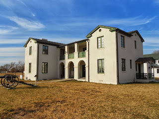
Original Fort Reno structure along the Great Western Trail
In Decatur Texas on the courthouse lawn is an historical marker that mentionss the Chisholm Trail as it passed through this town located about 55 miles north/northwest of downtown Dallas.

Visit Duncan Oklahoma and take a drive east to where a general store servicing the drovers once stood. There you'll see an historical marker and if you explore real good you'll see visible ruts in the ground from the millions of cattle hooves that passed this site heading north. You'll also want to visit the Chisholm Trail heritage Center in Duncan. Here you'll be treated to a  multi-sensory exploration of the Chisholm Trail as well as the story of early settlement in the southern plains. Duncan Oklahoma is located about 80 miles southwest of Oklahoma City and about 64 miles northeast of Wichita Falls Texas.

 Doan's Crossing on the Great Western Trail

The Great Western Trail began in the area south and southwest of San Antonio Texas down to the Rio Grande and, with it's many side routes, actually reached as far north as the Canadian border. The Great Western Trail or Texas Trail is considered the longest of all the old west cattle trails.

There is a spot along the Red River dividing Texas from Oklahoma called Doan's Crossing which was where cattle driven along the Great Western Trail, sometimes referred to as the Western Trail and Texas Trail, crossed on their way north to Dodge City Kansas during the 1870's. An interesting side note is that Jonathan Doan who established the trading post at the crossing became the first person to permanently settle in Wilbarger County Texas.


cattle drive chuckwagon
Chuckwagon exhibit at NM History Museum
The site was location of a trading post and general store where cowboys could stock up on supplies before driving their cattle further north into Indian Territory. Today the site is a ghost town with interesting historical markers but once a year there is a large gathering which is open to the public. The annual May Day Picnic is an event you want to see if you're in the area. For more information on this annual event see website www..tshaonline.org/handbook/online/articles/hvd50

Doan's Crossing is located about 13 miles northeast of Vernon Texas and about 60 miles northwest of Wichita Falls.

In 2003 a project was launched to mark the entire Great Western Trail with a cement post place every six miles. The initial plan was to mark the trail from the Rio Grande to Ogallala, Nebraska.

The Great Western Trail also passed historic Fort Reno Oklahoma which was originally built while in Indian Territory. This is a stop you want to make while driving through Oklahoma on Interstate 40 west of Oklahoma City. Tour the original buildings of the fort as well as it's museum with many fine artifacts. Fort Reno is located about 27 miles west of Oklahoma City and just north of the Interstate.

A few additional Western Trips articles you may enjoy are on the links below... 

American Cowboy Gear and Attire

Texas Ranching

Famous Texas Rancher George Littlefield House / Austin TX

A Visit to Doan's Crossing on the Red River 


old las vegas new mexico
Las Vegas NM along the Goodnight-Loving Trail
The Goodnight-Loving Cattle Trail

Among the historic accomplishments of Charles Goodnight was when he created the Goodnight-Loving Trail from Fort Belknap Texas into New Mexico in 1867. The Goodnight-Loving Trail would eventually run from Fort Belknap (near present day Newcastle Texas) west into New Mexico, then up to Denver Colorado and later further north into Cheyenne Wyoming.

Goodnight did this with the knowledge that Indian trouble could commence at any time and it was said that at one point he drove the herd some eighty miles without water. In fact, Oliver Loving, Goodnight's partner in 1867, died while wounded and trying to hold off Indians on his way to deliver beef to Fort Sumner New Mexico. This 2,000 mile trail to Fort Sumner and then north into Colorado would soon be named the Goodnight-Loving Trail.

The journey and terrain by all accounts was very tough but in making it Goodnight proved to all that cattle could be driven over rugged regions that were considered by many to be a cattleman's graveyard. The route left Fort Belknap and followed the old Butterfield Stage Line route to the Pecos River. Then it was up the Pecos to near Las Vegas New Mexico and further northward past Raton Pass and into Colorado.

The Goodnight-Loving Trail would pass by Raton New Mexico and enter Colorado through Raton Pass where a toll keeper was charging about ten cents per head for access through the pass. It wasn't long before Charles Goodnight found a slightly alternate route through the pass avoiding this fee. Raton Pass would later be the entryway into New Mexico from Colorado by the Atchison Topeka & Santa Fe Railroad.


charles goodnight house
Goodnight Ranch House, Goodnight TX
Charles Goodnight is considered by many today to be the Father of the Texas Panhandle. Goodnight Texas is located on U.S. Hwy 287 just about 40 miles southeast of Amarillo. At this site is the Goodnight ranch house which has been restored. The Goodnight  home was renovated by the Armstrong County Museum in Claude Texas just a few miles west of the now ghost town of Goodnight.

Another site commemorating Goodnight's ranching achievements is a statue of him outside of the fascinating Panhandle-Plains Historical Museum in Canyon Texas, about a 15 minute drive south of Amarillo along Interstate 27. If you have not visited this museum I would highly recommend it to anyone traveling through the Amarillo Texas area. There is an amazing amount of historic artifacts plus an excellent historic research center.

To see where the Goodnight-Loving Trail ran along the Pecos River in New Mexico, stop at Fort Sumner which has an amazing museum and is the site where Billy the Kid is buried. Fort Sumner is located about 45 miles south of Santa Rosa New Mexico. Santa Rosa is directly on Interstate 40 about 114 miles east of Albuquerque.

Three excellent books on the subject of ranchers, cowboys and cattle drives include The Cattle Kings by author Lewis Atherton...The Western: The Greatest Texas Cattle Trail, 1874 - 1886 by authors Gary Kraisinger and Margaret Kraisinger...Charles Goodnight: Father of the Texas Panhandle by author William T. Hagan.


(Article and photos copyright 2013 Western Trips)

Thursday, September 26, 2013

Schooner Alma, Photos and History / San Francisco

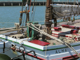
Located at San Francisco's Hyde Street Pier is the historic schooner Alma. The schooner was built in 1891 and is still sailing the San Francisco Bay. Today, the sixty foot long and square bow scow schooner is home ported at the San Francisco Maritime National Historic Park. The scow schooner Alma is thought to be the only survivor of this type of vessel still afloat and she is still certified to carry passengers.

scow schooner alma
Scow Schooner Alma
Visiting the Alma

If your trip west takes you to the San Francisco Bay area you'll want to plan a stop at the San Francisco Maritime National Historic Park where not only is the Alma ported but also several other very historic vessels including the steam ferry Eureka and the tall ship Balclutha.

Located in the Fisherman's Wharf area, the San Francisco Maritime National Historical Park offers the sights, sounds, smells and stories of Pacific Coast maritime history. Included are a library and research center. The Visitor Center is located across the street from Hyde Street Pier. The Visitor Center address is: 499 Jefferson Street, San Francisco. Hours are 9:30A to 5P. The park is closed on Thanksgiving, Christmas and New Year's Days.

Two additional vessels located adjacent to the park at Fishermans Wharf and well worth a visit to are the World War Two submarine USS Pampanito and the Liberty Ship the Jeremiah O'Brien.

Two additional Western Trips photo article links of historic ships at the park include...

The Passenger Ferry Eureka

The Tall Ship Balclutha 


scow schooner photo
Schooner Alma, San Francisco, CA
The Alma Was a Versatile Cargo Hauler on San Francisco Bay

The Alma is the last of about 400 scow schooners that were locally built. The Alma was built by Fred Siemer's shipyard at Hunters Point. Siemer built two scow schooners at his Hunters Point facility and named one for his daughter Adelia and the other for daughter Alma. The Alma's home port was usually Mission Creek which is adjacent to the current Giants ballpark.

The boat was designed to haul salt, lumber, hay, bricks and just about any bulk cargo. The flat bottomed Alma was able to navigate the shallow parts of the bay and delta. Back during the latter 1800's and during the first few decades of the 1900's, shipping freight on a scow schooner like the Alma was considered the least expensive way to move goods all along the Bay Area. It's said that the Alma during almost all of her long career operated in the immediate San Francisco Bay area.

The Scow Schooner

The maritime term "scow" is used to describe a wide, flat-bottomed, square ended vessel without a deep keel. Scows were often equipped with a centerboard or leeboard. When in shallows these boards could be pulled up letting navigation in very shallow waters possible including sections along the Sacramento and San Joaquin Rivers. While the scow schooners were primarily built to be sailing vessels they could also be poled while in the shallows. Scows also had the ability of coming right onto the beach and intentionally grounding. These obviously were very versatile vessels. 


schooner alma
Deck of the restored  schooner Alma
The descriptive term "Schooner" refers to the arrangement of masts and sails. A schooner has at least two masts, with the forward mast being shorter than or the same height as the aft mast. Today, these type of vessels are not easy to find. If you looked about one hundred years ago you'd see them everywhere. The scow schooner was primarily used for cargo transport on coastal and inland waters. These vessels were simply designed for hard work and heavy hauling.

In 1918 Alma had her masts removed. For about eight years afterward she was essentially used as a barge hauling salt until a new owner purchased her in 1926. The new owner installed a gas engine and the Alma was primarily used to carry oyster shells to Petaluma on the north bay. 

The scow schooner hauling business came to an end when trucks were mostly used for transporting cargo on newly completed highways. Operating the Alma profitably came to an end in 1957 when she retired from service.

The Alma is 100 feet in length, is 22.6 feet wide and draws about 3 1/2 feet of water. 

san francisco maritime park
Bay view from the SF National  Maritime Historic Park
Restoring the Alma

The Alma was sold to the state of California in 1959. Because the Alma had a long history of work all around the Bay Area local historians were well aware of her long service. It was this knowledge that led to the effort for her restoration. The restoration didn't begin however until 1964 and lasted for several years.. The National Park Service took ownership of the Alma in 1978 and the vessel was designated a National Historic Landmark in 1988.

Two good books to explore the subject further include Scow Schooners of San Francisco Bay by authors Roger R. Olmstead and Nancy Olmstead and San Francisco Maritime Park: The Story Behind the Scenery by authors Stephen J. Canright, Lynn T. Cullivan and William G. Thomas.


(Article and photos copyright 2013 Western Trips)

Monday, September 23, 2013

A Drive From Santa Fe to Taos New Mexico

Many people who travel to Santa Fe New Mexico enjoy taking a drive up to Taos. There's a lot of reasons for this and one of the biggest is that it's a beautiful drive and you're sure to get some excellent photo opportunities.

rio grande river
Scenic Rio Grande between Santa Fe and Taos NM
The drive north to Taos is pretty much a straight shot up US-285 and NM-68 for a distance of about 71 miles and a driving time of about 1 1/2 hrs or a bit longer. 

The last half of the drive fairly follows the course of the Rio Grande until you get nearer to Taos where the Rio Grande is more off to the west. Along the way you'll pass through several Native American reservations and drive through some of the most scenic areas of New Mexico. Part of the drive follows along the banks of the picturesque Rio Grande.


To be sure, between Santa Fe and Taos there are several historic sites and art communities off the main highway. depending on how much time you've set aside for your trip to Taos, you may want to visit a few of these.

Some Great Stops for Your Trip Planner

northern new mexico
More picturesque views of the Rio Grande
They include the Sancturario de Chimayo in Chimayo which is east of Espanola and the art gallery town of Truchas located on what is named "The High Road to Taos". This small village is filled with very interesting art galleries that are filled with excellent art pieces and all things New Mexico. It's a favorite stop during Art Tour Days.

New Mexican Vineyards


The Estrella Del Norte Vineyard just 15 minutes north of Santa Fe might also make a good addition to your Santa Fe vacation planner when driving north to Taos. Their hours are also seasonal with summer hours 10:00 am to 6:00 pm Mon. thru Sat. and 12:00 to 6:00 pm Sunday. Winter hours have a close time of 5 pm.To get there, drive north on US Hwy-285 to NM 503 which is just north of the Los Alamos Hwy turnoff. Turn right on NM 503 and go about 3/4 mile. The vineyard is at the intersection of NM 503 and North Shining Sun. To contact the vineyard phone 505-455-2826.

Another good winery stop between Santa Fe and Taos is the La Chiripada Winery and Vineyards in Dixon New Mexico. Dixon is about fifty miles north of Santa Fe. This winery produces over twenty different varieties of wine from dry reds to port and crisp whites. The name La Chiripada means "stroke of luck" in Spanish and the winery took the name from the old ranch where it is now located. The winery also operates a tasting room in Taos at 103 Bent Street. For more information and hours of operation, their phone number is 505-579-4437.

charles bent house
Charles Bent House, Taos NM
When you arrive in Taos you'll find some excellent art galleries and a very good selection of restaurants. Also, you'll want to make a stop at the old Charles Bent House which today is a very interesting museum.

Charles Bent was the very first governor of the New Mexico Territory. The New Mexico Territory was created after the Mexican American War in the latter part of the 1840’s. The territory was ceded to the U.S. from Mexico as part of the peace agreement. The Mexican government only controlled New Mexico for about twenty years after they expelled the Spaniards from North America in the 1820’s. 

Charles Bent was unfortunately killed in his home during an uprising of Mexicans, Indians and outlaws during the territory's infancy. The army based in Santa Fe journeyed to Taos, put down the revolt and arrested several participants who were eventually executed. The old Bent House is located on Bent Street just one block north of the Taos plaza.

The links below are to our Western Trips photo articles on the Sancturario de Chimayo and the Kit Carson Home and Museum...

A Visit to Sanctuario de Chimayo

Kit Carson Home and Museum


taos historic homes
Historic Taos Territorial House
You'll also want to stop at the Kit Carson Home and Museum in Taos. It's a real step back into the 1850's when New Mexico was a young territory. The Kit Carson Home and Museum is located at 113 Kit Carson Road just a few blocks east of the central plaza. The home and museum has many artifacts on display from the Kit Carson days including several firearms owned by the legendary frontier figure.Visitors are also treated to a short documentary regarding Kit Carson and some of his exploits in the west. A few blocks north and east of the museum is the grave site of Kit Carson. It's in easy walking distance from the museum.

Along the way and in Taos are many historical structures and landmarks. The Taos Territorial House shown above is just one of these.Today, the Territtrial House is a Historic Hacienda with luxury lodging and is on the National Register of Historic Places. The Taos Territorial House is a restored adobe home which was built in the mid 1870's. The address is 114 Padre Martinez Lane just a few short blocks from the Taos plaza.

Because of it's close proximity to Santa Fe, making a trip to Taos can be a day trip or a fun overnight visit. Either way it's quite worth the trip.

(Article and photos copyright 2013 Western Trips)

Saturday, September 21, 2013

Soldiers on the Western Frontier

Many times when we consider the America's western frontier we remember pictures of the frontier infantry soldiers and cavalry soldiers fighting the Indians of the plains. Protecting settlers from Indians was aprimary duty of the western soldier. They were involved with Indian Wars for decades in the 1800′s which most historians believe finally ended in 1890 at Wounded Knee.

fort union new mexico wagon ruts
Adobe ruins, Fort Union New Mexico
What really hasn’t had the same publicity as the Indian Wars was what the many duties the rank and file soldier was tasked with. It's surprising just how many roles the western frontier soldier played in civilian life.

Visiting Old Frontier Forts

A lot can be learned by visiting some of the old west forts that today are National Historical Sites. Some of the best include Fort Stockton in southwest Texas, Fort Union in northeastern New Mexico and Fort Concho in San Angelo Texas, Fort Garland in Colorado, Fort Dodge in Kansas and Fort Reno and Fort Sill in Oklahoma.

These are just a few, but they make are fascinating visits.. Everyone of these former frontier forts feature many artifacts of the old west military days and they allow you to get a good feel for what the duties and everyday life was for a soldier in frontier America.


fort apache arizona buildings
Historic structure, Fort Apache Arizona
Protecting Settlers Along the Famous Western Trails

When settlers headed west during the mid 1800's, a lot of this was during the time of the California Gold Rush when tens of thousands of people headed west and two specific army forts were critical in aiding these overland travelers. Those were forts on the Platte Road, often referred to as the Overland Trail... Fort Kearney in Nebraska and Fort Laramie in Wyoming.

Kearney stood as the first well provisioned fort after the journeys were begun, mostly from towns in western Missouri. Laramie stood further west at the junction of the Bozeman Trail which ran northwest to Montana. To be sure, both forts were established to provide a degree of security for the emigrants and that meant to protect them against Indian raids. Many key cavalry soldier battles with Native Americans were fought in the Powder River region of Montana and further south into Wyoming. Two of the most well know of these battles and two which ended in defeat for the U.S. Army were Battle of the Little Bighorn and the Fetterman Massacre. Those were two which seemed to receive the most publicity. The Little Bighorn Battle which occurred about twenty years after the Fetterman Massacre in Wyoming probably received the most. There were many other fierce battles raged at various times from Arizona to Montana to Idaho.


fort stockton texas fort buildings
Cavalry barracks, Fort Stockton Texas
Fort and Road Building

Aside from engaging Indians, what some may not realize was that the frontier America soldier also was a common laborer.  Aside from actually constructing the forts themselves, they built and improved trails and were responsible for keeping the trails open physically. That meant moving stones and boulders and cutting down trees. It also meant constructing bridges and repairing trails after floods. This was all in addition to risking their lives protecting settlers.

Each new fort was built a bit further west extending the doctrine of Manifest Destiny.Some of these forts were built within stockades for protection and many of them were not. Those not inside stockades were usually a set of structures built around a parade ground. Before these forts were complete and fully occupied they were often referred to as camps. By the same token, a good many forts were built, occupied and then abandoned after not too many years when the army decided they were no longer needed. This progression of course went east to west.


fort richardson texas structures
Doctor's office, Fort Richardson Texas
Settling Civilian Disputes

Although it could get sensitive and not relished by the military brass, the frontier soldier  became involved in civilian matters on the trail.

One example was an officer serving as judge during a dispute on the Platte Road between two groups of emigrants. The group wanted to split up but couldn’t agree whose property and provisions were ownede by who. A cavalry officer was called in and made the decision himself and the groups traveled on.

Both Kearney and Laramie were well provisioned to sell supplies to the travelers but there were times when the soldiers had to find supplies in emergencies when people found themselves stranded without food. Not all pioneers knew how to stock up for a 2,000 mile journey.  Many purchased mules that weren’t fit for such a long trip. In general, many left on the journey ill equipped. A lot of things can go wrong on a long journey through an unforgiving land.


fort reno oklahoma structures
Original structure, Fort Reno Oklahoma
The Soldier as a Lawman

The cavalry soldier also became a quasi lawman when the military was called upon by the locals to hunt down dangerous outlaws. The new small settlements typically had inadequate law enforcement short of vigilante groups and these were many.  Mostly the army became involved if there was a high profile crime such as a train robbery. The train carried U.S. mail and from that perspective a case could be made for legal military involvement. By law the U.S. Army was to stay away from civilian disputes and was not to be a law enforcement agency but, considering the unique circumstances on the western frontier, the army had little choice but to be involved to a degree.

Below are links to additional Western Trips photo articles you may enjoy...

Fort Apache Arizona

Fort Union New Mexico

Fort Stockton Texas

Some of the Best Historic Western Forts to Visit Today

Some of the best old west forts that today have large exhibits of the old west and how it related to the frontier American soldier include...Fort Stockton in southwest Texas, Fort Union in northeastern New Mexico, Fort Garland in southern Colorado, Fort Reno in central Oklahoma, Fort Sill in southern Oklahoma, Fort Richardson just to the northwest of the Dallas/Fort Worth area and Fort Apache in eastern Arizona.

(Article and photos copyright 2013 Western Trips)
Sunday, September 15, 2013

Historic Antonito Colorado


steam train hotel antonito
Steam Train Hotel, Antonito, CO
Like so many settlements in Colorado, historic Antonito owes it's early growth to the arrival of the railroad.

 Located in the southern part of the San Luis Valley and at an elevation of 7,888 feet, the town was once on the mainline of the Denver & Rio Grande Railroad. The once sheep herding camp of San Antonio Junction, the settlement incorporated as Antonito Colorado in 1889. The change in names occurred about the same time that the railroad built it's line south from Alamosa Colorado to Antonito.

Today, Antonito Colorado is a tourist destination as well as a railroad shipping point.  The popular Cumbres & Toltec Scenic Railroad runs between Antonito and Chama New Mexico. Antonito actually served as the switching point between the regular gauge Denver & Rio Grande Railroad that went north to Alamosa and the narrow gauge railroad running down to Chama.

The Cumbres & Toltec Scenic Railroad

Vacations in Colorado always offer unique and scenic adventures. The Cumbres & Toltec Scenic Railroad has been one of these adventures for years and you can access the train from Antonito.

The Cumbres & Toltec Scenic Railroad, originally built in 1880, offers all day excursions on their narrow gauge train powered by a coal burning steam locomotive. The route the train travels is a very scenic one which is common in this beautiful area of northern New Mexico and southern Colorado. Terrific views are offered of the San Juan and Sangre de Cristo Mountain Ranges. Along it's route, this scenic railroad runs over the 10,000 foot Cumbres Pass.


cumbres and toltec railroad locomotive
Cumbres & Toltec steam locomotive
The Cumbres & Toltec Scenic Railroad offers excursions from the train depot in Chama New Mexico as well as the depot in Antonito Colorado. Trains depart each morning from both depots. Passengers can ride all the way between both towns or return to where they departed on the other train at Osier, an old stagecoach stop, where lunch is served. The steam locomotives used by the Cumbres & Toltec Scenic Railroad are engines that once worked on this line and on the Denver & Rio Grande Western.

The 1911 Steam Train Hotel

Located on main Street in the center of Antonito is the Steam Train Hotel. Many people stay at this charming old red brick hotel in conjunction with their excursion on the Cumbres & Toltec Scenic Railroad. The Steam Train Hotel overlooks the spot that Indiana Jones jumped off the steam train and ran into the movie set film home of the Jones family in the blockbuster film Indiana Jones and the Last Crusade


Renovations were made in 2010 and accommodations include everything from basic singles to doubles with kitchenettes to entire two bedroom family suites.

Each hotel room is individually decorated with antiques that are tasteful but comfortable. You will feel as though you stepped back in time, as luxury is present at every turn.

historic church antonito colorado
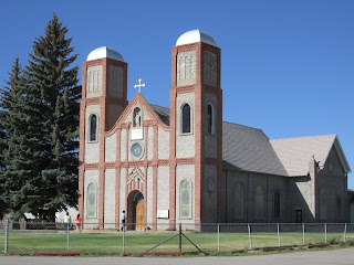
Our Lady of Guadalupe Church
Colorado's Oldest Church

Just a two mile drive north of Antonito is the settlement on Conejos. Here you will find Our Lady of Guadalupe Church.

Our Lady of Guadalupe Church was founded in 1856 and it’s parish is the oldest in Colorado. The very first church on the site was constructed of logs put plastered with adobe. In 1863 a larger adobe church was built. Renovations took place through the years but the building was burned down in 1926 by an electrical fire. The walls and towers were saved but new brick towers and a brick entrance were built in 1948. When you visit the church you’ll see a niche above the front entrance up near the roof line containing the statue of the Virgin of Guadalupe. This is the original statue brought by the first settlers of the area.

Below are links to Western Trips articles about more southern Colorado trip destinations...

Historic Fort Garland

Beautiful Manitou Springs Colorado

A Visit to Mesa Verde National Park


train station antonito colorado
Antonito CO Train Depot
Los Caminos Antiguos Scenic Byway 

Running directly through Antonito Colorado is the Los Caminos Antiguos Scenic Byway. This 129 mile long connection of highways. The name of this scenic byway in Spanish means “the ancient road” and it is true that this roadway winds itself through an area that was once home to the ancient Indians of the southwest as well as the territory of Nuevo Mexico which was once ruled by Spain.

Travel on the Los Caminos Antiguos Scenic Byway for an opportunity to explore the culture and traditions of some of Colorado’s oldest communities.

You’ll view the spectacular San Juan and Sangre de Cristo Mountain ranges as well as the high, fertile San Luis Valley which is today Colorado’s largest agricultural area. Also, along this highway among other interesting stops you’ll explore the town of San Luis Colorado and the Shrine of the Stations of the Cross, the historic frontier military outpost of Fort Garland, Alamosa Colorado and it's Rio Grande Scenic Railroad and the Great Sand Dunes National Park, the site of the highest sand dunes in North America.

frontier carbines
Authentic frontier carbines exhibit, Fort Garland, CO
For more information on Colorado's Los Caminos Antiguos Scenic Byway and a map of the route see website www.coloradodot.info/travel/scenic-byways/south-central/los-caminos.

The entire region of southern Colorado and northern New Mexico is filled with a tremendous amount of historic sites, National Parks, National Monuments, wildlife refuges, and museums. Vacations in Colorado offer something for everyone. If you have an opportunity to travel southern Colorado you'll find many fun and educational sites to add to your road trip planner.


(Article and photos copyright 2013 Western Trips)


View Larger Map

Friday, September 13, 2013

New Mexico Hot Springs / Ojo Caliente


Western Trips visited a unique western travel destination in the scenic beauty of northern New Mexico. The historic town of Ojo Caliente is a stop you want to add to your western road trip planner. In Spanish the name Ojo Caliente means 'hot spring" and this is what you'll find today when you visit this most very unique town.

Scenic trails around Ojo Caliente NM
Ojo Calient is about a one hour drive north of Santa Fe New Mexico and about a fifty minute drive from Taos. Ojo Caliente's location makes it an excellent companion trip to the National Parks in southern Colorado and northern New Mexico as well as the historic sites in and around Santa Fe and Taos. Ojo Caliente is also about a two hour drive north of Albuquerque.

The Site of Ancient Pueblos

The first inhabitants of what is today Ojo Caliente New Mexico were the Pueblo Indians. Ancient peoples, the ancestors of today’s Native American Tewa tribes, built pueblos and terraced gardens overlooking the springs. The hot springs were considered a source of healing and thousands of people lived there.

The Spaniards and Ojo Caliente

During the 1500's, the Spaniards in their search for gold and the "fountain of youth" also discovered these springs.Spanish explorer Cabeza de Vaco found the springs in 1534 and described them as follows...

"The greatest treasure that I found these strange people to possess are some hot springs which burst out at the foot of a mountain...so powerful are the chemicals contained in this water that the inhabitants have a belief that they were given to them by their gods. These springs I have named Ojo Caliente"


Ojo Caliente Historic 1916 Hotel
Ojo Caliente would eventually be a part of Nuevo Mexico when the Spaniards came north along the Rio Grande to establish their new colony with Santa Fe as it's capital.

It was during the late 1600's that the Spaniards built a settlement at Ojo Caliente but attacks by both the Ute and Comanche Indians caused the site to be abandoned in 1748. The settlement was revived in the 1800's.  Zebulon Pike, the explorer of southern Colorado and northern New Mexico and whose name is on the famous peak in Coroado, was at Ojo Caliente in 1807 as a prisoner after his arrest by the Spaniards in Taos. He was charged with exploring in New Spain. While Pike was held in Ojo Caliente he made the observation..."the greatest natural curiosity is the warm springs". Pike also observed that the settlement as built with mud walls, the houses being a part of the walls. He thought that the settlement was built in a defensive manner with perhaps 500 residents.

Ojo Calient Today

In 1868, New Mexico Territory's first representative to Congress, Antonio Joseph, opened the first overnight lodging facility at Ojo Caliente. This was one of the first natural health resorts in the country. The facility was a health spa taking advantage of the local hot springs. It's estimated that more than 100,000 gallons of steaming water come up to the surface daily.


Adobe Round House built in 1924
Today, tourists to Ojo Caliente will find a facility named Ojo Caliente Mineral Springs Resort and Spa. The site of this resort and spa is at the site of the original spa and three original buildings have been restored and maintained. They are listed on the National Registry of Historic Places. This includes the bath house which was built in 1868, the Historic Hotel, which was built in 1916 and the Adobe Round Barn built in 1924.

At the Ojo Caliente Mineral Springs Resort and Spa you'll experience four different sulfur free mineral waters. These are lithia, arsenic, soda and iron. The word "spa" is the acronym for the Latin phrase, “Salus Per Aquas”, meaning “health through water”.

Some visit the springs at Ojo Caliente for a day and others for a weekend or longer. Locals have visited the springs on a reguler basis. It's a truly unique place to experience the different types of hot springs mineral waters.The Ojo Caliente springs have a reputation of bringing tourists back many times. People fid it as the perfect place to get away from the hustle and bustle of modern day living. The scenery around Ojo Caliente and northern New Mexico is some of the most picturesque you'll experience anywhere.

There are two additional Western Trips photo articles regarding hot springs in northern New Mexico that you'll enjoy. The links are below...

A Visit to Jemez Springs

Montezuma's Castle / Las Vegas New Mexico


Mineral spring pools at Ojo Caliente Resort
Hiking and Biking at Ojo Caliente

In addition to the spa and mineral water activities, there are several good hiking trails you'll find that has their trail heads at the resort and spa site.The resort occupies about 1,100 acres and is adjacent to national forest and public land. Included among the trails is the hilltop trail to the ancient Posi Pueblo. Some of this trail is steep and rocky and other portions are fairly level. The Posi Pueblo is in relatively good condition and the Ojo Caliente Resort has partnered with the Bureau of Land Management to protect this special place. The round trip hike to the ancient pueblo is a bit over one mile from the resort. As with all trails in New Mexico, hikers and bikers should make sure to bring along plenty of water.

There is also a mountain bike trail through the surrounding mesas to the historic Mica Mines. This is about a four mile round trip. Mica was mined at one time in the U.S. but most now is imported. At one time mica mining was a big industry in the southwest. The high desert mesa scenery on this hike will give you plenty of great photo opportunities. There are no facilities for bike rentals but if you're traveling to Ojo Caliente from either Taos or Santa Fe there are outfitters at both locations. There is also a relatively short walk from the resort to the Adobe Round Barn which is a must if you're visiting the resort. Trail maps can be obtained at the resort front desk.

Historic Hotel lobby
Ojo Caliente Mineral Springs Resort and Spa offers accommodations in the Historic Hotel as well as in cottages and suites all adjacent to the hot springs. Rv sites are also available on the grounds. There is a daily rate for those who just wish to spend the day at the spa and springs while visiting nearby tourist destinations. The hotel has a terrific restaurant which offers breakfast, lunch and dinner.

Whether you wish to book a room or just enjoy the hot springs for the day or perhaps attend a yoga class , Ojo Caliente will make a fine addition to your northern New Mexico trip planner.

(Article and photos copyright 2013 Western Trips)


View Larger Map

Sunday, September 8, 2013

Frontier Forts / Fort Garland Colorado


fort garland colorado
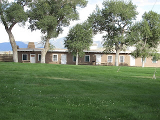
Restored adobe structures from parade ground

Western Trips had the opportunity to explore the southern Colorado military outpost of Fort Garland. Fort Garland was established in 1858, about a decade after the U.S. took possession of the southwest from Mexico, to protect settlers in the San Luis Valley. This area of Colorado is a particularly scenic part of a very scenic state. Fort Garland is also just south of towering Blanca Peak which has an elevation of 14,345 feet. Blanca Peak is the highest peak in all of the Sangre de Cristo Mountains.

Southern Colorado's Unique Tourist Sites

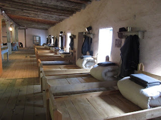
Fort Garland is an excellent addition to your southern Colorado trip planner and it's near to several other popular tourist destinations. This old frontier fort has a vast array of 1800's artifacts including a large collection of frontier firearms and furnished barracks as they would have looked in the 1800's.

Fort Garland is located about 25 miles east of Alamosa Colorado, 78 miles north of Taos New Mexico and about 90 miles southwest of Pueblo Colorado.


1800s infantry barracks
Fort Garland infantry barracks interior
One of several unique travel sites near Fort Garland is the Great Sand Dunes National Park which is about a 29 mile drive west and northwest of the fort. Another is Pike's Stockade which was built by Zebulon Pike in 1807.The site is four miles east of Sanford Colorado via Colorado Hwy 136. Pike raised the American flag at this fort in Spanish territory during his second expedition into the Louisiana Territory. The site is a National Historic Landmark.

The link below is our Western Trips photo article on the Great Sand Dunes National Park.

The Great Sand Dunes

 Another fun family activity nearby in Alamosa Colorado is the Rio Grande Scenic Railroad. This excursion train rides from Alamosa to La Veta Colorado and a connection to the Cumbres and Toltec Railway which offers scenic rides to Chama New Mexico. The Rio Grande Scenic Railroad route takes you through fascinating mountain country that's not seen from the highway.


frontier carbines
Display of 1800's carbines
Fort Garland and the San Luis Valley

Fort Garland is considered the gateway to the San Luis Valley. The San Luis Valley is an agricultural area about 125 miles long and 50 miles wide. The highly productive valley receives it's irrigation from the Rio Grande and from artesian wells which makes it the most productive agricultural valley in all of Colorado. Lettuce, barley and Red McClure potatoes are some of the main crops shipped out of the San Luis Valley.

The San Luis Valley is a unique region. The valley lies in elevations above 7,000 feet and in many respects is a high desert but lies above aquifers. The valley had been occupied for centuries by Native Americans and then by the Spaniards. By the end of the 1800's most of the valley had been cultivated by the many settlers who arrived from the east after the end of the Mexican American War.

Fort Garland and the Sangre de Cristo Land Grant

Fort Garland has a very rich history which has been preserved and on display at the fort museum. The fort itself was built on land leased from the Sangre de Cristo Land Grant which was part of a system to reward land during the times of Spanish and Mexican occupation of North America. At the time of their occupation of the southwest, Colorado was part of Nuevo Mexico with it's capital being in Santa Fe.


blanca peak colorado
View toward Blanca Peak
Land grants were important to the Spaniards and Mexicans for several reasons. First, served as a catalyst to help settle a region. Land grants also served a military purpose. Land owners were expected to ride along the borders of their property to show ownership, commit to improvements, and  pledge to defend the land against foreign attacks as both the Spanish and Mexican Governments did not have the military forces capable of defending their outermost territories.

As it turned out after the Americans took over this territory as well as California, there were many disputes regarding the land grants awarded simply because the Spanish and Mexican systems were so different than the American method of land ownership. It's interesting to note that there still remains disputes of land ownership in the U.S. as a direct result from these early Spanish and Mexican land grants.

In particular, the Mexican's who inherited the Spanish administration after 1821, allowed for French, British, and American born men to own  land so that they essentially became the large landowners in Mexico.  All that was required of the land recipients was to pledge to defend Mexico against American westward expansion.

Fort Garland and Kit Carson
As an active U.S. military fort, it leased land from the historic Sangre de Cristo Land Grant. - See more at: http://www.historycolorado.org/museums/history-fort-0#sthash.JPKjcwJ8.dpuf

When Fort Garland was established by the War Department in 1858, the area where the fort would be established was in the Territory of New Mexico. Fort was built to replace Fort Massachusetts which had been built six miles to it's north. Fort Massachusetts happened to be built in what was soon determined to be a poor defensible position therefore the establishment of Fort Garland was needed as a replacement. The fort was named after the Commander of the Department of New Mexico, John Garland.


1800s cavalry officers hat
Cavalry Officer's hat exhibit
Fort Garland, whose buildings were constructed in adobe architecture, at one time was commanded by the legendary Kit Carson who occupied the fort with his regiment of New Mexico Volunteers. Carson commanded Fort Garland from 1866 to 1867, not long after the conclusion of the American Civil War.While commanding the fort, Kit Carson was credited with making peace with the Ute Indians of the region.

Kit Carson died just one year after his Fort Garland command ended. Carson died in 1868 at nearby Fort Lyon at the age of only 58 of what was described as a abdominal aortic aneurysm. He was buried near his home in Taos New Mexico. 

Visitors to Taos today can take a tour of the old Kit Carson home which is also a museum. The home and museum is located just a short walk east of the Taos Plaza. Kit Carson's grave site is a short walk northeast of the home.

Below are links to a Western Trips photo articles regarding Kit Carson and Taos New Mexico. 

Kit Carson and Taos New Mexico 

Kit Carson and a Trip Through the Navajo Nation


frontier 1800s tobacco
Fort Garland frontier pipe and tobacco exhibit
Fort Garland and the Civil War

During the Civil War Fort Garland was utilized as an enlistment point for Colorado Union Volunteers. Some of the troops put together at Fort Garland fought in the key Battle of Glorieta Pass, a site just to the east of Santa Fe New Mexico and along present day Interstate 25.

The battle was key in that it turned back General Henry Sibley and his Confederates who were attempting to travel north and attack the important Fort Union along the old Santa Fe Trail. Up to thae point of the battle, Sibley had occupied both Albuquerque and Santa Fe. The Union victory at Glorieta Pass checked the Confederate advance and forced their eventual withdrawal from all of New Mexico Territory.

Fort Garland is located at a point in southern Colorado that makes it very easy to combine a visit their to other fine tourist destinations. Taos New Mexico is just 78 miles to the south. Santa Fe New Mexico is just another 65 miles south of Taos and to the west is Alamosa Colorado with the Great Sand Dunes National Park and two very popular National Wildlife Refuges and the Rio Grande Scenic Railroad.

(Article and photos copyright 2013 Western Trips)


View Larger Map

Tuesday, September 3, 2013

Where the Southwest Meets the Rockies


If your western road trip takes you to southern Colorado you'll be traveling in an area of the U.S. where the Great Southwest meets the Rocky Mountains. One town in particular you'll want to add to your trip planner is Alamosa Colorado.

alamosa colorado
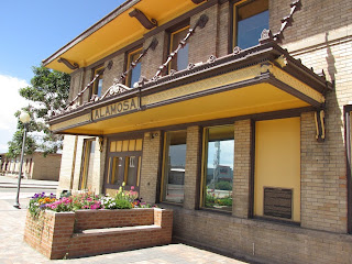
Downtown  Alamosa Colorado
Alamosa Colorado is located about 85 miles north of Taos New Mexico and about 70 miles west of Walsenburg Colorado on Interstate 25 via U.S. Hwy 160. Alamosa is also a two and one half hour drive north of Santa Fe New Mexico which makes it a good addition while vacationing in Santa Fe.


The Railroad Made Alamosa

Alamosa Colorado is one of those many towns in the western U.S. who owes it's original growth to the railroad. Where the early railroad built to, in many instances, determined what towns prospered and what towns did not. In the case of Alamosa, the real engine of growth was the Denver and Rio Grande Western Railroad which built to it in June of 1878 from Garland Colorado to the east and eventually continued onward. To emphasize the importance of the railroad to Alamosa, the town today calls itself  "the town that grew overnight". The Denver and Rio Grande Western Railroad changed a tent settlement to a solid town literally overnight. It's said that whole buildings were transported to Alamosa on rail cars and the town incorporated in August of 1878.


train depot alamosa colorado
Historic Alamosa Colorado train depot
Alamosa in the San Luis Valley

Alamosa Colorado is located in the San Luis Valley where agriculture is the major economic catalyst. The San Luis Valley is about 125 miles long and about 50 miles wide. To the east are the towering Sangre de Cristo Range and to the west are the San Juan Mountains. At one time the valley was inhabited by both the Comanche and Ute Indians who hunted game such as deer and elk.

The Spaniard, Diego de Vargas, was the first European to enter the valley. Lieutenant Zebulon Pike’ s expedition traveled through the San Luis Valley while still a Spanish territory in 1806-1807. After the end of the Spanish American War in the 1840's the region became a territory of the United States.

This valley receives it's irrigation from the Rio Grande and from artesian wells which makes it the most productive agricultural valley in all of Colorado. Lettuce, barley and Red McClure potatoes are some of the main crops shipped out of the San Luis Valley.

The San Luis Valley is a unique region. The valley lies in elevations above 7,000 feet and in many respects is a high desert but lies above aquifers. By the end of the 1800's most of the valley had been cultivated. 

When the Denver and Rio Grande Western Railroad built into town it made Alamosa a major shipping point for the valley's crops.

rio grande scenic railroad
Rio Grande Scenic Railroad locomotive
Attractions In and Near Alamosa Colorado

Alamosa, which means cottonwood in Spanish, is the place to stay when visiting nearby attractions including the Great Sand Dunes National Park which is located about thirty-eight miles northeast of town. These are the tallest sand dunes in America and if you've never visited this area you'll want to add it to your western vacation planner. Camping is allowed inside the park and there are room accommodations just outside the park entrance.

Another very popular attraction in Alamosa itself is the Rio Grande Scenic Railroad. This excursion train rides from Alamosa to La Veta Colorado and a connection to the Cumbres and Toltec Railway which offers scenic rides to Chama New Mexico. The Rio Grande Scenic Railroad route takes you through fascinating mountain country that's not seen from the highway.

alamosa colorado railroad
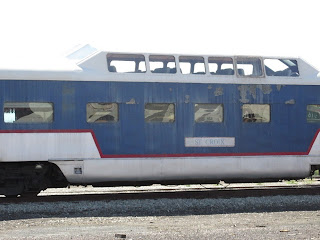
Vintage rail cars at Alamosa railyard

The Alamosa National Wildlife Refuge was established in 1962 as a haven for migratory birds and other wildlife. The refuge is over 11,000 acres in size. According to the U.S. Fish & Wildlife Service, the refuge consists of wet meadows, river oxbows and riparian corridor primarily within the flood plain of the Rio Grande, and dry uplands vegetated with greasewood and saltbush. These areas support songbirds, water birds, raptors, mule deer, beaver and coyotes.

The Monte Vista National Wildlife Refuge was established in 1953 particularly as a haven for waterfowl. The U.S. Fish & Wildlife Service state that the refuge is a major stopover for migrating greater sandhill cranes moving between their wintering area around Bosque del Apache National Wildlife Refuge in New Mexico and breeding grounds in the northern United States and southern Canada. There is also a great number of elk seen in this refuge. As is the case with the valley's agriculture, the water provided by the Rio Grande and the underground aquifers make both the Alamosa National Wildlife Refuge and the Monte Vista National Wildlife Refuge possible.

While searching for oil during the 1930's, hot water was struck near Hooper Colorado to the north of Alamosa. Today the Alamosa area offers visitors a very unique mineral water swimming pool. The Sand Dunes Swimming Pool and RV Park offers a 150,000 gallon pool where underground hot springs water enters the pool at 118 degrees Fahrenheit and is maintained in the pool between 98 and 100 degrees. There is an adjoining 24 person therapy pool whose temperature stays a consistent 108 to 109 degrees.  The pool also offers an excellent snack bar, family fun, relaxation and rejuvenation and it's just 20 miles from Alamosa. It's a great stop to add to your itinerary when visiting all of the other attractions in and around Alamosa Colorado.

great sand dunes
Great Sand Dunes National Park
The links below are to three Western Trips photo articles that make good companion trips with a visit to Alamosa Colorado...

Great Sand Dunes National Park

A Visit to the Cave Dwellings at Mesa Verde

The Great Sand Dunes National park is just about a 45 minute drive northeast of Alamosa Colorado. Mesa Verde national park is just west of Durango Colorado which is another must stop while in southern Colorado and about 180 miles west of Alamosa. The drive from Alamosa to Mesa Verde is about three and a half hours.

(Article and photos copyright 2013 Western Trips)