Western Trips

Thursday, January 31, 2013

Livermore Valley / Wineries


Western Trips makes a road trip to one of northern California's popular wine regions, the Livermore Valley.

The beautiful Livermore Valley is located about 45 miles east of San Francisco and about 35 miles east of Oakland California. driving there for a pleasant side trip from the Bay Area is easy. Livermore California is located along Interstate 580.
wente vineyards
Wente Vineyards, Livermore Valley CA
The Livermore Valley

The types of grapes grown in any region of California has most to do with it's climate and soil. As opposed to Sonoma County grape growing, the Livermore Valley has a warmer climate. The Petite Sirah is one of Livermore's grapes that produces a very popular red wine

The first grapes were planted in the valley during the late 1760's by missionaries.  Robert Livermore, of who the city's name is in honor of planted the first commercial vines in the 1840s and Livermore Valley commercial wine production also commenced back in the 1840's. One of the very first wineries to open in the valley was the Cresta Blanca Winery in 1882. The Livermore Valley came to the attention of the world wine industry when their wines won America's first Gold Medal for Wine at the Paris exposition in 1889.

The Livermore Valley today offers more than forty wineries and over 5,000 acres of vineyards. Tasting rooms showcase award-winning wines and offer year around activities as well. On of the best websites to get an up to date calendar of upcoming events is that of the Livermore Valley Wine Growers Association. Their site is www.lvwine.org.

livermore valley winery
Beautiful grounds at Wente Vineyards
Wente Vineyards

Western Trips visited the famous and hugely popular Wente Vineyards. Of special distinction is that the Wente Vineyard is the oldest continuously operated family-owned vineyard in the country. The vineyard was founded in 1883 by C. H. Wente, a first-generation immigrant from Germany who learned wine making from Charles Krug. Wente recognized the potential for quality grape production in the Livermore Valley which offered warm days and cool nights. Wente's very first vineyard was on forty-eight acres. Today's Wente Vineyards is comprised of about 2,000 acres in the Livermore/san Francisco Bay area and 800 acres outside of Monterey California.

As our photos show, the Wente Vineyards site is spacious and beautiful. Visit the Wente Vineyards tasting room and the award winning restaurant. Wente Vineyards has also been long known as a concert venue. The concerts at Wente Vineyards combine entertainment with one the most unique backdrops found anywhere. A great place to see top name entertainment in a spacious outdoor vineyard setting. This is just one more reason why a day trip to the Livermore Valley as part of your San Francisco Bay trip is a lot of fun.

concannon vineyard in livermore valley
Concannon Vineyard Tasting Room
Concannon Vineyard

Concannon Vineyard was founded by James Concannon, an Irish immigrant who traveled to the United States in 1865. By 1874, the James Concannon family had moved from Maine to Oregon and then to the San Francisco Bay area. After much study and consultation with wine experts of the era, Concannon set out to build his vineyard and winery in the Livermore Valley. By accomplishing this, James Concannon became the first Irish immigrant to establish a successful winery in America.

Concannon Vineyard  has the distinction of being one of the first wineries in California to make Bordeaux style wines. The first vineyards were planted in 1883. Concannon's first white Bordeaux cuttings were planted in the late 1880's.

Another interesting fact is that the Concannon Vineyard was active producing sacramental wine for the Roman Catholic Church during the prohibition era of the early 1900's.The vineyard has also been registered as a California Historic Landmark.


concannon vineyard victorian house
1883 Victorian House
In addition to an excellent tasting room, Concannon Vineyard also features the Underdog Wine Bar which offers small plates for wine pairings.

Another distinctive item you'll see when entering the Concannon Vineyard is the Victorian house which was built in 1883.

Links to two additional Western Trips photo articles you'll enjoy are Downtown Napa California and beautiful St. Helena California.

Visiting the Livermore Valley Wineries

The Livermore Valley is easy to reach from any San Francisco Bay area city. From any Eastbay city you'll want to take Interstate 580 eastbound to the city of Livermore. From Oakland you can get directly on Interstate 580. From San Jose to the south you'll be able to take Interstate 880 northbound and follow the signs to Interstate 680. I 680 which will intersect with I 580 in Dublin. Take the I 580 eastbound exit which will take you to Livermore. Off of Interstate 580 exit Livermore Avenue and go south into the middle of Livermore.

When you put together your San Francisco Bay area trip planner and you're looking for a close in unique and historic wine area to visit, you'll want to add the Livermore Valley wineries to that list.

(Photos from author's collection)

Saturday, January 26, 2013

Historic Churches


There are historic churches all over the western United States, many of whose origins go all the way back to the 1800's. These churches are all fine additions to your western vacation planner and we want to highlight just a few of these in this article.

Churches of the West

Your western road trip will include towns and cities which hold a lot of history. Much of the history can be learned by visiting some of the museums we've highlighted in Western Trips articles. In addition to this, the historic churches also tell much about a town's history. Just like the first courthouse and hotel and saloon was built by the local citizenry, so it was the same with the many early churches that dotted the old west. In addition to different architectural designs which in itself is very interesting, the church in the old west also tells us much about the people who originally inhabited a settlement.


St. Peter's Chapel, Mare Island California
St. Peter's Chapel

St. Peter's Chapel / Mare Island California was built in the year 1901. This is one of the historic churches in northern California featuring a collection of twenty-five Comfort Tiffany stained- glass windows that illuminate the chapel. Located adjacent to Vallejo California and on the old Mare Island Naval Base, St. Peter's Chapel is one of Vallejo's best secrets. Mare Island and the city of Vallejo are located at the northern end of San Francisco Bay. St. Peter's brown-shingled structure is a great example of Craftsman architecture. The simple lines of the chapel and it's wood tones and rustic charm set off the brilliance of the windows beautifully. Of special note is that more than 5,000 Tiffany windows over a period of fifty years  were constructed throughout the U.S. as part of an American Renaissance that replaced much of the ornamentation of Victorian design. If you ever have an opportunity to view an exhibit of true Tiffany windows this is a great site to do it.

Read more here: http://www.sacbee.com/2012/12/02/5019794/modest-chapel-in-vallejo-features.html#storylink=cpy


Read more here: http://www.sacbee.com/2012/12/02/5019794/modest-chapel-in-vallejo-features.html#storylink=cpy
St. Peter's Chapel on Mare Island is the oldest surviving Navy chapel in the United States. The effort of preserving Saint Peter's windows and providing access to the public is the work of  the Mare Island Foundation. The foundation is comprised of all volunteers. The Foundation is a 501(c)(3) Non Profit organization.

First United Methodist Church

 san marcos texas historic churches
First United Methodist Church, San Marcos TX
First United Methodist Church in San Marcos Texas, between San Antonio and Austin on the Interstate 35 corridor, is an imposing site that you can't miss while visiting San Marcos. The First Methodist Church building on this site goes all the way back to 1853. The current church sanctuary dates back to 1893 and still has the original walnut pews and pulpit. Some of the updates over the years included a pipe organ in 1912 which was the first ever pipe organ in San Marcos and cost the church about $3,500 at the time. When electricity came to this part of Texas in 1924 the organ was converted into electric. Art glass windows were added to the church in 1938. The bell that hangs in the church chapel is thought to be the oldest artifact in San Marcos.

The First United Methodist Church in San Marcos was added to the National Register of Historic Places in 1974.

grass valley california historic church
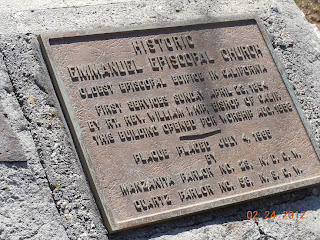
Emmanuel Episcopal Church

Emmanuel Episcopal Church located in Grass Valley California has the distinction of being the oldest Episcopal Church in California. Established in 1855 during the latter California Gold Rush days, the church is still an active place of worship. Emmanuel Church history  Emmanuel's history is much the same as the miners and frontier pioneers that settled the area as part of the California Gold Rush. The church address is 235 South Church Street.

Grass Valley is in Nevada County California in the Sierra Nevada foothills. The town of Grass Valley grew from an original mining camp the same as most others in this part of California.


emmanuel episcopal church grass valley
During the mid 1800's there was a strong effort to establish a library in Grass Valley. The town sprouting from a small mining camp was now a prosperous and growing settlement and to ensure that the culture was improving, a library was a necessity. While the church was established during the 1850's, it wasn't until the year that the non-denominational Emmanuel Church Library was created to provide library services. About ten years later the city of Grass valley took over operations of the library and subsequently received a large grant from the Carnegie Foundation for the building of a new facility. That building is today's library at 207 Mill Street.


Nuestra Senora de las Remedios de Galisteo


Nuestra Senora de los Remedios de Galisteo, the Catholic church shown in this article, was completely rebuilt in 1706 after the Pueblo Revolt of 1680 and the pueblo resettled by 150 families of the “Tano Nation.” Prior to the revolt, the original church building had three naves whereas the rebuilt one here has only one. 

galisteo church
Nuestra Senora de los Remedios de Galisteo
When De Vargas explored the area after the Spaniard's return in 1692 he found all of the former pueblos Galisteo empty of inhabitants. It wasn't until about 1706 that families once again resettled there.

Galisteo lies in the next valley east of Santa Fe where Native Americans first came in contact with Europeans during the Coronado Expedition of 1540. Today, archeologists have identified nine pueblo ruins within the Galisteo Valley. Out of the nine ruins, two are on the north side and seven on the south side of the valley. Founded in circa 1250 AD, and with an estimated population of 350 in 1749, the Galisteo Pueblo was totally abandoned by the Indians in 1792. The reasons cited for the abandonment were a small pox epidemic as well as continual raids form the Comanche Indians. Galisteo is located about 23 miles south of Santa Fe New Mexico.


Links to three additional Western Trips photo articles you'll enjoy include the Loretto Chapel in Santa Fe New Mexico...Mission San Francisco de Asis outside of Taos New Mexico and the Carmel Mission in Carmel California.


frisco texas historic churches
Lebanon Baptist Church, Frisco TX
Lebanon Baptist Church

The photo shown in this article is of the Lebanon Baptist Church in Frisco Texas. Frisco is a far northern suburb of Dallas. The first church building was constructed in 1883. That building was destroyed by a storm in March of 1904. The church seen here is the one constructed later in 1904.

The town of Lebanon which continued to grow was overtaken by a new town nearby named "Frisco" as a result of the railroad coming there in 1902. Many of the people of Lebanon decided to relocate their homes and businesses to Frisco in anticipation of the commerce brought in because of the new railroad line.

The Lebanon Baptist Church exhibit is now located at the Frisco Heritage Center. The church remained in Lebanon and continued to hold services in this same structure until 2003 when the members donated it to the City of Frisco for use in the Frisco Heritage Center.

The Frisco Heritage Center is a fun and educational place to visit with the family. It's located just east of the Frisco City Hall and Library on Page Street. The Heritage Center is located on about six acres of City property adjacent to the BNSF Railroad. In addition to an excellent museum building, it contains eight structures plus a steam locomotive and wooden caboose.

These are just a few of the many historic churches located throughout the western United States. Depending on where your next vacation or road trip might take you, any and all of these sites are good additions to your trip planner.

(Photos from author's private copyrighted collection)

Read more here: http://www.sacbee.com/2012/12/02/5019794/modest-chapel-in-vallejo-features.html#storylink=cpy


Wednesday, January 23, 2013

West Texas


west texas
West Texas
Located about 19 miles north of Waco, the town of West Texas, along Interstate 35, has a rich history of being the home to a great number of Czechoslovakian immigrants to Texas during the latter 1800's. It was during the 1880's that the immigrants, mostly Czech and German, migrated to this area from Europe and began farming the rich soil. In addition to farming, Czech immigrants were active in opening businesses in West and most of these businesses reflected their European culture.

The Railroad Brought Commerce

Anywhere you may travel throughout the western United States, you'll learn that the single largest catalyst for town building was the railroad. During the latter 1800's, people were migrating west in droves for a variety of reasons. The abundance of land was one of them. Commerce seemed to grow in leaps and bounds wherever the railroad went. The story of the beginnings of West Texas was no different. The rail lines of the Katy Railroad which ran through the town beginning in 1882 was a big boost to the entire area. As a result, the town of West Texas was formally created in 1892. At that time, West was the commercial center of that particular area of central Texas.

katy railroad depot west texas
Old Katy Railroad Depot, West Texas
Today, the City of West is a thriving community with it's unique Czech heritage being proudly displayed in every way. West, Texas declares itself as being the "Czech Heritage Capital of Texas". Czech Texas is most populous in the area of central Texas north of Waco and south of Dallas
and east of present day Interstate 35.

The Early Settlers

The area around today's West Texas saw it's first settlers as far back as the 1840's. These were farming people from the east who migrated there for the rich soil and for the land sold by the government for the purpose of building Texas schools. Agriculture activities included raising cattle and growing wheat maize and cotton. During the mid 1800's settlers gathered around a site that became known as Bold Springs, so named for the freshwater found there in abundance. By 1860, Bold Springs had a population of about 300 people.


The Railroad and West Texas 

West Texas has all to do with the land that was owned by one Thomas West at the time that the Katy Railroad came through in 1881. West had moved to the area about 1859. The Katy Railroad had already built out between Waco and Hillsboro Texas to the south and was extending it's rail line through land owned by Thomas West. This would have been to the north/northeast of Hillsboro.

mkt railroad caboose
Katy Railroad caboose
Thomas West sold land to the railroad for a depot and other parcels along the right of way were sold to merchants and other business people. As far as Thomas West was concerned, he served as the first postmaster for Bold Springs. The post office was located in the Katy train station which is still preserved near the center of today's West. The West Depot is now home for a railroad museum and Information Center.

The Czech Immigration

A very interesting aspect of West Texas is that some of the descendants of the first Czech settlers still reside in the city today and still operate businesses there. The Czech immigrants had the custom of having very large families and they continued that custom in their new Texas home. By the 1920's the Czech European culture became the dominate culture in West Texas.

To give you an idea of the growth of Czech migration to Texas in the 1800's, the online Texas Historical Association states that by the time of the American Civil War there were about 700 Czech immigrants in Texas.
crash at crush texas historical marker
The Crash at Crush

By the same token the Texas Czech people were not involved in the Civil War for really two reasons. They weren't familiar with the concept of slavery as it was not part of their European culture and morals. Mostly because of this they didn't fully understand the reasons behind the North/South conflict. As a result of their non-allegiance in Texas there was some animosity between Czechs and Anglos during the war.

By the year 1900, there were more than 9,000 foreign born Czech immigrants living in the state.  The majority of Texas Czech immigrants came from Moravia and the majority of the Czech language spoken in Texas is characterized by Moravian dialects.

The Crash at Crush

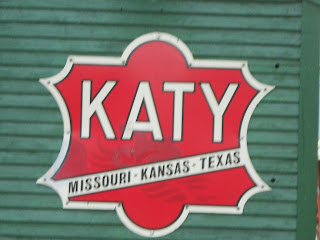
Just about three miles south of West Texas was the site of one of the most spectacular if not strange promotional events ever staged by a railroad. The Misouri Kansas & Texas Railroad, known as the Katy or MKT, attracted some 30,000 spectators to witness the planned head on collision of two locomotives. The staged event of a Texas train crash was touted for months beforehand and  received national attention

katy railroad sign
The event occurred on September 15th, 1896. Each train was traveling at about 45 MPH when the collision occurred. Although the railroad's mechanics thought that the locomotive boilers would not explode, they indeed did. Spectators were allowed too close to the actual railroad collision point. The result was that two spectators were killed and many injured by flying debris from the explosion. The site where the locomotive collision occurred was nicknamed "Crush Texas" for the man who conceived the idea, passenger agent William Crush of the MKT. This by far was the most strange and never tried again promotional stunt of any railroad in America. The historic sign shown above commemorates the event and is currently located next to the West Texas train depot and museum.

Links to additional Western Trips photo articles about central Texas destinations are Hillsboro Texas, the county sat of Hill County and the historic art community of Salado Texas. Both are excellent stops when your road trip or Texas vacation takes you between Dallas and Austin.

Also, see our Western Trips articles on the Old Spanish Trail Highway that ran from St. Augustine Florida to San Diego California and Historic Lockhart / The Barbecue Capital of Texas.

Visit West Texas

Two must stops during your visit to West Texas are the old Katy Railroad Depot and Museum located in the center of town. In addition to photos of the 1896 MKT locomotive collision, the depot museum exhibits many  photographs that tell the story of the relationship between the railroad and the community of West Texas.

crush texas locomotive collision
1896 photo of the Crash at Crush
Make certain to stop and pick up a "Kolache" when visiting West. West Texas also declares itself the "Kolache Capital of Texas". A kolache is a pastry that holds fruit rimmed by a puffy pillow of supple dough. In central Texas, the kolache is widespread among Czech Americans and there's some great places in West Texas to pick them up at.  

The Czech Stop and Little Czech Bakery is located at 105 N College Ave. Also, Gerik's Ole Czech Smokehouse and Bakery located at 511 West Oak St. Another is The Village Bakery located at 108 East Oak St., West, TX.

The map below will give you the exact location of West Texas along Interstate 35 between Dallas and Waco.

(Photos from author's collection. Crash at Crush 1896 photo from the public domain) 


View Larger Map

Monday, January 21, 2013

Mission San Rafael Arcangel


mission san rafael arcangel
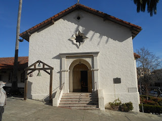
Mission San Rafael Arcangel
One of the most interesting stories pertaining to the old Spanish Missions of California regards Mission San Rafael Arcangel in San Rafael California. This is an easy mission to explore being located just about twenty miles north of San Francisco along U.S. Hwy 101. If your vacation plans include San Francisco, make certain to put this historic site on your trip planner.

A Mission for Healing

Mission San Rafael Arcangel is the twentieth of the twenty-one missions established in California. The mission was originally established as a hospital site and helper to nearby Mission Dolores in San Francisco although some historians believe that the perceived threat of Russian activity just to the north may have also influenced it's establishment. In December 1817 some two hundred Indians along with four Franciscan friars crossed San Francisco Bay to establish a hospital mission. The new mission's name was in honor of Arcangel Rafael, God's healing messenger. By the year 1820, an estimated five hundred native Americans had been transferred to San Rafael Arcangel.

mission san rafael
Mission San Rafael Arcangel interior
The necessity for such a site was due to the illness suffered by a majority of the Indians residing at Mission Dolores. The friars at Mission Dolores, also referred to as Mission San Francisco de Asis, concluded that the harsh weather and regular fog  on the San Francisco peninsula was not only causing much of the sickness but preventing recovery as well. At that time there was never the intent to have the mission site attain status as a full fledged mission however it did in the year 1822. Mission San Rafael Arcangel was built to be a branch, or asistencia, of Mission Dolores. During the early years, Mission San Rafael Arcangel served as what would be the first sanitarium in Alta California.To protect the mission and/or sanitarium from possible hostile Indian attack, a small group of soldiers were transferred their from the presidio in San Francisco.

Mission San Rafael did have it's share of trouble by hostile Indians. At one point there was quite a controversial event when a Father Mercado was accused of arming his neophytes and sending them out to fight Indians who the father suspected were getting ready to attack. A large number of the suspected hostiles were killed and wounded. As a result, Father Mercado was given a six month suspension.

Searching for a Milder Climate


The realities at Mission Dolores were such that it's believed that 5,000 Native Americans were buried at the mission cemetery. Disease ran rampant at the mission site and as was the case with much contact between Europeans and Native Americans, the Indians were quite suceptable to European bred diseases. This phenomena began from the very first contact between Native American and European.

mission san rafael arcangel bells
Historic bells to the left of entrance
The site of Mission San Rafael Arcangel was chosen for a reason. The area which is present day San Rafael California had much more sunshine and much less fog than the San Francisco peninsula to the south. The mountains to the west of San Rafael acted as a buffer to the weather coming off the Pacific Ocean. The San Francisco peninsula lacked this natural barrier. The added sunshine and generally milder weather was sought to help the healing process. The move to establish the mission in San Rafael seemed to work quite well. Ailing Native Americans seemed to recover very well at this new more sunny and mild location.


Mission Dimensions and Characteristics

The original church was eighty-seven feet long and forty-two feet wide and eighteen feet high with a clay tile roof. Rather than being mounted on top of the new church, the church bells  were hung from a plain wooden frame in the front to the left of the door as one faced the church. Those same bells are on display today, at the same location in front of the replica church. The visitor today will also see the star shaped window above the church door which is a distinguishing characteristic of the current structure. Interestingly enough, the star shaped window never was on the original building. It appeared in 1899 in paintings of Edwin Deakin. In essence, it never existed. Deakin's star shaped window did survive in his artwork and was built into the replica building which was constructed in 1949.

Three additional Western Trips photo article links about San Francisco area Spanish Missions you'll find interesting are Mission Dolores in San Francisco...Mission San Francisco Solano in Sonoma...and Santa Clara de Asis Mission in Santa Clara California.


spanish mission bell
Original mission bell
Mission San Rafael Arcangel Replica 

The original mission replica you'll explore today, the one dedicated in 1949, was built according to specifications known at the time. There were no photos of the original structure therefore the replica was built based on what was known with some variations. The small church building faces west whereas the original faced east. The site location is next to the St. Raphael Parish of the Archdiocese of San Francisco. The replica site is approximate since other church buildings had been built adjacent prior to 1949.

Today's visitor will notice that the old mission replica is in no way adorned as are the other California missions to the south. This was because, as mentioned above, Mission San Rafael Arcangel was not originally planned to become an official stand alone mission. Built as a branch of Mission Dolores, the church building was a fairly plain unadorned structure.

san rafael parish
Today's San Raphael Parish
The replica building reflects this. This of course is one of the facts that make Mission San Rafael Arcangel unique among the California Spanish missions.

Visiting Mission San Rafael Arcangel 

A day trip north of the Golden Gate Bridge to Mission San Rafael Arcangel is an excellent addition to a Bay Area trip planner. The story of the Spanish Missions is really a vivid story of the very beginnings of California settlement. There's much to learn visiting any of the old missions and Mission San Rafael Arcangel tells us a very unique part of that story.


From San Francisco, drive north on U.S. Highway 101 from the Golden Gate Bridge about fifteen miles and exit at Central San Rafael (Exit 452). The mission is located at 1104 Fifth Avenue about four blocks west of the freeway.   

(Photos from author's private collection)
THOUGHTS ON EARLY CALIFORNIA SPANISH MISSIONS VIDEO


View Larger Map

Friday, January 18, 2013

San Francisco Nob Hill


There's always plenty to see in San Francisco. When you're making a list of things to see in San Francisco, Nob Hill is a must. Nob Hill is one of San Francisco's most prominent landmarks. The Nob Hill area of San Francisco is distinctive for several reasons. First, it's one of the forty-four hills in the city. Secondly, Nob Hill is one of the original "seven hills of San Francisco".

nob hill san francisco
A view to downtown San Francisco from atop Nob Hill
Early San Francisco, the settlement during the California Gold Rush era, was a city of hills. Much of the shore land enjoyed by the tourist today didn't exist during this time. What is now the area of the marina district and much of the land around the Embarcadero was the result of landfill that was the byproduct of urbanization of the hills themselves.Interestingly, the landfill used in San Francisco also contained pieces of broken down sailing ships left abandoned during the gold rush.

The Neighborhood of the Wealthy

When you visit Nob Hill one of the first things you'll notice are some of the spectacular views of the city and bay. This prime locale was one of the big reasons that the wealthy built their mansions on Nob Hill. The Nob Hill area came into being in the late 1800's when the city of San Francisco was growing rapidly. New neighborhoods were being created every year and would eventually reach westward all the way to the Pacific Ocean.

Interestingly enough, the earthquake and fire of 1906 brought along many changes. For one, many of the residents owning Nob Hill mansions that were destroyed during this event decided to relocate. Some moved to the Pacific Heights district.

nob hill fairmont hotel
Nob Hill's Fairmont Hotel

Historic Hotels of Nob Hill

It's quite interesting just how the hotels on San Francisco's Nob Hill tell a story about both California and the city.

The Fairmont Hotel

One of the most well known hotels on Nob Hill is the Fairmont. Many have seen the facade of this grand hotel featured in movies and television over the years. The Fairmont Hotel was still in it's final construction stage when the great earthquake and fire of 1906 struck San Francisco. As a result, while the building itself remained intact, the interior was heavily damaged by fire and the hotel's opening was delayed a year until 1907. During this time the structure was also reenforced with concrete that could help it survive another earthquake. For those wondering how the hotel received it's name, it was named after U.S. Senator James Graham Fair. It so happened the hotel was constructed by his daughters, Virginia Fair Vanderbilt and Theresa Fair Oelrichs.

Today, the Fairmont stands out as one the most prestigious hotels in San Francisco. It is part of the Fairmont hotel and resort chain, a leader in the global hospitality industry.


mark hopkins hotel
Mark Hopkins Hotel
The Mark Hopkins Hotel

Another well known hotel you've most likely heard of is the Mark Hopkins. The Mark Hopkins Hotel had a very different history than it's neighbor the Fairmont. The land where the Mark Hopkins sits was at one time the home of Mark Hopkins, one of the Big Four investors and founders of the Central Pacific Railroad. Historians will know that the Central Pacific was the railroad from California that connected with the Union Pacific train at Promontory Utah in May of 1869 creating the first true transcontinental railroad. 

As it turned out, Mark Hopkins passed away in 1878 before his mansion was completed. Hopkins' widow lived in the house until her death in 1891. The property was eventually donated to the San Francisco Art Association which was to use it for a museum and school. The house, while still standing, was damaged extensively by the fire that followed the 1906 earthquake. Soon afterward, the property was bought by a mining engineer and investor who built the first hotel on the site. The hotel changed ownership in the 1960's and today is operated by the InterContinental Hotels Corporation. The Mark Hopkins Hotel is a California Historical Landmark.

An interesting side note is that three of the Big Four investors involved with founding the Central Pacific Railroad once had mansions on San Francisco's Nob Hill.

Links to other Western Trips photo articles about great stops near San Francisco's Nob Hill are the San Francisco Cable Car Museum, the USS Pampanito World War Two Submarine Tour and the old Spanish Mission Dolores.

Of special note is that the Cable Car Museum is just a few blocks north of Nob Hill and is a very unique place to visit. The museum is also an active cable car power house and car barn. In addition to viewing the many great artifacts and photos on display, you can also see the cable car system in action. See our link above for more information. The museum is located at the corner of Washington and Mason Streets.


san francisco grace cathedral
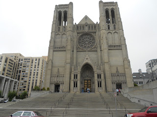
Grace Cathedral

Grace Church, which predates Grace Cathedral, has it's origins back in the California Gold Rush era. The church was first built in 1849. Today's Grace Cathedral is erected on land which at one time was the home of Charles Crocker, one of the Central Pacific railroad's Big Four. Crocker's home was destroyed by the 1906 fire and he donated the property to the Epsicopal Diocese. Today, there are portions of Crocker's rear gate that are still visible.

Today, Grace Cathedral  is the third largest Episcopal cathedral and the fifth largest Gothic-style cathedral in the United States. The present church building was built between the years of 1924 and 1964. Among the many works of art within Grace Cathedral is a very large display of work by Jan Henryk De Rosen.  De Rosen was was a Polish painter and patriot who became famous for his mural and mosaic works. De Rosen lived between 1891 and 1982. The cathedral has sixty-six windows of stained glass. The cathedrals large organ has 7,466 pipes. It's a very unique and beautiful cathedral to visit.

(Photos from author's private collection)

Wednesday, January 16, 2013

New Mexico Pueblo / Pottery


new mexico scenery
Scenery at Ghost Ranch, NM
Visiting New Mexico offers the traveler many excellent venues to view artifacts from the early pueblo era.

The New Mexico pueblo has been and remains a large part of southwest American culture. Over the centuries, many interesting artifacts have been uncovered all over the southwest and fortunately there are several unique museums that make great additions to your New Mexico vacation planner.

One very interesting southwest pueblo culture and the one highlighted in this article, dates back to between 1000 and 1300 AD. These were the Gallina people. The Gallina culture dates well before the Spanish occupation of the southwest and was located in the north central region of New Mexico.


florence hawley ellis museum
Florence Hawley Ellis Museum of Anthropology

This is a museum that you want to add to your New Mexico vacation planner for several reasons. The Florence Hawley Ellis Museum of Anthropology is located at Ghost Ranch in northern New Mexico. Florence Hawley Ellis was one of the first women to receive a PhD in anthropology. Ellis received her PhD from the University of Chicago in 1934 and made beautiful Ghost Ranch her home. Dr. Ellis was also a  long time professor of anthropology at the University of New Mexico in Albuquerque. Dr. Ellis was involved with and led Ghost Ranch archaeology excavations from 1971 until 1990. Many people may also remember that Ghost Ranch was home to the artist Georgia O'Keeffe.

The Florence Hawley Ellis Museum of Anthropology features exhibits covering a very wide range of Native American artifacts. Some of these are highlighted below.

bandelier black on white pottery
Bandelier Black on White
What Happened to the Gallina People?

Information about the Gallina is scarce. One of the most sought after answers pertaining to the Gallina culture was why did it simply disappear? Most studies of this subject point to the the year 1275 AD as the time the culture vanished. The Gallina settlers either left the region or were exterminated. It's a fact that almost all Gallina ever discovered appeared to have been killed.

One possible scenario from historians claim that they may have been murdered by the Anasazi. What is known is that whatever happened to these people, if conflict with the Anasazi did occur, the victors moved on and didn't seem to occupy the Gallina land.

The Gallina Artifacts

On the standpoint of Gallina artifacts, there are several interesting exhibits on display. The Gallina culture left us evidence of their architecture, pottery, tools, shells and stone pipes. The Gallina architecture, for example, consisted of both surface structures and pit houses. A typical village might have from five to twenty homes. The villages were also known to have a north to south orientation.

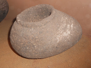
shoe pot pottery
Shoe Pot
Bandelier Black on White

The large Bandelier Black on White shown in the photo above is a storage jar. The Rio Grande region potters created distinctive local varieties of this pottery. This pottery employed black mineral paint which was believed to be prior to 1200 AD. After 1200 AD black vegetal paint was mostly used. The paint was used against a white, off-white, or a light gray background. The Black on White Pottery appeared to die out after 1750 AD. The Bandelier name attached to this pottery is indicative of the area where it came from. Today's Bandelier National Monument is very nearby the Rio Grande where most of the pueblo people had settled.

Shoe Pot

The shoe pot shown above was a cooking vessel. The shoe pot is a asymmetrical vessel with the opening at one end, and typically a handle at the rim of the opening. These pots were used all over Mexico and into present day New Mexico.

gallina water container pottery
Gallina Water Container

Another interesting pueblo pottery artifact is the Gallina Water Container. The container shown in the photo was used for exactly what it's name implies. Gallina Pottery was of two kinds. Utility wares and decorative wares. It's interesting to note that vessels such as this have been and are used to study the movements of the pueblo people. In this case, the movement of the Gallina. Most contend that the utility vessels and the decorative vessels really originate form different times. The ceramic conservatism evident in Gallina ceramics as opposed to other pueblo peoples is one reason why the Gallina have been thought to have been both geographically and culturally separate from other New Mexican and southwest pueblos.

Two additional Western Trips photo articles you'll find interesting area a Visit to the Puye Cliff Dwellings just a short drive northwest of Santa Fe New Mexico the very unique Mesa Verde National Park in southwestern Colorado.


Visiting the Florence Hawley Ellis Museum of Anthropology

This very unique museum is located on the grounds of Ghost Ranch. Ghost Ranch is located about 47 miles north of Santa Fe New Mexico. The drive from Santa Fe is about one hour.In addition to exhibits from local artists, the Florence Hawley Ellis Museum of Anthropology displays ancient artifacts from Paleo Indian culture of 10,000 years ago through ancestral Puebloan periods to present time pottery and weavings.

Today, Ghost Ranch is a conference center set in one of the most beautiful parts of New Mexico. Ghost Ranch serves also as both a retreat and an educational center. Many courses are offered during the year. Some can be commuted to and others offer accommodations and meals at the ranch.

If you haven't already, you may just want to add a visit to New Mexico and it's many pueblo sites and archeological museums to your upcoming vacation planner.

The map below will show you the exact location of the museum and Ghost Ranch.

(Article and photos copyright Western Trips)

Monday, January 14, 2013

A Visit to Pleasanton California


pleasanton california
Pleasanton, CA
 Pleasanton California is located in the greater San Francisco Bay Area about 25 miles east of Oakland. Located on the old lands of the Rancho Santa Rita and near the site of an Indian ranchera, the settlement  was originally named "Alisal". Alisal earned the nickname of  "The Most Desperate Town in the West" largely due to it's influx of bandits. This was the time of the California Gold Rush and at the time that the Americans were heading to the gold fields by the thousands.

Bandits in Old Alisal

At the same time some notorious bandits such as Joaquin Carrillo Murrieta were loose in the area and preying on gold miners traveling back and forth to the mines. Murrieta was often referred to as a Mexican Robin Hood although to settlers and miners he was a wanted bandit. Much of the feelings toward Murrieta had to do on how you felt about Alta California being lost to the U.S. as a result of the Mexican American War of the 1840's. The town of Alisal was located along the La Vereda del Monte, “The Mountain Trail”, which ran north-south through the Coast Range. The trail crossed the Livermore Valley and ended at Point of Timber near present day Brentwood to the north.  The trail was used extensively by bandits and, Alisal, located along that trail, had the dubious distinction of being the hide away or temporary domain of bandits such as Murrieta. Criminal activity in this area ranged from armed hold ups to cattle and horse theft. Many contend that some of the thievery of the 1840's and 1850's was abetted by certain Anglo ranchers who served as fences for the stolen livestock.


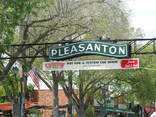
pleasanton california downtown
Downtown Pleasanton
The Founding of Pleasanton California

Today's Pleasanton California is on an old Mexican land grant and was founded by former Alameda County Justice of the Peace, John W. Kottinger. Pleasanton received it's name in honor of Kottinger's good friend, Union Army Major General John Pleasonton. The tale is that due to an error by a U.S. Postal worker, the town's name was misspelled with an "a" rather than an "o". Regardless of the error, the misspelling stuck and the spelling remained. Pleasanton California was incorporated in 1878.

By the start of the 1900's, Pleasanton became the agribusiness center for the entire Amador Valley. 

Today's Pleasanton

Many years ago Pleasanton received attention for being chosen as the location for the movie "Rebecca of Sunnybrook Farm", starring Mary Pickford. Since that time, Pleasanton, in particular it's beautiful and historic downtown area, has been the setting for many films. Some know it as "The Hollywood of the West".

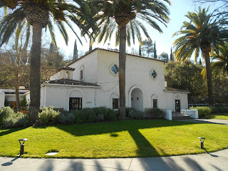
pleasanton hotel
Pleasanton Hotel
Pleasanton California attracted a large amount of retail business as well as being a magnet for business parks. The largest in northern California is located there. During the latter 1900's, Pleasanton grew by leaps and bounds. Although the city grew large it has kept it's downtown area active and vibrant and at the same time maintained it's many historical buildings. I found it the kind of downtown where you can spend hours just strolling and explore the unique retail shops, coffee shops and eateries.

Must See Stops in Pleasanton

To walk through downtown Pleasanton is to take a walk back in time, past historic old buildings. All throughout the downtown area you'll be able to see structures dating back to the latter part of the 1800's. One must stop is the Pleasanton Hotel. The hotel was originally constructed in 1864 as the Farmer's Hotel. After a 1919 Victorian renovation, the hotel was renamed the Riverside Hotel. In 1934 the hotel was renamed the Pleasanton Hotel and has kept that name. Today the hotel is not a hotel. The first floor has a unique Victorian era dining room and bar and the second floor contains offices.

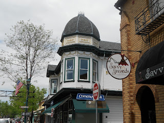
pleasanton california historic buildings
Beautiful architecture of downtown Pleasanton, CA
Downtown you'll come across the Gay 90's Pizza Company. This building was constructed in 1864 and was one of the first commercials buildings in Pleasanton. The site also served as a stop for the Wells Fargo stagecoach.

Look for the address 450 main Street. The building at this site was built in 1893 in an Italianate style and first the Arendt Commission House. It was one of Pleasanton's first mercantile stores.

The building at 500 Main was built in 1912 and served as the Post Office, the Bank of Pleasanton and then the Bank of Italy.

The wood frame building at 624 Main was constructed in 1890 and was first a general merchandise store. The building was covered by stucco in 1954 and eventually became Dean's Cafe.

You'll find another building at 728 Main Street that was built in 1911 in the Mission Revival style. The building was first a department store and had the distinction of being Pleasanton's first building with a fire escape.

pleasanton california restaurants
One of the many unique restaurants in downtown Pleasanton
For a complete guide for your walking tour of downtown Pleasanton California, go to the website   www.pleasantondowntown.net/pdfs/WalkingTourGuide/pdf

Here are links to our Western Trips photo articles about excellent trip sites near Pleasanton. These include a Visit to Danville California and the Museum of the San Ramon Valley and a Visit to the John Muir National Historical Site and Home in Martinez California.

Gateway to the Livermore Valley Wineries

When visiting Pleasanton California you'll want to add a visit to the Wente Vineyards. Wente Vineyards is the country's oldest, continuously operated family-owned winery in business for over 125 years. The vineyard is located at 5050 Arroyo Road, Livermore, CA. This is about 9 miles east of downtown Pleasanton. 

Getting to Pleasanton California 

Pleasanton is located between the San Francisco Bay area and California’s Central Valley. The city is easily accessible by car from Interstates 580 and 680. Pleasanton is also a stop on the Bay Area Rapid Transit (BART) line. See the map below for Pleasanton California location.

When you're looking for things to do in San Francisco and the surrounding Bay area, a fun day trip to historic Pleasanton is a good addition to your vacation trip planner.

(Photos from author's private collection)


View Larger Map

Sunday, January 13, 2013

Navy Vessels / SS Red Oak Victory


One very interesting Navy vessel tour is available in the San Francisco Bay Area and is well worth a visit to. A complete tour of the historic SS Red Oak Victory is available to visitors during normal business hours
from 10:00am to 3:00pm on Tuesdays, Thursdays, Saturday and Sundays.


SS Red Oak Victory History


ss red oak victory
SS Red Oak Victory
The SS Red Oak Victory is among navy vessels that saw service during World War Two and whose service spanned through the Vietnam War era. Over the years the SS Red Oak Victory was operated by various companies for various purposes, was put into storage until it was retrieved in 1998 from the Suisun Bay Ready Reserve Fleet in Suisun Bay, California. 

The ship would have been scrapped eventually but fortunately for us the Richmond Museum Association put together plans to save the vessel and restore it as a historical exhibit. The ship now is on permanent display at the old Port Richmond Shipyards in Richmond California, across the bay from San Francisco.The SS Red Oak Victory is now operated by the  Richmond Museum Association and is is part of the Rosie the Riveter/ World War Two Home Front National Historical Park.


MCV-544 was christened SS RED OAK VICTORY and was officially launched at 10:00 am on November 9th, 1944 by Mrs. Edna Reiley, the wife of W.S. Reiley, M.D., Mayor of Red Oak, Iowa. The ship was commissioned on December 5th, 1944 and was assigned to the 8th Service Squadron of the United States Pacific Fleet

ship bridge
SS Red Oak Victory Bridge
The ships naval career was a bit short. The naval vessel was decommissioned from the United States Navy on May 21st, 1946. Records for the ship indicate that it operated from 1966 to 1968 as a U.S. military cargo carrier in support of the Vietnam War from U.S. Pacific Northwest ports to Southeast Asian ports. The vessel made a dozen trips to Southeast Asia during this two year period.

Western Trips photo articles on two additional ship tours available in the San Francisco area are the World War Two submarine USS Pampanito and the Jeremiah O'Brien Liberty Ship. Both are on permanent display in San Francisco's Fishermans Wharf area.  

Another Western Trips photo article you'll enjoy is a Tour of the Balclutha, the historic three masted tall ship moored at the San Francisco National Maritime Museum.

You may also enjoy Helicopters on the USS Midway


mackay radio direction finder
Mackay Radio Direction Finder
Touring the Bridge

Touring the SS Red Oak Victory is a lot of fun and you'll learn much about it's service history, especially it's assignments while serving the military. One of the most interesting areas of the ship to tour is the bridge area.

The bridge of the SS Red Oak Victory is currently set up as it would have been during it's operational years. You'll see some amazing and historic equipment including numerous electronic navigation equipment that today, in the GPS world, would be outdated but during it's time were state of the art.

Mackay Radio Direction Finder

One interesting piece of navigation found on the SS Red Oak Victory is the Mackay Radio Direction Finder. The radio direction finder essentially homes into distant radio signals to chart the ship's direction and position. The radio beacons located on land serve in a way as a lighthouse would.

Scott Marine Radio SLRM Receiver


scott marine radio slrm
Scott marine Radio SLRM Receiver
Another vintage piece of radio equipment found on the SS Red Oak Victory's bridge is the Scott Marine Radio SLRM Receiver. This brand name may not be the most recognizable. Scott Radio Labs. actually had several different versions of an innovative receiver for marine use.  The vintage World War Two Scott marine receiver like the one shown here was designed to have very low local oscillator radiation. This helped the ship to avoid detection via the enemy's use of radio direction finding gear. When the equipment was produced, the priority for their use was on ocean going vessels. It's believed they were found on some lake craft after the war. The Scott marine Radio unit shown on this page received LW, AM and 3 SW bands and were 120V AC/DC units

The next piece of equipment on the SS Red Oak Victory bridge is the Echo Depth Recorder. This particular piece of marine equipment dates to the mid 1950's. The Echo Depth Recorder operates by sending a signal from the bottom of the vessel to the sea floor. 


echo depth finder photo
Echo Depth Recorder
The sound waves are reflected back by the sea floor and the time taken from transmission to reception is measured. The speed of sound in water is 1500 m/sec

The sea depth can then be calculated which will be half the distance traveled by sound waves. The entire theory behind the depth recorder is that water is an excellent medium for transmitting sound waves. A pulse will bounce off a reflecting layer. The sound pulse simply returns to it's source as an echo. The same principle was applied to submarine detection during World War Two.


The next piece of marine navigation found on the SS Red oak Victory bridge dates back to 1943 and involves the automaker Dodge. As most know, the federal government banned the production of civilian automobiles beginning in February 1942 when the United States entered World War Two. Automakers were then involved producing jeeps, trucks, tanks and a variety of war materials. 


sperry marine gyro repeaterThe Dodge Division of the Chrysler Corporation was given a contract to produce gyro compasses. Dodge ended up producing some 5,500 Sperry Gyro-Compass marine navigation units. They also produced  repeater dial motors like the one shown here as well as spare parts for the U.S. Navy Bureau of Ships. A gyro repeater is essentially a gyro compass under the control of a gyroscope that indicated true north.

The gyro repeater like the 1943 model shown in this article was made by the Dodge Division of the Chrysler Corporation with licensing from Sperry.

Touring the Bridge of the SS Red Oak Victory

The navigation equipment shown in this article represents only a few of the total on display on the bridge of the SS Red Oak Victory. There's a lot to see and learn on this type of tour. If you find yourself on a San Francisco vacation or weekend trip, I would highly recommend a stop and tour of this historic old naval vessel.

The SS Red Oak Victory is located at 1337 Canal Blvd., Berth 6A Richmond, CA. From I-580, take the Canal Blvd. Exit and continue on Canal Blvd to 1337 Canal Blvd.


Refer to the map below for location.

(Photos from author's private collection)


View Larger Map