Western Trips

Wednesday, May 30, 2012

Mission Dolores / San Francisco

dolores mission in San Francisco
Original Mission Dolores
If your next vacation, western road trip or business trip happens to take you to San Francisco, this is a historic site you'll want to take a few minutes of your time to explore. One of the very oldest landmarks in San Francisco is the historic Mission Dolores which was originally built in 1779.

The Mission is also referred to as Mission San Francisco de Asis. The mission of course has gone through several changes and repairs over the years, especially resulting from the 1906 San Francisco Earthquake. The structures that are at the corner of today's Dolores and Sixteenth Streets are a fascinating sight who's history goes back to the founding of San Francisco itself. The original Dolores Mission is now considered the oldest intact building in the city.

The Origins of Mission Dolores

The building of Mission Dolores San Francisco came shortly after the Juan Bautista de Anza Expedition of 1776 came to the Bay Area from Mexico with the direct intention of bringing settlers to the area. De Anza's expedition essentially first settled what is now the city of San Francisco. When de Anza arrived, his first two tasks were to find a suitable place for both a mission and for a presidio.

mission dolores
Mission Dolores, San Francisco
There are many interesting facts to know about Mission Dolores San Francisco. The site that de Anza had chosen for the mission was on the banks of a very small rivulet that he named Arroyo de los Dolores. This small stream emptied into a small lake.

Father Francisco Palou who was with the expedition held the first mass in a thatched hut. Later, Father Palou moved the mission to a better site a few blocks away to where it stands today.

The Dolores Mission, where it resides today, was formally dedicated in 1791 and hasn't changed much since. The quadrangle of the mission was finally completed in 1798, twenty years after the missions founding. The small lake where the stream led was eventually over the decades covered up. Interestingly enough, the lake that was filled in and covered was eventually used for settlement with homes being built upon the land fill. This small section received considerable damage during the 1906 Earthquake.

The Mission Indians

mission dolores basilica
Basilica built in 1918
When the Spaniards explored up into the San Francisco peninsula, the Indians residing there mostly fled and fled quickly. The Indians jumped in their canoes and set across the Bay.

Years later, a group of Indian Christian neophytes were sent out to convince the exiles to come back but the small expedition met with trouble and about a half of them were slain.

The duty of the Spanish mission system was to Christianize the Native population and thus turn them into subjects of the king of Spain. Needless to say, this wasn't necessarily an easy task and there were many Natives who fled after once joining the mission. This really was the case with just about all of the twenty-one missions at one time or another. Even so, the Spanish missions did largely succeed in their goals.

Indians Exposed to Disease

Dolores Mission didn't escape the problem of Indians becoming sick with European diseases. When the native population came in contact with the Spaniards, there immune system couldn't handle the introduction of new diseases and as a result many became sick and died. This was a tragedy that would cause the same results, to devastating effects with the plains Indians during America's push westward. Many of the Indians went to the then Mission San Rafael to the north to live in the better weather. Some estimates of Indian deaths from Dolores Mission put the number at 5,000.

Mexican Rule Comes to Alta California

mission dolores basilica entrance
Entrance, Dolores Basilica
Mexican rule which came a relatively short time afterwards in the 1820's of course brought major changes to the old Spanish mission system. The mission was Mexican secularization caused the adjoining one and two story adobe buildings to be used for commercial purposes and they were rented out.  

Much of the mission lands throughout Alta California were divided into smaller Ranchos and then sold to Mexican citizens who were helpful during the war against Spain for independence.

U.S. Rule Comes to California

The U.S. took over Alta California during the Mexican American War of 1846 and the situation changed yet again. In 1863, thirteen years after California statehood, President Abraham Lincoln signed an Act declaring that all of the 21 missions in the California mission chain would become the property of the Catholic Church. That has remained so ever since.

The cemetery adjacent to the original Dolores Mission structure also tells much of the history of Mission Dolores. There are thought to be 5,000 Ohlone and Miwok Indians buried in the cemetery. There are also well known pioneers of the area interred there. Luis Antonio Argüello, a former governor of Alta California who died in 1830 is buried at the Mission Dolores cemetery.

California Changes With The Gold Rush

mission dolores altar
Altar, Mission Dolores Basilica
The California Gold Rush of the early 1850's  was the impetus for the massive growth the town and then city experienced. The mission district was a bit removed from the area of activity along the San Francisco waterfront.  

At one time, two plank roads were built out to the mission and it would be normal for residents and visitors to make leisurely excursions by horse carriage to the Dolores Mission site.


By the latter 1800's, the city's population was growing and the infrastructure was changing. The original low rise adobe buildings adjacent to the original Dolores Mission were taken down so 16th Street could be lengthened. The small chapel became too small to handle the congregations and a new Victorian designed church was constructed to serve as the parish center and was dedicated in 1876.

 This date was the one-hundred year anniversary of the original mission's founding on the small creek Arrroyo de las Dolores during the time of the de Anza Expedition.

dolores mission interior
Window inside 1918 Dolores Mission
The 1906 San Francisco Earthquake did not entirely spare Dolores Mission. The large parish church which was dedicated in 1876 was ruined and was not repaired. A new parish church was not entirely completed until 1918, being delayed by World War One. It was dedicated on Christmas Day of that year. 

Dolores Mission became a basilica in 1954 because of it's important historical status.

Two other related articles we have written which you'll find interesting are Mission Carmel in Carmel California and the Story of the Spanish Missions.

The present site of Mission Dolores Parish includes both the old mission and the newer basilica which was completed in 1918. 

This historic San Francisco basilica and the old mission building is an excellent addition to a San Francisco vacation planner and is easy to reach from anywhere in the city. The old mission's religious, architectural and historical place in San Francisco's history and the city's very founding make it a very worth while destination for visitors to San Francisco. In San Francisco, all history leads back to the Dolores Mission.

(Article and photos copyright Western Trips)


View Larger Map


Monday, May 28, 2012

Beartooth Highway

Running across the Beartooth Mountains of Montana is one of the finest and scenic National Byways of the northwest. The Beartooth Highway, a National Scenic Byway. If your western road trip takes you to this part of the country, you'll want to consider adding this drive to your vacation planner. The Beartooth Highway features the scenery of twenty mountain peaks over 12,000 feet in elevation.

Driving the Beartooth Highway

beartooth highway
Beartooth Highway switchbacks
The Beartooth Highway route will take you through high elevation zones, past mountain lakes and alpine tundra. When driving up through Beartooth Pass, the road goes above the tree line and takes you into through alpine terrain.

The Beartooth Highway is known to be the highest highway in the northern Rockies. The Scenic Byway will also offer entrance to Yellowstone National Park in it's northeast section along the Montana and Wyoming border. The Beartooth Highway is the a part of U.S. Hwy 212 and highway maps will show that  it runs between Red Lodge Montana and Cooke City Montana. (See Google Map below)


The History of a Scenic Byway


The history of the Beartooth National Scenic Byway is very interesting and it's origin dates back to 1872 and an expedition commander by General Phillip Sheridan. After inspecting Yellowstone with some 120 men, Sheridan followed a route related to him by a hunter. Although Sheridan was advised against accepting this advice he did decide to try it and some two days later, despite extremely deep snow and even forest fires, Sheridan's troops completed the first crossing of the Beartooth Mountains. The group came out near present day Red Lodge, Montana. 

The Beartooth Highway opened in the year 1936 after about five years of construction and when you drive this route today you are essentially following the same route that Sheridan and his men took in 1882. The route was made a National Scenic Byway in 1989.

The regions economy relied heavily on coal mining. The mining industry there grew not long after Sheridan's travels through the Beartooth Mountains. Excellent coal deposits had originally been identified as far back as 1866 and gold was discovered there in 1870. Gold mining fuels the great boom in Montana during the late 1860's and 1870's. The old Bozeman Trail was one of the busiest routes into Montana from Wyoming during the late 1860's.

An Historic Region
beartooth mountains
Beartooth Highway scenery

During this period of the late 1860's, prospectors and pioneers traveled the Bozeman Trail and eventually resulted in a conflict called Red Cloud's War. A treaty was signed with the Crow Indians in 1882 which allowed the area to be successfully settled.

Red Lodge Montana also received it's first U.S. Post Office in 1884. Red Lodge Montana today is the county seat of Carbon County Mountain. As an interesting side note, Red Lodge Montana experienced a hard time during the Great Depression of the 1930's and mining ceased up and the town was then known as a large manufacturer of bootleg liquor. The liquor produced at Red Lodge was distributed far and wide and into the larger cities of the east.

Points of Interest

the bears tooth montana
The Bear Tooth
Some of the points of interest you'll want to make note of in your trip planner include Lake Creek Falls at an elevation of over 7,000 feet. The 200 foot wide falls is a spectacular site.

Also check out the Top of The World Store which is along the highway's highest elevation at just under 11,000 feet. At Top of the World Store, drivers can rest up and replenish their food and fuel supplies. Another noteworthy and scenic site is the actual Bears Tooth. It's name was derived from the Crow Indians and was formed by glaciation. The Bear Tooth of course is also the namesake of the Bear Mountains themselves.

The Hellroaring Plateau will also be a great addition to your Montana trip planner. This area is above 10,000 feet in elevation and the area includes beautiful mountain lakes, alpine scenery and glaciated canyons. One of the most beautiful areas in North America.

Touring Montana
twin lakes beartooth highway
Beartooth Mountains Twin Lakes

The state of Montana identifies six different tourism regions. These are the Glacier Country, Russell Country, Missouri River Country, Southeast Montana, Yellowstone Country and the Goldwest Country.

All of these regions are historic and can be a part of a terrific western vacation adventure.  You can visit sites going back to the Battle of the Little Bighorn and visit the famous Montana Gold Rush towns such as Virginia City. You can take a canoe down the wild and scenic Missouri River and fishing the streams of Montana is always popular for anglers.

Four additional articles you'll find interesting and make good vacation additions. A story about the smokejumpers and the Smokejumpers Museum ..Driving California State Rte 49 ...the Old Spanish Trail Highway from Florida to California and the. Chief Joseph Scenic Byway .

There's another unique opportunity for cyclists on the Beartooth Highway. There's a short period in the spring between when the snow crews clear the passes and open the gates for automobile traffic. Cyclists find that during this time they essentially have all of the roadway to themselves without concern for motorized vehicles.

The highway will typically see thousands of cyclists on the road during this short period. If you love cycling, this may be something to take note of.

Montana offers a wide variety of vacation destinations and activities. You may find scenic and historic Montana an excellent addition to your western road trip planner.

(Photos are from the public domain)


View Larger Map

Friday, May 25, 2012

Flintlock Firearms of the American West

When touring museums and other historical sites in the American West, inevitably you'll find many fine displays of frontier firearms. Some of the best displays I've viewed are those of flintlock firearms including flintlock rifles. Flintlock firearms go quite a ways back in American history.

How the Flintlock Worked

flintlock mechanisms
Flintlock mechanisms
The flintlock mechanisms shown on the left are good images of how the firearm worked. The flintlock weapon came into use during the early 1600's and was used for both military purposes and for personal protection.

The Flintlock muzzleloader used black powder that was ignited from the flint's spark. These were ingenious yet quite simple weapons. On the flip side of the coin, the black powder rifles posed several problems, some dangerous.

First of all, handling black powder pistols could be problematic if not done properly. Funnels were used to help mitigate the problem of premature ignition. Secondly, the flintlock was noted for discharging a flash or sparks forward and sideways. This could be a problem when a group would fire a volley.

Using the Flintlock Weapons

Essentially, the group of soldiers would need to fire their shots simultaneously to avoid one person's discharge setting off another persons gun by accident. Accidental firing was often a problem. Barrels would have to be cleaned often because the black powder residue would build up after firing. Another problem of course would be the time it took to reload for a second shot. One answer to this was the multi-barreled flintlock. Some had two to four barrels.

flintlock pistol
Flintlock pistol from California State Military Museum
The problem with this weapon could be a simultaneous explosion where all barrels fired at once. The gun could blow up in the users hands. The idea was to fire each barrel separately, but the sparks from the first fire could unintentionally ignite the others. The alternative for rapid fire was just to carry more than one single shot pistol.

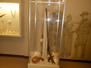
The flintlock pistol shown right is a 1860 model. next to it is a copper and leather powder pouch. This firearm is on display at the California State Military Museum in Old Town Sacramento California.

The Kentucky Long Rifle

In addition to the flint lock pistols, the flintlock long rifles were another thing altogether. The long rifle, sometimes referred to as the Kentucky Long Rifle, came into use in the 1740's. At that time Kentucky would have been the western frontier.

The flintlock long rifle went through some modifications over the years and eventually was replaced in the first half of the 1800's. Rifles, in general, became more popular then the musket primarily because of their much increased range. Some of the lineage of the long rifle goes back to German immigrants who migrated to the American colonies in the early 1600's. The earliest long rifles in America were being designed in Pennsylvania by German craftsmen. They were subsequently taken into and used in the western frontier, then Kentucky and Ohio, by trappers, hunters and explorers. The early long rifle was generally made of maple, was .50 caliber and had a muzzle length of perhaps 46 inches.

long rifle
Long Rifle on display at Red River Museum
The downside to the long rifle as opposed to the musket was that the loading time took about three times longer. Not too bad if you're using the long rifle for hunting but a bit disadvantageous in battle situations.

An advantage in battle was that the long rifle could hit a target perhaps three times distant than the musket. This was attributed to the fact that the long muzzle gave the black powder more time to burn thus increasing the power and resulting in better accuracy.

The authentic long rifle shown at left is on display at the Red River Museum in Vernon Texas. You can see just how long these muzzles were. The barrel is some 40 plus inches. Vernon is located on U.S. Hwy 287 about 50 miles west of Wichita Falls, TX. If you're in that area it's a very worth while stop.


long rifles
The photo to the right was taken at the Fort Sumner Museum in Fort Sumner New Mexico. This is the museum located at the site of the old Ft. Sumner Military outpost and at Billy the Kid's grave site. You can appreciate the barrel length of the Long Rifles looking from top to bottom. The top rifle is has a 40 plus inch barrel and the one under it just about three inches shorter.

Percussion Replaces the Flintlock
 
The percussion or sometimes called caplock eventually replaced the flintlock. This happened in the early 1800's and then in about the mid 1800's the muzzle loaders were being replaced by the breech loaders. The Sharps Rifle developed by Christian Sharps at about 1850 is a good example of an early breech loader. Starting in the 1850's, the Sharps Rifle was the premiere weapon for accurate long distance shooting.

Two addition articles we have that you'll find interesting are Frontier Firearms of the 1800's and the Bison and Sharps Rifle.

While traveling the western U.S., I have found numerous historic sites and museums where authentic frontier weaponry is on display. You may want to make note of a few of these for your next western road trip.

Fort Stockton Museum in Fort Stockton Texas

Kit Carson Home and Museum in Taos New Mexico

Fort Sumner Museum in Fort Sumner New Mexico

The California State Military Museum in Old Town Sacramento California


The History Museum of New Mexico in Santa Fe

The Red River Valley Museum in Vernon Texas

Texas Rangers Hall of Fame and Museum in Waco Texas

Buffalo Bill Cody Museum in Cody Wyoming

These represent only a few. There of course are many others spread all across the U.S. There are many long rifle associations across the country as well as sale events that draw enthusiasts from near and far. There is also a very good book published, North Carolina Schools of Longrifles, 1765-1865, by author William Ivey.

(Photo of flintlock mechanism is in the public domain. Other photos shown  and article are copyright Western Trips)


Thursday, May 24, 2012

The Chief Joseph Scenic Byway and The Nez Perce War


If your western road trip vacation happens to take you to or near the fascinating and beautiful Yellowstone National Park, then you may have an opportunity to drive on the Chief Joseph Scenic Byway. This highway, which is located northeast of Yellowstone National Park, offers wonderful and very scenic views in the area of Idaho and Wyoming and was named in honor of the Nez Perce Indian Chief. It's a great area to visit while touring Yellowstone. The Chief Joseph Scenic Byway also has a very interesting story to tell about Chief Joseph and the Nez Perce and his relationship and conflict with the U.S. Government and military during the latter part of the 1800's.

 Chief Joseph of the Nez Perce

chief joseph
Chief Joseph and family, 1880
The story of Chief Joseph has all to do with America's settlement westward and at a time near the end of what historians called the Indian Wars. The conflict that the U.S. military had with the Nez Perce was really no different than their dealings with other Native American tribes throughout the Great Plains and the west. The U.S. essentially wanted the Nez Perce to give up their ancestral lands and move to designated reservations. This type of plan started more than one Indian war. In the case of the Nez Perce, some of their bands, but not all, disagreed and fought a war against the U.S. Army in the year 1877. The war lasted from June to October of that year.

The Nez Perce War

The Nez Perce War started very similar to the way the Sioux War of 1876-77 was ignited. Gold, and lot's of it. The Sioux went to war in part because of the massive invasion of white Americans into the Black Hills of Dakota Territory. This occurred in the early 1870's after George Armstrong Custer and others confirmed that gold was there in large quantities. With the Nez Perce it had to do with gold being discovered in Idaho and Montana in the 1860's. Just like the Sioux who had a treaty with the U.S. for ownership of the Black Hills, the Nez Perce had a U.S. treaty going back to 1855 which stipulated they were to have about 12,000 square miles of land in what are now the states of Idaho, Oregon and Washington. The treaty of 1855 also forbid encroachment by white settlers. All of this came to a screeching halt in 1860 when gold was discovered in Idaho. The result were some 5,000 prospectors and others immediately invading the Nez Perce homeland or reservation. In the period of 1876-77, about the time and shortly after the Sioux War to the east, everything came to a boiling point. The complaint from the Nez Perce perspective was that there were Indians killed by white settlers without any sign of prosecution. This just inflamed an already bad situation.

The Conflict Begins

chief joseph scenic byway
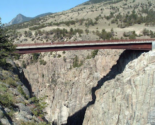
Sunlight Bridge, Chief Joseph Nat'l Scenic Byway
The opening salvo of this conflict began in June 1877 when a small band of Nez Perce attacked some white settlers. They followed up the attack with another the next day and about twenty settlers were killed in all. The army sent out about 130 troopers in response. One of the first battles fought, the Battle of White Bird Canyon, was a victory for the Nez Perce. In short order however, the Nez Perce hostiles were in a general retreat. Many battles were fought where casualties were heavy on both sides. A relatively small band of Nez Perce held off the cavalry in several encounters. Eventually the chase ended in a surrender. Chief Joseph surrendered on October 5, 1877. The mastermind on the U.S. side for the victory fell to the famous General Nelson Miles who had joined directly in the pursuit of the Nez Perce on orders from his superior, William Tecumseh Sherman.

 The Aftermath
 
The Nez Perce would not see their homeland again for many years. Eventually, and apparently against the agreement of the 1877 surrender, the Nez Perce ended up being transported to Indian Territory which is now the state of Oklahoma. One of the most historically remembered events during the surrender was Chief Joseph's speech which historians have named "I Will Fight No More Forever". 

There are many side stories to the Nez Perce War and one has to do with Crazy Horse. The year 1877, one year after Custer's defeat at the Little Bighorn, Crazy Horse finally surrendered to the military near Fort Robinson in northeastern Nebraska. It wasn't an easy surrender and Crazy Horse had his doubts. With Sitting Bull in exile in Canada, Crazy Horse was considered the last of the hostile leaders to surrender. For whatever reason, Crazy Horse was urged by the army to join them in their fight against the Nez Perce. The Sioux and the Nez Perce were not on friendly terms at the time. This, Crazy Horse refused to do and he was pressured several times, not just once. The result caused a lot of friction between the newly surrendered Sioux leader and his army keepers. The relationship between Crazy Horse and the army really never improved during the short time he was put on a reservation. Neither side really trusted the other. The animosity for his refusal to help fight the Nez Perce and his refusal to travel to Washington DC at the behest of the army for perhaps political purposes, soured any relationship there was.

Our article , The Surrender of Crazy Horse, gives more detail about this historic event.

big hole battlefield
Big Hole Nat'l Battlefield, Idaho, courtesy NPS
Chief Joseph was not the only leader of the Nez Perce peoples. There were others from various bands however Chief Joseph was the most famous and remembered leader during this 1877 conflict and beyond.

By most historical accounts, Chief Joseph was the strategist for the Nez Perce during the war. During the remainder of his life, Chief Joseph was outspoken about the injustice of United States policy toward the Nez Perce in particular and Native Americans in general. He petitioned presidents to this end including Theodore Roosevelt.

Chief Joseph was generally admired by many whites because of the way he treated prisoners, his concern for women, children, and the old, and because he had a history of buying supplies from ranchers and general stores rather than stealing them.

Chief Joseph died in 1904 and is buried near Lake Roosevelt National Recreation Area on the Confederated Tribes of the Colville Reservation and is part of Nez Perce National Historical Park. The park is outside Lewiston Montana and about 100 miles south of Spokane Washington.

(Photos are from the public domain)


View Larger Map

Tuesday, May 22, 2012

Buddy Holly Story / Buddy Holly Center

buddy holly center lubbock texas
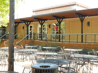
Buddy Holly Center, Lubbock Texas
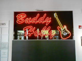
When traveling through Lubbock Texas on a western road trip I had the opportunity to visit the Buddy Holly Center and learn more about the Buddy Holly story. Whether you're old enough to remember a lot about Buddy Holly or young enough to just appreciate all genres of music, you will truly enjoy a visit to this remarkable place.

According to the Buddy Holly Center web site, the Center has dual missions... preserving, collecting and promoting the legacy of Buddy Holly and the music of Lubbock and West Texas, as well as providing exhibits on Contemporary Visual Arts and Music, for the purpose of educating and entertaining the public. I will add that they do an excellent job of both. The Buddy Holly Center is located in downtown Lubbock on Crickets Avenue. if you find yourself traveling through or near Lubbock Texas whether on business or on a Texas vacation, the Buddy Holly center should really be a part of your Texas trip planner. In addition to this fine Lubbock museum you'll find a great selection of Lubbock restaurants and hotels.

The Buddy Holly Center is a site housing an extensive collection of Buddy Holly memorabilia, changing arts exhibits, and a gallery showcasing West Texas musicians. This Lubbock museum is a must stop for anyone remotely interested in the early years of rock and roll.

buddy holly statue
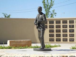
Buddy Holly statue created by Grant Speed
In January, 1959, Buddy Holly, Ritchie Valens, J.P. "The Big Bopper", Dion and the Belmonts, Frankie Sardo, Waylon Jennings, Tommy Allsup and Carl Bunch set out on a three week tour of the cold mid west. The story of Buddy Holly's hit records and short life and career have been told literally thousands of times. It's an interesting story that goes back to the very earliest days of rock and roll. Many might remember seeing his appearance on the Ed Sullivan Show. Holly's relatively brief career, his highest fame lasted about two years, ended when the small single engine plane he, J.P. Richardson (The Big Bopper) and Ritchie Valens  crashed after midnight in an apparent blizzard near Clear Lake Iowa in 1959.

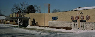
The group and others had just finished a concert at Clear Lake's Surf Ballroom to an audience of over a thousand. At the time of the Buddy Holly plane crash the group of three were on their way to play a concert the next evening in Moorehead MN. The rest of the group would make the trip on their bus which had severe heating problems in almost zero temperatures. The plane was chartered at Holly's request so that the three entertainers could avoid the freezing bus trip. As it turned out by a quirk of fate, the two other passengers who were to originally accompany Buddy Holly on the plane were actually Waylon Jennings and Tommy Allsup. Both ended up giving their seats away to the Big Bopper and Ritchie Valens just before the flight.

Some interesting facts about the tour, "Winter Dance Party", emerged after the tragedy. One was that the young twenty-one year old pilot who was flying the aircraft for a charter company was not legally certified to fly under instrument only weather conditions. He was certified for visual conditions only which meant he really should not have been up in the air under those dark and blizzard conditions.

buddy holly center
Entrance to Buddy Holly Center
The plane crash investigation afterward concluded that the pilot obviously became disoriented due to the weather and was not trained well enough to read the attitude gauges and subsequently ran the aircraft into the ground. Another was that the tour bus heater was so inoperable that one of the band members of Buddy Holly's "Crickets" was hospitalized at the time in Minnesota for frost bite. That gives you a good idea of just how bad the tour bus ride was and would have been.

A few other interesting facts about Buddy Holly's career was that his legal name was actually spelled Holley. His birth name was Charles Hardin Holley but during the early days of his career it was changed to Holly for touring and publicity purposes. It appears that the name was spelled that way a few times on publicity material and the spelling just stuck. Another interesting fact was that his successful recordings were produced in a studio in Clovis New Mexico, about 90 miles northwest of Lubbock Texas. The Norman Petty Studio in Clovis recorded for singers such as Ray Orbison, Waylon Jennings, Jimmy Gilmer, Sonny West and Buddy Holly. Many other recorded there as well. Petty was also a musician himself as well as a recording engineer and recorded himself at the the studio. Norman Petty was also serving as Holly's manager to some degree. After Buddy Holly's death, Petty reportedly overdubbed some of Holly' unfinished recordings to add to the Holly collection. Petty posthumously was named Clovis New Mexico Citizen Of The Year in 1984.


Buddy Holly at the time of his death in February 1959 was married only for a very short time. Holly married Maria Elena Santiago on August 15, 1958 only about two months after first meeting. Their honeymoon was in Acapulco Mexico. It was reported that Holly also entertained the possibility of a future acting career such as that of singer Elvis Presley. He went as far as enrolling in acting classes.

buddy holly center sign
Buddy Holly Center sign with glasses logo
The Buddy Holly Center in Lubbock Texas has quite a lot to offer anyone interested in the music of the late 1950's. A video is shown about Buddy Holly and others of that era. Included are some very good music videos by the Big Bopper, J.P. Richardson. In fact, these could be considered the earliest music videos produced. The video is both very entertaining and informative. Among the many exhibits in the Buddy Holly Center is the actual guitar that Holly used during his last performance in Clear lake Iowa. Since the guitar was being transported on the tour bus, it was not damaged. There is also some of Holly's personal property such as his 45 RPM record case and jackets holding his personal collection. Also included are clothing, recording contracts, tour itineraries, Holly's glasses, homework assignments and report cards. There are also many interesting photos of Buddy Holly, Waylon Jennings, the Crickets, the Big Bopper and others spread throughout the museum. The pictures are very interesting and each tells a story. The Buddy Holly Center collects, preserves and interprets artifacts pertaining to Lubbock's most famous native son

Another interesting fact about the Surf Ballroom in Clear Lake Iowa is that they continue today to memorialize Buddy Holly and the old Winter Dance Party. The annual event held at the Surf Ballroom was the idea of a local radio announcer called the "Mad Hatter". His name was Darryl Hensley and the idea took off. The event began in 1979 and is held during the first week of February.

Surf Ballroom as it appeared in 1988. Public domain photo
The statue of Buddy playing his guitar is located at the Buddy and Maria Elena Holly Plaza which is across the street from The Buddy Holly Center on Crickets Avenue. The plaza also includes the Walk of Fame. The statue of Holly shown on the photo above was created by sculpturer Grant Speed of Utah. Grants Speed was also well known for his statue of famed Texas Panhandle rancher Charles Goodnight. Goodnight's statue is located at the Panhandle Plains Historical Museum in Canyon Texas. Another of Speed's sculptures in Lubbock is a life size horse and rider piece created for Texas Tech University depicting the school's mascot, the Red Raider.

Two other interesting travel stops while touring West Texas is the Charles Goodnight Home located in Goodnight Texas just east of Amarillo. Rancher Charles Goodnight is referred to as the Father of the Texas Panhandle. Also, the unique old Harvey House dining room along the railroad tracks in Slaton Texas, about 10 miles south of Lubbock. The historic Slaton Harvey House is now operated as a delightful B & B.

You'll also be interested in our article and photos of the Roger Miller Museum in Erick Oklahoma.

The Buddy Holly Center is located at 1801 Crickets Avenue in Lubbock Texas. The Center is in the renovated old Fort Worth and Denver South Plains Railway Depot. The depot was designed  by prominent Fort Worth architect, Wyatt C. Hedrick, in the Spanish Renaissance Revival style. This is an excellent addition to your Texas vacation planner.

(Photos are from author's private collection)

Sunday, May 20, 2012

The Harvey House / La Castaneda

Fred Harvey was credited for establishing both America's first true restaurant chain as well as building some of the most popular hotels during the nation's booming railroad era. The Harvey House chain gained world fame. Together with the Atchison Topeka & Santa Fe Railroad, Fred Harvey made the railroad trip west a much more comfortable adventure.  

Harvey partnered himself with the AT& SF Railroad. Trains in the late 1800's lacked refrigeration systems and dining cars, so Harvey built a restaurant every 200 miles along the Santa Fe's tracks. It worked marvelously and attracted additional passengers to the line. What these dining rooms added was a high degree of quality that travelers could count on.

las vegas new mexico plaza
Historic buildings around the Las Vegas NM Plaza
Las Vegas New Mexico

During the railroad era Las Vegas boomed and became one of the largest cities in the American southwest. At the same time it was realized that suitable hotels and hospitality were greatly needed. High quality railroad hotels and dining rooms were quite popular with the traveling public. 

The Fred Harvey Company as well as the AT& SF built the La Casteneda Harvey House in Las Vegas New Mexico, about 55 miles east of Santa Fe. The AT& SF also built another magnificent hotel in Las Vegas NM called  Montezuma's Castle. This was a 400 room, 90,000 square foot building that operated beginning in 1886. Prior to that there were two earlier buildings on the site in 1881 and 1885. When the railroad constructed the hotel they were taking advantage of the natural hot springs adjacent to it. This was quite a tourist draw and even today you can relax in one of the outdoor hot water tubs. In it's day it was a nationally popular resort in Las Vegas NM.

The Historic La Castaneda

la castenada in las vegas new mexico
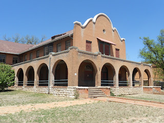
Left wing of La Castaneda Hotel
La Castaneda was built as a 50,000 square foot railroad hotel in 1898. This Harvey House was considered an absolute jewel in the Fred Harvey chain and was built as a luxury resort reached by passengers from the Atchison Topeka & Santa Fe Railroad whose tracks ran directly in front.

La Castaneda is one of the earliest Harvey Houses to be built in the Mission Revival style. The architects of this grand hotel and resort were Frederick Roehrig and A. ReinschThe Rawlings Building which is across the street from the hotel and the Las Vegas train station was used during the period to house the Harvey Girls who staffed the La Castaneda. The Harvey Girls and their history is a unique part of the Fred Harvey tradition. Harvey Girls were held to extremely high standards and did much for the reputation of the Harvey Houses.

When you walk around the depot area today you'll see several turn of the century buildings. The railroad district is about one and one-half miles east of the plaza. La Castaneda was a sister hotel to Albuquerque's Alvarado Hotel, which was unfortunately demolished in 1970.

Refrigerator Cars Brought in Fresh Food

To add to the quality of food that Fred Harvey was so noted for, the AT& SF Railroad brought in fresh meat to the Harvey House with their new refrigerator rail cars. Food could virtually be brought in from anywhere in the country. There was also a dairy facility in Las Vegas that made it possible to consistently offer fresh milk to customers. As many people know, Fred Harvey was able to offer good food portions at reasonable prices and this plus The Fred Harvey Company's well known quality made the Harvey Houses a big hit with the traveling public. When the AT& SF Railroad finally added dining cars to their routes, Fred Harvey was asked to mange these as well.

la castenada harvey house
Right wing of old Harvey House in Las Vegas, NM
Another thing that Fred Harvey was well noted for was his automobile tours of the surrounding area. He established the tours in several locations including from the La Castaneda, the La Fonda Hotel in Santa Fe and from the El Tovar at the south rim of the Grand Canyon.

All of these hotels were a Harvey House. Visitors to a Harvey House in New Mexico would also be offered authentic Indian products such as jewelry and pottery. Because the railroad and Fred Harvey were at the very forefront of American southwest travel, their names became a real part of the southwest.

Two additional related articles of ours you'll find interesting are Fred Harvey and the AT& SF Civilize the Southwest and the Harvey House in Slaton Texas which today operates as a very unique B & B.

Other Interesting Harvey Houses in the West

There are many old Harvey Houses spread west of the Mississippi River and into California. Each has had their own destiny. Some have been demolished such as the old Alvarado in Albuquerque which is unfortunate. Others have been turned into museums and in the case of the Slaton Texas, into a B & B. These old structures, although outdated and many in need of drastic restoration, truly do stand as monuments to a time when the railroad was king and western expansion and tourism was growing rapidly.

harvey house in las vegas nm
View of La Castaneda wrap around porch
Today, the old La Castaneda Hotel is in the hands of private owners. The hotel today is essentially the way it was originally built. It is closed up except for a small bar that opens in the late afternoon. It's unclear what the future holds for this historic landmark.

Passengers traveling on today's Amtrak Southwest Chief which runs daily between Chicago and Los Angeles get a real good glimpse of the former Harvey House hotel as they stop at the train station directly next door. People passing by Las Vegas New Mexico on Interstate 25 can also see the old La Castaneda about two blocks off the Interstate along the train tracks.

If your western road trip takes you through this part of New Mexico on the Interstate, I would highly recommend a stop at the Las Vegas railroad district. Visiting Las Vegas New Mexico and the old Fred Harvey La Castaneda is a fine addition to your western road trip vacation planner.

(Article and photos copyright Western Trips)


View Larger Map

Thursday, May 17, 2012

John Muir Home / Muir National Park

The John Muir National Historic Site located in Martinez California preserves the Victorian house and a part of the fruit ranch where the naturalist and preservationist John Muir lived from 1890 to his death in 1914. The historic site was established in 1964. While John Muir lived in Martinez, in 1916 he worked on the very foundations for the creation of the National Park Service. In a large way, the history of the National Parks is a history of John Muir.

john muir home
John Muir home in Martinez, CA
John Muir, born in Dunbar, East Lothian, Scotland, on the North Sea, emigrated to the United States and on to Wisconsin in 1848, at the age of ten years. John Muir had a fairly harsh early life working on the family farm with a strict father who insisted he memorize the Holy Bible.

 It was from that harsh beginning that Muir gradually wandered away to read and pursue subjects that caught his interest. Those subjects were primarily found in the realm of mechanization and nature.  John Muir was certainly not wealthy as a young man. He worked in sawmills, a factory, on farms and as a sheepherder. Ironically, his first acquaintance with what today is Yosemite National Park was while working with a man who was trying to construct a sawmill.

The John Muir National Historic Site in Martinez highlights the life and accomplishments of Muir from about 42 years of age on. The Victorian home site where visitors can now tour throughout was originally built by Muir's father in-law, Dr. Strentzel, who had come to California during the Gold Rush era. Built in the Italianate style, the house had all the modern conveniences including gas lighting, coal burning fireplaces and flush toilets. The home had a phone installed in 1885.

In 1880, Muir married  Louie Wanda Strentzel, the daughter of this doctor and fruit grower in Martinez. At the time, Louie's father had a 2,600 acre ranch. The 8.8 acre John Muir National Historic Site today in Martinez California, preserves the house where Muir lived with his wife and two daughters, Wanda and Helen.

At first, John and his wife Louie lived in the Strentzel's original home about one mile south of the mansion. When Dr. Strentzel died in 1890, Louie's mother asked her and John to join her in the new larger house. John Muir and his family lived on the mansions second floor. The 17 room mansion in the Alhambra Valley which Dr. Strentzel built in 1882, was his wife's ultimate inheritance.

John Muir in Martinez CA

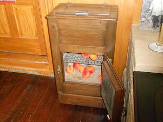
john muir kitchen refrigerator
Early refrigerator in Muir kitchen
John Muir worked as ranch manager for his father-in-law for about ten years and during that time was able to amass $250,000 which was quite a fortune. That money allowed him to retire at 42 years of age and devote the remainder of his life to the movement to save America's natural resources.

Among his accomplishments were his influence to urge the U.S. Government to set aside public lands for future generations to enjoy. In this same vein were his efforts to help found the Sierra Club of which he served as it's first president. John Muir was credited with writing over 300 magazine articles and 12 books. Writings by John Muir included My First Summer in the Sierra, The Mountains of California and A Thousand Mile Walk to the Gulf. At the time of his death, in 1914 Muir was writing a book about his Alaska travels. It was said that at the time of his death he had enough notes prepared for perhaps ten additional books.

John Muir The Inventor

What some might not realize was that John Muir was an inventor as well as a preservationist. As a youngster on the Wisconsin farm, Muir constructed many devices including water-wheels, thermometers, hygrometers, clocks, automatic horse feeders, and an "early-rising machine," a device that dumped the sleeper out of bed at a set time.

One of his earlier inventions was a "clockwork desk.  Most of his earlier devices had to be constructed early in the morning or late at night to avoid the wrath of his strict father. In the book about John Muir, Rediscovering America by author Frederick Turner, the author points out that the motivation for Muir's inventing and tinkering around had more to do with the fun of it and as a way to forget the mind numbing drudgery of the farm work rather than trying to build something of practical use.

While his father preferred quite strongly that John should be studying scripture each evening, the young Muir hid in the basement working on his contraptions. One of these devices was actually a very large thermometer which while hung on the barn wall could be read while working down below in the fields.

muir home solarium
Solarium in John Muir Home
In the John Muir biography of 1913, The Story of My Boyhood and Youth, Muir described his clockwork desk invention which he used in his college dorm room...I invented a desk in which the books I had to study were arranged in order at the beginning of each term. I also made a bed which set me on my feet every morning at the hour determined on, and in dark winter mornings just as the bed set me on the floor it lighted a lamp. Then, after the minutes allowed for dressing had elapsed, a click was heard and the first book to be studied was pushed up from a rack below the top of the desk, thrown open, and allowed to remain there the number of minutes required. Then the machinery closed the book and allowed it to drop back into its stall, then moved the rack forward and threw up the next in order, and so on, all the day being divided according to the times of recitation, and time required and allotted to each study.

Touring the John Muir Historic Site


john muir riding saddle
John Muir's riding saddle exhibit
Some of the interesting things you'll tour in the home today is the kitchen with it's coal fired stove and the carving table. Both of these items are the originals from the Muir era. In the rear on the first floor is a room with it's original long sliding door which was also used as an examining room and office by Dr. Strentzel. In the living room is the brick fireplace that John Muir had rebuilt as a result of damage from the 1906 earthquake.

A tour of the second floor shows the bedroom arrangement and in the front portion is a room that John Muir used as his office. The desk facing the front window of that room features Muir's own desk.

An interesting photo in the house shows the front porch area where two small palm trees were sitting during the first decade of the 1900's. Today, you'll still see those same two trees however they are now towering palms located at each side of the steps leading to the front porch.

Two additional short trips we've featured on Western Trips that you'll find interesting in the San Francisco Bay area are a visit to the USS Hornet floating museum in Alameda and a tour of the famous Mare Island which was the U.S. Navy's first Pacific Coast shipyard.

Also, see our travel article on Beautiful Tomales Bay California.

The John Muir National Historic Site is located at the Alhambra exit on Hwy 4 in Martinez California. The site is administered by the National Park Service. The tour of the home and grounds are very interesting both in relation to the life and times of America's premiere preservationist and naturalist John Muir and of life in the in this region of northern California during the late 1800's and early 1900's. It's a great stop and an excellent addition to your San Francisco area vacation planner.

(Article and photos copyright Western Trips)


View Larger Map

Tuesday, May 15, 2012

Russian River Kayaking / Things To Do In Northern California

russian river kayakers
Kayakers on the Russian River
Looking for fun and and low cost things to do in northern California? River kayaking is a popular sport and recreation activity in northern California and the Russian River is a great place to practice it. The Russian River has long been a northern California tourist destination. Being a relatively short drive north of San Francisco, many people have been able to enjoy the river on weekend getaways. The Russian River starts out from California's Mendocino County and winds it's way southward to around the town of Healdsburg where it then starts a westerly progression toward the Pacific Ocean. Over the centuries, the river had a variety of names. The native Indians of the region had named it "Ashokawna" meaning water to the east. Another name was "Bidapte" meaning big river. The Spaniards who had settlements just to the south of the Russian River even named it the "Rio Grande". Eventually, the name Russian River came from the Russians who had trading settlements in the area, most prominently Fort Ross of the Russian-American Company on the northern Pacific coast, north of the town of Jenner.

The million acre watershed of the Russian River is one of the largest in northern California. The 110 long mile river blends together a landscape of contrasts. You'll find steep mountains with coniferous forest, chaparral, and oak woodland on each side of wide flat river valleys.

mouth of russian river
Mouth of Russian River on Pacific Ocean at Jenner, CA
The lower Russian River is a most popular in spring and summer and into fall as the river is safe then for kayaking, boating and swimming, with a very gentle current. The Russian River has been and is a great vacation area for many people from around the world and kayaking and canoeing are two of it's biggest draws. As the Russian River winds through valleys of Sonoma Wine Country on it's lower portion, it offers a perfect river opportunity for kayakers of all levels. The lush redwood trees offer a great scenic backdrop and the Russian River is home to a wide variety of wildlife.

If you own your own kayak or canoe there are many excellent sites along the river to launch them. There are a host of canoe and kayak rental companies in many Russian River locales which offer a variety of trip options. Both single day and multi-day kayaking trips are offered. Simple kayak rentals are also available. On the lower river between Hwy 101 and the Pacific coast is the town of Guerneville which offers rentals for canoeing and kayaking adventures. In this section, many people start their river journey from Steelhead Beach, east of Guerneville, and travel downriver back to Guerneville. Depending on how many stops you make along the way, this route will give you a pleasant half day or more trip. There are several places to stop along the way and rest or enjoy a short picnic.

guerneville california
Guerneville California
Johnsons Beach in Guerneville during the summer months is popular for those who wish to rent a low priced kayak and paddle around in the general area. The beach area there is large and food and beverages are available. Many people spend the entire day at Johnsons Beach.

The Russian River has a lot of interesting history attached to it. The Russian River runs through the beautiful  Redwood country and therefore was quite attractive to the logging industry in the late 1800's. Before pioneer settlement, the Russian River canyon and its tributaries held some of the largest redwood trees found anywhere. Because of this, the early logging industry in this area flourished.


guerneville russian river bridge
Bridge over Russian River, Guerneville, CA
The boom of the logging industry was during the period of 1870 to 1910. One lower Russian River town, Guerneville picked up the nickname of Stumptown. In fact, the North Pacific Coast Railroad which was established in 1874 was busy carrying lumber south to Sausalito California and then across by ferry to San Francisco. Many redwoods were cut down from the 1860s to 1880s to construct houses and buildings in San Francisco and other surrounding bay area communities. River Road which runs from today's U.S. Hwy 101 westward to Jenner on the Pacific coast was once a logging railroad. When the lumber industry declined by the end of the 1800's, the River Road route became a tourist line and vacation resorts and other tourist lodgings were developed.Vineyards and orchards are now found in level areas along the river that are not developed for residences.

A large amount of passenger traffic, in addition to logging traffic, was also carried by the North Pacific Coast Railroad. The line ended in the north at Duncan Mills with a short spur line further north to Cazadaro. Duncan Mills boasted a large sawmill where flatbed rail cars were loaded up. The railroad operated up until 1935. At the start of the tourist boom, people crossed from San Francisco on the ferry boat, received their railroad tickets in Sausalito and rode north to the end of the line. The Russian River area in the redwoods attracted a lot of people who wanted to enjoy the river beaches, kayaking, canoeing and the fresh mild climate.

I hope you enjoy the Russian River as I have for years. It's a canoeing & kayaking paradise. It also makes a terrific combination road trip along with your Sonoma County winery tours and offers a lot of low cost outdoor recreation options for the entire family in one of the most scenic areas of northern California.

Sunday, May 13, 2012

Pecos National Historical Park and the Pecos Pueblo / New Mexico

pecos national historical park ruins
Pecos Pueblo mission ruins
The Pecos National Historical Park and the adobe Spanish mission ruins is a very unique site. The adobe ruins of the settlement of the old Pecos Pueblo are fascinating. The kivas, mounds and adobe ruins mark the site of the old Pecos Pueblo and the Spanish mission complex that was part of it. The Pecos Pueblo was at one time considered the largest Indian pueblo in the southwest. This national historic site tells the story of some 7,000 years of human habitation in the immediate area. The park also tells the story of the Spanish exploration of North America.

If your road trip or southwest vacation takes you along Interstate 25 about twenty-eight miles east of Santa Fe, you will be wise to add this stop to your trip planner. As you can see from the photos in this article, the ruins are quite extensive and represent some of the best New Mexico pueblo ruins to be viewed. The Pecos National Historical Park is located about two miles south of Pecos New Mexico and about one mile north of Interstate 25. It's about a forty minute drive from Santa Fe and very well worth the visit.

pecos national historic park
Pecos National Historical Park grounds
What is known today is that recorded history of the Pecos Pueblo area began at about 800 A.D.  It is believed by archeologists and historians that pueblo settlers moved up to the upper Pecos Valley from the Rio Grande Valley about that time. Beginning about 1100 A.D., the pueblo Indians spread out to the east over the Sangre de Cristo Mountains and settled in villages. Some two centuries later they moved into pueblo settlements that resemble much of what you see today in New Mexico. Their populations grew substantially over the next centuries prior to the arrival of the Spaniards. The first Spaniard expedition that led into present day New Mexico was the Coronado Expedition of 1540. One of Coronado's officers did have contact with the Pecos Pueblo Indians during that first expedition but nothing more was heard from the Spaniards until about 1590. What the natives did hear that year was the storming of their pueblo by the Spaniards who took control and had a priest live in the settlement beginning in 1598. For most intents and purposes, change was to come to the Pueblo tribes throughout the region at about the very end of the 1500's. On a historical perspective, Santa Fe, just to the west of Pecos Pueblo, was founded during the first decade of the 1600's.

Prior to the invasion of their lands by the Spaniards, the location of Pecos Pueblo proved advantageous to the Indians. The pueblo was between the agricultural producing Indians to the west along the Rio Grande Valley and the nomadic tribes on the plains to the east. Trade thus became a big factor.

pecos adobe ruins
Adobe brick wall structure at Pecos Pueblo
The first Spanish mission church was built at Pecos Pueblo in 1621. At the time it was the largest of the New Mexico Spanish missions and named "La Mission de Nuestra Senora de Los Angeles".This large mission was much like others of the region. Included were quarters for the Franciscan friars, classrooms, workshops, grazing land and cattle corals. Of supreme importance to the Franciscan missionaries was the task of converting the Pueblo Indians into Christianity. This first mission, like most others, were destroyed during the very bloody Pueblo Revolt of 1680. Historians will remember that this was the uprising by pueblo tribes against Spanish rule of the colony. Much of the trouble arose from the forced conversion to Christianity and the strict rules laid down by the Franciscans banning a return to their old practices. There was also a large measure of forced labor put upon the Indians for the construction of churches. Religious persecution was the rule. All of this combined to set off a revolt that was especially violent. Spanish settlers were murdered as were the friars and Indians who were captured during the fighting were executed. During the Pueblo Revolt of 1680, the end result was that the Spaniards were effectively driven out of Nuevo Mexico or New Mexico today down the Rio Grande into then New Spain or present day Mexico.

pecos national historical park visitor center
Pecos National Historical Park Visitors Center
The next mission at Pecos Pueblo, though smaller than the original, was constructed in 1692, the year the Spaniards returned to the area after their exile. The Spaniards returned under new leadership and with a different attitude toward the native population. A very good book you can read on this subject is The Pueblo Revolt of 1680 by author Andrew L. Knaut. Another is The Pueblo Revolt by author David Roberts. Both of these books go into detail as to how the Spaniards ruled the region during the 1600's and what took place during the revolt.

During the 1700's, the Pecos Pueblo went into a decline. The trade was decreasing and there were a significant number of deaths from disease introduced by the European occupiers. The Indian's immune system couldn't fight the new strains of serious disease. This same story played out during the 1800's with the advance of white settlers from the eastern U.S. westward into the great plains and beyond. Disease decimated native populations during almost two centuries.

In 1782 the Pecos mission was abandoned, its people then being ministered by a priest from Santa Fe. The Pecos pueblo population had dwindled to 152 between 1790 and 1793, most likely because of a Comanche raid in which nearly every man in the tribe was killed. By the year 1801 the Pecos pueblo tribe declined to 104. In 1838 the pueblo was finally abandoned completely and seventeen survivors moved to Jemez to the west where there are now about 25 Indians of Pecos blood, only one of whom however was born at the mother pueblo.

Two additional travel articles with photos that are excellent combination trips to the Pecos National Historical Park are the Wagon Ruts at Fort Union New Mexico and the Turquoise Trail and Madrid New Mexico just south of Santa Fe.Also see our article Breckenridge Colorado / Old Mining Town and Year Round Resort

The Pecos National Historical Park is a unique western travel stop which I'm sure you'll enjoy while traveling America's Southwest.

(Photos and article copyright Western Trips)


View Larger Map