Western Trips

Sunday, January 29, 2012

The Texas Capitol / The National Historic Landmark a Ranch Built

When on a trip to Austin during your next vacation or weekend road trip, a visit to the beautiful Texas State Capitol building is a terrific side trip. Austin, at the edge of the famed Texas Hill Country, is a popular place for tourists. Great scenery, excellent dining and plenty of historic sites make Austin a must stop for any Texas vacation. When you visit the state of Texas capitol building you will walk along unique pathways, past a beautiful manicured lawn and historic statues such as the Volunteer Fireman Memorial shown at the bottom of this page. This is truly a fun and historic side trip while on your trip to Austin.

texas state capitol building
State Capitol Building, Austin Texas
The Texas state capitol building in Austin claims one of the more colorful stories of Texas history. Texas became a republic in 1836 after breaking free from Mexico. Settlers poured into Texas, which of course at that time was a separate country from the U.S., and it's history is one of trial, conquest and ruggedness. Austin was made the capitol of Texas in 1840. The first state capitol building, erected in 1850, was small, however, still cost $100,000 at the time. It was at the same site as the current one but burned down in 1881. Even at the time of the fire, plans were being worked on for a new structure. The current building was built between the years 1882-1888 with the dedication taking place in may of 1888. While the construction was going on, the new magnificent Driskill Hotel, several blocks south of the Austin capitol, was used at various times as the substitute meeting place for the legislature.

During the Civil War, Texas was aligned with the Confederacy. Many battles were fought and the U.S. army posts that had been established during the 1850's were abandoned by the Union and taken over by the South. In fact, during the Civil War years Texas was sort of the gateway to the west for Confederate troops to infiltrate into the southern part of what was then New Mexico Territory. Many battles were fought there as well including the westernmost battle of the Civil War at Picacho Pass Arizona in April 1862. After the war's end, the western forts were occupied again by the U.S. Army. The southern pass through El Paso was reached by traveling through Texas and the state remained strategically important to traveling settlers. There's quite a bit of history of the "buffalo soldiers" who were garrisoned at many of the Texas forts after the Civil War trying to keep the trails safe from Comanche and Apache attacks.

The ranching business has always been important for Texas and in the latter part of the 1800'sit was huge. The two largest ranches during this time were the King Ranch just south of Corpus Christie and the XIT Ranch in the Texas Panhandle. The King Ranch was the oldest having begun prior to the American Civil War. It's interesting just how far apart geographically these two ranches were. The King Ranch was in the extreme southeast part of Texas and the XIT Ranch in the far northwestern corner.

The state of Texas was growing by leaps and bounds and it was apparent that a new Capitol would have to be built. That's why planning was already underway at the time of the 1879 fire at the old TX Capitol.

texas capitol rotunda
Capitol rotunda
The story about the larger and current state Capitol of Texas building has all to do with the XIT. In fact, it was the forming of the XIT and the selling of the public land for it's creation that funded the building of the state capitol. The amount of land in 1879 which the state of Texas set aside for sale in that portion of the Panhandle totaled over 3 million acres.The deal was essentially three million acres of the Texas Panhandle in exchange for constructing a Capitol. Through a lengthy process, the land was sold to the Farwell brothers, Charles and John, of Chicago Illinois who had along with them a group of British investors. The XIT would eventually cover portions of ten counties and be considered the largest cattle ranch in the world. The XIT was a famous brand.

The Texas State Capitol building is just a few blocks south of the University of Texas campus and is comprised of twenty-two acres of grounds. The capitol building is mostly built from materials found in abundance in the nearby Texas Hill Country. The original plans were for the building to be constructed of limestone from a site just to the southwest of Austin. The limestone was found to have a high iron content and was discolored. The builders of the capitol then came across an offer from the owners of a Marble Falls Texas operation. Marble Falls is west of Austin in the Texas Hill Country. The owners of Granite Mountain offered to supply all the pink granite needed for the capitol building at no charge. Oak Hill limestone was used in the foundation and behind walls covered by the pink granite. Most of the buildings woodwork is oak and pine. The capitol building was constructed at a cost of $3.7 million. Labor consisted mostly of convicted prisoners and migrant workers.

texas state capitol dome
Dome interior
History books report that as many as a thousand at a time were working on it's construction. When you tour Austin you might notice that many of the state buildings are constructed with pink granite. Many people when they first view the Texas Capitol say it resembles the U.S. Capitol building in Washington D.C. The main difference of course is the pink granite used in Austin. The Texas Capitol building was made a National Historic Landmark in 1986 and is considered an impressive example of late 19th century public architecture in America.

You may want to begin your tour of the capitol building at the Capitol Visitors Center located on the southeast corner of the capitol grounds. The address of the visitor's center is 112 East 11th Street. The Capitol Visitor Center exhibits many displays including a 15 minute video presentation concerning how the capitol was build from the sale of land to the XIT Ranch investors. Also included at the visitors center is a complete history of the Texas Governors Mansion. The capitol Visitor center is a great place for all information concerning Texas state history. History minded travelers will enjoy the visit.

Since Texas at one time was a republic, there is quite a lot of exhibits and information about the revolution that broke it free from Mexican rule. As an example, people helping Texas with their struggle against Mexico in 1836 received free land grants. Make sure to visit the largest display area on the second floor of the visitor center. There are six computers in a unique star-shaped kiosk that explores a time line of six distinct eras of Texas history. This includes both Texas Republic and Texas State history.

volunteer fireman memorial
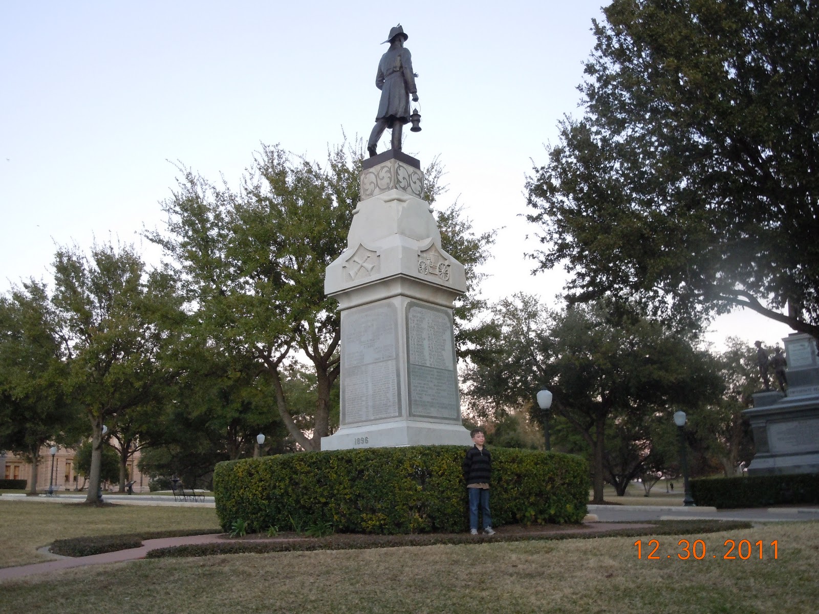
Volunteer Fireman Memorial, erected 1896.
After years of construction, the walls were up and the dome began to take shape by mid 1887. An impressive achievement occurred in February 1888 when the Goddess of Liberty statue was placed on the dome. At completion, the Capitol building measured over 310 feet in height, had 392 rooms, 924 windows and 404 doors. Pictures of the State of Texas Capitol are impressive.  The fact that it took some 1,000 workers over seven years to build makes this historic structure quite unique.

To learn more about Texas, it's time line in history from a Spanish and Mexican possession to an independent republic and then onto statehood, a side trip to the Texas State Capitol Building is a fun and educational visit. Austin Texas is about 200 miles southwest of Dallas and about 80 miles northeast of San Antonio.

(Photos from author's private collection).

Friday, January 27, 2012

Mesa Verde National Park and the Anasazi / A Western Trip

mesa verde national park
What is Mesa Verde? In Spanish, the term means "green table". No doubt, what is today Mesa Verde National Park was indeed first viewed by the Spanish explorers who traversed this area in the very southwest corner of Colorado and which at one time, centuries ago, was home to what we refer to as the Anasazi.

 It's also a great place to explore today as part of your western U.S. road trip. Located not far from the "four corners" area, Mesa Verde park makes an excellent addition to your western vacation planner. Mesa Verde is located between Durango and Cortez Colorado, both two good towns to also add to your summer vacation itinerary.

The Founding of Mesa Verde National Park

Mesa Verde National Park was established on June 29, 1906 by President Theodore Roosevelt, a President who did quite a lot to foster the growth of the National Park system. The cliff dwellings at Mesa Verde National Park are an invaluable display of North American Indian culture. They are considered among the best preserved of all cave dwellings found in the American southwest. Mesa Verde in Colorado is a showcase of how the pueblo Indians lived over a span of some 700 years. The showcase is so incredible, when you first view the cliff dwellings, you may very well ask yourself how they were ever constructed. The very size and craftsmanship that would have to go into their construction is mind boggling.

The Anasazi

cave dwelling photo
Historians believe that about 1,400 years ago, the people who lived in what we call today the "four corners" (where the boundaries of Colorado, New Mexico, Utah and Arizona meet) moved up to the present site of Mesa Verde.

These people are referred to as the Anasazi. Since about 1936, archeologists used the term to describe these ancient Native Americans. There is some debate about the meaning of Anasazi. In Navajo, the term is spelled as 'anaasazi" which translates to "enemy ancestor" which is not what the use of the term implies today. Nevertheless, the term was coined in the 1800's and started to be used regularly around 1936. While some once believed that the people who lived in these magnificent cliff dwellings simply disappeared, in actuality they are considered the forefathers of the more modern day pueblo Indians who eventually moved to the south.

What we know mostly about the Anasazi was garnered from their petroglyphs and pictographs on rock walls. The petroglyphs are found in many places in the American southwest in addition to Mesa Verde National Park.

Both Bandelier National Monument and Petroglyph National Monument, both in New Mexico, are good examples. Originally thought to be a nomadic people, the Anasazi eventually built a close knit society comprised of cliff dwellings and free standing stone structures several stories high. They also became accomplished farmers. Far from being a primitive group of people, the Anasazi raised crops such as squash and went on to produce baskets, pottery and weaving items that evolved from cord to cotton. Over the centuries, the Anasazi developed the bow and arrow which was a better hunting weapon than a spear.

The structures the Anasazi built were quite impressive as the photos on this page illustrate. Multi-storied structures could contain hundreds of rooms. As you can see, the structures were built on rock ledges.

Why Did The Anasazi Leave?

mesa verde park photo
The biggest question that's asked regarding the Anasazi is...why did these people abandon their highly crafted cliff dwellings and move to the south into today's New Mexico and Arizona? 

As you can imagine, there have been many different answers proffered. Archeologists have discussed issues such as drought  and sanitation problems.

Possibly their move south was a result of warfare. One probable explanation may have been that the Anasazi simply outgrew their dwellings and needed to move to more open spaces.

There's also some evidence that the migration away from the Mesa Verde area may have occurred over hundreds of years and took place family by family as opposed to one mass movement. That being said, the prevailing story among many historians and archeologists seems to be that a severe drought caused the exodus. This may be just one of those curiosities that will never be answered for certain.

The modern pueblo people can claim to be direct descendents of the Anasazi, although as mentioned above, there is some dispute among tribes as to the meaning of the term. The modern puebloans built a culture along the same lines as the ancient ones. Stone and adobe structures are the mainstay. A history of active agriculture also binds the two groups together. The Spaniards discovered these Native Americans with their multi-storied family houses and gave them the name "pueblo", which in Spanish refers to a village. When you travel and vacation in New Mexico, you will see the adobe architecture just about everywhere.

Today's modern adobe styled structures are built with thick walls made of wood frame, concrete block or a combination of both. The original true adobe structures were built primarily of mud and straw. One benefit of essentially using the earth itself as a building material was that it kept the inside temperature relatively constant or within a general range. The downside to this type of construction was that, over time, it would deteriorate to the point of collapsing. As an example, New Mexico was and is home to many original adobe structures such as churches or missions which did indeed fall down.


kachinas photo
The centuries old civilization of the Anasazi and their descendents in the American southwest is a fascinating subject to read about and a great area of the United States to visit.

The religion, culture, pueblo living, and the arts and crafts that have been passed down over the centuries offers the visitor or tourist a chance to learn much more about the people who inhabited the southwest long before the Spanish Conquistadors landed on the continent.

As you can see from the Mesa Verde photos above, the scenery is very unique. I think you'll find your trip to Mesa Verde National Park in Colorado a fascinating visit and probably quite unlike any you've taken in the past.

 (Photos from author's private collection. Images of kachinas are public domain. Article copyright Western Trips)


View Larger Map

Wednesday, January 25, 2012

TV Route 66 and the 1959 Corvette

1959 corvette
1959 Corvette
To many, Route 66 meant a fun western road trip. It meant a journey or vacation through America's heartland and to the beautiful southwest with it's mountains, mesas, desert and pueblos.

The very popular early 1960's television show Route 66 was a story of modern cross country travel and one of America's most famous highways. The show blazed a television trail also having been the first television series shot entirely on location. As you can imagine there wasn't a shortage of scenery. I also think beyond a doubt that the TV series gave the urge to many to take to America's roadways.

While it's stated that only some of the scenes were actually shot in towns along this historic highway, the show itself invoked a lot of adventurous feelings in those who followed it. After all, who hadn't heard of Route 66, the "Mother Road"? If nothing else, Route 66 let people go "somewhere". It was a ticket to adventure and travel.

The television series, Route 66", was based on two young men who traveled the country and ended up involved in a variety of intrigues and situations. Every week of course was a new adventure. It was said that when the series was in the planning stages, several TV executives doubted that sponsors would back a show that essentially showed two fellows traveling the roadways without jobs. In other words, who would sponsor a show about a pair of bums.

route 66 sign As it turned out, the sponsors did back the show and did very well. Ratings were quite good. I guess times were changing in the early 60's.

The TV series Route 66 ran for four seasons from 1960 to 1964. The show featured actors Martin Milner and George Maharis. Most people that remember the old TV series remember the Corvette convertible like the one shown above. You can just imagine what the show did for sales of Corvettes during it's run. There's no question that the historic nature of Route 66 and it's big part in luring people to the west helped the show's ratings.

The Beginnings of Route 66

Strong automobile sales in the early 1900's along with the Federal Aid Highway Act of 1921, which called for the networking of roads, made Route 66 a reality. As history shows us, however, what made Route 66 possible in the first place eventually led to it's downfall. Route 66's popularity led to its downfall. The Interstate highway legislation of 1956 created the Interstate System. Today, there are some five Interstates that bypass some portion of old Route 66. During it's glory years, the historic highway allowed people to head west out of the dust bowl of the 1930's. During the 1950's it ushered in the era of driving out west on vacation.

1960 corvette
Route 66 at it's beginning was a patchwork of prior roads and trails. East of New Mexico for example the road was a combination of the Lone Star Trail, the Old Santa Fe Trail along with parts of the Ozark Trail. The Ozark Trail was a system of roads that ran from St. Louis, through the Ozarks, then across Oklahoma and Texas to El Paso. The National Old Trails Road which was from St. Louis to Los Angeles was picked west of Albuquerque New Mexico. It wasn't until 1938 that the entire highway was paved. The road was used extensively during World War Two for military transportation to the west coast.

Facts About Route 66

There's some very interesting facts about the old Route 66. First of all, the state of Oklahoma still retains about 400 miles of Route 66. In fact, Oklahoma has more of the original alignment of Route 66 than any other state.

The Interstate highway system did plenty to erase the historic highway. As an example, when you travel Interstate-40 through New Mexico and Arizona, most of the original highway which followed this Interstate is gone. There are bits and pieces of the roadway left and while traveling Interstate-40 you'll see the signs.

Another interesting fact is that when Route 66 was first established in 1929, the roadway went through Santa Fe New Mexico. The photo above shows a sign in Santa Fe which denotes where the road went through the city prior to 1936. The story of why Route 66 pulled out of Santa Fe in interesting and you can read more about it at this westerntrips link. When you visit Santa Fe New Mexico you'll see several of these signs. It's also a fact that the original Route 66 in several places did go through major realignments over the years.

1954 corvette
1954 Corvette
When Route 66 made it's way into New Mexico, drivers had their first look at the beautiful scenery that the southwest is so noted for. Today, in New Mexico, Arizona and California, Route 66 essentially runs along Interstate-40 with some original stretches of highway available to drive at various lengths.

To be sure, there's plenty of opportunities to hop off the Interstate and go through some smaller towns such as Seligman Arizona, between Flagstaff and Kingman.In Seligman, just as in several other old Route 66 towns, you'll see some structures dating all the way back to the highway's heyday years. While on Interstate 40 just a few miles inside New Mexico from the Texas border, there is an absolutely terrific vintage car museum inside of the large building of Russell's Truck Stop. It's a hidden gem in a remote part of the Interstate and very well worth the stop.

See our Western Trips article regarding the Old Spanish Trail Highway that ran from Florida to California and still exists.

route 66 in arizona
Rte. 66 west of Flagstaff
There are many interesting and historic parts of Route 66 still in existence and they can be found virtually all the way from Illinois to California. You'll even find some hotels and diners that are from the "Mother Roads" beginning years that are still in operation. When you're on the modern Interstates, make certain you keep an eye out for the signs that designate the old route's remaining sections. 

There are four sections of current day Route 66 which I've particularly enjoyed driving on while traveling on Interstate 40 in New Mexico and Arizona. The four are Santa Rosa New Mexico, Gallup New Mexico, Flagstaff Arizona and Seligman Arizona. You may want to make these an item on your next western road trip planner.

(Article copyright Western Trips)


View Larger Map

Monday, January 23, 2012

The Great Train Robbery / The Union Pacific Posse


 Visit the Union Pacific Railroad Museum

When your western road trip takes you through Council Bluffs Iowa, one of the most historically interesting stops you can make is the Union Pacific Railroad Museum. Union Pacific train history is quite fascinating. One of the primary reasons that a stop at this well known museum is fun and educational is the fact that the building and running of this railroad was a large part of America's western expansion. The Union Pacific Railroad is western history itself. The Union Pacific Railroad Museum in Council Bluffs Iowa houses one of the oldest corporate collections in the nation. It includes artifacts, photographs, and rare documents that tell the story of the railroad and the American West it helped build. Among the collection is information about the era's outlaws, weaponry, and a lot about the immigrants who traveled west to build a new life. It's an excellent family side trip when on a road trip to Council Bluffs. The museum address is 200 Pearl Street in Council Bluffs, Iowa.

The Train Robbers

great train robbery poster
There are also some particularly interesting stories that came from operating this railroad. One very unique story is how the Union Pacific dealt with the increasing threat from the latter 1800's outlaws.

 In fact, the period of the great train robbers gave creation to the twelve minute 1903 movie "The Great Train Robbery". This film was made during the very early years of the movie industry when the studios were located on the east coast. This particular film was shot in Milltown New Jersey.

Post Civil War Train Robbers

After the end of the Civil War there was a significant increase in highway and railroad express car robberies. Stagecoaches were stopped and robbed by highwaymen and the railroads experienced the same fate on the tracks. A good deal of the problem for the Union Pacific was in the Wyoming area. This was a region where the train robbers could easily flee to some of the most rugged country in North America. If the train express car was attacked late in the day, the bandits could head straight for the Hole-in-the-Wall area (noted place for bandit hideouts) or to the North park country. They would be fleeing at sunset or night time and their pursuers had an almost impossible task in catching up to them. The infamous Wild Bunch gang operating in southern Wyoming was a particular problem for the Union Pacific Railroad.

The Railroad Posse and the Pinkertons

The question to be figured out by the Union Pacific Railroad was simply...how do you catch the outlaws after the robbery occurs and how do you act to discourage the attack in the first place? The Union pacific came up with the answer. A mobile posse force. Today, you might call it a first responder group or possibly a SWAT team. The railroad created a force of special agents which were equipped with horses capable of traveling one hundred miles per day. The agents and horses were moved around on trains and because of this never before ability the special railroad posse could be chasing the outlaws just a few hours after the robbery. This represented quite an improvement in railroad crime fighting.

The famed Pinkerton National Detective Agency was also involved with railroad and express company protection and made a lot of money doing it. The Pinkertons were on the trail of known outlaws and train robbers such as Jesse James, the Younger brothers, Butch Cassidy, Sam Bass and many others.

 The Pinkertons began in the 1850's and founder Allan Pinkerton was involved with the Union forces during the Civil War. Pinkerton security services grew tremendously after the war's end. The company was eventually run by his sons William and Robert. William Pinkerton, who operated the Chicago office, was known to be quite personally involved chasing down western outlaws and reportedly spent many days in the saddle. One Union Pacific train robbery of note occurred on June 2, 1899.

The Outlaw Butch Cassidy and the Union Pacific

Butch Cassidy and the Wild Bunch robbed the Overland Flyer near Wilcox Wyoming. Once the bandits had left the scene, the trainmen limped their broken train about 12 miles into Medicine Bow, the next regular stop, where engineer Jones reported the holdup by telegram to Union Pacific officials. The Union Pacific Railroad  sent the specially outfitted train kept ready in Laramie, Wyoming loaded with horses, equipment, food and men to the robbery site near Wilcox Station.

Including the Pinkertons and locals there were about 100 posse men out chasing the train robbers within hours after the crime. The robbers after dynamiting the safe in the express car left shortly after 4am. The Union Pacific posse train arrived in Wilcox about 9am. The posse never did catch the robbers and there are some who believe that Butch Cassidy wasn't even involved although he reportedly got some of the money. During the chase, the posse was supposedly ambushed by the gang and during the shootout a Pinkerton contract employee was shot and killed. The posse chase ended after the Pinkerton contract detective/agent was shot. As it turned out, not the Pinkertons, the Union Pacific Railroad posse or anyone else in the U.S. was ever able to arrest Butch Cassidy after the Wilcox robbery. The public domain photo below is of Butch Cassidy circa 1900.

Take our fun twenty-five question history quiz on our Trips Into History site. 

Short History Quiz

butch cassidy photo
Butch Cassidy, circa 1900
The Pinkerton security story is unique in as much as during the late 1800's this private detective agency acted in a quasi -government law enforcement agency. While the Pinkertons were a private company, some people refer to the Pinkerton agency as being the start in a way of the federal agency which decades later evolved into the FBI. When the federal law enforcement agencies grew over the years, the Pinkertons became more of a guard service than a law enforcement vehicle.

In a way, when the Union Pacific formed their mobile posse, they were only doing what all railroads do, even today, and that was protecting their property. While train robbery is fairly nonexistent today, virtually every railroad has it's own police security force.

More Good Stops for Your Trip Planner

There are also other excellent museums concerning the Union Pacific Railroad which you may want to visit during a western road trip. The Cheyenne Depot Museum is located in downtown Cheyenne Wyoming. This non profit museum is housed in the renovated Union Pacific depot. The Cheyenne Depot Museum tells the story of the founding of Cheyenne during the construction of the Transcontinental Railroad. Along with many artifacts of the time, the museum will features the story of the construction of the Union Pacific Depot.  In Omaha Nebraska there is the Union Pacific Historical Museum which is located in the Union Pacific Railroad headquarters building. The museum is open Monday through Friday and Saturday mornings to the public.

(Photos and images from the public domain)

Saturday, January 21, 2012

Gila County Arizona / History and Hiking

arizona state flag
Gila County and Payson Arizona are a vacation playground with fun and historic sites and lots of outdoor recreation opportunities.

Historic sites, museums and scenic hiking trails abound. The area around Payson AZ in Arizona's beautiful Gila County is often referred to as the Rim Country and sometimes Zane Grey Country.

You may have also heard of it as The Heart of Arizona. When adding this stop to your Arizona road trip, Payson is located about 90 miles northeast  Phoenix and about 75 miles south/southeast of Flagstaff . Payson, located in northern Gila County, is indeed a very scenic part of the state. Being only a ninety minute scenic drive from Phoenix, the Payson Arizona area makes a good side trip during your Phoenix vacation. If you decide to spend the night there are several excellent Payson hotels available.

The county was named from the Gila River, which is a part of its southern boundary. The county seat was originally Globe City and is now called Globe. The entire county is a history and outdoor playground with historic sites everywhere. Mining was and still is a major industry along with tourism. The history of Arizona is remarkable and the Gila County region is a good example.

Visiting Payson Arizona

gila county arizona
Gila County AZ
So what are the fun and historically interesting things to do in Payson AZ?

The Rim Country Museum consists of the oldest Forest Ranger station and residence in the American southwest. The structure was originally built in 1907 and then later rebuilt on the same foundation. The Rim Country Museum is operated by the Northern Gila County Historical Society. The exhibit hall in the museum is a replica of the Herron Hotel which was dubbed the "Hilton of Payson" during the early 1900's. Driving directions to Payson from Phoenix... take Loop 202 east to Country Club exit. Turn left on Country Club which will turn into Beeline Hwy (87) and go north on Hwy 87 for about 75 miles.

Another excellent site, and a part of Arizona history, is the replica of Zane Grey's cabin which is also a museum. Zane Grey, the famous western writer of over 60 novels and 300 short stories, was very fond of this area. Grey was one of the most popular western writers in the 1920's and 30's and Hollywood produced dozens of westerns based on his writings.


An interesting side note is that Grey started out as a dentist before becoming a writer. Zane Grey left Arizona in 1929 after a dispute with Fish and Game officials. In the 1950's a local businessman refurbished the worn down structure to it's original condition and did it with his own funds. Because of that, today visitors can enjoy viewing the cabin which was once owned by one of America's most celebrated western writers.

Also, make a fun stop at the one room Strawberry Schoolhouse in Strawberry Arizona, about 30 miles northwest of Payson, which was erected in 1884. The structure is the oldest standing schoolhouse in the state of Arizona. Amazingly, a group of volunteers joined together and built the schoolhouse in only one day. Strawberry is surrounded by beautiful tall pines and the area has several popular lakes.

Prior to the Civil War the Apache Indians lived in the area but with the influx of the military they were dispersed. The height of white settlement in the area was pretty much connected with a gold discovery around 1878 with the largest emigration to the town in 1882. The schoolhouse was constructed a few years later. There's another site near Strawberry which you might want to add to your travel itinerary. Ten miles south of Strawberry is the large tourist attraction, the Tonto Natural Bridge, which is said to be one of the world's few natural bridges.

Arizona Hiking

arizona mountains
The southern Gila County area offers some of the very best hiking trails in the state. Indeed, there are hiking trails for all skill levels.

One of the more leisurely trails can be found at the Boyce Thompson Arboretum. The Arboretum has a 320 acre collection of plants operated in a partnership with the University of Arizona College of Agriculture and Life Sciences and Arizona State Parks.

The grounds of the Arboretum features more than two miles of hiking trails and paths. There are very good bird watching opportunities and you can even bring your leashed pet along for the hike.

The site is two miles south of Globe AZ. From Globe, take paved Jess Hayes Road southeast to the junction of Icehouse Canyon Road/Forest Road (FR) 112 and Sixshooter Canyon Road/Forest Road 222. Turn right and continue on FR 122 for 3 miles to the junction of FR 55 and FR 112. Stay left and continue following FR 122 for another 3 miles to the site entrance. Follow this access road, FR 112B, a short distance to the horse trailer parking at the hitching rail and further to the main site.

There's another famous landmark not far east of Payson. One of the key Arizona military outposts during the mid to latter 1800's was Fort Apache. Lots of great old west history there and a fun and educational stop foir the whole family. To take a road trip to Fort Apache..from Globe Arizona, follow US 60 north approximately 60 miles to the western end of AZ 73 at Carrizo Junction.  Turning right onto AZ 73 at the Fort Apache and Whiteriver signs, and continue on the state highway 25 miles, turning right at Fort Apache Road.  The park and fort is located ½ mile east of AZ 73.


arizona sceneryAn annual event which is popular in Gila County is the Payson Arizona Loggers Sawdust Festival.

The first thoughts concerning Arizona are usually the dry desert and cactus. In Arizona's high country it's a different story. The Gila high country is home to one of the world's largest stand of Ponderosa pines and logging has always been an important element to the counties economy. Most of the private timber was cut down by the start of World War Two. After that point, logging permits were required and several mills were constructed.

The first loggers festival took place in 1979. In 1984 the event was renamed the first annual Arizona State Logger Championship. This is an exciting outdoor event which is fun for the entire family. The loggers festival usually takes place in June. To coordinate it with your Arizona trip you may want to visit the Payson website at Payson Loggers Sawdust Festival.


(Article copyright Western trips. Photos and images in public domain)


View Larger Map

Thursday, January 19, 2012

Bryce Canyon National Park


When you're planning your western road trip you will want to consider a tour of what is one of the most unique National Parks in America, Bryce Canyon National Park in Utah. Bryce Canyon is probably one of the hardest of all National Parks to describe. Bryce was carved by the freeze and thaw cycle, quite different from most canyons that were carved by river flow. The hoodoos that are formed by this process are truly amazing  This is what makes a  road trip Bryce Canyon National Park such a unique experience. As one of our most treasured National Parks Bryce makes a great addition to your western trip travel planner.

bryce canyon national park
Bryce Canyon became a National Park back in 1928. Located in southwestern Utah, this beautiful area was named after Ebenezer Bryce, a Morman pioneer. Bryce was raised in Scotland, converted to the Mormon faith and then emigrated to Utah at only seventeen years of age. During his lifetime, Bryce moved to Pine Valley Utah where he constructed the Pine Valley Chapel and what is today the oldest Mormon chapel still in use. Pine valley is about a 150 mile winding drive west of Bryce Canyon National Park. The straight line distance is much less

During the first decade of the 1900's the first visitor accommodations will built at Bryce along the Paunsaugunt Plateau rim. By 1920 efforts were started to set aside these scenic wonders. President Warren G. Harding in 1923 designated part of the area as Bryce Canyon National Monument under the Powell National Forest. A year later in 1924 Congress passed a bill which established the area as Utah National Park. Legislation was passed in 1928 that year to change the name of the park to Bryce Canyon National Park.The park is open all year and offers recreational opportunities during all four seasons. It's estimated that Bryce Canyon National Park is visited by more than 1.5 million people annually and from all around the world. During summer hiking, sightseeing, and photography are the most popular activities. The spring and fall time offers a peaceful solitude. During winter months the park offers the most unique winter views found anywhere in the U.S.

bryce canyon
As a historical note, there is also a small community in Arizona named after Bryce. Bryce Arizona is located northeast of Tucson and just a few miles north of Pima Arizona, not far from the New Mexico border. This was where Ebenezer Bryce eventually settled with his family and died in September 1913 at age eighty-three. Ebenezer Bryce is buried in this settlement.

Bryce Canyon National Park and the Bryce Canyon Lodge receive thousands of tourists each summer that arrive to see the hoodoos. In fact, southwestern Utah is a summer playground for outdoor enthusiasts. To the south and west of Bryce canyon is Zion National Park. To the south and east is the Glen Canyon Recreation Area which includes Lake Powell for boaters as well as the historic Glen Canyon Dam.

hoodoos
One of the more fun things to do at Bryce Canyon is the trail ride. The escorted ride takes you down and through the canyon past the many beautiful geologic formations called "hoodoos". A hoodoo is a tall, thin spire of rock that protrudes from the bottom of an arid basin. A "hoodoo" has an uneven thickness which really gives it it's unique look. Pinnacles and spires differ in that they have uniform thickness. As you can see from the pictures of hoodoos on this page, they vary greatly in size. Some are over 100 feet tall. I had the opportunity to take this trail ride and I can tell you it's quite a lot of fun. The guides are terrific and you don't need horseback riding experience to enjoy this activity.  To sign up for the Bryce trail ride simply go to the lobby of the Bryce Canyon Lodge where you will be greeted by a cowboy at the trail ride desk.

bryce canyon trail
After signing up for the ride they will direct you to the  corral where you will be assigned the horse or mule that best fits you..The trail ride is one of those must things to do at Bryce Canyon National Park. It's a fun and relaxing way to see the hoodoos.

When you take the trail ride and view the hoodoos close up, you will notice how the lower parts of the formation were eroded away. The hoodoos which are sometimes called "tent rocks"were created when volcanic ash was covered with more solid volcanic rock such as basalt. The volcanic ash on the lower portion eroded away much faster than the rock on top. Eventually over a much longer period of time the lower portion will erode away to the extent that the upper harder cap will topple over. The same way which hoodoos were formed will eventually destroy them. Wind and freezing temperatures still work their wonders on these beautiful geologic formations. The pictures on this page show how uneven the vertical thickness is as you view each formation from top to bottom.

hoodoo formation bryce canyon
The ranger programs at Bryce are excellent and free. The magic of Bryce Canyon sparks the imagination and wonder in park rangers as well as visitors. The length of ranger programs can vary from minutes to hours so you can pick the tour that best fits your schedule. Ranger programs offer an excellent way to expand your exploration of Bryce Canyon. Typical ranger programs include the Rim Walk, Geology Tours, Evening programs, Full Moon Walk and of course plenty of programs for the kids. I had the opportunity to go on many of these. They are all great and I think the evening program was one of the best.

If your western road trip brings you to Bryce Canyon from the south from the vicinity of the Grand Canyon, you will want to drive north to Page Arizona via US Hwy 89. Continue on Hwy 89 over the Glen Canyon Dam and drive westward. At Mount Carmel Junction Utah Hwy 89 turns to the north. Follow US Hwy 89 northward to state route 12 and drive east. The mileage to Bryce Canyon National Park from Page Arizona is about 154 miles on US Hwy 89. Campers will delight in the fact that there are two campgrounds at Bryce Canyon which are open all year.

(Photos from author's private collection)

View Larger Map

Tuesday, January 17, 2012

Victorian Houses / A Western Tour of a Pioneer Homestead

When you pack up the car for a western road trip, there is an excellent museum just north of Dallas Texas that makes for a low budget family side trip and a fine educational experience. A trip to the heritage Farmstead Museum in Plano Texas is a fun time for the entire family and offers a very good display of turn of the century Victorian architecture.

Victorian Architecture in the U.S.

The term Victorian architecture is not merely one style but encompasses several different versions which were dominant during the middle and latter part of the 1800's. Old pioneer houses came in many different styles, both in Victorian style and other designs. It should be noted that both England and France had the habit of naming architectural styles after reigning monarchs. Thus, Victorian refers to the reign of Queen Victoria of England but doesn't necessarily coincide with the exact years that the monarch was on the throne. Most historians place the Victorian period between 1825 to 1900.

victorian house
Victorian front porch
During the latter 1800's there was a variety of architectural designs employed in the American west. The adobe style which was part pueblo Indian and part Spanish flourished in the southwest. The northern plains and America's northwest had their styles as well. Victorian homes could also be found in any of these regions. Victorian design was very popular in the latter 1800's and still is.

Pioneer Homesteads

 In north Texas for example, a farm or homestead very typically could be built in Victorian style.

The home pictured above is the Farrell-Wilson House built on the Farrell-Wilson Farm north of Dallas Texas outside of a town named Plano. This is about twenty-five miles north of downtown Dallas. The Farrell-Wilson home which dates back to 1891 is an excellent example of the "shingle end" Victorian design. The house was built originally with four rooms over four rooms. Later a wrap around veranda was added. The Farrell-Wilson house has the distinction of using nine original colors. Doorways and windows were placed for maximum air circulation which of course was very important during the hot summer months in Texas. Pioneer homes in Texas unfortunately didn't have air conditioning.

victorian style house
Victorian design
A pioneer homestead at the turn of the 20th century typically had an assortment of outbuildings. The carriage house, the curing shed, the root cellar were all vital parts of the pioneer home and farm.

Also typical was the pole barn. Pole barns had the advantage of being much more easily constructed than a typical four sided barn. The construction method simply uses large poles (or squared off posts) as vertical structural members and strong "girts" that are placed parallel to the floor at right angles to the posts as the  structural skeleton. Pole barns are still quite popular today with several companies offering pole barn kits. The pole barn shown here on the Farrell-Wilson homestead was built with logs that were hauled in from the Red River to the north. This particular pole barn was utilized as both an animal shelter and a machinery shed.

pole barn
Pole barn
Another important outbuilding on this historic farm was the "curing shed". The curing shed is quite different from a smokehouse that has a pit in the middle for building a fire. The curing shed processed and preserved meats with salt and lard. This of course was done to keep the meat from spoiling.

Typically with the salt method of curing meat, the meat would be put in large salt crates with the layers of meat separated by layers of salt. This method was known as "dry curing'. The method of "brine curing" was where the meat was placed in earthenware crocks of brine water. After a few days the meat was hung up from the rafters or placed in butcher paper. The meat would end up similar to 'beef jerky". The curing shed was a pioneer farm necessity. It was an ideal place to store butchered meat from the farm livestock and prepare it for use.

curing shed
Pot in curing shed
root cellar
Root cellar entrance
Another typical structure on turn of the century farms was the "potting shed" and "root cellar". The ground floor of the structure was used similar to a greenhouse.

Small growing plants prior to planting in the garden would be stored there as well as seeds ordered from catalogs. Canning tools would also be stored in the building. The steps leading below ground entered the root cellar. The root cellar would serve as a storm shelter, especially from tornadoes, and for a food storage area. Potatoes, squash and turnips as an example would be wrapped in newspaper and then buried in either sawdust, sand or put in barrels. Fruits and vegetables would be stored where the air was the coolest.

The Carriage House and It's Surrey

What today we would refer to as our garage was called the carriage house. The carriage shown in this carriage house was known as a "surrey". The surrey shown below is a three spring cabriolet sold by Sears and Roebuck. Two advantages of the cabriolet was that it was lower to the ground making it easier to get in and out of and with one spring in the front and two in the rear, the ride was considered more comfortable. The interior of this carriage was made of mohair which, at the time, was considered more luxurious than leather.
surrey
Surrey in carriage house

Sears advertised this same model surrey at a price of $104.95. Either one or two horses could be attached. You may also be interested in our article on Trips Into History on the Sears Modern Home Kit sold during the first decades of the 1900's.

The Heritage Farmstead Museum offers one of the best displays of a turn of the century northern Texas homestead and of a Victorian architectural farm.

This museum location in Plano Texas just north of Dallas on 15th Street was and is today one of the areas main arteries. The street was once called the Plano-Birdville Road and the farm's location made it easy enough to walk or ride a horse to both the schoolhouse or to the old town of Plano which is only a few miles to the east.

 Many new residents arrived to the area around 1888 when the Saint Louis and Southwestern Railroad came through to Plano. The new railroad also made it easy to transport heavier items to the area such as cast iron stoves and parlor organs.

The link below is to another Western Trips photo article you may enjoy. This is about the historic homes in McKinney Texas just north of Plano. 

McKinney Texas Homes From The 1800's

If your Texas road trip takes you to the Dallas Texas area, a trip to the Heritage Farmstead Museum in Plano makes for a great family western road trip.
The museum address is 1900 W. 15th Street, Plano Texas. (Photos from author's private collection).
View Larger Map

Sunday, January 15, 2012

Yellowstone Steamboat

Steamboats played a big role in American transportation in the 1800's and there may not have been a more significant steamboat in U.S. history than the Yellowstone. The stern wheeler boat was originally built in Louisville Kentucky in 1831 for the American Fur Company. The American Fur Company was owned by John Jacob Astor and went on to be the dominant fur trading company in America by the early 1830's.

It was at one time the largest company in the U.S. and virtually had a monopoly on the country's fur trade. Starting with trade in the Great lakes region and the midwest, beginning in the 1820's the company expanded into the plains area and to the Pacific Northwest. The fur trading industry played a major part in the development of both the United States and Canada for centuries.

The Many Journey's of the Yellowstone

steamboat yellowstone
Steamboat Yellowstone
The Yellowstone history includes steam boating from the far reaches of the northern Missouri River to the Mississippi and then on to Texas and operations on the Brazos River are a treasure trove of American western history.

In fact, by the year 1832, the Yellowstone made it up the Missouri River right to the mouth of the Yellowstone River. In 1831 while on her maiden voyage, the Yellowstone made it all the way up the Missouri River to Pierre South Dakota, farther than any other steamboat to date.

The Yellowstone's itinerary was pretty much dependent on the season of the year. While working on the Missouri River the steamboat took advantage of the higher river due to April snow melts and again in June and July by favor of snow melt from the Rocky Mountains which of course occurred later. During the winter months the Yellowstone moved to the Mississippi River and worked regularly along the southern portion.

The years 1835 and 1836 were big. Texas fought against the Mexican government for it's independence and the Yellowstone steamboat joined the crusade. By this time the Yellowstone had been sold by the American Fur Company and was actually on it's third owner, Thomas Toby and Brother. The boat was dispatched to Texas for the purpose of carrying cotton bales down the Brazos River to Quintana Texas on the Gulf of Mexico. Eventually, the Yellowstone departed from New Orleans on New Years Eve 1835 and steamed to Texas loaded with arms, ammunition and volunteers to help fight for Texas.

san jacinto monument in texas
San Jacinto Mon.
The Yellowstone continued in service to the Texas independence cause and spent the war ferrying troops down river and assisting any way it could. During the war for Texas independence, the Yellowstone actually combined cotton hauling with hauling Texas troops on and across the Brazos River. This boat caused a lot of difficulty for the Mexican Santa Anna and his army.

After the Mexican War

At the end of Texas' war for independence, and after the decisive Battle of San Jacinto, the Yellowstone was used to transport the wounded Sam Houston as well as the captured Mexican commander Santa Anna along with over forty Mexican prisoners.

The plans were that the Yellowstone would actually transport Santa Ana back to Mexico but the trip was put off. Santa Anna ended up however meeting President Andrew Jackson and didn't return to Mexico until 1837, and unfortunately for him, when he did it was as a disgraced man. The Mexican government essentially refused to recognize any surrender terms put forth by Santa Anna and didn't recognize the new Texas Republic until the Treaty of Guadalupe Hidalgo in 1848 which officially ended the Mexican American War. That same treaty placed California and the southwest in U.S. hands.

Steamboats and the U.S. Military

While the steamboat Yellowstone played a key role in the Texas fight for independence, the role of steamboats and the military would not end there. Another famous steamboat, the Far West, played a big role in the Sioux Wars of 1876 when it served as command headquarters for General Terry while conducting the campaign which included Custer's Battle of the Little Bighorn. During that campaign, the stern wheeler Far West steamed all the way up the Yellowstone River in Montana to the mouth of the Little Bighorn River. This was quite a feat in itself.

The Fate of the Steamboat Yellowstone

mexican leader santa anna
Santa Anna, Pub. Domain
There is no concrete information as to what ultimately happened to the steamboat Yellowstone. Some say she sank near the Houston area. Another story is that a record was discovered that records the steamboat Yellowstone passing through the Louisville and Portland Canal on the Ohio River in the summer of 1837.

When you research records and archives from that period, nearly 200 years ago, it's not uncommon that information is a bit sketchy. What is documented well is that early steamboats often had a short life span, sometimes five to eight years due to deadly steam boiler explosions. This was a large danger during the mid 1800's. While there is information that the Yellowstone did have work performed on it's boilers in New Orleans, there are no records I could find that indicates the Yellowstone ever suffered this fate.

History however kept the name alive with our nation's first National Park named Yellowstone Park, a tribute to both this famed steamboat and the beautiful river that runs through Montana and Wyoming.

Incredibly, the Yellowstone was involved from the far reaches of the northern Missouri River all the way down to New Orleans and then over to Texas which all occurred in her first five years of existence. While she went through several owners in a very short time, the Yellowstone was relied on continuously for either commercial or military purposes.

Texas tourists today can visit the San Jacinto Battleground State Historic Site which is located about twenty-five miles east of Houston. There you can view the magnificent San Jacinto Monument which has the distinction of being the tallest memorial column in the world rising 570 feet.

There are several museums spread out in the western United States chronicling the history of steam boating. One excellent site which has a lot of history about the steamboat Yellowstone is the Museum of the Fur Trade located in Nebraska. The museum is located three miles east of Chadron, Nebraska on U. S. Highway 20, in the northwest corner of the state. This amazing museum features every type of object exchanged by Europeans and Americans with the Native people of North America.

You may also enjoy our Western Trips photo article on the old Spanish Missions in San Antonio Texas.

(Article copyright Western Trips. Photos and images from the public domain)


Saturday, January 14, 2012

Vintage Cars / A Western Trip to the Car Museums

When you travel through the western United States on either a vacation trip or for business, you may wish to set aside a bit of time to avail yourself of some excellent displays of vintage cars. There are many excellent places to see America's classic car collections in the west and I want to point out several of them. Some sites are full automotive museums and others are small collections but all make an interesting travel stop. Antique car museums are great places to learn more of America's 20th century culture.

Blackhawk Museum

One of the finest car museums I have visited is in Danville California just about 25 miles east of the San Francisco bay area. The Blackhawk Museum located at 3700 Blackhawk Plaza Circle in Danville displays a massive collection of the very earliest to the contemporary automobile. This antique car museum has one of the most extensive collections of classic cars on the west coast. The auto museum operates as a non-profit and was created to ensure that significant automotive treasures would be exhibited for both public enjoyment and educational enrichment. If you're in the east bay area of San Francisco it's an excellent addition to your trip itinerary. The Blackhawk Museum is one of the best classic car museums in America. You'll enjoy your visit there.

Our AutoMuseumOnline site also has a gallery with photos and the history of many vintage and classic cars and trucks.

Russell's Truck Stop Auto Museum

Another stop in quite different surroundings yet has a terrific collection of vintage cars and trucks is an automobile museum located inside a large truck stop on Interstate 40 in Endee New Mexico. Endee is just a few mile west of the New Mexico and Texas border directly off the Interstate. When you exit at Endee, the first thing you'll notice is the truck stop plaza. When you walk inside and go to the rear of the building you'll come across another large room with a terrific display of classic cars and trucks. This small automobile museum makes a unique rest stop while traveling Interstate 40.
1959 corvette
1959 Corvette

It's truly a gem of a car museum. It's not nearly as large as others but the collection is absolutely superb. In fact, you'll marvel at what they have on display, including the beautiful 1959 Corvette shown at right.

The stop you'll be looking for is Russells Truck Stop and Classic Car Museum. Entrance to the auto museum is free of charge however you can leave a donation. If you happen to enjoy those older muscle cars, you'll find them in great shape at Russells. The car restorations have been done with great care.

Heritage Farmstead Museum

If you happen to be traveling through the north suburbs of Dallas Texas, there is a Ford Model T on display at the Heritage Farmstead Museum in Plano Texas, about 25 miles north of downtown Dallas. This outdoor museum features fine displays of late 1800's and turn of the century pioneer homestead exhibits but additionally it owns a collection of not only a genuine Ford Model T but a fine collection of vintage early 1900's farm tractors, one of which is an old Fordson Tractor produced by the Ford Motor Company.

If you are in the Dallas Texas area, the Heritage Museum is located at 1900 W. 15th Street in Plano Texas. Take US Hwy 75 north from Dallas, exit at 15th St in Plano and turn left and follow 15th St about 2 miles. Museum is on the left.

Petersen Automotive Museum

ford model t
Ford Model T
For those living in southern California, the Petersen Automotive Museum located at 6060 Wilshire Boulevard  in Los Angeles is a well known classic car museum. The Petersen Automotive Museum was started in 1994 by Margie and Robert E. Petersen. The Petersen's donated over $30 million to make this non profit museum a reality..The vintage car museum exhibits over 150 rare and classic cars, trucks and motorcycles. This four floor museum also includes race cars, celebrity cars, concept cars and cars used in movies. This western auto museum is dedicated to the exploration and presentation of the automobile in regards to it's impact on American life. You'll also find special events and exhibits which rotate and change with various automotive themes. This automobile museum attracts thousands annually.

Forney Museum of Transportation

Another terrific vintage car museum is the Forney Museum of Transportation in Denver Colorado. The museum is located at 4303 Brighton Blvd in Denver. The Forney Museum of Transportation began as the private collection of Mr J. D. Forney of Fort Collins Colorado. As you will see when visiting this museum, Mr. Forney liked all means of transportation and along with vintage cars you'll find steam locomotives, steam tractors and much much more. One very interesting exhibit at the Forney Museum is the 1923 Kissell Speedster which was owned by the famous flier Amelia Earhart. It was said that Earhart called her car the "Kizzle," but later referred to it as the "Yellow Peril.". Amelia Earhart and her mother made a 7,000 mile round trip in this car in 1924 going from Boston to Los Angeles and then returning to Boston via Canada. To be sure, a very daring auto trip considering road conditions in that era. This was even before historic Route 66 was opened.

kissel cars poster
Mr. Forney loved collecting anything to do with transportation and engaged in car restoration. At first he was storing his vintage auto collection in his garages. When the collection totaled more than 200 items he knew it was time to find larger quarters.

After several moves to a variety of locations including the historic old Tramway Building and teaming up with another Denver area collector, the transportation museum finally found a permanent home.

It certainly had to be big because along the way the Union Pacific railroad donated the Alco "Big Boy" locomotive to the museum. A warehouse facility was found on Brighton Blvd. directly next to the Denver Coliseum. This was purchased and renovations got under way in 1998. was purchased. Renovations began in 1998. Thanks to the work of many volunteers most of the collection was at the new museum by the spring of 1999. It took 2 years of acquiring, permits, rail track laying, etc to relocate the Big Boy locomotive to its new permanent home on Brighton Blvd.

Lemay-American Car Museum

Visit the amazing  LeMay-America's Car Museum located at 2712 E. D Street in downtown Tacoma Washington. The ACM will feature over 500 cars, trucks and motorcycles from private collectors, companies and from the famous LeMay collection. The massive automobile museum will be 165,000 square feet in size and will no doubt be a popular car enthusiast destination for people from around the world. There may very well not be another one like it.
1939 jaguar car
1939 Jaguar 3.5 litre
Per the car museums website, the ACM is conceived on the premise that there is an important, unique automotive story to tell about the past, present and future of cars, trucks and motorcycles. From what I understand the ACM in Tacoma will also serve as a social gathering place for car enthusiasts where automobile social networks can be established. The scope and size of this museum plus it's massive collection will make it a premiere classic car museum venue.

As a side note, the Chicago Sun Times has announced the creation of another new vintage car museum, this one in the windy city of Chicago Illinois. This new car museum is planned to feature a 300 plus car collection. According to the Chicago news story, some of the automobiles to be displayed in this new museum include Rolls-Royces, Packards and Duesenbergs. Also a 1920s fire engine and an Amphicar, an amphibious auto that Lyndon Johnson once owned. At this time the classic car museum will be called the Imperial Auto Collection and there is no fee to visit. The museum location is 3111 N. Knox, just east of Belmont and Cicero in Chicago Illinois.

Dick's Classic Garage

Here is a wonderful museum with dozens of classic and vintage cars and trucks. Located in San Marcos Texas just off Interstate 35, Dicks' Classic Garage is part of the Central Texas Museum of Automotive History. The museum is dedicated to the display and history of the automobile. This museum displays cars from the 1950's through the 1950's. Address is 120 Stagecoach Trail, San Marcos, TX. For more information see website www.dicksclassicgarage.com

There are a great many classic car museums spread throughout the United States. Each has a very interesting story to tell and it's really a good way to learn more about how America evolved along with the automobile during the 20th century. If you're looking to possibly purchase a classic automobile, some of these museums may be able to connect you with possible sellers.On top of that, when you visit one of these car museums you're assured to take some pretty good pictures. Hopefully you'll have an opportunity to visit some of the ones listed above on your next vacation or weekend outing.

(Corvette,Model T from author's private collection. Remainder public domain)